Grade II* listed buildings in South Hams
There are over 20,000 Grade II* listed buildings in England. This page is a list of these buildings in the district of South Hams in Devon.
South Hams
| Name | Location | Type | Completed [note 1] | Date designated | Grid ref.[note 2] Geo-coordinates |
Entry number [note 3] | Image |
|---|---|---|---|---|---|---|---|
| Lower Washbourne Barton | Ashprington | Farmhouse | Formerly | 9 February 1961 | SX8051655259 50°23′06″N 3°40′55″W |
1108384 |  |
| Painsford Manor | Painsford, Ashprington | Farmhouse | 1952 | 11 November 1952 | SX8006956827 50°23′57″N 3°41′20″W |
1108403 |  Painsford Manor |
| Summer House about 290 Metres South East of Sharpham | Ashprington | Summerhouse | c1770-1780 | 26 April 1993 | SX8290457674 50°24′26″N 3°38′57″W |
1324937 |  |
| Church of St Andrew | Aveton Gifford | Anglican Church | 1868 | 26 January 1967 | SX6959047840 50°18′58″N 3°49′59″W |
1108171 | 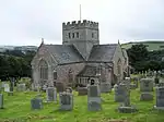 Church of St Andrew |
| Deer Park Wall at Berry Pomeroy Castle | Berry Pomeroy | Boundary Wall | Pre 1292 | 21 May 1985 | SX8413462428 50°27′01″N 3°38′00″W |
1108572 |  |
| Week | Berry Pomeroy | House | Circa 16th century | 9 February 1961 | SX8390261368 50°26′26″N 3°38′11″W |
1108575 |  |
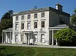
| Maristow House | Maristow Park, Bickleigh | Country House | 1760 | 29 March 1960 | SX4735964542 50°27′39″N 4°09′07″W |
1162231 | |
| Warleigh House | Warleigh, Bickleigh | House | Earlier | 29 March 1960 | SX4567761706 50°26′06″N 4°10′28″W |
1162274 | 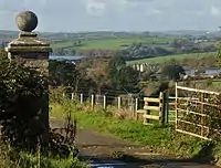 Warleigh House |
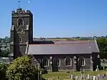
| Church of St Lawrence | Bigbury | Parish Church | 14th century | 26 January 1967 | SX6678646642 50°18′17″N 3°52′19″W |
1325078 | 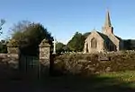 Church of St Lawrence |
| Buckland Tout Saints Hotel | Bearscombe, Buckland-Tout-Saints | Country House | Late 17th century | 26 January 1967 | SX7593746046 50°18′05″N 3°44′36″W |
1168323 | 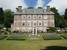 Buckland Tout Saints Hotel |
| Church of St Sylvester | Chivelstone | Parish Church | 15th century | 26 January 1967 | SX7832338746 50°14′10″N 3°42′27″W |
1108470 | 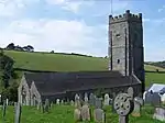 Church of St Sylvester |
| Manor Farmhouse | South Allington, Chivelstone | Farmhouse | Early 18th century | 26 January 1967 | SX7940838706 50°14′10″N 3°41′32″W |
1168730 |  |
| Church of St Mary | Churchstow | Anglican Church | 19th century | 28 July 1989 | SX7124845911 50°17′57″N 3°48′33″W |
1108148 | 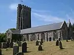 Church of St Mary |
| Blachford including Service Wing and Stables to East | Blachford Park, Cornwood | House | Circa 16th century | 29 March 1960 | SX6124659957 50°25′23″N 3°57′17″W |
1309689 |  |
| Chapel immediately North West of Fardel Manor House | Fardel, Cornwood | Chapel | may be circa 13th century | 29 March 1960 | SX6118957442 50°24′02″N 3°57′16″W |
1325390 |  |
| Hanger Farm House including Garden Area Wall and Mounting Block Immediately South | Hanger, Cornwood | Farmhouse | late C15/early 16th century | 23 April 1952 | SX6136258680 50°24′42″N 3°57′09″W |
1309643 |  |
| The Slade | Cornwood | House | 16th century | 23 April 1952 | SX5980058496 50°24′34″N 3°58′28″W |
1162516 |  |
| Church of St Barnabas | Tigley, Dartington | Chapel of Ease | 1885 | 26 April 1993 | SX7594860643 50°25′57″N 3°44′53″W |
1324985 | 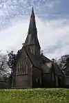 Church of St Barnabas |
| Church of St Mary | Dartington | Parish Church | 1878-1880 | 9 February 1961 | SX7853862654 50°27′04″N 3°42′44″W |
1219488 | 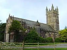 Church of St Mary |
| High Cross Hill House | Dartington Hall, Dartington | Garage | 1932 | 16 January 1981 | SX7936062488 50°26′59″N 3°42′02″W |
1220922 |  |
| Christopher Martin Memorial | Dartington Hall, Dartington | Sculpture | 1945-6 | 26 April 1993 | SX7972062536 50°27′01″N 3°41′44″W |
1108324 | .jpg.webp) Christopher Martin Memorial |
| Old Postern | Dartington Hall, Dartington | Kitchen | c. 1860 | 9 February 1961 | SX7868662699 50°27′06″N 3°42′37″W |
1219732 |  |
| Britannia Royal Naval College, Main Complex and attached Walls | Dartmouth | Naval Officers House | 1899-1905 | 23 October 1972 | SX8760552046 50°21′27″N 3°34′53″W |
1208626 | 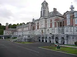 Britannia Royal Naval College, Main Complex and attached Walls |
| Royal Castle Hotel | Dartmouth | Jettied House | 1639 | 14 September 1949 | SX8779351372 50°21′06″N 3°34′43″W |
1218065 | |
| The Cherub | Dartmouth | Jettied House | 2nd half of 15th century | 14 September 1949 | SX8778751249 50°21′02″N 3°34′43″W |
1209644 |  |
| The Mansion House | Dartmouth | Apartment | 1949 | 14 September 1949 | SX8782351228 50°21′01″N 3°34′41″W |
1197496 |  |
| The Old Battery | Dartmouth Castle, Dartmouth | Barracks | 1861 | 23 February 1994 | SX8869250280 50°20′31″N 3°33′56″W |
1297087 |  |
| 4 The Quay | Dartmouth | House | 19th century | 14 September 1949 | SX8782151323 50°21′04″N 3°34′41″W |
1297056 | 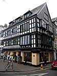 4 The Quay |
| 12 The Quay | Dartmouth | Apartment | 1994 | 14 September 1949 | SX8779051383 50°21′06″N 3°34′43″W |
1197587 |  |
| 13 The Quay | Dartmouth | Apartment | 1994 | 14 September 1949 | SX8779351391 50°21′06″N 3°34′43″W |
1292142 |  13 The Quay |
| 5 Higher Street | Dartmouth | House | c. 1960 | 11 December 1969 | SX8779451270 50°21′02″N 3°34′43″W |
1209616 |  |
| Addislade | Dean Prior | Farmhouse | Circa late 16th century | 27 May 1986 | SX7154264055 50°27′44″N 3°48′40″W |
1325409 |  |
| Dean Court | Lower Dean, Dean Prior | Farmhouse | Late 16th century | 11 November 1952 | SX7328064782 50°28′09″N 3°47′13″W |
1107414 |  |
| Bickham Bridge | Diptford | Road Bridge | 16th century or early 17th century | 9 February 1961 | SX7258555385 50°23′04″N 3°47′37″W |
1108342 | 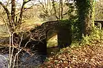 Bickham Bridge |
| Church of St Andrew | East Allington | Parish Church | 13th century | 26 January 1967 | SX7697248353 50°19′20″N 3°43′47″W |
1108031 | 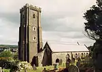 Church of St Andrew |
| Church of St Winaloe | East Portlemouth | Parish Church | 14th century | 26 January 1967 | SX7488138357 50°13′55″N 3°45′20″W |
1306828 | 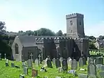 Church of St Winaloe |
| Keyndon Farmhouse including Secondary Range immediately to the West | Frogmore and Sherford | Farmhouse | 15th century | 25 October 1951 | SX7747143295 50°16′37″N 3°43′15″W |
1108451 |  |
| Ranscombe Farmhouse | Frogmore and Sherford | Farmhouse | Early 17th century | 26 January 1967 | SX7606544896 50°17′27″N 3°44′28″W |
1108453 |  |
| Beenleigh | Harberton | House | 12th century or 13th century or earlier site of | 9 February 1961 | SX7972056545 50°23′47″N 3°41′37″W |
1214051 |  |
| Church House Inn | Harberton | Cruck House | mid to late 16th century | 9 February 1961 | SX7778758612 50°24′53″N 3°43′17″W |
1108225 | 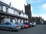 Church House Inn |
| Gate House immediately South East of Beenleigh | Beenleigh, Harberton | Gatehouse | 16th century | 26 April 1993 | SX7973656521 50°23′46″N 3°41′36″W |
1108281 |  |
| Flete Lodge | Holbeton | Gate Lodge | 1889 | 19 July 1984 | SX6305151932 50°21′05″N 3°55′35″W |
1107778 | 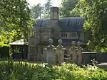 Flete Lodge |
| Garden Wall immediately South of Mothecombe House | Mothecombe, Holbeton | Garden Wall | Early 18th century | 19 July 1984 | SX6086147772 50°18′48″N 3°57′20″W |
1168292 |  |
| Barn, originally Longhouse, approx 40 Metres West of Inglettes Farmhouse | Holne | Barn | Circa early 16th century | 27 May 1986 | SX6958368961 50°30′21″N 3°50′26″W |
1147349 |  |
| Holne Bridge | Holne | Road Bridge | c. 1413 | 9 February 1961 | SX7301670585 50°31′16″N 3°47′34″W |
1107419 | |
| Knowle House | Kingsbridge | House | C17/Early 18th century | 13 December 1949 | SX7346944641 50°17′17″N 3°46′39″W |
1249361 |  |
| The Old Grammar School | Kingsbridge | Grammar School | 1670 | 13 December 1949 | SX7343444566 50°17′15″N 3°46′41″W |
1325371 |  |
| The Shambles | Kingsbridge | Market | 1586 | 13 December 1949 | SX7343244399 50°17′09″N 3°46′41″W |
1165593 | 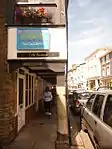 The Shambles |
| Church of St James the Less | Kingston | Church | 14th century | 26 January 1967 | SX6352947795 50°18′51″N 3°55′05″W |
1166006 | 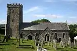 Church of St James the Less |
| Wonwell Court | Wonwell, Kingston | Kitchen | 16th century | 25 October 1951 | SX6295847598 50°18′44″N 3°55′34″W |
1309086 |  |
| Greenway House | Kingswear | Country House | 1780-1790 | 21 May 1985 | SX8720954755 50°22′55″N 3°35′16″W |
1108548 | |
| Nethway House | Kingswear | House | 1949 | 18 October 1949 | SX9025452141 50°21′32″N 3°32′39″W |
1146591 |  |
| Gatcombe House | Littlehempston | Apartment | 1969 | 9 February 1969 | SX8211362439 50°27′00″N 3°39′43″W |
1108554 |  |
| Hampstead Manor | Littlehempston | Farmhouse | 16th century | 9 February 1961 | SX8042561624 50°26′32″N 3°41′07″W |
1324864 |  |
| Church of St Michael and All Angels | Loddiswell | Church | 19th century | 26 January 1967 | SX7209848649 50°19′26″N 3°47′53″W |
1108121 | 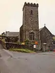 Church of St Michael and All Angels |
| Barn immediately North of Compton Castle | Compton, Marldon | Barn | Circa 18th century | 21 May 1985 | SX8654064903 50°28′23″N 3°36′01″W |
1108518 |  |
| Chain House | Modbury | Clothiers House | Early 18th century | 25 January 1990 | SX6586851685 50°20′59″N 3°53′12″W |
1325095 | 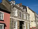 Chain House |
| Old Traine East & Old Traine West | Traine, Modbury | House | 1990 | 26 January 1967 | SX6609451911 50°21′07″N 3°53′01″W |
1147100 |  |
| Church of St Peter | Noss Mayo, Newton and Noss | Parish Church | 1882 | 29 March 1960 | SX5499447753 50°18′43″N 4°02′16″W |
1325259 | |
| Courtyard Walls, Gatepiers and Outbuilding immediately South East of Puslinch House | Newton and Noss | Gate | circa early 18th century | 19 July 1984 | SX5699950877 50°20′25″N 4°00′39″W |
1168902 |  |
| Garden Walls immediately to South of Puslinch House | Newton and Noss | Gate Pier | c. 1720 | 19 July 1984 | SX5693250853 50°20′25″N 4°00′43″W |
1325264 |  |
| Gnaton Hall | Newton Ferrers, Newton and Noss | Country House | c. 1826 | 29 March 1960 | SX5799049745 50°19′50″N 3°59′48″W |
1325263 | 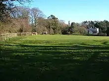 Gnaton Hall |
| Parsonage Farmhouse | Newton Ferrers, Newton and Noss | Farmhouse | Medieval | 19 July 1984 | SX5521448605 50°19′10″N 4°02′07″W |
1168805 |  |
| Black Hall | Avonwick, North Huish | Country House | circa 1820s | 9 February 1961 | SX7128657641 50°24′16″N 3°48′45″W |
1216358 |  |
| Church House Inn | Rattery | Inn | 16th century | 9 February 1961 | SX7400861543 50°26′25″N 3°46′32″W |
1308433 |  |
| Luscombe Farmhouse | Rattery | Farmhouse | 16th century | 27 May 1986 | SX7482963731 50°27′36″N 3°45′53″W |
1147441 |  |
| Syon Abbey | Rattery | Country House | 18th century | 9 February 1961 | SX7242661067 50°26′08″N 3°47′52″W |
1147483 | 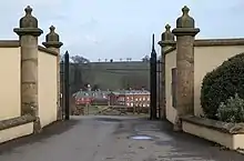 Syon Abbey |
| Church of All Hallows | Ringmore | Anglican Church | 1915 | 26 January 1967 | SX6526845993 50°17′54″N 3°53′35″W |
1108047 | 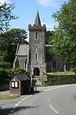 Church of All Hallows |
| Church of the Holy Trinity | Salcombe | Church | 1843 | 3 May 1949 | SX7400539198 50°14′22″N 3°46′05″W |
1212759 | 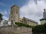 Church of the Holy Trinity |
| Old Porch House | Salcombe | House | 1660 | 27 February 1974 | SX7393939156 50°14′20″N 3°46′09″W |
1213252 |  |
| Snapes Manor | Batson Creek, Salcombe | House | 12th century | 3 May 1949 | SX7408439743 50°14′39″N 3°46′02″W |
1212753 |  |
| The Grange | Salcombe | House | Late 18th century | 3 May 1949 | SX7405138856 50°14′10″N 3°46′03″W |
1212730 |  |
| Woodcot | Salcombe | House | 1797 | 3 May 1949 | SX7362538456 50°13′57″N 3°46′24″W |
1212788 |  |
| Truelove Farm House | Truelove, Shaugh Prior | Farmhouse | Late 16th century | 29 March 1960 | SX5518660706 50°25′42″N 4°02′25″W |
1162826 |  |
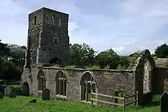
| Ruins of Church of St Andrew | South Huish | Parish Church | 13th century | 26 January 1967 | SX6951941112 50°15′20″N 3°49′54″W |
1108465 | |
| Barn approximately 30 Metres to the North East of Court Barton | South Pool | Threshing Barn | Circa late 16th century or early 17th century | 19 February 1990 | SX7767740352 50°15′02″N 3°43′02″W |
1108438 |  |
| Scoble | South Pool | Farmhouse | Circa 1720 - 40 | 26 January 1967 | SX7601739874 50°14′45″N 3°44′25″W |
1169744 |  |
| Gate Piers approximately 1300 Metres North West of Boringdon Hall | Plympton, Sparkwell | Gate Pier | Late 17th century | 9 November 1998 | SX5283858394 50°24′25″N 4°04′20″W |
1245698 |  |
| Gatepiers and Garden Boundary Wall immediately to East of Great Stert Farm House | Sparkwell | Gate Pier | Circa late 17th century | 29 March 1960 | SX5982257524 50°24′03″N 3°58′26″W |
1162976 |  |
| Great Stert Farm House | Sparkwell | Farmhouse | Circa early 17th century | 29 March 1960 | SX5979257523 50°24′03″N 3°58′27″W |
1107406 |  |
| Newnham Park | Newnham Park, Sparkwell | Country House | c. 1700 | 20 March 1960 | SX5556057937 50°24′13″N 4°02′02″W |
1309444 | 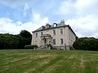 Newnham Park |
| Church of St Matthew | Landscove, Staverton | Parish Church | 1849-1850 | 21 May 1985 | SX7744666389 50°29′04″N 3°43′44″W |
1108532 | 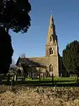 Church of St Matthew |
| Dovecote approximately 100 Metres North West of Pridhamsleigh Manor | Staverton | Dovecote | circa 16th century | 9 February 1961 | SX7489067774 50°29′47″N 3°45′55″W |
1108528 |  |
| Kingston House | Staverton | Country House | 1743 | 11 November 1952 | SX7947165460 50°28′36″N 3°42′00″W |
1108525 |  Kingston House |
| Pridhamsleigh Manor Farm House | Staverton | Farmhouse | 16th century | 11 November 1952 | SX7492567665 50°29′43″N 3°45′53″W |
1147332 |  |
| Woodend Farmhouse | Staverton | Farmhouse | Circa early 16th century or earlier | 21 May 1985 | SX7487568700 50°30′17″N 3°45′57″W |
1308548 |  |
| Woolston Green Farmhouse | Woolston Green, Staverton | Farmhouse | circa late 15th century or early 16th century | 21 May 1985 | SX7770166157 50°28′57″N 3°43′31″W |
1108491 |  |
| Church of St Peter | Stoke Fleming | Parish Church | 13th century | 26 January 1967 | SX8620148311 50°19′25″N 3°36′00″W |
1325163 | 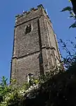 Church of St Peter |
| Sandridge Park | Stoke Gabriel | Country House | 1805 | 11 November 1952 | SX8599056475 50°23′49″N 3°36′20″W |
1108493 | |
| Widdicombe House | Stokenham | Country House | 1720-5 | 25 October 1951 | SX8119641729 50°15′49″N 3°40′05″W |
1107963 |  |
| Gate-piers about 100 Metres South South East of Higher Fuge | Strete | Gate Pier | 18th century | 25 March 1991 | SX8323748058 50°19′15″N 3°38′30″W |
1107950 |  |
| Higher Fuge | Strete | Farmhouse | 1726 | 26 January 1967 | SX8319248153 50°19′18″N 3°38′32″W |
1165419 |  |
| Church of All Saints | Thurlestone | Parish Church | 13th century | 26 January 1967 | SX6732442882 50°16′15″N 3°51′47″W |
1324947 | 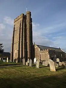 Church of All Saints |
| Barclay's Bank | Totnes | Bank | c. 1585 | 7 January 1952 | SX8021260429 50°25′53″N 3°41′17″W |
1236275 |  |
| Church House | Totnes | House | Modern | 7 January 1952 | SX8022560443 50°25′54″N 3°41′16″W |
1264772 |  |
| Eastgate House | Totnes | Inn | renamed in 1642 | 7 January 1952 | SX8027160417 50°25′53″N 3°41′14″W |
1236273 |  |
| Follaton House (South Hams District Council offices) | Totnes | Country House | Early 19th century | 7 January 1952 | SX7870160467 50°25′53″N 3°42′33″W |
1235624 | 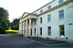 Follaton House (South Hams District Council offices) |
| King Edward VI School | Totnes | House | 17th century | 7 January 1952 | SX8042460369 50°25′51″N 3°41′06″W |
1235862 |  |
| Outbuilding to rear of No 39 (former Kitchen Block), Butterwalk | Totnes | Kitchen | Former | 28 October 1981 | SX8012860486 50°25′55″N 3°41′21″W |
1237072 |  |
| Priory Gate House, Fore Street | Totnes | House | possibly former | 7 January 1952 | SX8031160427 50°25′53″N 3°41′12″W |
1235702 |  |
| Priory House | Totnes | House | later 17th century | 7 January 1952 | SX8024560606 50°25′59″N 3°41′15″W |
1264386 |  |
| The Royal Seven Stars Hotel | Totnes | Courtyard | Late 17th century | 7 January 1952 | SX8056560364 50°25′51″N 3°40′59″W |
1236781 |  The Royal Seven Stars Hotel |
| Totnes Bridge | Bridgetown, Totnes | Bridge | 1826-1828 | 7 January 1952 | SX8067360300 50°25′49″N 3°40′53″W |
1107495 | 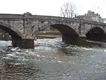 Totnes Bridge |
| Nos 34, 34a and 34b (flat), Fore Street | Totnes | Apartment | Late 18th century | 25 March 1969 | SX8044160375 50°25′52″N 3°41′05″W |
1264900 |  |
| 48 Fore Street | Totnes | Kitchen | later 16th century or early 17th century | 7 January 1952 | SX8038060391 50°25′52″N 3°41′08″W |
1264828 |  |
| 50 Fore Street | Totnes | House | late 16th century or early 17th century | 7 January 1952 | SX8037260393 50°25′52″N 3°41′08″W |
1235797 |  |
| 52 Fore Street | Totnes | House | 17th century | 7 January 1952 | SX8036660395 50°25′52″N 3°41′09″W |
1235939 |  |
| 54 Fore Street | Totnes | House | c. 1607 | 7 January 1952 | SX8036160396 50°25′52″N 3°41′09″W |
1264832 |  |
| 64 Fore Street | Totnes, South Hams | House | Early 19th century | 7 January 1952 | SX8032160406 50°25′53″N 3°41′11″W |
1264833 |  |
| 68 Fore Street | Totnes | House | Mid 18th century | 7 January 1952 | SX8031060409 50°25′53″N 3°41′12″W |
1264834 |  |
| 8 High Street | Totnes | House | Extended | 7 January 1952 | SX8024560423 50°25′53″N 3°41′15″W |
1236315 |  |
| 10, 10a and 10b High Street | Totnes | House | Early 17th century | 7 January 1952 | SX8023160419 50°25′53″N 3°41′16″W |
1264676 |  |
| 22 High Street | Totnes | House | early to mid 19th century | 25 March 1969 | SX8019460431 50°25′53″N 3°41′18″W |
1264633 |  |
| 26 High Street | Totnes | House | Early 18th century | 7 January 1952 | SX8018160432 50°25′53″N 3°41′18″W |
1236350 |  |
| 28 High Street | Totnes | House | Early 18th century | 7 January 1952 | SX8017660433 50°25′53″N 3°41′18″W |
1264634 |  |
| 32 High Street | Totnes | House | c. 1560 | 7 January 1952 | SX8016060434 50°25′53″N 3°41′19″W |
1264635 |  |
| 33 High Street | Totnes | House | later 16th century | 7 January 1952 | SX8014160460 50°25′54″N 3°41′20″W |
1264727 |  |
| 39 and 41 High Street | Totnes | House | c. 1624 | 7 January 1952 | SX8012260461 50°25′54″N 3°41′21″W |
1236133 |  |
| 55 High Street | Totnes | House | later 16th century | 7 January 1952 | SX8007760466 50°25′54″N 3°41′23″W |
1236135 |  |
| 10 Warland | Totnes | House | early 16th century (after 1508) | 16 March 1978 | SX8048060177 50°25′45″N 3°41′03″W |
1236977 |  |
| Cross Re-used as Gate Post immediately South East of Haredon Farmhouse | Ugborough | Gate | Medieval | 18 February 1985 | SX6733055187 50°22′54″N 3°52′03″W |
1307167 |  |
| Haredon Farmhouse | Ugborough | Farmhouse | Circa late 15th century | 19 February 1985 | SX6732055192 50°22′54″N 3°52′03″W |
1107371 |  |
| Fort Bovisand | Wembury | Battery | 1861-1869 | 12 November 1999 | SX4875550663 50°20′11″N 4°07′36″W |
1379615 | 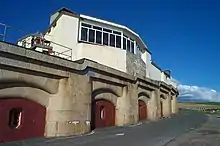 Fort Bovisand |
| Garden Wall, Steps and Gate Piers immediately South of Langdon Court Hotel | Langdon, Wembury | Gate Pier | circa early 18th century | 19 July 1984 | SX5147349687 50°19′42″N 4°05′17″W |
1169143 |  |
| Hele Almshouses | Wembury | Almshouse | 1682 | 29 March 1984 | SX5325049415 50°19′35″N 4°03′47″W |
1306680 | 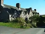 Hele Almshouses |
| Langdon Court Hotel | Langdon, Wembury | Country House | Medieval | 29 March 1960 | SX5148149722 50°19′43″N 4°05′17″W |
1324841 | 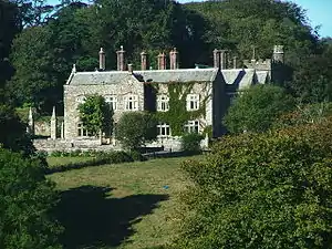 Langdon Court Hotel |
| Pair of Garden Houses approximately 35 Metres South of Langdon Court Hotel | Langdon, Wembury | Gazebo | circa early 18th century | 29 March 1960 | SX5147349665 50°19′41″N 4°05′17″W |
1108587 |  |
| Two Pairs of Gate Piers adjoining South West and South East of Langdon Court Hotel | Langdon, Wembury | Gate Pier | 17th century | 29 March 1960 | SX5150749701 50°19′43″N 4°05′15″W |
1169129 | 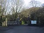 Two Pairs of Gate Piers adjoining South West and South East of Langdon Court Hotel |
| Wall Approximately 90 Metres West of Wembury House | Wembury | Wall | circa late 16th century | 19 July 1984 | SX5303549189 50°19′27″N 4°03′57″W |
1169185 |  |
| Wembury House | Wembury | Country House | 1803-6 | 23 April 1952 | SX5312049207 50°19′28″N 4°03′53″W |
1108590 |  |
| Old Stones and School Cottage & Pay Cottage | West Alvington | Cruck House | Circa early 16th century | 25 October 1951 | SX7244043836 50°16′50″N 3°47′30″W |
1324917 |  |
| Brook Manor House | West Buckfastleigh | Manor House | 1656 | 27 May 1986 | SX7132967680 50°29′41″N 3°48′56″W |
1168435 |  |
| Church of St Mary | Woodleigh | Sundial | 1707 | 26 January 1967 | SX7378648842 50°19′33″N 3°46′28″W |
1108128 | 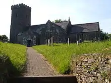 Church of St Mary |
| Church of St Bartholomew | Yealmpton | Parish Church | 1850 | 29 March 1960 | SX5777651701 50°20′53″N 4°00′01″W |
1306637 | 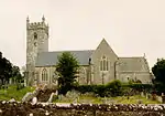 Church of St Bartholomew |
| Former Stables approximately 60 Metres North West of Lyneham House | Lyneham, Yealmpton | Stable | c. 1700 | 29 March 1960 | SX5782153492 50°21′51″N 4°00′01″W |
1324866 |  |
| Goreus Stone | Yealmpton | Gravestone | C3 | 19 July 1984 | SX5775451697 50°20′53″N 4°00′02″W |
1169259 |  |
Notes
- The date given is the date used by Historic England as significant for the initial building or that of an important part in the structure's description.
- Sometimes known as OSGB36, the grid reference is based on the British national grid reference system used by the Ordnance Survey.
- The "List Entry Number" is a unique number assigned to each listed building and scheduled monument by Historic England.
External links
![]() Media related to Grade II* listed buildings in Devon at Wikimedia Commons
Media related to Grade II* listed buildings in Devon at Wikimedia Commons
This article is issued from Wikipedia. The text is licensed under Creative Commons - Attribution - Sharealike. Additional terms may apply for the media files.

.jpg.webp)