Grade II* listed buildings in Worcester
There are over 20,000 Grade II* listed buildings in England. This page is a list of these buildings in the district of Worcester in Worcestershire.
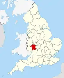
Worcestershire shown within England
Worcester
| Name | Location | Type | Completed [note 1] | Date designated | Grid ref.[note 2] Geo-coordinates |
Entry number [note 3] | Image |
|---|---|---|---|---|---|---|---|
| Warndon Court | Warndon, Worcester | Farmhouse | Early 17th century | 14 March 1969 | SO8874056864 52°12′36″N 2°09′58″W |
1166562 |  Warndon Court |
| Boundary Walls to East Side of River Severn extending North from the Water Gate | Worcester | Boundary Wall | Possible 14th-century origins | 5 April 1971 | 49°46′01″N 7°33′26″W | 1389929 |  Boundary Walls to East Side of River Severn extending North from the Water Gate |
| Boundary Walls to East Side of River Severn extending South from the Water Gate | Worcester | Boundary Wall | Possible 14th-century origins | 27 June 2001 | SO8491054360 52°11′14″N 2°13′20″W |
1389930 |  Boundary Walls to East Side of River Severn extending South from the Water Gate |
| Britannia House (Alice Otley School) | Worcester | House | 1730-1750 | 22 May 1954 | SO8480855701 52°11′58″N 2°13′25″W |
1390240 | .jpg.webp) Britannia House (Alice Otley School) |
| Bushwackers | Worcester | House/Pub | c. 1750 | 22 May 1954 | SO8503555034 52°11′36″N 2°13′13″W |
1390182 | %252C_entrance_from_The_Avenue%252C_Worcester_(geograph_3164610).jpg.webp) Bushwackers |
| Church of All Saints | Worcester | Parish Church | Norman | 22 May 1954 | SO8478554875 52°11′31″N 2°13′26″W |
1063890 |  Church of All Saints |
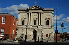
| Church of St George (Roman Catholic) | Worcester | Church | 1829 | 22 May 1954 | SO8509155182 52°11′41″N 2°13′10″W |
1390134 | |
| Church of St Helen | Worcester | Record Office | From 1957-2002 | 22 May 1954 | SO8501054708 52°11′25″N 2°13′15″W |
1389795 |  Church of St Helen |
| Church of St John | Worcester | Church | 1481 Tower added | 22 May 1954 | SO8401654466 52°11′18″N 2°14′07″W |
1390120 |  Church of St John |
| Church of St John the Baptist | Claines, Worcester | Parish Church | 12th century | 14 March 1969 | SO8514358862 52°13′40″N 2°13′08″W |
1063810 | 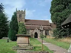 Church of St John the Baptist |
| Church of St Martin | Worcester | Parish Church | 1768-1772 | 22 May 1954 | SO8513455002 52°11′35″N 2°13′08″W |
1389755 | 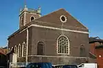 Church of St Martin |
| City Museum and Library with Gates | Worcester | Museum | 1896 | 5 April 1971 | SO8490755372 52°11′47″N 2°13′20″W |
1389828 | 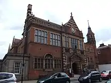 City Museum and Library with Gates |
| Former Church of St Nicholas | Worcester | Restaurant | 2001 | 22 May 1954 | SO8499455059 52°11′37″N 2°13′15″W |
1390194 | .jpg.webp) Former Church of St Nicholas |
| Huntingdon Hall | Crowngate, Worcester | Chapel/Concert Hall | 22 May 1954 | SO8491354856 52°11′30″N 2°13′20″W |
1063893 | 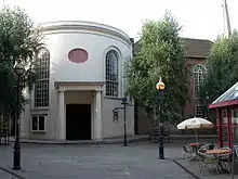 Huntingdon Hall | |
| Judges Lodgings and attached Railings | Worcester | Office | 2001 | 5 April 1971 | SO8495555428 52°11′49″N 2°13′18″W |
1390144 |  |
| King Charles House | Worcester | Apartment | 2001 | 22 May 1954 | SO8518554943 52°11′33″N 2°13′05″W |
1389751 | .jpg.webp) King Charles House |
| King Charles House | Worcester | House | Restored 1986 | 22 May 1954 | SO8518854931 52°11′33″N 2°13′05″W |
1390020 |  King Charles House |
| Monastic Ruins | Worcester | Benedictine Monastery | c. 1320 | 22 May 1954 | SO8491354487 52°11′18″N 2°13′20″W |
1359629 | .jpg.webp) Monastic Ruins |
| Nash House (no 7 and 7a, New Street) | Worcester | House | c. 1674 | 22 May 1954 | SO8515554800 52°11′28″N 2°13′07″W |
1390010 | .jpg.webp) Nash House (no 7 and 7a, New Street) |
| No 15, College Green and Wall adjoining to East | Worcester | House | c1720-30 | 22 May 1954 | SO8506454459 52°11′17″N 2°13′12″W |
1063827 | .jpg.webp) No 15, College Green and Wall adjoining to East |
| No 9, College Green and attached Wall to left at rear | Worcester | House | C18-early 19th century extension | 22 May 1954 | SO8495254353 52°11′14″N 2°13′18″W |
1063821 |  |
| Old Assembly Room | Worcester | Assembly Rooms | 1749 | 22 May 1954 | SO8489955155 52°11′40″N 2°13′20″W |
1390155 |  Old Assembly Room |
| Powick Mills | Lower Wick, Worcester | House | 1999 | 7 March 1989 | SO8350752542 52°10′15″N 2°14′33″W |
1390029 |  Powick Mills |
| Premises occupied by Bradford and Bingley Building Society | Worcester | House | Early 18th century | 22 May 1954 | SO8500355007 52°11′35″N 2°13′15″W |
1390187 |  Premises occupied by Bradford and Bingley Building Society |
| Queen Elizabeth House | Worcester | Timber Framed House | Early and Mid 18th century | 22 May 1954 | SO8507355019 52°11′36″N 2°13′11″W |
1390238 |  Queen Elizabeth House |
| Rose Place | Claines, Worcester | House | Early 19th century | 21 March 1985 | SO8593758404 52°13′25″N 2°12′26″W |
1389926 |  Rose Place |
| Royal Worcester Porcelain Works: Pan Grinding Shop and attached Buildings | Worcester | Boiler House | 1862-1870 | 15 March 1990 | SO8517154280 52°11′12″N 2°13′06″W |
1390149 |  Royal Worcester Porcelain Works: Pan Grinding Shop and attached Buildings |
| Shire Hall | Worcester | Shire Hall | c1834-35 | 22 May 1954 | SO8492255420 52°11′48″N 2°13′19″W |
1389831 | |
| Shrub Hill Station: Waiting Room to East Platform | Worcester | Waiting Room | c. 1880 | 5 April 1971 | SO8583055128 52°11′39″N 2°12′31″W |
1390157 | |
| South African War Memorial | Worcester | War Memorial | 1908 | 19 August 1999 | SO8502554577 52°11′21″N 2°13′14″W |
1389731 |  South African War Memorial |
| St Andrew's Church Tower | Worcester | Church | 15th century | 22 May 1954 | SO8486454783 52°11′28″N 2°13′22″W |
1389762 |  St Andrew's Church Tower |
| The Deanery (no 10, College Green) and Office (10A) with attached Walls | Worcester | House | Possible earlier origins | 22 May 1954 | SO8493754374 52°11′15″N 2°13′18″W |
1063822 |  |
| The Pheasant | Worcester | Jettied House | Late 16th century | 22 May 1954 | SO8517954896 52°11′32″N 2°13′06″W |
1390016 |  The Pheasant |
| Tudor House Museum | Worcester | Timber Framed House | c1575-1625 | 22 May 1954 | SO8513154648 52°11′24″N 2°13′08″W |
1389852 | .jpg.webp) Tudor House Museum |
| Water Gate House and attached Walls and Gate to East | Worcester | House | 17th century | 22 May 1954 | SO8490754425 52°11′16″N 2°13′20″W |
1063824 |  Water Gate House and attached Walls and Gate to East |
| Whiteladies House at Worcester Grammar School | Worcester | House | c. 1720 | 22 May 1954 | SO8479455808 52°12′01″N 2°13′26″W |
1390245 |  |
| 61 Broad Street | Worcester | House | Circa 1740s | 22 May 1954 | SO8491654954 52°11′33″N 2°13′19″W |
1063886 |  61 Broad Street |
| 3 Edgar Street | Worcester | House | 1732 | 22 May 1954 | SO8511854438 52°11′17″N 2°13′09″W |
1389776 |  |
| 14, 16 and 18 Friar Street | Worcester | House | Later alterations | 22 May 1954 | SO8512054710 52°11′26″N 2°13′09″W |
1389840 |  14, 16 and 18 Friar Street |
| 26–32 Friar Street | Worcester | House | Later alterations | 22 May 1954 | SO8512554681 52°11′25″N 2°13′08″W |
1389846 | .jpg.webp) 26–32 Friar Street |
Notes
- The date given is the date used by Historic England as significant for the initial building or that of an important part in the structure's description.
- Sometimes known as OSGB36, the grid reference is based on the British national grid reference system used by the Ordnance Survey.
- The "List Entry Number" is a unique number assigned to each listed building and scheduled monument by Historic England.
References
External links
![]() Media related to Grade II* listed buildings in Worcestershire at Wikimedia Commons
Media related to Grade II* listed buildings in Worcestershire at Wikimedia Commons
This article is issued from Wikipedia. The text is licensed under Creative Commons - Attribution - Sharealike. Additional terms may apply for the media files.

.jpg.webp)
