Grade I listed buildings in Herefordshire
There are over 9,000 Grade I listed buildings in England. This page is a list of these buildings in the county of Herefordshire.
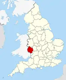
Herefordshire shown in England
County of Herefordshire
| Name | Location | Type | Completed [note 1] | Date designated | Grid ref.[note 2] Geo-coordinates |
Entry number [note 3] | Image |
|---|---|---|---|---|---|---|---|
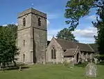
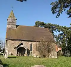
| Church of St Mary | Abbey Dore | Abbey | Late 12th century to Early 13th century | 26 January 1962 | SO3871730401 51°58′07″N 2°53′36″W |
1099794 | 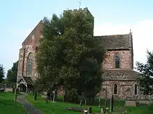 Church of St Mary |
| Gatehouse attached to west end of the Grange | Grange, Adforton | Gatehouse | 14th century | 11 June 1959 | SO4101271270 52°20′11″N 2°52′02″W |
1349753 | .jpg.webp) Gatehouse attached to west end of the Grange |
| Outbuilding about 95 yards West-north-west of the Grange | Grange, Adforton | Gatehouse | 14th century with later alterations | 11 June 1959 | SO4092371320 52°20′12″N 2°52′07″W |
1082061 |  |
| Remains of Wigmore Abbey | Grange, Adforton | Abbey | Late 12th century | 11 June 1959 | SO4106771308 52°20′12″N 2°51′59″W |
1179921 | |
| Storage Building about 100 yards West-north-west of the Grange | Grange, Adforton | Storehouse | 14th century with later alterations | 11 June 1959 | SO4090571309 52°20′12″N 2°52′07″W |
1179912 | |
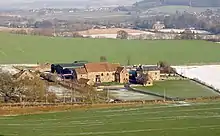
| The Grange | Grange, Adforton | Grange | 12th century | 11 June 1959 | SO4104171274 52°20′11″N 2°52′00″W |
1082057 | 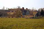 The Grange |
| Church of St Mary | Almeley | Parish Church | Later alterations | 2 September 1966 | SO3327451501 52°09′28″N 2°58′36″W |
1081702 | 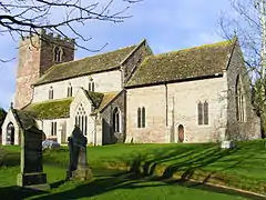 Church of St Mary |
| Church of St John the Baptist and St Alkmund | Aymestrey | Parish Church | 12th century | 11 June 1959 | SO4260265130 52°16′53″N 2°50′34″W |
1082113 |  Church of St John the Baptist and St Alkmund |
| Church of St Peter | Birley, Birley with Upper Hill | Parish Church | 13th century | 2 September 1966 | SO4535653354 52°10′33″N 2°48′02″W |
1081970 | 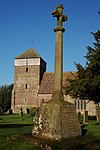 Church of St Peter |
| Bell Tower | Bosbury | Bell Tower | 13th century | 26 March 1986 | SO6955843420 52°05′18″N 2°26′45″W |
1349189 | 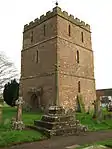 Bell Tower |
| Church of Holy Trinity | Bosbury | Parish Church | Early 12th century | 6 March 1972 | SO6954943451 52°05′19″N 2°26′45″W |
1098890 |  Church of Holy Trinity |
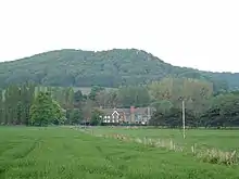
| Brampton Bryan Castle | Brampton Bryan | Castle | Early 14th century | 11 June 1959 | SO3703072577 52°20′51″N 2°55′33″W |
1082066 | |
| Church of St Barnabas | Brampton Bryan | Bell Tower | 19th century | 11 June 1959 | SO3704872514 52°20′49″N 2°55′32″W |
1179943 | 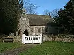 Church of St Barnabas |
| Ruins of Hall about 10 yards North of Brampton Bryan Castle | Brampton Bryan | Hall House | Early 14th century | 11 June 1959 | SO3703072596 52°20′52″N 2°55′33″W |
1301697 | .jpg.webp) Ruins of Hall about 10 yards North of Brampton Bryan Castle |
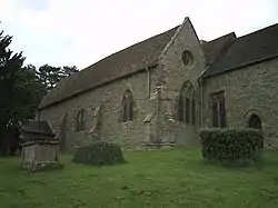
| Church of St Andrew | Bridge Sollers | Parish Church | 12th century | 2 September 1966 | SO4147842615 52°04′44″N 2°51′19″W |
1157590 | 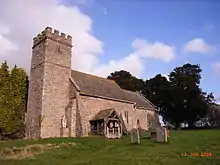 Church of St Andrew |
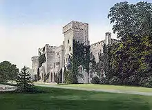
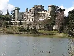
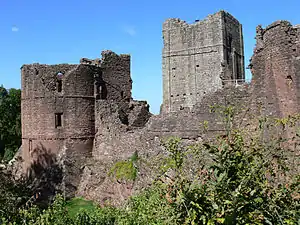
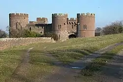
| Ruins of Wilton Castle and House attached to South | Wilton, Bridstow | Castle | c. 1300 | 18 May 1953 | SO5900624371 51°54′59″N 2°35′51″W |
1214349 |  Ruins of Wilton Castle and House attached to South |
| Wilton Bridge and Sundial (that Part in Bridstow Civil Parish) | Wilton, Bridstow | Bridge | 1597 | 22 March 1973 | SO5898024215 51°54′54″N 2°35′52″W |
1288736 | 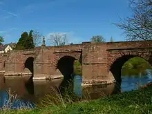 Wilton Bridge and Sundial (that Part in Bridstow Civil Parish) |
| Brinsop Court | Brinsop and Wormsley | House | 14th century | 20 February 1953 | SO4460345792 52°06′28″N 2°48′37″W |
1349793 | |
| Church of St George | Brinsop, Brinsop and Wormsley | Parish Church | 12th century | 2 September 1966 | SO4423344791 52°05′55″N 2°48′56″W |
1081971 | 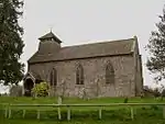 Church of St George |
| Church of St Mary | Monnington on Wye, Brobury with Monnington on Wye | Parish Church | 15th century | 2 September 1966 | SO3735543325 52°05′05″N 2°54′56″W |
1349851 | 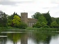 Church of St Mary |
| Church of All Saints | Brockhampton | Parish Church | 1901-1902 | 25 February 1966 | SO5941332147 51°59′11″N 2°35′33″W |
1349021 | 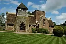 Church of All Saints |
| Gatehouse South West of Lower Brockhampton House | Brockhampton | Gatehouse | Late 15th century | 12 April 1973 | SO6874155979 52°12′04″N 2°27′32″W |
1082376 | |
| Lower Brockhampton House | Brockhampton | Cross Wing House | Late 14th century or early 15th century | 9 April 1952 | SO6875356002 52°12′05″N 2°27′31″W |
1176676 | |
| Church of St Peter | Bromyard, Bromyard and Winslow | Church | Late 12th century | 25 October 1951 | SO6554154842 52°11′27″N 2°30′20″W |
1307758 | 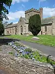 Church of St Peter |
| Church of St John the Baptist | Byford | Parish Church | 12th century | 2 September 1966 | SO3971742917 52°04′53″N 2°52′52″W |
1349866 |  Church of St John the Baptist |
| Church of St Lawrence | Canon Pyon | Parish Church | 13th century | 2 September 1966 | SO4500849176 52°08′17″N 2°48′18″W |
1081974 | 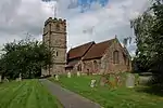 Church of St Lawrence |
| Church of St Michael | Castle Frome | Parish Church | 12th century | 6 March 1967 | SO6675845868 52°06′36″N 2°29′13″W |
1098869 | 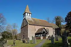 Church of St Michael |
| Church of All Saints | Clehonger | Parish Church | 12th century | 26 January 1967 | SO4654637949 52°02′14″N 2°46′50″W |
1301135 | 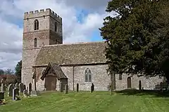 Church of All Saints |
| Clifford Castle and Barbican | Clifford | Castle | Late 13th century | 17 January 1949 | SO2434945677 52°06′15″N 3°06′21″W |
1167903 | |
| Church of St Mary | Credenhill | Parish Church | 12th century | 27 January 1967 | SO4503043882 52°05′26″N 2°48′13″W |
1168027 | .jpg.webp) Church of St Mary |
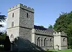
| Church of St Michael | Croft Castle, Croft and Yarpole | Parish Church | Mid 14th century | 11 June 1959 | SO4498665427 52°17′03″N 2°48′28″W |
1166506 | |
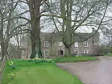
| Croft Castle | Croft and Yarpole | Country House | Late 16th century to early 17th century | 8 November 1956 | SO4494365435 52°17′03″N 2°48′31″W |
1166451 | |
| Tower about 15 metres South of Church of St Leonard | Yarpole, Croft and Yarpole | Bell Tower | 13th century | 11 December 1987 | SO4697464844 52°16′45″N 2°46′43″W |
1081790 | 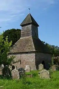 Tower about 15 metres South of Church of St Leonard |
| Church of St Mary | Dilwyn | Parish Church | c. 1200 | 2 September 1966 | SO4152154674 52°11′14″N 2°51′25″W |
1349814 | 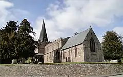 Church of St Mary |
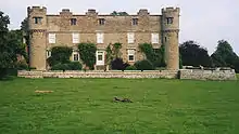
| Downton Castle and adjoining Stable Courtyard | Downton | Country House | c1774-8 | 11 May 1987 | SO4451174733 52°22′04″N 2°48′59″W |
1081758 | |
| Church of St. Mary Magdalene | Eardisley | Parish Church | 12th century | 16 October 1967 | SO3124049127 52°08′10″N 3°00′22″W |
1349544 | .jpg.webp) Church of St. Mary Magdalene |
| Church of St John the Baptist | Eastnor | Church | 12th century | 18 November 1952 | SO7313437227 52°01′58″N 2°23′35″W |
1266756 | 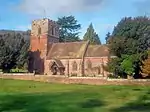 Church of St John the Baptist |
| Eastnor Castle | Eastnor | Country House | 1811-1820 | 18 November 1952 | SO7350036876 52°01′47″N 2°23′16″W |
1156712 | |
| Church of St Michael and All Angels | Eaton Bishop | Parish Church | 11th century | 26 January 1967 | SO4430439104 52°02′51″N 2°48′49″W |
1099705 | .jpg.webp) Church of St Michael and All Angels |
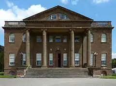
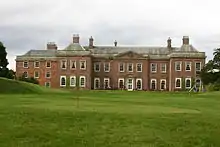
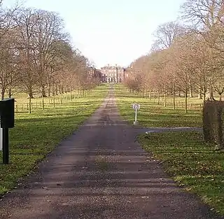
| Berrington Hall and adjoining Outbuildings | Eye, Moreton and Ashton | Country House | 1778-c1781 | 11 June 1959 | SO5093063660 52°16′08″N 2°43′14″W |
1082564 | |
| Church of St Peter and St Paul | Eye, Eye, Moreton and Ashton | Parish Church | Late 12th century | 11 June 1959 | SO4964063809 52°16′12″N 2°44′22″W |
1166756 | 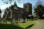 Church of St Peter and St Paul |
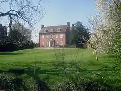
| Eye Manor | Eye, Moreton and Ashton | Country House | 1673 | 11 June 1959 | SO4960963842 52°16′13″N 2°44′24″W |
1349522 | |
| Church of St Mary | Fownhope | Anglican Church | 1881 | 26 January 1967 | SO5810334273 52°00′19″N 2°36′42″W |
1099890 | 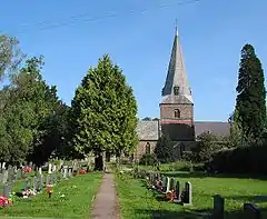 Church of St Mary |
| Church of St Mary | Foy | Parish Church | 13th century | 25 February 1966 | SO5979228348 51°57′08″N 2°35′11″W |
1157820 | 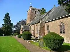 Church of St Mary |
| Church of St Michael | Garway | Church | 12th century | 1 March 1960 | SO4550522482 51°53′54″N 2°47′36″W |
1099751 | 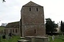 Church of St Michael |
| Dovecote about 80 yards South East of the Church of St Michael | Garway | Dovecote | 14th century | 1 March 1960 | SO4554022413 51°53′51″N 2°47′34″W |
1348781 | 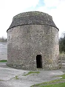 Dovecote about 80 yards South East of the Church of St Michael |
| Flanesford Priory | Goodrich | Augustinian Monastery | 1346 | 25 February 1966 | SO5790719381 51°52′17″N 2°36′46″W |
1157248 | |
| Goodrich Castle | Goodrich | Castle | Early 14th century | 14 February 1966 | SO5771119987 51°52′37″N 2°36′57″W |
1348917 | |
| Church of St Andrew | Hampton Bishop | Anglican Church | 15th century or 16th century | 26 January 1967 | SO5588638011 52°02′19″N 2°38′40″W |
1301948 | 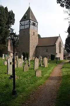 Church of St Andrew |
| St Catherine's Church, Hoarwithy | Hoarwithy, Herefordshire | Church | c. 1840 | 26 March 1987 | SO5457429405 51°57′41″N 2°39′45″W |
1214570 | |
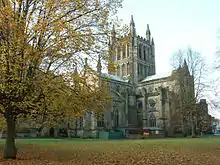
| Cathedral Church of St Mary and St Ethelbert | Hereford | Cathedral | 11th century to 15th century | 10 June 1952 | SO5099939790 52°03′16″N 2°42′58″W |
1196808 | |
| College of Vicars Choral | Hereford | College of the Vicars Choral | c. 1473 | 10 June 1952 | SO5105139694 52°03′12″N 2°42′55″W |
1196809 | .jpg.webp) College of Vicars Choral |
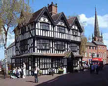
| The Old House | Hereford | Box Frame House | c. 1621 | 10 June 1952 | SO5108140032 52°03′23″N 2°42′54″W |
1207754 | |
| Wye Bridge | Hereford | Bridge | Late 15th century | 10 June 1952 | SO5081139595 52°03′09″N 2°43′07″W |
1196768 | 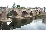 Wye Bridge |
| Church of St Cuthbert | Holme Lacy | Parish Church | 13th century | 26 January 1967 | SO5684834736 52°00′34″N 2°37′48″W |
1099563 | |
| Holme Lacy House | Holme Lacy | Country House/Hotel | 1674 | 26 January 1967 | SO5546534968 52°00′41″N 2°39′01″W |
1348852 | |
| Church of St Bartholomew | Holmer and Shelwick | Parish Church | Late 12th century | 27 January 1967 | SO5053142404 52°04′40″N 2°43′24″W |
1099290 | 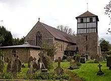 Church of St Bartholomew |
| Hampton Court | Hope under Dinmore | House | 1427-36 | 11 June 1959 | SO5204952426 52°10′05″N 2°42′09″W |
1157291 | |
| Church of St Michael | Kenchester | Parish Church | Late 12th century | 27 January 1967 | SO4341343247 52°05′05″N 2°49′38″W |
1172691 | .jpg.webp) Church of St Michael |
| Kentchurch Court | Kentchurch | Castle | 14th century | 29 September 1952 | SO4231125905 51°55′43″N 2°50′25″W |
1157632 | |
| Church of St Mary and St David | Kilpeck | Church | c1134-40 | 26 January 1967 | SO4451030514 51°58′13″N 2°48′33″W |
1099582 | |
| Church of St John the Baptist | King's Caple | Parish Church | 13th century | 25 February 1966 | SO5589128836 51°57′23″N 2°38′36″W |
1349008 | .jpg.webp) Church of St John the Baptist |
| Church of St Mary | King's Pyon | Parish Church | 12th century | 2 September 1966 | SO4386550625 52°09′04″N 2°49′19″W |
1179970 | |
| Church of St Michael | Kingsland | Parish Church | 13th century | 11 June 1959 | SO4468361287 52°14′49″N 2°48′42″W |
1167022 | 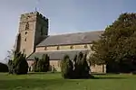 Church of St Michael |
| Church of St Mary | Kington | Parish Church | c. 1300 | 8 October 1953 | SO2913556762 52°12′16″N 3°02′18″W |
1208031 | |
| Church of St James | Kinnersley | Bust | C12, 13th century and 14th century | 2 September 1966 | SO3455649618 52°08′27″N 2°57′28″W |
1157630 | 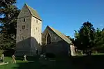 Church of St James |
| Church of St Andrew | Laysters (or Leysters) | Parish Church | 12th century | 11 June 1959 | SO5683763250 52°15′57″N 2°38′02″W |
1166945 | .jpg.webp) Church of St Andrew |
| Church of St Michael and All Angels, Including the detached Bell Tower | Ledbury | Bell Tower | c. 1230 | 18 September 1953 | 49°46′01″N 7°33′26″W | 1301825 |  Church of St Michael and All Angels, Including the detached Bell Tower |
| Ledbury Park | Ledbury Park, Ledbury | House | 1590 | 18 September 1953 | SO7113837564 52°02′09″N 2°25′20″W |
1180078 | .jpg.webp) Ledbury Park |
| Market House | Ledbury | Market House | c. 1617 | 18 September 1953 | SO7110237708 52°02′13″N 2°25′22″W |
1349392 | 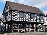 Market House |
| Church of St Mary Magdalene | Leintwardine | Anglican Church | 1865 | 11 June 1959 | SO4046274095 52°21′42″N 2°52′33″W |
1349757 | 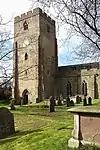 Church of St Mary Magdalene |
| The Priory Church of St Peter and St Paul | Leominster | Parish Church | 13th century | 24 July 1954 | SO4985259278 52°13′46″N 2°44′08″W |
1077617 | 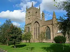 The Priory Church of St Peter and St Paul |
| Church of St John the Baptist | Letton | Parish Church | C12,C13 and 14th century | 2 September 1966 | SO3351246451 52°06′45″N 2°58′20″W |
1157735 | 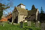 Church of St John the Baptist |
| Church of St Mary | Linton | Church | 12th century | 17 March 1987 | SO6602125332 51°55′32″N 2°29′44″W |
1167319 | 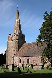 Church of St Mary |
| Church of St Deinst | Llangarron | Parish Church | 14th century | 26 February 1966 | SO5303721169 51°53′14″N 2°41′02″W |
1348911 | 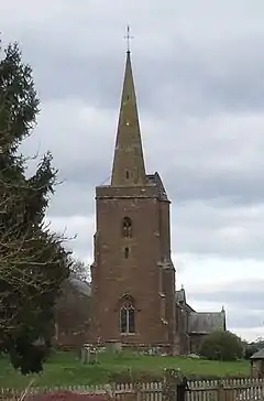 Church of St Deinst |
| Church of St Clodock | Clodock, Longtown | Parish Church | 12th century | 26 January 1967 | SO3264827513 51°56′31″N 2°58′52″W |
1078150 | 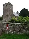 Church of St Clodock |
| Church of the Nativity of the Blessed Virgin Mary | Madley | Parish Church | 12th century | 26 January 1962 | SO4199838720 52°02′38″N 2°50′50″W |
1348768 | 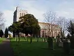 Church of the Nativity of the Blessed Virgin Mary |
| Amberley Court | Amberley, Marden | Hall House | Early 14th century | 20 October 1952 | SO5458047808 52°07′36″N 2°39′54″W |
1302188 | |
| Church of St Mary | Marden | Parish Church | 13th century and 14th century | 26 January 1967 | SO5118047057 52°07′11″N 2°42′52″W |
1302203 | 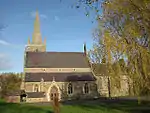 Church of St Mary |
| Church of St Mary | Middleton on the Hill | Parish Church | 12th century | 11 June 1959 | SO5405264606 52°16′40″N 2°40′30″W |
1167020 | 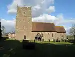 Church of St Mary |
| Church of St Michael and All Angels | Moccas Park, Moccas | Parish Church | Mid 12th century | 2 September 1966 | SO3574343275 52°05′03″N 2°56′21″W |
1157759 | 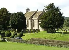 Church of St Michael and All Angels |
| Moccas Court | Moccas Park, Moccas | Country House | 1775-81 | 2 September 1966 | SO3577043533 52°05′11″N 2°56′20″W |
1081852 | |
| Church of Saints Cosmas and Damian | Stretford, Monkland and Stretford | Parish Church | 12th century | 2 September 1966 | SO4435055741 52°11′49″N 2°48′56″W |
1349846 | |
| Church of St Mary | Much Cowarne | Church | Early 13th century | 9 June 1967 | SO6186347133 52°07′16″N 2°33′30″W |
1082241 | 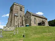 Church of St Mary |
| Church of St David | Much Dewchurch | Parish Church | 12th century | 26 January 1967 | SO4822431117 51°58′34″N 2°45′19″W |
1348822 |  Church of St David |
| The Mynde | Much Dewchurch | House | 15th century and 16th century | 20 October 1952 | SO4706829726 51°57′49″N 2°46′18″W |
1348825 | |
| Church of St Bartholomew | Much Marcle | Parish Church | C13-C15 | 6 March 1967 | SO6570832746 51°59′32″N 2°30′03″W |
1156241 | 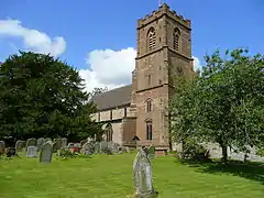 Church of St Bartholomew |
| Summerhouse about 100 yards West South West of Homme House | Much Marcle | Summerhouse | Late 17th century | 6 March 1967 | SO6526531788 51°59′00″N 2°30′26″W |
1099011 | |
| Church of St George | Orleton | Parish Church | 12th century | 11 June 1959 | SO4943467174 52°18′01″N 2°44′35″W |
1349873 |  Church of St George |
| Belfry about 5 metres North-east of the Church of St Mary | Pembridge | Bell Tower | Early 13th-century origins | 16 October 1967 | SO3911058086 52°13′03″N 2°53′34″W |
1301249 |  Belfry about 5 metres North-east of the Church of St Mary |
| Church of St Mary | Pembridge | Parish Church | 12th century and 13th century | 16 October 1967 | SO3909558052 52°13′02″N 2°53′34″W |
1081754 | 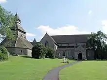 Church of St Mary |
| Church of St Peter | Peterchurch | Parish Church | Mid 12th century | 26 January 1967 | SO3449638520 52°02′28″N 2°57′23″W |
1296560 | 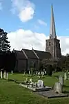 Church of St Peter |
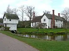
| Wellbrook Manor | Peterchurch | Aisled House | 2nd half 14th century | 29 September 1952 | SO3508638469 52°02′27″N 2°56′52″W |
1099488 | 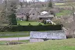 Wellbrook Manor |
| Church of St Giles | Aston, Pipe Aston | Parish Church | 12th century | 11 June 1959 | SO4612471793 52°20′30″N 2°47′32″W |
1349901 | 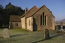 Church of St Giles |
| Church of St Bartholomew | Richards Castle | Parish Church | 12th century | 11 June 1959 | SO4843370280 52°19′41″N 2°45′29″W |
1167572 | |
| Dovecote about 10 metres West of Court House Farmhouse | Richards Castle | Dovecote | 17th century | 11 June 1959 | SO4912669840 52°19′27″N 2°44′52″W |
1167549 | |
| Tower about 10 metres East of Church of St Bartholomew | Richards Castle | Tower | 14th century | 11 December 1987 | SO4846170277 52°19′41″N 2°45′28″W |
1081780 | 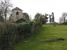 Tower about 10 metres East of Church of St Bartholomew |
| Rudhall House | Rudhall, Ross Rural | Hall House | 14th century | 25 February 1966 | SO6254425383 51°55′33″N 2°32′46″W |
1099663 | |
| Church of St Mary the Virgin | Ross-on-Wye | Church | 17th century | 22 October 1952 | SO5979824046 51°54′49″N 2°35′09″W |
1098720 | 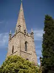 Church of St Mary the Virgin |
| Wilton Bridge (that Part in Ross on Wye Urban District) | Ross-on-Wye | Bridge | 1597-1599 | 22 October 1952 | SO5899724214 51°54′54″N 2°35′51″W |
1349266 | 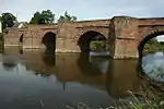 Wilton Bridge (that Part in Ross on Wye Urban District) |
| Church of St Peter | Rowlstone | Parish Church | 12th century | 26 January 1967 | SO3737827131 51°56′21″N 2°54′44″W |
1078157 | 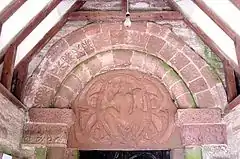 Church of St Peter |
| Church of St Mary | Sarnesfield | Anglican Church | c. 1870 | 2 September 1966 | SO3747250925 52°09′11″N 2°54′55″W |
1349517 | 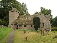 Church of St Mary |
| Church of St Tysilio | Sellack | Church | 1711 | 26 March 1987 | SO5653527659 51°56′45″N 2°38′02″W |
1214929 |  Church of St Tysilio |
| St John's Church, Shobdon | Shobdon Park, Shobdon | Parish Church | 14th century | 11 June 1959 | SO4011462847 52°15′38″N 2°52′44″W |
1166734 | |
| Church of St Margaret | St Margarets | Parish Church | 12th century | 26 January 1967 | SO3537933777 51°59′55″N 2°56′34″W |
1266723 | 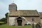 Church of St Margaret |
| Church of St Weonard | St Weonards | Church | 13th century | 30 April 1986 | SO4961024333 51°54′55″N 2°44′02″W |
1179982 |  Church of St Weonard |
| Treago | St. Weonards, Herefordshire | Fortified House | Late 15th century or early 16th century | 30 April 1986 | SO4902123910 51°54′41″N 2°44′33″W |
1099712 | |
| Church of St Mary | Staunton on Wye | Parish Church | C12,C13 and 14th century | 2 September 1966 | SO3755144833 52°05′54″N 2°54′47″W |
1166457 | 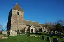 Church of St Mary |
| Church of St Mary | Stoke Edith | Anglican Church | 17th century | 26 January 1967 | SO6040340656 52°03′46″N 2°34′44″W |
1099825 |  Church of St Mary |
| Church of St Lawrence | Stretton Grandison | Parish Church | Early 12th century | 6 March 1967 | SO6328544073 52°05′38″N 2°32′14″W |
1157113 |  Church of St Lawrence |
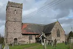
| Church of St Bartholomew | Thruxton | Parish Church | 14th century | 26 January 1962 | SO4371434624 52°00′26″N 2°49′17″W |
1178827 | .jpg.webp) Church of St Bartholomew |
| Churchyard Cross about 8 yards South of the Chancel of the Church of St Mary | Tyberton | Cross | 14th century | 21 February 1986 | SO3803539881 52°03′14″N 2°54′18″W |
1179124 | .jpg.webp) Churchyard Cross about 8 yards South of the Chancel of the Church of St Mary |
| Church of St John the Baptist | Upton Bishop | Parish Church | 12th century | 25 February 1966 | SO6502527210 51°56′32″N 2°30′37″W |
1166738 |  Church of St John the Baptist |
| Church of St Bartholomew | Vowchurch | Parish Church | 12th century | 26 January 1967 | SO3619036467 52°01′23″N 2°55′53″W |
1225063 | 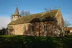 Church of St Bartholomew |
| Church of St Michael | Walford | Church | 12th century | 17 March 1987 | SO5862220424 51°52′51″N 2°36′09″W |
1167585 | 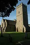 Church of St Michael |
| Hill Court Manor | Walford | Country House | 1698-1700 | 18 May 1953 | SO5750621652 51°53′30″N 2°37′08″W |
1099665 | |
| Church of St Margaret | Wellington | Parish Church | Late 12th century | 15 July 1985 | SO4971948201 52°07′47″N 2°44′09″W |
1099322 |  Church of St Margaret |
| Church of St Mary | Welsh Newton | Parish Church | 13th century | 25 February 1966 | SO4996118022 51°51′31″N 2°43′41″W |
1224918 |  Church of St Mary |
| Pembridge Castle | Welsh Newton | Castle | Late 12th century or early 13th century | 25 February 1966 | SO4881319274 51°52′11″N 2°44′41″W |
1224913 | |
| The Church of Saint Peter and Saint Paul | Weobley | Bell Tower | Mid 14th century | 2 September 1966 | SO4017751865 52°09′42″N 2°52′33″W |
1301343 | 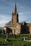 The Church of Saint Peter and Saint Paul |
| The Ley | Weobley | House | Late 19th century | 20 February 1953 | SO3926351194 52°09′20″N 2°53′21″W |
1349847 | 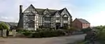 The Ley |
| Church of St Bartholomew | Westhide | Parish Church | Late 12th century | 26 January 1967 | SO5862244191 52°05′40″N 2°36′19″W |
1301742 | 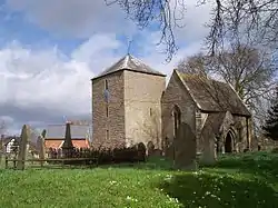 Church of St Bartholomew |
| Barn on West Side of Farmyard and Curtain Wall Enclosing Yard at Bollitree Castle | Weston under Penyard | Curtain Wall | Mid 18th century | 18 May 1953 | SO6367724032 51°54′49″N 2°31′46″W |
1296781 | 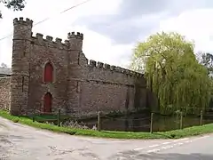 Barn on West Side of Farmyard and Curtain Wall Enclosing Yard at Bollitree Castle |
| Rudhall House (that Part in Brampton Abbotts Civil Parish) | Rudhall, Weston under Penyard | Hall House | 14th century | 25 February 1966 | SO6255225390 51°55′33″N 2°32′46″W |
1099260 | |
| Chapel Farmhouse | Deerfold, Wigmore | Farmhouse | Early 15th century | 11 June 1959 | SO3942868435 52°18′38″N 2°53′24″W |
1081779 | |
| Church of St James | Wigmore | Parish Church | Late 11th century | 11 June 1959 | SO4129269066 52°19′00″N 2°51′46″W |
1178822 |  Church of St James |
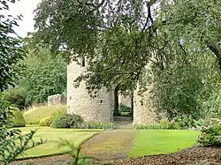
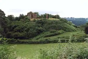
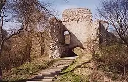
| Ruins of Wigmore Castle | Wigmore | Castle | MID 11th century ORIGINS | 11 June 1959 | SO4083969220 52°19′04″N 2°52′10″W |
1178673 |
.jpg.webp)

Jan2006.jpg.webp)

Feb2006.jpg.webp)

.jpg.webp)
.jpg.webp)
See also
- Category:Grade I listed buildings in Herefordshire
- Grade II* listed buildings in Herefordshire
Notes
- The date given is the date used by Historic England as significant for the initial building or that of an important part in the structure's description.
- Sometimes known as OSGB36, the grid reference is based on the British national grid reference system used by the Ordnance Survey.
- The "List Entry Number" is a unique number assigned to each listed building and scheduled monument by Historic England.
References
External links
![]() Media related to Grade I listed buildings in Herefordshire at Wikimedia Commons
Media related to Grade I listed buildings in Herefordshire at Wikimedia Commons
This article is issued from Wikipedia. The text is licensed under Creative Commons - Attribution - Sharealike. Additional terms may apply for the media files.