Grade I listed buildings in West Sussex
The county of West Sussex in South East England has 176 Grade I listed buildings. Such buildings are described by English Heritage, the authority responsible for their designation, as "of exceptional interest [and] sometimes considered to be internationally important". Grade I is the highest of the three grades of listed status in England: about 2.5% (or 9,300) of the country's 374,000 listed buildings have this designation.
West Sussex and its buildings
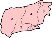
West Sussex, a non-metropolitan county, is divided for administrative purposes into seven local government districts, as marked on the map:
Listed buildings in England
In England, a building or structure is defined as "listed" when it is placed on a statutory register of buildings of "special architectural or historic interest" by the Secretary of State for Culture, Media and Sport, a Government department, in accordance with the Planning (Listed Buildings and Conservation Areas) Act 1990 (a successor to the 1947 act).[1] English Heritage, a non-departmental public body, acts as an agency of this department to administer the process and advise the department on relevant issues.[2] There are three grades of listing status. Grade I, the highest, is defined as being of "exceptional interest"; Grade II* is used for "particularly important buildings of more than special interest"; and Grade II, the lowest, is used for buildings of "special interest".[3] As of July 2009, about 374,000 buildings in England were listed. Around 92% of these had the lowest designation, Grade II; 5.5% were listed at Grade II*; and about 2.5% had the highest grade.[3]
Listed status gives buildings a degree of protection from unapproved alteration, demolition or other changes.[3] Local authorities must consult English Heritage when an application for alteration of a Grade I-listed building is made.[4]
Adur
| Name | Location | Type | Completed [note 1] | Date designated | Grid ref.[note 2] Geo-coordinates |
Entry number [note 3] | Image | Ref. |
|---|---|---|---|---|---|---|---|---|
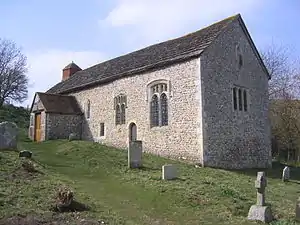
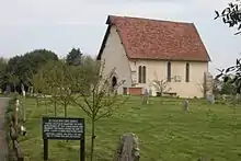
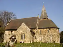
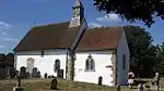
| Coombes Church | Coombes | Church | 11th century | 12 October 1954 | TQ1905908156 50°51′38″N 0°18′35″W |
1353728 | [5] | |
| Lancing College (Chapel) | Lancing | Chapel | 1882 | 12 October 1954 | TQ1960806609 50°50′48″N 0°18′09″W |
1286548 | [5] | |
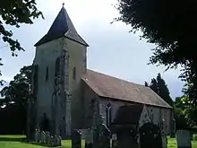
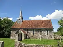
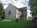
| St James the Less Church | Lancing | Parish church | 13th century | 12 October 1954 | TQ1820605598 50°50′16″N 0°19′21″W |
1192533 | [5] | |
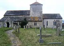
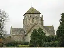
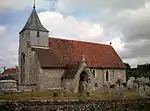
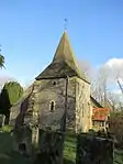
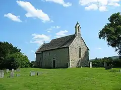
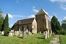
| Church of St Mary the Blessed Virgin | Sompting | Parish church | 12th century | 12 October 1954 | TQ1614505635 50°50′19″N 0°21′07″W |
1353763 | [5] | |
| St Julian's Church | Kingston Buci | Parish church | 11th century | 8 May 1950 | TQ2357205216 50°50′00″N 0°14′48″W |
1027871 | [5] | |
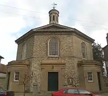
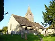
| St Mary de Haura Church | Shoreham-by-Sea | Parish church | 12th century | 8 May 1950 | TQ2162305126 50°49′58″N 0°16′27″W |
1192780 | [5] | |
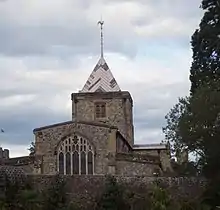
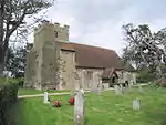
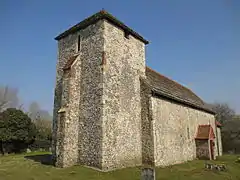
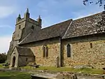
| St Nicolas' Church | Shoreham-by-Sea | Parish church | 12th century | 8 May 1950 | TQ2080305986 50°50′27″N 0°17′08″W |
1027872 | [5] |
.jpg.webp)
.jpg.webp)
Apr2006.jpg.webp)
Arun
| Name | Location | Type | Completed [note 1] | Date designated | Grid ref.[note 2] Geo-coordinates |
Entry number [note 3] | Image | Ref. |
|---|---|---|---|---|---|---|---|---|
| St Mary the Virgin's Church | Aldingbourne | Parish church | Medieval | 5 June 1958 | SU9233905479 50°50′29″N 0°41′24″W |
1027736 | .JPG.webp) St Mary the Virgin's Church | |
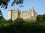
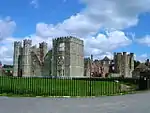
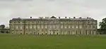
| Arundel Castle | Arundel | Castle | Pre-1732 | 26 March 1949 | TQ0191807254 50°51′21″N 0°33′12″W |
1027926 | ||
| St Nicholas' Church | Arundel | Parish church | 1380 | 26 March 1949 | TQ0163907253 50°51′21″N 0°33′27″W |
1027914 | .JPG.webp) St Nicholas' Church | |
| Fitzalan Chapel | Arundel | Collegiate Church | 1380 | 26 March 1949 | TQ0167207259 50°51′21″N 0°33′25″W |
1263812 | ||
| Cathedral of Our Lady and St Philip Howard and Piers surrounding Churchyard | Arundel | Roman Catholic Cathedral | 1869 | 26 March 1949 | TQ0152607178 50°51′19″N 0°33′32″W |
1248090 | ||
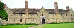
| Barnham Court | Barnham | House | Mid 17th century | 5 June 1958 | SU9557703572 50°49′26″N 0°38′40″W |
1233144 | 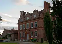 Barnham Court | |
| St Mary the Virgin's Church | Barnham | Parish church | Norman | 5 June 1958 | SU9564203558 50°49′25″N 0°38′37″W |
1027690 | .JPG.webp) St Mary the Virgin's Church | |
| The Dome | Bognor Regis | Terrace | 1787 | 22 July 1949 | SZ9412199668 50°47′20″N 0°39′58″W |
1353844 | 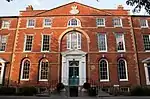 The Dome | |
| St Mary's Church | Burpham | Parish church | Norman | 12 October 1954 | TQ0392608981 50°52′16″N 0°31′28″W |
1027657 | .jpg.webp) St Mary's Church | |
| St Mary's Church | Clapham | Parish church | Transitional Norman | 12 October 1954 | TQ0959606639 50°50′56″N 0°26′40″W |
1276634 | .jpg.webp) St Mary's Church | |
| St Mary's Church | Climping | Parish church | Late 12th century | 5 June 1958 | TQ0029302551 50°48′50″N 0°34′40″W |
1027640 | .JPG.webp) St Mary's Church | |
| St Mary's Church | East Preston | Parish church | Medieval | 12 October 1954 | TQ0649602530 50°48′45″N 0°29′23″W |
1027649 | .JPG.webp) St Mary's Church | |
| St Andrew's Church | Ferring | Parish church | 13th century | 12 October 1954 | TQ0943402584 50°48′45″N 0°26′53″W |
1276447 | .JPG.webp) St Andrew's Church | |
| St John the Baptist's Church | Findon | Parish church | Transitional Norman | 12 October 1954 | TQ1164408474 50°51′54″N 0°24′54″W |
1027619 | 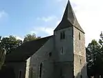 St John the Baptist's Church | |
| St Andrew's Church | Ford | Parish church | Norman | 5 June 1958 | TQ0025603709 50°49′27″N 0°34′41″W |
1233989 | .JPG.webp) St Andrew's Church | |
| St Mary Magdalen's Church | Lyminster | Parish church | Saxon | 12 October 1954 | TQ0227804775 50°50′01″N 0°32′56″W |
1027604 | 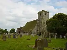 St Mary Magdalen's Church | |
| St Thomas a Becket's Church | Pagham | Parish church | C11-12 | 5 June 1958 | SZ8836997474 50°46′12″N 0°44′54″W |
1353902 | .JPG.webp) St Thomas a Becket's Church | |
| St John the Divine's Church | Patching | Parish church | 13th century | 12 October 1954 | TQ0871806589 50°50′55″N 0°27′25″W |
1275573 | .jpg.webp) St John the Divine's Church | |
| St John's Priory | Poling | House | 1546 | 12 October 1954 | TQ0466405690 50°50′29″N 0°30′53″W |
1217172 | 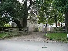 St John's Priory | |
| St Nicholas' Church | Poling | Parish church | Saxon | 12 October 1954 | TQ0470204602 50°49′53″N 0°30′53″W |
1275560 | 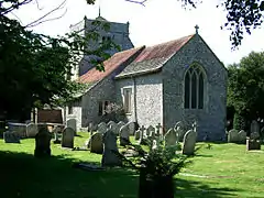 St Nicholas' Church | |
| St Mary's Church | Slindon | Parish church | 13th century | 5 June 1958 | SU9610608346 50°52′00″N 0°38′08″W |
1027563 | .JPG.webp) St Mary's Church | |
| St Leonard's Church | South Stoke | Parish church | 11th century | 12 October 1954 | TQ0266010040 50°52′51″N 0°32′32″W |
1221989 | 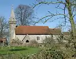 St Leonard's Church | |
| St Mary's Church | Walberton | Parish church | 12th century | 5 June 1958 | SU9714605734 50°50′35″N 0°37′18″W |
1274629 | ||
| St Mary's Church | Yapton | Parish church | 12th century | 5 June 1958 | SU9817003535 50°49′23″N 0°36′27″W |
1237782 | .JPG.webp) St Mary's Church |
.JPG.webp)
.JPG.webp)
Chichester
| Name | Location | Type | Completed [note 1] | Date designated | Grid ref.[note 2] Geo-coordinates |
Entry number [note 3] | Image | Ref. |
|---|---|---|---|---|---|---|---|---|
| Rymans | Apuldram | House | about 1410 | 5 June 1958 | SU8418303224 50°49′21″N 0°48′22″W |
1354451 |  Rymans | |
| St Mary's Church | Apuldram | Parish church | 13th century | 5 June 1958 | SU8415903364 50°49′25″N 0°48′24″W |
1026474 | 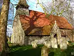 St Mary's Church | |
| St Mary's Church | Barlavington | Parish church | Late 12th century | 22 February 1955 | SU9721816050 50°56′09″N 0°37′04″W |
1274820 | 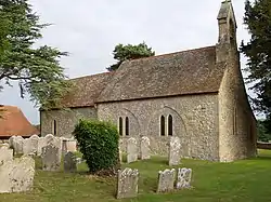 St Mary's Church | |
| St Mary's Church | Bepton | Parish church | 13th century | 18 June 1959 | SU8551718283 50°57′28″N 0°47′02″W |
1026059 | 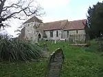 St Mary's Church | |
| Holy Cross Church | Bignor | Parish church | Medieval | 22 February 1955 | SU9824714673 50°55′23″N 0°36′13″W |
1026553 | 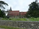 Holy Cross Church | |
| St James' Church, Birdham | Birdham | Parish church | Medieval | 5 June 1958 | SU8237300314 50°47′48″N 0°49′57″W |
1287246 | ||
| Holy Trinity Church | Bosham | Parish church | 13th century | 5 June 1958 | SU8042903885 50°49′44″N 0°51′34″W |
1354443 | ||
| Ruins of the Monastic Buildings of Boxgrove Priory | Boxgrove | Priory | now ruinous | 5 June 1958 | SU9081307559 50°51′38″N 0°42′40″W |
1026436 | ||
| Priory Church of St Mary and St Blaise | Boxgrove | Parish church | founded about 1117 | 5 June 1958 | SU9082607506 50°51′36″N 0°42′39″W |
1230005 | 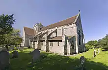 Priory Church of St Mary and St Blaise | |
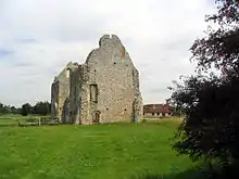
| Ruins of Old Halnaker House | Halnaker | Country house | 13th century | 5 June 1958 | SU9082708856 50°52′19″N 0°42′38″W |
1026405 | .jpg.webp) Ruins of Old Halnaker House | |
| St John the Evangelist's Church | Bury | Parish church | 12th century | 22 February 1955 | TQ0166113091 50°54′30″N 0°33′20″W |
1222367 | 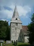 St John the Evangelist's Church | |
| Chichester Cathedral Bell Tower | Chichester | Bell tower | Late C14/Early 15th century | 5 July 1950 | SU8591204830 50°50′12″N 0°46′53″W |
1026825 | .jpg.webp) Chichester Cathedral Bell Tower | |
| Canon Gate | Chichester | Gate | 16th century | 5 July 1950 | SU8603004664 50°50′06″N 0°46′47″W |
1026655 | 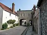 Canon Gate | |
| Greyfriars Chapel (Chichester Guildhall) | Chichester | Guildhall | 1541 | 5 July 1950 | SU8623905124 50°50′21″N 0°46′36″W |
1026695 | ||
| City Walls | Chichester | Boundary Wall | Roman | 8 October 1971 | SU8589105149 50°50′22″N 0°46′54″W |
1354262 | 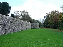 City Walls | |
| St John the Evangelist's Church | Chichester | Redundant church | 1813 | 5 July 1950 | SU8638104706 50°50′08″N 0°46′29″W |
1026696 | ||
| Pallant House | Chichester | House | 1712 | 5 July 1950 | SU8616104665 50°50′06″N 0°46′40″W |
1354302 | 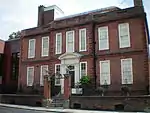 Pallant House | |
| St Mary's Hospital | Chichester | Almshouse | 1680 | 5 July 1950 | SU8624404937 50°50′15″N 0°46′36″W |
1026704 | 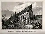 St Mary's Hospital | |
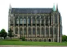
| Chichester Cathedral and Cloisters | Chichester | Cathedral | 1091-1123 | 5 July 1950 | SU8595604776 50°50′10″N 0°46′51″W |
1354261 | 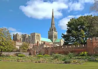 Chichester Cathedral and Cloisters | |
| St Olave's Church | Chichester | Redundant church | 11th century | 8 October 1971 | SU8610104891 50°50′14″N 0°46′43″W |
1026724 | .JPG.webp) St Olave's Church | |
| John Edes House | Chichester | House | 1696 | 5 July 1950 | SU8579804880 50°50′14″N 0°46′59″W |
1026616 | ||
| Market Cross | Chichester | Market Cross | 1500 | 5 July 1950 | SU8606204819 50°50′11″N 0°46′45″W |
1026826 | _(March_2012).JPG.webp) Market Cross | |
| Bishop's Palace | Chichester | Palace | 13th century | 5 July 1950 | SU8586904772 50°50′10″N 0°46′55″W |
1286999 | .jpg.webp) Bishop's Palace | |
| The Royal Chantry | Chichester | House | 13th century | 5 July 1950 | SU8597004722 50°50′08″N 0°46′50″W |
1026810 | .jpg.webp) The Royal Chantry | |
| Vicar's Hall and Crypt | Chichester | Clergy house | Late 14th century | 5 July 1950 | SU8602404735 50°50′09″N 0°46′47″W |
1026653 |  Vicar's Hall and Crypt | |
| 24 and 25 South Street (Cath Kidston) | Chichester | Shops | 18th century | 8 October 1971 | SU8602704656 50°50′06″N 0°46′47″W |
1026656 |  24 and 25 South Street (Cath Kidston) | |
| St Catherine of Siena's Church | Cocking | Parish church | 12th century | 18 June 1959 | SU8795517522 50°57′02″N 0°44′57″W |
1026062 | ||
| St Michael's Church | Up Marden | Parish church | 13th century | 5 June 1958 | SU7952514111 50°55′16″N 0°52′12″W |
1026390 | 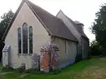 St Michael's Church | |
| St George's Church | Donnington | Parish church | Early 13th century | 5 June 1958 | SU8523002214 50°48′48″N 0°47′30″W |
1231136 | .JPG.webp) St George's Church | |
| St Richard's Church | Burton Park, Duncton | Parish church | Norman | 22 February 1955 | SU9676017569 50°56′58″N 0°37′26″W |
1238093 | 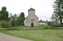 St Richard's Church | |
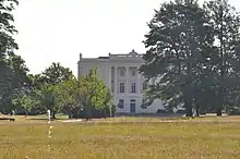
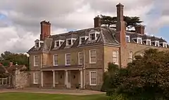
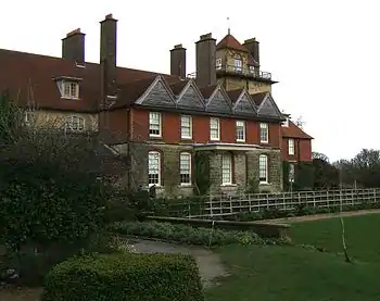
| Burton Park House | Burton Park, Duncton | House | c. 1828 | 22 February 1955 | SU9681217494 50°56′56″N 0°37′24″W |
1274798 | ||
| St Margaret's Church | Eartham | Parish church | Medieval | 5 June 1958 | SU9385909359 50°52′34″N 0°40′02″W |
1026364 | 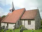 St Margaret's Church | |
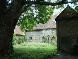
| Easebourne Priory | Easebourne | Priory | 13th century | 18 June 1959 | SU8950922502 50°59′42″N 0°43′33″W |
1277106 | ||
| St Mary's Church | Easebourne | Parish church | 13th century | 18 June 1959 | SU8950422530 50°59′43″N 0°43′34″W |
1277103 | .JPG.webp) St Mary's Church | |
| The Refectory | Easebourne | House | 13th century | 18 June 1959 | SU8948922495 50°59′42″N 0°43′34″W |
1026017 | 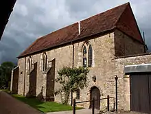 The Refectory | |
| Ruins of Cowdray House | Easebourne | Country house | c. 1533 | 18 June 1959 | SU8914021653 50°59′15″N 0°43′53″W |
1277176 | ||
| All Saints Church | East Dean | Parish church | 12th century | 5 June 1958 | SU9052913196 50°54′40″N 0°42′49″W |
1026377 | .JPG.webp) All Saints Church | |
| St Andrew's Church | Didling | Parish church | 13th century | 18 June 1959 | SU8350718122 50°57′23″N 0°48′45″W |
1217762 | 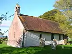 St Andrew's Church | |
| St Agatha's Church | Coates | Parish church | Norman | 22 February 1955 | SU9974717807 50°57′04″N 0°34′53″W |
1026522 | 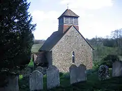 St Agatha's Church | |
| St Mary's Church | Fittleworth | Parish church | Late 11th century | 22 February 1955 | TQ0092819286 50°57′51″N 0°33′51″W |
1238939 | .JPG.webp) St Mary's Church | |
| St Andrew's Church | West Stoke | Parish church | C11/C12 | 5 June 1958 | SU8264608732 50°52′20″N 0°49′37″W |
1232313 | 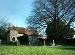 St Andrew's Church | |
| St James's Church | Selham | Church | 11th century | 18 June 1959 | SU9328020684 50°58′41″N 0°40′22″W |
1232817 | 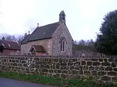 St James's Church | |
| Uppark: Old Laundry and Kitchen Block | South Harting | Kitchen | c. 1770 | 18 June 1959 | SU7802417635 50°57′10″N 0°53′26″W |
1232940 | ||
| St Mary and St Gabriel's Church | South Harting | Parish church | c. 1300 | 18 June 1959 | SU7842019412 50°58′08″N 0°53′04″W |
1233417 | 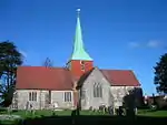 St Mary and St Gabriel's Church | |
| Uppark: Stable Block | South Harting | Stables | c. 1770 | 18 June 1959 | SU7793317632 50°57′10″N 0°53′31″W |
1276851 | ||
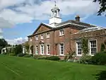
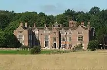
| Uppark | South Harting | Country house | c. 1689 | 18 June 1959 | SU7798117583 50°57′09″N 0°53′28″W |
1025979 | ||
| St John the Baptist's Church | Kirdford | Parish church | Medieval | 22 February 1955 | TQ0182226494 51°01′44″N 0°32′58″W |
1239138 | 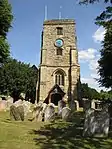 St John the Baptist's Church | |
| St Mary's Church | East Lavant | Parish church | Medieval | 5 June 1958 | SU8619608484 50°52′10″N 0°46′35″W |
1354517 | .JPG.webp) St Mary's Church | |
| Goodwood Golf Clubhouse and Kennels Cottage | Goodwood Park, Westhampnett | House | 1787 | 5 June 1958 | SU8817509096 50°52′29″N 0°44′53″W |
1026301 |  | |
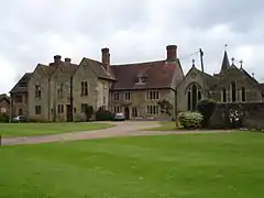
| Shulbrede Priory | Linchmere | House | 16th century | 18 June 1959 | SU8763929894 51°03′42″N 0°45′03″W |
1025945 | ||
| Aldworth House | Black Down, Lurgashall | House | 1869 | 18 June 1959 | SU9256830789 51°04′08″N 0°40′49″W |
1234518 | | |
| St Mary's Church | North Marden | Parish church | 12th century | 5 June 1958 | SU8071716137 50°56′21″N 0°51′09″W |
1026317 | 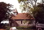 St Mary's Church | |
| St Peter's Church | East Marden | Parish church | 12th century | 5 June 1958 | SU8074014634 50°55′32″N 0°51′09″W |
1232622 | 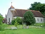 St Peter's Church | |
| St Giles' Church | Merston | Redundant church | 13th century | 28 January 1986 | SU8936402622 50°48′59″N 0°43′58″W |
1276899 | 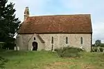 St Giles' Church | |
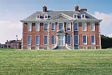
| Petworth House | Petworth | Country house | 14th century | 22 February 1955 | SU9758621891 50°59′17″N 0°36′40″W |
1225989 | ||
| St Mary's Church | Petworth | Parish church | 13th century | 22 February 1955 | SU9768221867 50°59′17″N 0°36′35″W |
1224199 | .JPG.webp) St Mary's Church | |
| St Bartholomew's Church | Rogate | Parish church | 13th century | 18 June 1959 | SU8076423798 51°00′28″N 0°51′01″W |
1275547 | 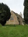 St Bartholomew's Church | |
| St Wilfrid's Chapel | Church Norton, Selsey | Redundant church | 13th century | 5 June 1958 | SZ8720295762 50°45′18″N 0°45′55″W |
1026240 | ||
| St Mary's Church | Sidlesham | Parish church | 13th century | 5 June 1958 | SZ8557199022 50°47′04″N 0°47′15″W |
1233271 | ||
| Church of the Blessed Virgin Mary | Singleton | Parish church | 11th century | 5 June 1958 | SU8780313032 50°54′36″N 0°45′09″W |
1354576 | .JPG.webp) Church of the Blessed Virgin Mary | |
| Stopham Bridge | Stopham | Bridge | 1423 | 15 March 1955 | TQ0297318382 50°57′20″N 0°32′07″W |
1354033 | 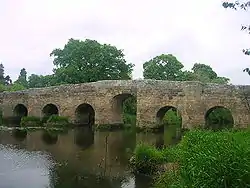 Stopham Bridge | |
| St Mary's Church | Stopham | Parish church | early Norman | 22 February 1955 | TQ0265418936 50°57′39″N 0°32′23″W |
1226926 | 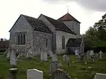 St Mary's Church | |
| St Paul's Church | Stansted Park | Parish church | Late 15th century | 5 June 1958 | SU7599510180 50°53′10″N 0°55′16″W |
1034392 | .jpg.webp) St Paul's Church | |
| St Peter's Church | Racton | Parish church | 12th century | 5 June 1958 | SU7798609218 50°52′38″N 0°53′35″W |
1026186 | 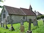 St Peter's Church | |
| St Mary's Church | Stoughton | Parish church | 11th century | 5 June 1958 | SU8009411561 50°53′53″N 0°51′45″W |
1026154 | 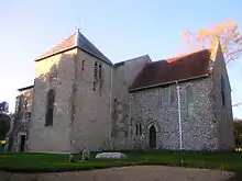 St Mary's Church | |
| St John the Baptist's Church | Sutton | Parish church | 11th century | 22 February 1955 | SU9788615555 50°55′52″N 0°36′30″W |
1265534 | 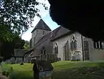 St John the Baptist's Church | |
| St Andrew's Church | Tangmere | Parish church | 13th century | 5 June 1958 | SU9016306167 50°50′53″N 0°43′14″W |
1276210 | 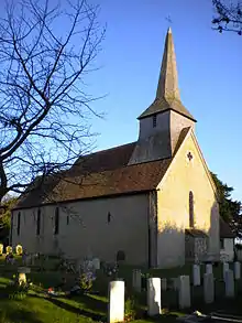 St Andrew's Church | |
| All Hallows Church | Tillington | Parish church | 13th century | 18 June 1959 | SU9630621998 50°59′22″N 0°37′45″W |
1217757 | 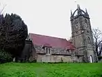 All Hallows Church | |
| St Mary's Church | Chithurst | Parish church | 11th century | 18 June 1959 | SU8425123080 51°00′03″N 0°48′02″W |
1221269 | 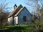 St Mary's Church | |
| The Old Rectory | Trotton | House | 18th century | 18 June 1959 | SU8355922334 50°59′40″N 0°48′39″W |
1221281 | | |
| St George's Church | Trotton | Parish church | Early 14th century | 18 June 1959 | SU8362922508 50°59′45″N 0°48′35″W |
1221344 | ||
| Trotton Bridge | Trotton | Bridge | c. 1600 | 18 June 1959 | SU8365422393 50°59′42″N 0°48′34″W |
1221337 | 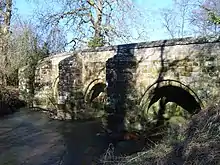 Trotton Bridge | |
| St Mary the Virgin's Church | Upwaltham | Parish church | Medieval | 5 June 1958 | SU9430613858 50°54′59″N 0°39′35″W |
1026165 |  St Mary the Virgin's Church | |
| St Nicholas' Church | West Itchenor | Parish church | Medieval | 5 June 1958 | SU7997600644 50°47′59″N 0°51′59″W |
1026102 | ||
| St Nicholas' Church | West Thorney | Parish church | Medieval | 5 June 1958 | SU7699002463 50°49′00″N 0°54′31″W |
1026105 | 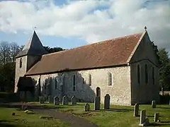 St Nicholas' Church | |
| St Peter and St Paul's Church | West Wittering | Parish church | 12th century | 5 June 1958 | SZ7770098393 50°46′48″N 0°53′57″W |
1354665 | .JPG.webp) St Peter and St Paul's Church | |
| St John the Baptist's Church | Westbourne | Parish church | Late 14th century | 5 June 1958 | SU7555807312 50°51′37″N 0°55′40″W |
1026167 | ||
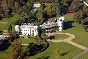
| Goodwood House | Goodwood Park, Westhampnett | Country house | Elizabethan | 5 June 1958 | SU8880808839 50°52′20″N 0°44′21″W |
1216953 | ||
| Shell Grotto to the North West of Carne's Seat | Goodwood Park, Westhampnett | Grotto | Mid 18th century | 5 June 1958 | SU8882509591 50°52′44″N 0°44′20″W |
1026091 | | |
| Stables at Goodwood House | Goodwood Park, Westhampnett | Stables | 1763 | 5 June 1958 | SU8869608802 50°52′19″N 0°44′27″W |
1026129 | | |
| St Peter ad Vincula Church | Wisborough Green | Parish church | Late 11th century | 22 February 1955 | TQ0518425844 51°01′20″N 0°30′06″W |
1265361 | 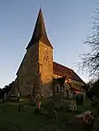 St Peter ad Vincula Church | |
| All Hallows Church | Woolbeding | Parish church | 11th century | 18 June 1959 | SU8730422666 50°59′48″N 0°45′26″W |
1221572 | 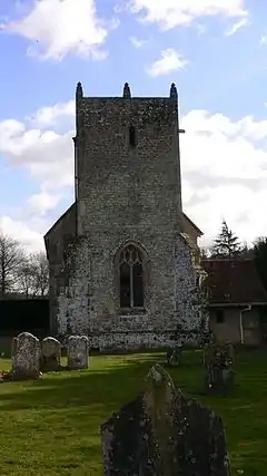 All Hallows Church | |
| Woolbeding House | Woolbeding | House | Elizabethan | 18 June 1959 | SU8732022713 50°59′50″N 0°45′25″W |
1221573 |
.JPG.webp)
.JPG.webp)
.JPG.webp)
.jpg.webp)
.JPG.webp)
.JPG.webp)
Crawley
| Name | Location | Type | Completed [note 1] | Date designated | Grid ref.[note 2] Geo-coordinates |
Entry number [note 3] | Image | Ref. |
|---|---|---|---|---|---|---|---|---|
| Ifield Friends Meeting House | Ifield | Friends Meeting House | 1676 | 21 June 1948 | TQ2524337911 51°07′36″N 0°12′42″W |
1298879 | ||
| St Margaret's Church | Ifield | Parish church | 13th century | 23 February 1983 | TQ2470337576 51°07′26″N 0°13′10″W |
1187108 | ||
| St Nicholas' Church | Worth | Parish church | Saxon | 28 October 1957 | TQ3019436196 51°06′37″N 0°08′30″W |
1187114 |
.jpg.webp)
.JPG.webp)
Horsham
| Name | Location | Type | Completed [note 1] | Date designated | Grid ref.[note 2] Geo-coordinates |
Entry number [note 3] | Image | Ref. |
|---|---|---|---|---|---|---|---|---|
| Amberley Castle | Amberley | Castle | 1377-1382 | 15 March 1955 | TQ0274913173 50°54′32″N 0°32′24″W |
1027499 | ||
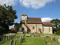
| St Michael and All Angels Church | Amberley | Parish church | Norman | 15 March 1955 | TQ0278713192 50°54′33″N 0°32′22″W |
1353924 | 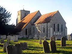 St Michael and All Angels Church | |
| St James's Church | Ashurst | Parish church | Mostly 13th century | 15 March 1955 | TQ1763716370 50°56′05″N 0°19′38″W |
1027453 | ||
| St Mary's Church | Billingshurst | Parish church | Medieval | 22 September 1959 | TQ0875725919 51°01′21″N 0°27′03″W |
1354139 | 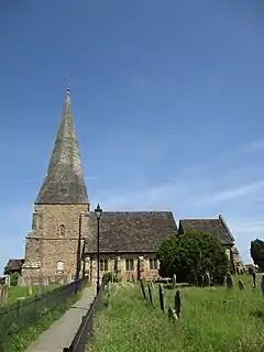 St Mary's Church | |
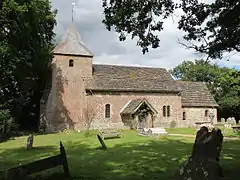
| St Botolph's Church | Botolphs | Parish church | Saxon | 15 March 1955 | TQ1935709253 50°52′14″N 0°18′18″W |
1191927 | ||
| Ruins of Bramber Castle | Bramber | Motte and Bailey | Norman | 15 March 1955 | TQ1857810652 50°53′00″N 0°18′57″W |
1286805 | 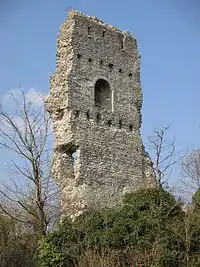 Ruins of Bramber Castle | |
| St Mary's House | Bramber | House | 19th century | 15 March 1955 | TQ1892510604 50°52′58″N 0°18′39″W |
1027419 | 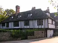 St Mary's House | |
| St Nicholas' Church | Bramber | Parish church | Largely Norman | 15 March 1955 | TQ1860810622 50°52′59″N 0°18′55″W |
1353947 | .jpg.webp) St Nicholas' Church | |
| All Saints Church | Buncton | Parish church | Norman | 15 March 1955 | TQ1450513910 50°54′48″N 0°22′21″W |
1354113 | ||
| St Peter's Church | Cowfold | Parish church | Medieval | 22 September 1959 | TQ2125122605 50°59′24″N 0°16′26″W |
1354161 | 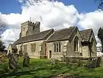 St Peter's Church | |
| Greatham Church | Greatham | Parish church | 13th century | 15 March 1955 | TQ0439415994 50°56′02″N 0°30′57″W |
1027395 | ||
| Hardham Priory | Hardham | Farmhouse | 15 March 1955 | TQ0342617096 50°56′39″N 0°31′45″W |
1027430 | |||
| Hardham Priory: Ruins of the Chapter House | Hardham | Chapter House | Mid 13th century | 15 March 1955 | TQ0343617108 50°56′39″N 0°31′45″W |
1192119 | | |
| St Botolph's Church, Hardham | Hardham | Parish church | 12th century | 15 March 1955 | TQ0387017612 50°56′55″N 0°31′22″W |
1353968 | ||
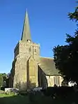
| St Mary's Church | Horsham | Parish church | 13th century | 20 May 1949 | TQ1706530259 51°03′35″N 0°19′51″W |
1353908 | .jpg.webp) St Mary's Church | |
| St Mary the Virgin's Church | North Stoke | Redundant church | 11th century | 15 March 1955 | TQ0199310770 50°53′15″N 0°33′05″W |
1286953 | ||
| Parham Park | Parham | House | 1577 onwards | 15 March 1955 | TQ0600914219 50°55′04″N 0°29′36″W |
1027355 | 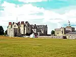 Parham Park | |
| St Peter's Church | Parham | Parish church | 15th century | 15 March 1955 | TQ0595814081 50°54′59″N 0°29′39″W |
1027354 | 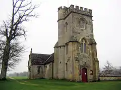 St Peter's Church | |
| The Stables and Laundry Wing at Parham Park | Parham | Stables | 15 March 1955 | TQ0602114272 50°55′05″N 0°29′35″W |
1027356 | 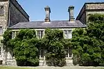 The Stables and Laundry Wing at Parham Park | ||
| St Mary's Church | Pulborough | Parish church | C13-C14 | 15 March 1955 | TQ0470118765 50°57′32″N 0°30′38″W |
1286174 | 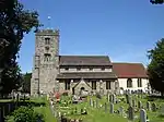 St Mary's Church | |
| Holy Trinity Church | Rudgwick | Parish church | Medieval | 22 September 1959 | TQ0909034303 51°05′52″N 0°26′36″W |
1354190 | ||
| St Mary Magdalene's Church | Rusper | Parish church | Medieval | 22 September 1959 | TQ2051937348 51°07′22″N 0°16′45″W |
1026946 | 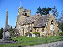 St Mary Magdalene's Church | |
| The Gateway and Porters Lodge to the North West of Ewhurst Manor | Shermanbury | Porters Lodge | Early 14th century | 15 March 1955 | TQ2114719016 50°57′28″N 0°16′35″W |
1194178 | 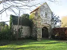 The Gateway and Porters Lodge to the North West of Ewhurst Manor | |
| Newbuildings Place | Shipley | House | 1683 | 22 September 1959 | TQ1407224467 51°00′30″N 0°22′32″W |
1180744 | 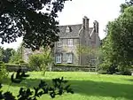 Newbuildings Place | |
| St Mary's Church | Shipley | Parish church | 12th century | 22 September 1959 | TQ1449321810 50°59′04″N 0°22′13″W |
1180756 | .JPG.webp) St Mary's Church | |
| St Andrew's Church | Steyning | Parish church | Ruins by 1578 | 15 March 1955 | TQ1790611402 50°53′24″N 0°19′30″W |
1285518 | .jpg.webp) St Andrew's Church | |
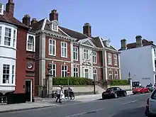
| Steyning Grammar School | Steyning | School | 1614 | 15 March 1955 | TQ1773711192 50°53′18″N 0°19′39″W |
1194367 | ||
| St Mary's Church | Sullington | Parish church | Saxon | 15 March 1955 | TQ0983613111 50°54′25″N 0°26′21″W |
1354077 | 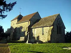 St Mary's Church | |
| Little Thakeham | Thakeham | Manor house | 1903 | 15 March 1955 | TQ1090315728 50°55′49″N 0°25′24″W |
1027209 | ||
| St Mary's Church | Thakeham | Parish church | 12th century | 15 March 1955 | TQ1099617317 50°56′41″N 0°25′17″W |
1354080 | 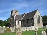 St Mary's Church | |
| Church of the Holy Sepulchre, Warminghurst | Warminghurst | Redundant church | 13th century | 15 March 1955 | TQ1171116855 50°56′25″N 0°24′41″W |
1027448 | ||
| Field Place | Warnham | Country house | Medieval | 22 September 1959 | TQ1472632098 51°04′36″N 0°21′49″W |
1026916 | .jpg.webp) Field Place | |
| St Margaret's Church | Warnham | Parish church | 14th century | 22 September 1959 | TQ1589433677 51°05′27″N 0°20′47″W |
1026877 | 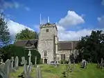 St Margaret's Church | |
| St Mary's Church, West Chiltington | West Chiltington | Parish church | Late 11th century | 15 March 1955 | TQ0901818345 50°57′15″N 0°26′57″W |
1354121 | ||
| St George's Church | West Grinstead | Parish church | 12th century | 22 September 1959 | TQ1708720682 50°58′25″N 0°20′01″W |
1284797 | .JPG.webp) St George's Church | |
| Wiggonholt Church | Wiggonholt | Parish church | 13th century | 15 March 1955 | TQ0601416770 50°56′26″N 0°29′33″W |
1027364 | 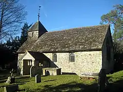 Wiggonholt Church | |
| Wiston House | Wiston | Country house | c. 1576 | 9 May 1980 | TQ1549912416 50°53′59″N 0°21′32″W |
1027156 |
.jpg.webp)
.jpg.webp)
_page_72.jpg.webp)
.jpg.webp)
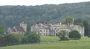
Mid Sussex
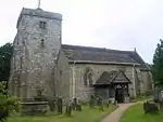
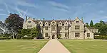
.jpg.webp)
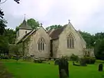
.JPG.webp)
.jpg.webp)
.JPG.webp)
Worthing
| Name | Location | Type | Completed [note 1] | Date designated | Grid ref.[note 2] Geo-coordinates |
Entry number [note 3] | Image | Ref. |
|---|---|---|---|---|---|---|---|---|
| Castle Goring | Worthing | Country house | 1798 | 11 October 1949 | TQ1026805644 50°50′23″N 0°26′07″W |
1025839 | ||
| St Mary's Church | Broadwater | Parish church | Transitional-Norman | 11 October 1949 | TQ1466204395 50°49′40″N 0°22′24″W |
1025810 | ||
| The Old Palace | West Tarring | House | 13th century | 11 October 1949 | TQ1327204010 50°49′28″N 0°23′35″W |
1250618 | |

.jpg.webp)
Notes
- The date given is the date used by Historic England as significant for the initial building or that of an important part in the structure's description.
- Sometimes known as OSGB36, the grid reference is based on the British national grid reference system used by the Ordnance Survey.
- The "List Entry Number" is a unique number assigned to each listed building and scheduled monument by Historic England.
References
Notes
- "Planning (Listed Buildings and Conservation Areas) Act 1990 (c. 9)". The UK Statute Law Database. Ministry of Justice. 24 May 1990. Retrieved 3 March 2010.
- "History of English Heritage". English Heritage. 2010. Retrieved 19 August 2011.
- "Listed Buildings". English Heritage. 2010. Archived from the original on 24 January 2013. Retrieved 26 August 2011.
- "Planning Advice". English Heritage. 2008. Retrieved 3 March 2010.
- Bristow, Paul (27 July 1984). "List of Buildings of Special Architectural or Historic Interest: District of Adur" (PDF). Department of the Environment. Retrieved 18 February 2010.
External links
![]() Media related to Grade I listed buildings in West Sussex at Wikimedia Commons
Media related to Grade I listed buildings in West Sussex at Wikimedia Commons