Grade I listed buildings in East Sussex
There are over 9300 Grade I listed buildings in England. This page is a list of these buildings in the county of East Sussex.
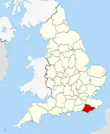
East Sussex shown in England
Eastbourne
| Name | Location | Type | Completed [note 1] | Date designated | Grid ref.[note 2] Geo-coordinates |
Entry number [note 3] | Image |
|---|---|---|---|---|---|---|---|
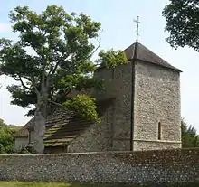
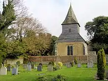
| Church of St Mary | Old Town, Eastbourne | Bell Tower | Early 14th century | 27 May 1949 | TV5986399460 50°46′22″N 0°15′57″E |
1293915 | 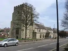 Church of St Mary |
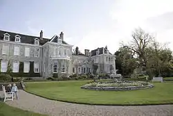
| Compton Place | Eastbourne | House | 1726 | 27 May 1949 | TV6029498582 50°45′53″N 0°16′18″E |
1353113 | |
| The Stables and Coachhouses at Compton Place | Eastbourne | Courtyard | 18th century | 27 May 1949 | TV6035998606 50°45′54″N 0°16′21″E |
1190359 |  |
.jpg.webp)
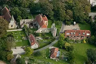
Hastings
| Name | Location | Type | Completed [note 1] | Date designated | Grid ref.[note 2] Geo-coordinates |
Entry number [note 3] | Image |
|---|---|---|---|---|---|---|---|
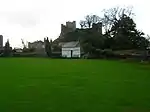
| Hastings Castle | Hastings | Castle | c. 1070 | 19 January 1951 | TQ8202709482 50°51′22″N 0°35′05″E |
1043579 |

Lewes
| Name | Location | Type | Completed [note 1] | Date designated | Grid ref.[note 2] Geo-coordinates |
Entry number [note 3] | Image |
|---|---|---|---|---|---|---|---|
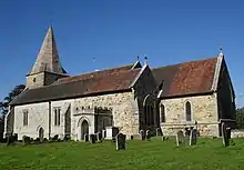
| The Parish Church of St Andrew | Beddingham, Lewes | Church | Norman | 20 August 1965 | TQ4450107897 50°51′09″N 0°03′05″E |
1276141 | 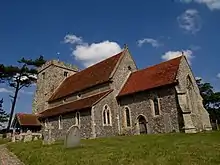 The Parish Church of St Andrew |
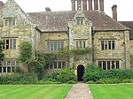
| Wings Place (Anne of Cleves House) | Ditchling, Lewes | Timber Framed House | Late 16th century | 17 March 1952 | TQ3249915208 50°55′16″N 0°06′59″W |
1043969 | 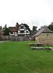 Wings Place (Anne of Cleves House) |
| The Parish Church of St Margaret | Ditchling, Lewes | Church | Pre Conquest | 20 August 1965 | TQ3253915237 50°55′17″N 0°06′57″W |
1352964 | .JPG.webp) The Parish Church of St Margaret |
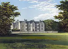
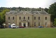
| Firle Place | Firle, Lewes | Country House | Late 15th century | 17 March 1952 | TQ4734507131 50°50′42″N 0°05′30″E |
1217315 | |
| The Parish Church of St Peter | Firle, Lewes | Church | 13th century | 20 August 1965 | TQ4712207128 50°50′42″N 0°05′18″E |
1043939 |  The Parish Church of St Peter |
| Glynde Place | Glynde, Lewes | Country House | 16th century | 17 March 1952 | TQ4565009356 50°51′55″N 0°04′06″E |
1221546 | |
| The Stables of Glynde Place to South West of the House | Glynde, Lewes | Wall | Between 1755 and 1760 | 17 March 1952 | TQ4562809296 50°51′53″N 0°04′05″E |
1221605 | 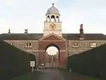 The Stables of Glynde Place to South West of the House |
| Shelley's Folly | Cooksbridge, Hamsey, Lewes | House | Late 17th century | 17 March 1952 | TQ4033615008 50°55′03″N 0°00′18″W |
1221876 |  Shelley's Folly |
| The Parish Church of St Peter | Hamsey, Lewes | Church | Early 12th century | 20 August 1965 | TQ4143212116 50°53′28″N 0°00′34″E |
1222114 | 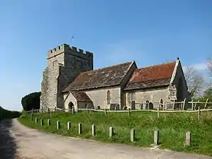 The Parish Church of St Peter |
| Swanborough Manor and the Dovecote to North West of the House | Iford, Lewes | House | 18th century | 17 March 1952 | TQ4009407806 50°51′10″N 0°00′40″W |
1274722 | |
| The Parish Church of St Nicholas | Iford, Lewes | Church | Early 12th century | 20 August 1965 | TQ4083407333 50°50′54″N 0°00′03″W |
1222119 |  The Parish Church of St Nicholas |
| Church of St Anne | Lewes | Church | Early 12th century | 25 February 1952 | TQ4093510005 50°52′21″N 0°00′06″E |
1043687 | 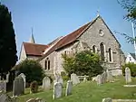 Church of St Anne |
| Church of St John the Baptist | Southover, Lewes | Church | Late 11th century or early 12th century | 25 February 1952 | TQ4126309649 50°52′09″N 0°00′22″E |
1353095 | 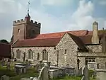 Church of St John the Baptist |
| Church of St Michael and Railings | Lewes | Gate | 13th century | 25 February 1952 | TQ4132210002 50°52′20″N 0°00′26″E |
1287005 | .jpg.webp) Church of St Michael and Railings |
| Jireh Chapel and Sunday School to North | Cliffe, Lewes | Sunday School | 1874 | 25 February 1952 | TQ4211910381 50°52′32″N 0°01′07″E |
1192055 | 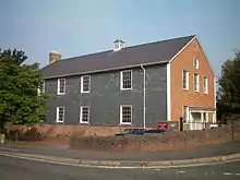 Jireh Chapel and Sunday School to North |
| Keep to Lewes Castle | Lewes | Castle | c. 1100 | 25 February 1952 | TQ4132710068 50°52′22″N 0°00′26″E |
1043894 | |
| Barbican to Lewes Castle and Walls to South | Lewes | Wall | Early 14th century | 25 February 1952 | TQ4140210071 50°52′22″N 0°00′30″E |
1043895 | 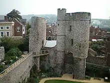 Barbican to Lewes Castle and Walls to South |
| Remains of Inner Gatehouse and Walls to East and West, Lewes castle | Lewes | Wall | 12th century | 16 March 1970 | TQ4140610084 50°52′23″N 0°00′30″E |
1293875 | |
| Malling House | Malling, Lewes | Country House | Mid 17th century | 25 February 1952 | TQ4164611125 50°52′56″N 0°00′44″E |
1043904 | |
| Ruins of Lewes Priory | Lewes | Country House | 1537-1540 | 25 February 1952 | TQ4142909558 50°52′06″N 0°00′31″E |
1190737 | |
| The Parish Church of St John | Piddinghoe, Lewes | Church | Early 13th century | 20 August 1965 | TQ4351003080 50°48′34″N 0°02′08″E |
1238098 | 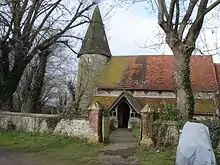 The Parish Church of St John |
| The Parish Church of St Michael and All Angels | Plumpton, Lewes | Anglican Church | c. 1200 | 20 August 1965 | TQ3567813503 50°54′18″N 0°04′18″W |
1238266 | 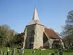 The Parish Church of St Michael and All Angels |
| The Parish Church of St Mary the Virgin | Ringmer, Lewes | Church | Medieval | 20 August 1965 | TQ4457812509 50°53′38″N 0°03′16″E |
1238690 | 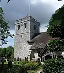 The Parish Church of St Mary the Virgin |
| The Parish Church of St Peter | Rodmell, Lewes | Church | Early 12th century | 20 August 1965 | TQ4216806267 50°50′19″N 0°01′04″E |
1238975 | 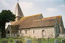 The Parish Church of St Peter |
| Church of St Andrew | Bishopstone, Lewes | Church | Saxon | 2 March 1950 | TQ4724500979 50°47′23″N 0°05′16″E |
1044059 | 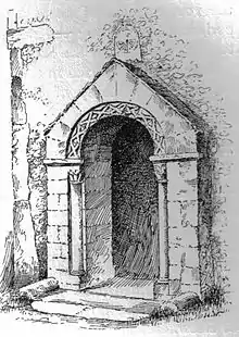 Church of St Andrew |
| The Parish Church of St Leonard | Seaford, Lewes | Parish Church | Early 12th century | 2 March 1950 | TV4826299028 50°46′19″N 0°06′05″E |
1352955 | .jpg.webp) The Parish Church of St Leonard |
| The Parish Church | Southease, Lewes | Church | 11th century | 20 August 1965 | TQ4230205271 50°49′46″N 0°01′09″E |
1239384 | 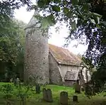 The Parish Church |
| The Parish Church of St Mary | Tarring Neville, Lewes | Church | Transitional Norman | 20 August 1965 | TQ4440803785 50°48′56″N 0°02′55″E |
1222661 | 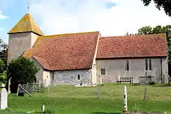 The Parish Church of St Mary |
| The Parish Church of St Lawrence | Telscombe, Lewes | Church | 12th century | 20 August 1965 | TQ4054803365 50°48′46″N 0°00′23″W |
1222720 | 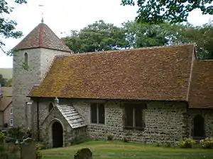 The Parish Church of St Lawrence |
| Great Ote Hall | Wivelsfield, Lewes | House | Modern | 17 March 1952 | TQ3312120282 50°58′00″N 0°06′20″W |
1223018 | .jpg.webp) Great Ote Hall |

.jpg.webp)
Rother
| Name | Location | Type | Completed [note 1] | Date designated | Grid ref.[note 2] Geo-coordinates |
Entry number [note 3] | Image |
|---|---|---|---|---|---|---|---|
| Parish Church of St Peter | Ashburnham, Rother | Parish Church | 15th century | 3 August 1961 | TQ6895114549 50°54′20″N 0°24′06″E |
1044264 | .jpg.webp) Parish Church of St Peter |
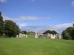
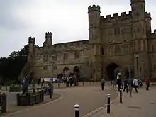
| The Ruins of Battle Abbey | Battle, Rother | Abbey | 1087 | 3 August 1961 | TQ7500715726 50°54′52″N 0°29′18″E |
1352861 | 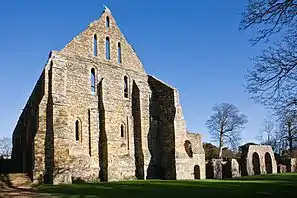 The Ruins of Battle Abbey |
| Battle Abbey School | Battle, Rother | Abbey | Medieval | 3 August 1961 | TQ7490115694 50°54′51″N 0°29′12″E |
1044211 | |
| The Gatehouse, Battle Abbey | Battle, Rother | Porters Lodge | 12th century | 3 August 1961 | TQ7484915786 50°54′54″N 0°29′10″E |
1278698 | 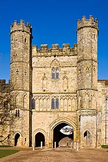 The Gatehouse, Battle Abbey |
| The Parish Church of St Mary | Battle, Rother | Parish Church | Medieval | 3 August 1961 | TQ7502615798 50°54′54″N 0°29′19″E |
1231477 | 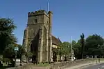 The Parish Church of St Mary |
| The Precinct Wall of Battle Abbey | Battle, Rother | Wall | 14th century | 13 May 1987 | TQ7497815772 50°54′54″N 0°29′16″E |
1044144 | 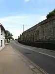 The Precinct Wall of Battle Abbey |
| The Parish Church of All Saints | Beckley, Rother | Parish Church | c. 1100 | 3 August 1961 | TQ8427223728 50°59′00″N 0°37′26″E |
1044150 | 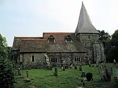 The Parish Church of All Saints |
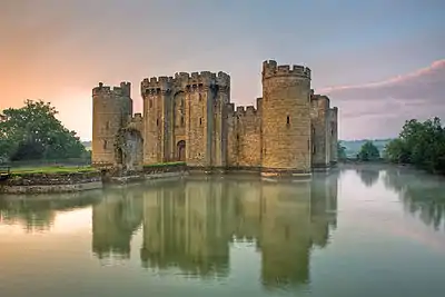
| Bodiam Castle | Bodiam, Rother | Castle | Post 1385 | 3 August 1961 | TQ7855425645 51°00′09″N 0°32′36″E |
1044134 | |
| The Parish Church of St George | Brede, Rother | Parish Church | 13th century | 3 August 1961 | TQ8253018265 50°56′06″N 0°35′47″E |
1232070 | .JPG.webp) The Parish Church of St George |
| The Parish Church of St Thomas a Becket | Brightling, Rother | Parish Church | 13th century | 3 August 1961 | TQ6835421004 50°57′50″N 0°23′46″E |
1352914 |  The Parish Church of St Thomas a Becket |
| Bateman's | Bateman's, Burwash, Rother | House | 1634 | 3 August 1961 | TQ6708423799 50°59′22″N 0°22′45″E |
1044063 | |
| The Parish Church of St George | Crowhurst, East Sussex | Parish Church | 15th century | 3 August 1961 | TQ7573312339 50°53′02″N 0°29′49″E |
1233292 | 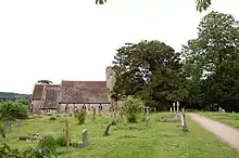 The Parish Church of St George |
| Haremere Hall | Etchingham, Rother | House | Early 17th century | 3 August 1961 | TQ7223426580 51°00′46″N 0°27′14″E |
1233611 |  Haremere Hall |
| The Parish Church of St Nicholas and St Mary | Etchingham, Rother | Parish Church | 1366-9 | 3 August 1961 | TQ7136126200 51°00′35″N 0°26′29″E |
1276456 | 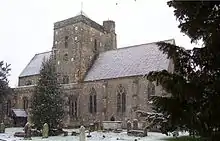 The Parish Church of St Nicholas and St Mary |
| The Parish Church of St James | Ewhurst Green, Ewhurst, Rother | Parish Church | Medieval | 3 August 1961 | TQ7955824568 50°59′33″N 0°33′26″E |
1233841 | 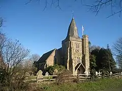 The Parish Church of St James |
| The Parish Church of St Laurence | Guestling Green, Guestling, Rother | Parish Church | Norman | 3 August 1961 | TQ8555714467 50°54′00″N 0°38′15″E |
1233969 | 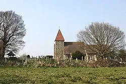 The Parish Church of St Laurence |
| Camber Castle | Winchelsea, Icklesham, Rother | Castle | 1538 | 3 August 1961 | TQ9218618457 50°56′01″N 0°44′01″E |
1234738 | |
| Land Gate, the Pipewell | Winchelsea, Icklesham, Rother | Town Gate | Pre 15th century | 3 August 1961 | TQ9037417641 50°55′37″N 0°42′27″E |
1234567 | 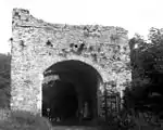 Land Gate, the Pipewell |
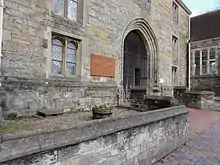
| The Court Hall Town Museum | Winchelsea, Icklesham, Rother | Town Hall | 1557 | 3 August 1961 | TQ9045117424 50°55′29″N 0°42′31″E |
1234513 | 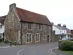 The Court Hall Town Museum |
| The New Gate | Winchelsea, Icklesham, Rother | Town Gate | Medieval | 3 August 1961 | TQ9010116438 50°54′58″N 0°42′11″E |
1234744 |  The New Gate |
| The Parish Church of All Saints (previously St Nicholas) | Icklesham, Rother | Parish Church | Norman | 3 August 1961 | TQ8804916474 50°55′02″N 0°40′26″E |
1276241 | .JPG.webp) The Parish Church of All Saints (previously St Nicholas) |
| The Parish Church of St Thomas the Martyr | Winchelsea, Icklesham, Rother | Parish Church | Decorated | 13 May 1987 | TQ9049917355 50°55′27″N 0°42′33″E |
1276072 |  The Parish Church of St Thomas the Martyr |
| The Ruins of the Church of Grey Friars Monastery in the Grounds of Grey Friars | Winchelsea, Icklesham, Rother | Church | c1310-20 | 3 August 1961 | TQ9060417099 50°55′19″N 0°42′38″E |
1234450 | 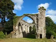 The Ruins of the Church of Grey Friars Monastery in the Grounds of Grey Friars |
| The Strand Gate | Winchelsea, Icklesham, Rother | Town Gate | Medieval | 3 August 1961 | TQ9068317406 50°55′29″N 0°42′43″E |
1234546 | 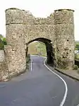 The Strand Gate |
| The Parish Church of All Saints | Iden, Rother | Parish Church | Older-Pre 14th century | 3 August 1961 | TQ9154923752 50°58′53″N 0°43′39″E |
1275899 | .jpg.webp) The Parish Church of All Saints |
| Brickwall | Northiam, Rother | House | Early 17th century | 3 August 1961 | TQ8305724048 50°59′12″N 0°36′24″E |
1217202 | |
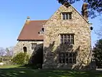
| Great Dixter, Rother | Northiam | House | 1912 | 3 August 1961 | TQ8196825105 50°59′48″N 0°35′30″E |
1216957 | .jpg.webp) Great Dixter, Rother |
| The Parish Church of St Peter and St Paul | Peasmarsh, Rother | Parish Church | Norman | 3 August 1961 | TQ8871821842 50°57′54″N 0°41′10″E |
1217124 | .JPG.webp) The Parish Church of St Peter and St Paul |
| The Parish Church of St Michael | Penhurst, Rother | Parish Church | 14th century | 3 August 1961 | TQ6943016556 50°55′25″N 0°24′34″E |
1217346 |  The Parish Church of St Michael |
| The Parish Church of St Michael | Playden, Rother | Parish Church | c. 1200 | 3 August 1961 | TQ9202021676 50°57′45″N 0°43′59″E |
1217674 | .JPG.webp) The Parish Church of St Michael |
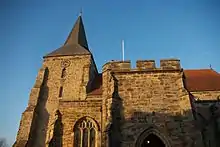
| Church of St Mary | Rye, Rother | Parish Church | 1150-80 | 12 October 1951 | TQ9215020302 50°57′00″N 0°44′03″E |
1190669 | .jpg.webp) Church of St Mary |
| Rye Working Men's Conservative Club | Rye, Rother | School | 1636 | 12 October 1951 | TQ9210220422 50°57′04″N 0°44′01″E |
1251550 | |
| The Landgate | Rye, Rother | Gate | 1340 | 12 October 1951 | TQ9221320608 50°57′10″N 0°44′07″E |
1251769 | 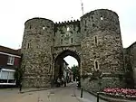 The Landgate |
| The Ypres Tower | Rye, Rother | Tower | 1250 approximately | 12 October 1951 | TQ9224720269 50°56′59″N 0°44′08″E |
1251521 | 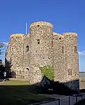 The Ypres Tower |
| Robertsbridge Abbey | Robertsbridge, Rother | Abbey | c. 1200 | 3 August 1961 | TQ7542823845 50°59′14″N 0°29′53″E |
1221354 | |
| The Parish Church of St Mary | Salehurst, Rother | Parish Church | 13th century | 3 August 1961 | TQ7493524244 50°59′28″N 0°29′29″E |
1221247 | .jpg.webp) The Parish Church of St Mary |
| Manor Cottages | Sedlescombe, Rother | House | 16th century | 3 August 1961 | TQ7806018042 50°56′04″N 0°31′58″E |
1274791 | |
| Pashley Manor | Ticehurst, Rother | House | Early 18th century | 3 August 1961 | TQ7062029060 51°02′08″N 0°25′56″E |
1222449 | 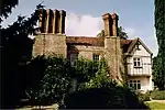 Pashley Manor |
| The Parish Church of St Mary | Udimore, Rother | Parish Church | Norman | 3 August 1961 | TQ8633718958 50°56′24″N 0°39′03″E |
1274500 | 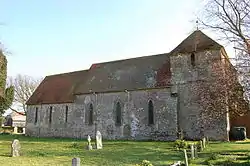 The Parish Church of St Mary |
| The Parish Church of St John the Baptist | Westfield, Rother | Parish Church | Norman | 3 August 1961 | TQ8098615211 50°54′29″N 0°34′22″E |
1238182 | .JPG.webp) The Parish Church of St John the Baptist |
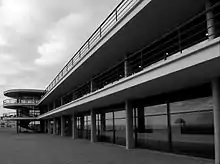
| The De La Warr Pavilion | Bexhill on Sea, Rother | Pavilion | 1936 | 28 January 1971 | TQ7411407134 50°50′15″N 0°28′17″E |
1352840 |


The City of Brighton and Hove
| Name | Location | Type | Completed [note 1] | Date designated | Grid ref.[note 2] Geo-coordinates |
Entry number [note 3] | Image |
|---|---|---|---|---|---|---|---|
| Arundel House | The City of Brighton and Hove | Guest House | 1950- | 13 October 1952 | TQ3331903426 50°48′54″N 0°06′32″W |
1379917 | |
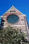
| Church of All Saints | The City of Brighton and Hove | Church | 1889-91 | 24 March 1950 | TQ2918005020 50°49′49″N 0°10′01″W |
1187592 | |
| Church of St Andrew including Walls, Railings and Gates | The City of Brighton and Hove | Gate | 1827-8 | 24 March 1950 | TQ2992104282 50°49′25″N 0°09′25″W |
1298653 | 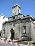 Church of St Andrew including Walls, Railings and Gates |
| Church of St Bartholomew | The City of Brighton and Hove | Anglican Church | 1872-1874 | 13 October 1952 | TQ3128905135 50°49′51″N 0°08′14″W |
1379913 | |
| Church of St Michael and All Angels and Attached Walls | The City of Brighton and Hove | Wall | Designed 1858 | 20 August 1971 | TQ3040204734 50°49′39″N 0°08′59″W |
1381083 | 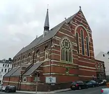 Church of St Michael and All Angels and Attached Walls |
| Church of St Wulfran | Ovingdean, The City of Brighton and Hove | Tower | Late 13th century | 13 October 1952 | TQ3553903559 50°48′57″N 0°04′39″W |
1380550 | |
| Falmer House Including Moat Within Courtyard | The City of Brighton and Hove | Moat | 1960-1962 | 30 August 1993 | TQ3459008940 50°51′52″N 0°05′20″W |
1381044 |  Falmer House Including Moat Within Courtyard |
| Marlborough House and Attached Railings | The City of Brighton and Hove | House | 1765 | 13 October 1952 | TQ3120904031 50°49′15″N 0°08′19″W |
1380671 | _(September_2018)_(2).jpg.webp) Marlborough House and Attached Railings |
| Nos 1-29 Brunswick Square and attached Railings | The City of Brighton and Hove | Terrace | 1825-27 | 24 March 1950 | TQ2981104365 50°49′27″N 0°09′30″W |
1187544 | .jpg.webp) Nos 1-29 Brunswick Square and attached Railings |
| Nos 1-6, Brunswick Terrace and attached Railings | The City of Brighton and Hove | Apartment | 1950 | 24 March 1950 | TQ2991504232 50°49′23″N 0°09′25″W |
1204829 | 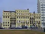 Nos 1-6, Brunswick Terrace and attached Railings |
| Nos 7-19, Brunswick Terrace and attached Railings | The City of Brighton and Hove | Apartment | 1992 | 24 March 1950 | TQ2983304249 50°49′24″N 0°09′29″W |
1281033 | 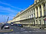 Nos 7-19, Brunswick Terrace and attached Railings |
| Nos 20-32, Brunswick Terrace and Attached Railings | The City of Brighton and Hove | Apartment | By 1992 | 24 March 1950 | TQ2964804288 50°49′25″N 0°09′38″W |
1187546 |  Nos 20-32, Brunswick Terrace and Attached Railings |
| Nos 33-42, Brunswick Terrace and attached Railings | The City of Brighton and Hove | Apartment | 1950 | 24 March 1950 | TQ2953904306 50°49′26″N 0°09′44″W |
1204856 | 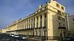 Nos 33-42, Brunswick Terrace and attached Railings |
| Nos 30-58, 30a and 33a (consecutive), Brunswick Square and attached Railings | The City of Brighton and Hove | Terrace | 1825-27 | 24 March 1950 | TQ2976304485 50°49′31″N 0°09′32″W |
1281017 | |
| Nos 1-14, Lewes Crescent and attached Railings | The City of Brighton and Hove | Terrace | 1823-1828 | 13 October 1952 | TQ3306703559 50°48′59″N 0°06′45″W |
1381658 |  Nos 1-14, Lewes Crescent and attached Railings |
| Numbers 15-28, Lewes Crescent and attached Railings | The City of Brighton and Hove | Apartment | 1952 | 13 October 1952 | TQ3325603501 50°48′57″N 0°06′35″W |
1381659 | |
| Numbers 1-14, Chichester Terrace and Chichester House and attached Railings | The City of Brighton and Hove | Terrace | 1824-1855 | 13 October 1952 | TQ3297003541 50°48′58″N 0°06′50″W |
1380256 | |
| Numbers 1-10, Sussex Square and attached Piers and Railings | The City of Brighton and Hove | Terrace | 1825-1827 | 13 October 1952 | TQ3313503621 50°49′01″N 0°06′41″W |
1380969 | 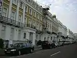 Numbers 1-10, Sussex Square and attached Piers and Railings |
| Numbers 11-40, Sussex Square and attached Railings | The City of Brighton and Hove | Apartment | 1999 | 13 October 1952 | TQ3322503728 50°49′04″N 0°06′36″W |
1380970 | |
| Numbers 41-50, Sussex Square and attached Railings | The City of Brighton and Hove | Apartment | 1999 | 13 October 1952 | TQ3324103587 50°48′59″N 0°06′36″W |
1380971 | |
| Stanmer House | Stanmer Park, The City of Brighton and Hove | House | Pre 1722 | 2 November 1954 | TQ3364509466 50°52′09″N 0°06′08″W |
1380958 | |
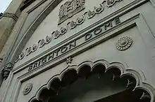
| The Corn Exchange and Dome Theatre | The City of Brighton and Hove | Corn Exchange | 1868 | 13 October 1952 | TQ3122404297 50°49′24″N 0°08′18″W |
1380398 | |
| The Royal Pavilion | The City of Brighton and Hove | Farmhouse | 1770s | 13 October 1952 | TQ3127304188 50°49′21″N 0°08′16″W |
1380680 | 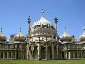 The Royal Pavilion |
| The West Pier | The City of Brighton and Hove | Kiosk | 1865-1866 | 9 October 1969 | TQ3027603796 50°49′09″N 0°09′07″W |
1381655 |  The West Pier |

Wealden
| Name | Location | Type | Completed [note 1] | Date designated | Grid ref.[note 2] Geo-coordinates |
Entry number [note 3] | Image |
|---|---|---|---|---|---|---|---|
| The Parish Church | Alciston, Wealden | Parish Church | Norman | 30 August 1966 | TQ5058505551 50°49′48″N 0°08′13″E |
1353272 |  The Parish Church |
| The Tithe Barn South West of Court House Farm | Alciston, Wealden | Abbey | Probably 16th century | 13 October 1952 | TQ5050505515 50°49′47″N 0°08′09″E |
1191019 | 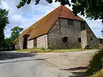 The Tithe Barn South West of Court House Farm |
| Parish Church of St Andrew | Alfriston, Wealden | Parish Church | c. 1360 | 30 August 1966 | TQ5215103001 50°48′24″N 0°09′29″E |
1043353 | |
| The Market Cross | Alfriston, Wealden | Market Cross | Medieval | 13 October 1952 | TQ5204203164 50°48′29″N 0°09′24″E |
1353268 | 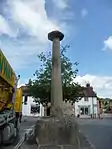 The Market Cross |
| Barbican Tower and Bridge over the Moat at Michelham Priory | Milton Hide, Arlington, Wealden | Tower | 15th century | 30 August 1966 | TQ5581209377 50°51′46″N 0°12′46″E |
1191633 |  Barbican Tower and Bridge over the Moat at Michelham Priory |
| Michelham Priory | Milton Hide, Arlington, Wealden | Augustinian Monastery | 13th century | 13 October 1952 | TQ5588809319 50°51′45″N 0°12′49″E |
1353289 | |
| The Parish Church of St Pancras | Arlington, East Sussex | Parish Church | Norman Transitional | 30 August 1966 | TQ5428307468 50°50′46″N 0°11′25″E |
1353287 | 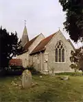 The Parish Church of St Pancras |
| The Parish Church of St Michael and All Angels | Berwick, East Sussex | Parish Church | 13th century | 30 August 1966 | TQ5188404921 50°49′26″N 0°09′18″E |
1043294 | .jpg.webp) The Parish Church of St Michael and All Angels |
| The Old Parish Church of St Margaret | Buxted, Wealden | Parish Church | 13th century | 26 November 1953 | TQ4859723042 50°59′15″N 0°06′57″E |
1028437 | |
| The Parish Church of St Bartholomew | Chalvington with Ripe, Wealden | Parish Church | 13th century | 30 August 1966 | TQ5189809334 50°51′49″N 0°09′25″E |
1286911 | .jpg.webp) The Parish Church of St Bartholomew |
| The Parish Church of St John the Baptist | Chalvington with Ripe, Wealden | Parish Church | Perpendicular | 30 August 1966 | TQ5138609862 50°52′06″N 0°09′00″E |
1043087 |  The Parish Church of St John the Baptist |
| The Parish Church | Chiddingly, Wealden | Parish Church | 13th century | 30 August 1966 | TQ5446614156 50°54′22″N 0°11′44″E |
1353279 |  The Parish Church |
| The Parish Church | Lullington, East Sussex | Parish Church | 13th century or early 14th century | 30 August 1966 | TQ5282303057 50°48′25″N 0°10′03″E |
1182150 |  The Parish Church |
| The Parish Church of All Saints | Westdean, Cuckmere Valley, Wealden | Parish Church | Norman | 30 August 1966 | TV5250699691 50°46′36″N 0°09′42″E |
1184445 | 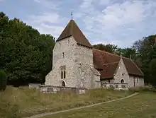 The Parish Church of All Saints |
| The Parish Church of St Michael the Archangel | Litlington, East Sussex | Parish Church | 12th century | 30 August 1966 | TQ5233801955 50°47′50″N 0°09′37″E |
1353380 |  The Parish Church of St Michael the Archangel |
| Friston Place | East Dean and Friston, Wealden | House | 16th century | 13 October 1952 | TV5484898840 50°46′07″N 0°11′40″E |
1353299 | |
| The Parish Church of Saint James | Friston, East Dean and Friston, Wealden | Parish Church | Saxon | 30 August 1966 | TV5517298181 50°45′45″N 0°11′56″E |
1043259 | 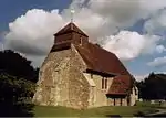 The Parish Church of Saint James |
| The Parish Church of St Simon and St Jude | East Dean and Friston, Wealden | Parish Church | Saxon | 30 August 1966 | TV5573197699 50°45′29″N 0°12′24″E |
1366117 |  The Parish Church of St Simon and St Jude |
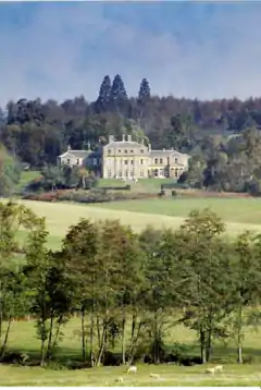
| Sheffield Park House | Sheffield Park Gardens, Fletching, Wealden | House | About 1779 | 26 November 1953 | TQ4135524138 50°59′57″N 0°00′47″E |
1028395 |  Sheffield Park House |
| The Parish Church of St Andrew and St Mary | Fletching, Wealden | Parish Church | Norman | 31 December 1982 | TQ4290423460 50°59′34″N 0°02′06″E |
1028414 | 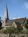 The Parish Church of St Andrew and St Mary |
| Hammerwood Park | Hammerwood, Wealden | House | c. 1795 | 26 November 1953 | TQ4422238852 51°07′51″N 0°03′35″E |
1191730 | |
| The Ruins of Bayham Abbey | Frant, Wealden | Abbey | Founded about 1200 | 26 November 1953 | TQ6501936498 51°06′15″N 0°21′20″E |
1192095 |  The Ruins of Bayham Abbey |
| The Parish Church of Saint Mary | Hailsham, Wealden | Parish Church | c. 1425 | 30 August 1966 | TQ5916609498 50°51′47″N 0°15′37″E |
1043232 | 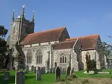 The Parish Church of Saint Mary |
| Holwych Farmhouse | Cowden, Hartfield, Wealden | House | 17th century or earlier | 26 November 1953 | TQ4837640236 51°08′32″N 0°07′11″E |
1286541 | |
| The Parish Church of St Mary | Hartfield, Wealden | Parish Church | 13th century | 26 November 1953 | TQ4796635722 51°06′06″N 0°06′43″E |
1192522 | 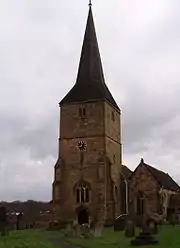 The Parish Church of St Mary |
| The Parish Church of All Saints | Waldron Village, Heathfield and Waldron, Wealden | Parish Church | 13th century | 30 August 1966 | TQ5490019227 50°57′06″N 0°12′14″E |
1284195 | 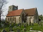 The Parish Church of All Saints |
| Horselunges Manor | Hellingly, Wealden | House | Early 15th century | 13 October 1952 | TQ5821512010 50°53′09″N 0°14′53″E |
1285385 |  Horselunges Manor |
| The Parish Church of St Peter and St Paul | Hellingly, Wealden | Parish Church | Transitional Norman | 30 August 1966 | TQ5808412302 50°53′19″N 0°14′46″E |
1043186 | 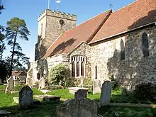 The Parish Church of St Peter and St Paul |
| Herstmonceux Castle with Attached Bridges to North and South and Causeway with Moat Retaining Walls to West | Herstmonceux Park, Herstmonceux, Wealden | Castle | c. 1441 | 24 July 1989 | TQ6465210335 50°52′09″N 0°20′19″E |
1272785 | 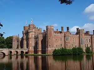 Herstmonceux Castle with Attached Bridges to North and South and Causeway with Moat Retaining Walls to West |
| Herstmonceux Place | Herstmonceux, Wealden | Flats | Early 18th century | 13 October 1952 | TQ6393711082 50°52′34″N 0°19′44″E |
1043172 |  Herstmonceux Place |
| The Parish Church of All Saints | Herstmonceux, Wealden | Parish Church | Late 12th century | 30 August 1966 | TQ6427110186 50°52′04″N 0°19′59″E |
1353333 |  The Parish Church of All Saints |
| The Parish Church of St Oswald | Hooe, Wealden | Parish Church | 13th century | 30 August 1966 | TQ6827409168 50°51′27″N 0°23′22″E |
1043159 |  The Parish Church of St Oswald |
| The Parish Church of St Margaret | Isfield, Wealden | Parish Church | 12th century | 26 November 1953 | TQ4438818125 50°56′40″N 0°03′14″E |
1353561 | .JPG.webp) The Parish Church of St Margaret |
| The Parish Church of All Saints | Laughton, Wealden | Parish Church | 13th century | 30 August 1966 | TQ5007212575 50°53′35″N 0°07′57″E |
1181698 |  The Parish Church of All Saints |
| The Parish Church of Saint Peter | Folkington, Long Man, Wealden | Parish Church | 13th century | 30 August 1966 | TQ5593803804 50°48′46″N 0°12′44″E |
1193438 | .jpg.webp) The Parish Church of Saint Peter |
| The Parish Church of St Mary and St Peter | The Street, Long Man, Wealden | Parish Church | 12th century | 30 August 1966 | TQ5441104280 50°49′03″N 0°11′26″E |
1028509 | |
| Wilmington Priory | The Street, Long Man, Wealden | House | 13th century | 30 August 1966 | TQ5438904254 50°49′02″N 0°11′25″E |
1185052 | |
| The Parish Church of St Bartholomew | Maresfield, Wealden | Parish Church | c. 1080 | 26 November 1953 | TQ4658624017 50°59′49″N 0°05′15″E |
1192995 | 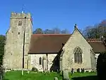 The Parish Church of St Bartholomew |
| Middle House Hotel | Mayfield and Five Ashes, Wealden | Hotel | 1575 | 26 November 1953 | TQ5870626983 51°01′13″N 0°15′41″E |
1028215 | 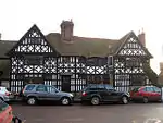 Middle House Hotel |
| The Old Palace (the Convent of the Holy Child Jesus, St Leonard's Mayfield School) | Mayfield and Five Ashes, Wealden | Archbishops Palace | 13th century | 26 November 1953 | TQ5873627111 51°01′17″N 0°15′43″E |
1353594 | |
| Parish Church of St Dunstan | Mayfield and Five Ashes, Wealden | Parish Church | 13th century | 26 November 1953 | TQ5864827027 51°01′15″N 0°15′38″E |
1193663 | |
| The Parish Church of St Mary | Ninfield, Wealden | Parish Church | 13th century | 30 August 1966 | TQ7050212288 50°53′06″N 0°25′21″E |
1182294 |  The Parish Church of St Mary |
| The Parish Church of St Nicholas | Pevensey, Wealden | Parish Church | 13th century | 30 August 1966 | TQ6469604835 50°49′11″N 0°20′12″E |
1353406 | |
| The Parish Church of St Denys | Rotherfield, Wealden | Parish Church | 13th century | 26 November 1953 | TQ5560529750 51°02′46″N 0°13′06″E |
1193874 | 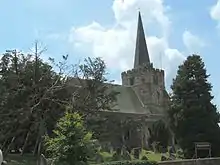 The Parish Church of St Denys |
| The Parish Church of St Peter and St Paul | Wadhurst, Wealden | Parish Church | 12th century | 26 November 1953 | TQ6407131871 51°03′46″N 0°20′24″E |
1028097 | 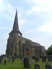 The Parish Church of St Peter and St Paul |
| The New House | Wadhurst Park, Wadhurst, Wealden | Country House | 1982-1986 | 2 July 2020 | TQ6323328810 51°02′08″N 0°19′36″E |
1457638 | |
| The Parish Church of St Mary Magdalene | Wartling, Wealden | Parish Church | 13th century | 30 August 1966 | TQ6578009162 50°51′30″N 0°21′15″E |
1353420 |  The Parish Church of St Mary Magdalene |
| The Parish Church of St Mary | Westham, Wealden | Parish Church | Medieval | 30 August 1966 | TQ6416404588 50°49′03″N 0°19′45″E |
1353431 | |
| The Parish Church of St Andrew | Willingdon and Jevington, Wealden | Parish Church | Saxon | 30 August 1966 | TQ5614301508 50°47′32″N 0°12′50″E |
1043127 | 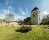 The Parish Church of St Andrew |
| The Parish Church of St Mary the Virgin | Willingdon and Jevington, Wealden | Parish Church | Late 12th century to early 13th century | 30 August 1966 | TQ5894302452 50°47′59″N 0°15′15″E |
1184822 | .jpg.webp) The Parish Church of St Mary the Virgin |
| 1–11 Church Street | The Hoo, Willingdon and Jevington, Wealden | House | 1902 | 10 December 1973 | TQ5889002406 50°47′58″N 0°15′12″E |
1184911 | |
| The Parish Church of St Michael | Withyham, Wealden | Parish Church | Medieval | 26 November 1953 | TQ4939535564 51°06′00″N 0°07′56″E |
1180384 | .jpg.webp) The Parish Church of St Michael |

.jpg.webp)
.jpg.webp)
.JPG)
Notes
- The date given is the date used by Historic England as significant for the initial building or that of an important part in the structure's description.
- Sometimes known as OSGB36, the grid reference is based on the British national grid reference system used by the Ordnance Survey.
- The "List Entry Number" is a unique number assigned to each listed building and scheduled monument by Historic England.
References
External links
![]() Media related to Grade I listed buildings in East Sussex at Wikimedia Commons
Media related to Grade I listed buildings in East Sussex at Wikimedia Commons
This article is issued from Wikipedia. The text is licensed under Creative Commons - Attribution - Sharealike. Additional terms may apply for the media files.