Grade I listed buildings in the West Midlands
There are over 9000 Grade I listed buildings in England. This page is a list of these buildings in the county of West Midlands, by borough.
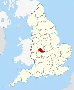
The West Midlands shown in England
Birmingham


Wolverhampton
| Name | Location | Type | Completed [note 1] | Date designated | Grid ref.[note 2] Geo-coordinates |
Entry number [note 3] | Image |
|---|---|---|---|---|---|---|---|
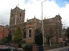
| Church of St Peter | City of Wolverhampton | Church | Late 13th century | 16 July 1949 | SO9142698793 52°35′13″N 2°07′41″W |
1282467 | |
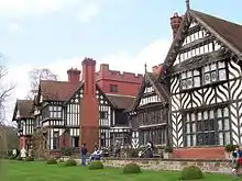
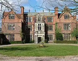
| Wightwick Manor | City of Wolverhampton | House | 1893 | 29 July 1950 | SO8694698441 52°35′01″N 2°11′39″W |
1201902 |
Dudley
| Name | Location | Type | Completed [note 1] | Date designated | Grid ref.[note 2] Geo-coordinates |
Entry number [note 3] | Image |
|---|---|---|---|---|---|---|---|
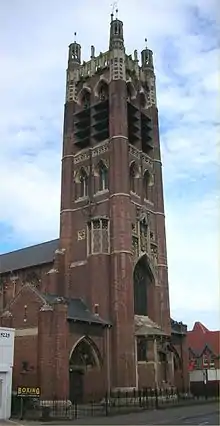
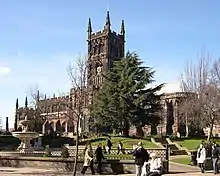
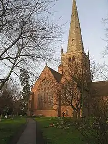
| Church of St John the Baptist | Halesowen | Parish Church | Norman to Perpendicular | 10 January 1950 | SO9663683583 52°27′01″N 2°03′03″W |
1063767 | .jpg.webp) Church of St John the Baptist |
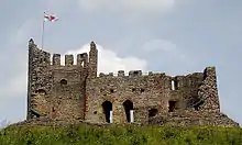
| Dudley Castle | Dudley | Kitchen | 14th century | 14 September 1949 | SO9468390678 52°30′50″N 2°04′47″W |
1343187 | |
| St Thomas' Church, Stourbridge | Stourbridge | Church | 1726 | 8 November 1949 | SO9003084214 52°27′21″N 2°08′53″W |
1343197 | |
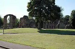
| Dudley Priory | Dudley | Cluniac Monastery | 1160 | 14 September 1949 | SO9433090847 52°30′56″N 2°05′06″W |
1343217 | |
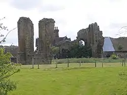
| Halesowen Abbey | Halesowen | Abbey | 13th century | 10 January 1950 | SO9758482846 52°26′37″N 2°02′13″W |
1063731 | |
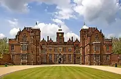
| The Leasowes | Dudley | House | Early 18th century | 10 January 1950 | SO9795883997 52°27′14″N 2°01′53″W |
1063761 |
.jpg.webp)
Sandwell
| Name | Location | Type | Completed [note 1] | Date designated | Grid ref.[note 2] Geo-coordinates |
Entry number [note 3] | Image |
|---|---|---|---|---|---|---|---|
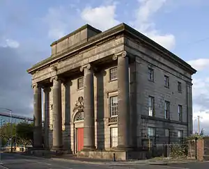
| Galton Bridge including attached railway bridge span | Smethwick | Footbridge | 1829 | 2 August 1972 | SP0150289342 52°30′07″N 1°58′45″W |
1214833 | 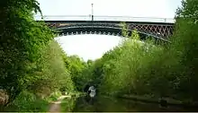 Galton Bridge including attached railway bridge span |
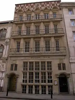
| West Bromwich Manor House | West Bromwich | Courtyard House | circa 1300 | 23 September 1955 | SP0055194316 52°32′48″N 1°59′36″W |
1077111 |
.jpg.webp)
Solihull
| Name | Location | Type | Completed [note 1] | Date designated | Grid ref.[note 2] Geo-coordinates |
Entry number [note 3] | Image |
|---|---|---|---|---|---|---|---|
| Church of St Mary | Temple Balsall | Church | 1677 | 8 September 1961 | SP2069975989 52°22′54″N 1°41′50″W |
1075995 | |
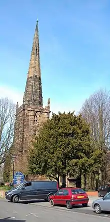
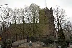
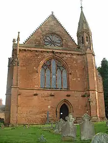
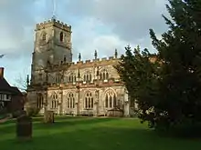
| Church of Saint John the Baptist | Berkswell | Church | Late 12th century | 8 September 1961 | SP2438579162 52°24′36″N 1°38′35″W |
1075974 | 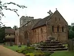 Church of Saint John the Baptist |
| Church of Saint Peter | Bickenhill | Parish Church | 12th century | 8 September 1961 | SP1882782409 52°26′22″N 1°43′28″W |
1343224 |  Church of Saint Peter |
| Bakehouse at Castle Bromwich Hall | Castle Bromwich | Bakehouse | Late 16th century | 11 November 1952 | SP1430389802 52°30′21″N 1°47′27″W |
1343226 |  |
| Castle Bromwich Hall | Castle Bromwich | House | Late 16th or early 17th century | 11 November 1952 | SP1428489779 52°30′21″N 1°47′28″W |
1366587 | |
| Church of Saint Mary and Saint Margaret | Castle Bromwich | Church | 15th century | 8 September 1961 | SP1424789859 52°30′23″N 1°47′30″W |
1075951 | |
| Church of Saint Mary and Saint Bartholomew | Hampton-in-Arden | Parish Church | 12th century | 8 September 1961 | SP2027880771 52°25′28″N 1°42′12″W |
1055777 |  Church of Saint Mary and Saint Bartholomew |
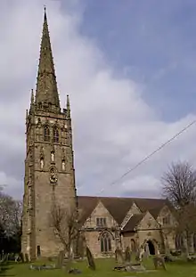
| Church of St Lawrence | Meriden | Parish Church | 12th century | 8 September 1961 | SP2522881661 52°25′56″N 1°37′49″W |
1031828 |  Church of St Lawrence |
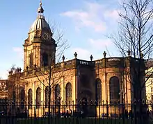
| Church of Saint Alphege | Solihull | Church | 14th century | 5 December 1949 | SP1533079287 52°24′41″N 1°46′34″W |
1076693 | |
| Church of Saint John the Baptist, Saint Lawrence and Saint Anne | Knowle | Church | 15th century | 5 December 1949 | SP1823876734 52°23′18″N 1°44′00″W |
1203309 | |
| Grimshaw Hall | Knowle | Country House | Early 17th century | 5 December 1949 | SP1842877470 52°23′42″N 1°43′50″W |
1076714 | |
| 936 Warwick Road | Solihull | House | Unknown | 17 September 1974 | SP1640878855 52°24′27″N 1°45′37″W |
1203586 | |
Notes
- The date given is the date used by Historic England as significant for the initial building or that of an important part in the structure's description.
- Sometimes known as OSGB36, the grid reference is based on the British national grid reference system used by the Ordnance Survey.
- The "List Entry Number" is a unique number assigned to each listed building and scheduled monument by Historic England.
References
This article is issued from Wikipedia. The text is licensed under Creative Commons - Attribution - Sharealike. Additional terms may apply for the media files.