Grade I listed buildings in Hampshire
There are over 9000 Grade I listed buildings in England. This page is a list of the 215 Grade I listed buildings in the county of Hampshire. There are also five Grade I listed parks and gardens which are nota listed here.
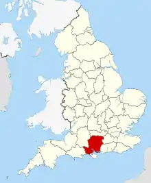
Hampshire shown in England
Basingstoke and Deane
| Name | Location | Type | Completed [note 1] | Date designated | Grid ref.[note 2] Geo-coordinates |
Entry number [note 3] | Image |
|---|---|---|---|---|---|---|---|
| Church of St James Corden | Ashmansworth, Basingstoke and Deane | Church | 12th century | 16 May 1966 | SU4107156631 51°18′26″N 1°24′44″W |
1092445 |  Church of St James Corden |
| Church of St Catherine | Wolverton, Hampshire | Church | Medieval | 16 May 1966 | SU5518658564 51°19′25″N 1°12′34″W |
1092569 | 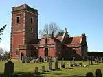 Church of St Catherine |
| Church of St James | Bramley, Hampshire | Church | ALL PERIODS | 26 April 1957 | SU6449458988 51°19′35″N 1°04′33″W |
1093029 | |
| Barn Approximately 40 Metres South West of Manor Farmhouse | Old Burghclere, Burghclere, Basingstoke and Deane | Threshing Barn | 1451-3 | 18 May 1984 | SU4689157966 51°19′08″N 1°19′43″W |
1157463 |  |
| Church of All Saints | Old Burghclere, Burghclere, Basingstoke and Deane | Church | c. 1100 | 16 May 1966 | SU4684757868 51°19′05″N 1°19′45″W |
1157301 | .jpg.webp) Church of All Saints |
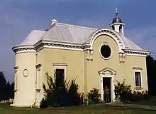
| Sandham Memorial Chapel | Harts Lane, Burghclere, Basingstoke and Deane | Almshouse | 1926 | 18 May 1984 | SU4632960830 51°20′41″N 1°20′10″W |
1339741 | |
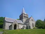
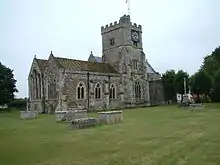
| Church of All Saints | Dummer, Hampshire | Church | c. 1200 | 26 April 1957 | SU5885646017 51°12′37″N 1°09′32″W |
1093019 |  Church of All Saints |
| Church of All Saints | Hannington, Hampshire | Church | Saxon | 16 May 1966 | SU5385855430 51°17′44″N 1°13′44″W |
1339767 |  Church of All Saints |
| Church of St Mary the Blessed Virgin | Hartley Wespall, Basingstoke and Deane | Church | 14th century | 26 April 1957 | SU6978458315 51°19′11″N 1°00′00″W |
1339496 |  Church of St Mary the Blessed Virgin |
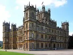
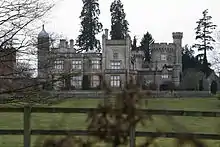
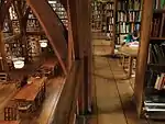
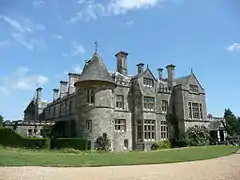
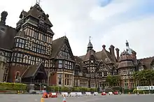
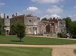
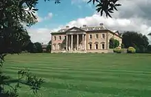
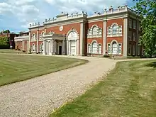
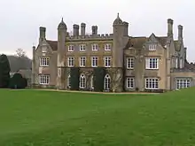
| Highclere Castle | Highclere Park, Highclere, Basingstoke and Deane | Country House | 1839-42 | 10 January 1953 | SU4463358796 51°19′35″N 1°21′39″W |
1092528 | |
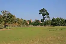
| Jackdaws Castle | Highclere Park, Highclere, Basingstoke and Deane | Folly | c. 1740 | 16 May 1966 | SU4490558796 51°19′35″N 1°21′25″W |
1092530 | .jpg.webp) Jackdaws Castle |
| Milford Lake House | Highclere Park, Highclere, Basingstoke and Deane | Summerhouse | Early 18th century | 16 May 1966 | SU4502460958 51°20′45″N 1°21′18″W |
1092532 | |
| Church of St Mary | Tufton, Hampshire | Church | Saxon | 16 May 1966 | SU4575046814 51°13′07″N 1°20′47″W |
1175684 | 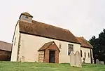 Church of St Mary |
| Church of St Nicholas | Freefolk, Laverstoke, Basingstoke and Deane | Church | late medieval | 16 May 1966 | SU4874048609 51°14′05″N 1°18′12″W |
1092725 | |
| Priory Farmhouse | Mapledurwell and Up Nately, Basingstoke and Deane | Farmhouse | 17th century | 26 April 1957 | SU6885452557 51°16′05″N 1°00′52″W |
1339548 | |
| Church of All Saints | Monk Sherborne, Basingstoke and Deane | Church | c. 1140 | 26 April 1957 | SU6083555798 51°17′53″N 1°07′44″W |
1339517 |  Church of All Saints |
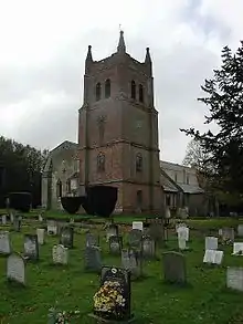
| Pamber Priory Church of the Holy Trinity, Our Lady, and St John the Baptist | Monk Sherborne, Basingstoke and Deane | Church | 1843 | 26 April 1957 | SU6089158156 51°19′09″N 1°07′39″W |
1092954 |  Pamber Priory Church of the Holy Trinity, Our Lady, and St John the Baptist |
| Church of St Swithin | Nately Scures, Newnham, Basingstoke and Deane | Church | 12th century | 26 April 1957 | SU6968253004 51°16′19″N 1°00′09″W |
1092926 | 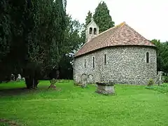 Church of St Swithin |
| Church of St Mary | Old Basing and Lychpit, Basingstoke and Deane | Church | Norman | 26 April 1957 | SU6659752927 51°16′18″N 1°02′48″W |
1339555 |  Church of St Mary |
| Tithe Barn | Old Basing and Lychpit, Basingstoke and Deane | Tithe Barn | 16th century | 26 April 1957 | SU6612252798 51°16′14″N 1°03′13″W |
1166768 |  Tithe Barn |
| Berrydown Court House | Overton, Hampshire | House | 1897-8 | 10 January 1977 | SU5260449485 51°14′32″N 1°14′52″W |
1302517 | |
| Entrance Lodge to Berrydown Court | Overton, Basingstoke and Deane | Carriageway | 10 January 1977 | SU5261949549 51°14′34″N 1°14′51″W |
1302479 | | |
| Walls to Kitchen Garden, Forecourt, and Roadside Boundary, with Garden Store Buildings, Berrydown Court | Overton, Basingstoke and Deane | Boundary Wall | 1897-8 | 12 April 1984 | SU5259849517 51°14′33″N 1°14′52″W |
1092705 | |
| Church of St. Andrew | Sherborne St John, Basingstoke and Deane | Church | c. 1150 | 26 April 1957 | SU6235855565 51°17′45″N 1°06′25″W |
1339594 |  Church of St. Andrew |
| The Vyne | Vyne Park, Sherborne St. John, Basingstoke and Deane | House | 1500–1520 | 26 April 1957 | SU6362756816 51°18′25″N 1°05′19″W |
1296972 | |
| Church of St. Mary | Silchester, Basingstoke and Deane | Church | 12th century | 26 April 1957 | SU6434162366 51°21′24″N 1°04′39″W |
1339600 |  Church of St. Mary |
| Church of St Peter | St Mary Bourne, Basingstoke and Deane | Church | Norman | 16 May 1966 | SU4225450315 51°15′02″N 1°23′45″W |
1092390 |  Church of St Peter |
| Church of St. Mary the Virgin | Stratfield Saye, Basingstoke and Deane | Church | 1758 | 26 April 1957 | SU6956161387 51°20′50″N 1°00′09″W |
1167723 | 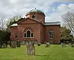 Church of St. Mary the Virgin |
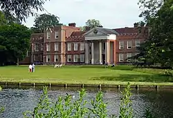
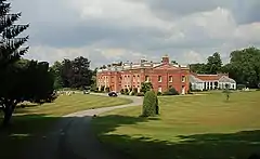
| Stratfield Saye House | Stratfield Saye Park, Stratfield Saye, Basingstoke and Deane | House | 1640 | 26 April 1957 | SU7001861566 51°20′56″N 0°59′46″W |
1092773 | |
| Church of St Peter | Tadley, Basingstoke and Deane | Church | 17th century or Earlier | 16 May 1966 | SU5978559981 51°20′09″N 1°08′35″W |
1092438 | 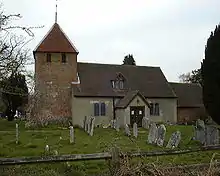 Church of St Peter |
| Church of St Mary | Upton Grey, Basingstoke and Deane | Church | 12th century | 26 April 1957 | SU6975048447 51°13′51″N 1°00′09″W |
1296652 | 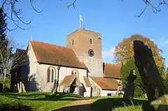 Church of St Mary |
| Church of St Michael | Basingstoke and Deane | Church | 14th century | 3 May 1949 | SU6366452186 51°15′55″N 1°05′20″W |
1092618 |


City of Portsmouth
| Name | Location | Type | Completed [note 1] | Date designated | Grid ref.[note 2] Geo-coordinates |
Entry number [note 3] | Image |
|---|---|---|---|---|---|---|---|
| 18 Gun Battery and Flanking Battery, Kings Stairs, Sallyport, Pointbarracks | The Point, City of Portsmouth | Gate | Late 17th century | 30 October 1969 | SZ6301599308 50°47′24″N 1°06′27″W |
1386892 | |
| Block Mill and Numbers 35 and 36 Stores (building Number 1/53) | Her Majestys Naval Base, City of Portsmouth | Wall | 17th century | 13 August 1999 | SU6285800814 50°48′13″N 1°06′34″W |
1078288 | |
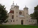
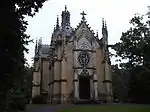
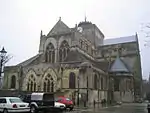
| Cathedral Church of St Thomas | City of Portsmouth | Cathedral | 1927 | 10 January 1953 | SZ6323299381 50°47′26″N 1°06′15″W |
1333198 | |
| Charles Dickens Birthplace Museum | Landport, City of Portsmouth | House | Late 18th century | 10 January 1953 | SU6440801230 50°48′25″N 1°05′14″W |
1103850 | 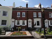 Charles Dickens Birthplace Museum |
| Docks 1 to 6 (consecutive) Quay Walls and Bollards (including North and South Camber Mast Pond and Tunnel to Same) | Her Majestys Naval Base, City of Portsmouth | Bollard | Mid 19th century | 13 August 1999 | SU6284300724 50°48′10″N 1°06′34″W |
1272267 | |
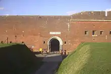
| Fort Southwick, That Part in Portsmouth Civil Parish | City of Portsmouth | Fort | c. 1860 | 30 October 1969 | SU6282306838 50°51′28″N 1°06′32″W |
1104368 | 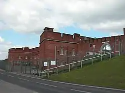 Fort Southwick, That Part in Portsmouth Civil Parish |
| Landport Gate | Portsea, Portsmouth | Town gate | 1760 | 18 March 1999 | SZ6346399717 50°47′37″N 1°06′03″W |
1387159 | |
| Number 10 Store (building Number 1/58) | Her Majestys Naval Base, City of Portsmouth | Museum | c. 1991 | 13 August 1999 | SU6284700479 50°48′02″N 1°06′34″W |
1272284 |  Number 10 Store (building Number 1/58) |
| Number 11 Store (building Number 1/59) | Her Majestys Naval Base, City of Portsmouth | Library | 1999 | 13 August 1999 | SU6280700540 50°48′04″N 1°06′36″W |
1272285 | |
| Number 9 Store (building Number 1/35) | Her Majesty's Naval Base, City of Portsmouth | Naval storehouse | 1782 | 13 August 1999 | SU6288900409 50°47′59″N 1°06′32″W |
1272283 | 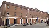 Number 9 Store (building Number 1/35) |
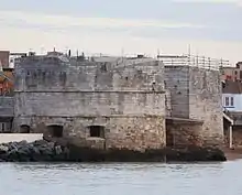
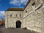
| The Round Tower | The Point, City of Portsmouth | Artillery tower | c. 1415 | 30 October 1969 | SZ6291199373 50°47′26″N 1°06′32″W |
1386901 | |
| The Square Tower | The Point, City of Portsmouth | Powder magazine | c. 1580 | 30 October 1969 | SZ6307699247 50°47′22″N 1°06′23″W |
1386904 | 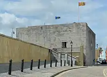 The Square Tower |
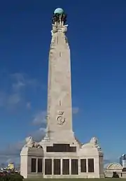
| Portsmouth Naval War Memorial | Southsea, City of Portsmouth | War memorial | 1924 | 23 May 2016 | SZ6385298495 50°46′57″N 1°05′44″W |
1386975 |
City of Southampton
| Name | Location | Type | Completed [note 1] | Date designated | Grid ref.[note 2] Geo-coordinates |
Entry number [note 3] | Image |
|---|---|---|---|---|---|---|---|
| Bargate and Guildhall | Southampton City Centre | Gate | 1180–1200 | 14 July 1953 | SU4199711636 50°54′10″N 1°24′15″W |
1092087 | |
| Canute's Palace | Southampton City Centre | Hall house | Late 12th century | 14 July 1953 | SU4194811002 50°53′49″N 1°24′18″W |
1340013 | |
| Church of St Julian | Southampton City Centre | Guest house | c. 1185 | 14 July 1953 | SU4204110951 50°53′47″N 1°24′13″W |
1091959 | |
| Church of St Mary | Swaythling | Parish church | 12th century | 14 July 1953 | SU4398815421 50°56′12″N 1°22′31″W |
1179339 | |
| Church of St Michael | Southampton City Centre | Parish church | c. 1070 | 14 July 1953 | SU4192711291 50°53′58″N 1°24′19″W |
1179142 | |
| King John's Palace | Southampton City Centre | Merchants house | c. 1170 | 14 July 1953 | SU4182211285 50°53′58″N 1°24′24″W |
1339942 | |
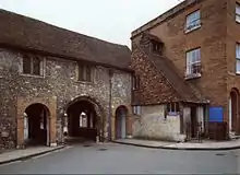
| God's House Gate | Southampton City Centre | Gate | c. 1300 | 14 July 1953 | SU4208810932 50°53′47″N 1°24′10″W |
1340004 | |
| Section of Wall Running North from God's House Along Back of the Walls to Round Tower Adjacent to No 15 | Southampton City Centre | Angle tower | 13th century | 14 July 1953 | SU4209610976 50°53′48″N 1°24′10″W |
1091982 | .jpg.webp) Section of Wall Running North from God's House Along Back of the Walls to Round Tower Adjacent to No 15 |
| Section of wall running west from Bargate to Arundel Tower and then south to point just south of Castle Water Gate. It includes Arundel Tower, Catchcold Tower, Garderobe Tower, the 40 Steps, Castle Water Gate and Castle Vault, the town walls, Bargate Street the West Gate including portions of town walls and arcades adjoining. | Southampton City Centre | Walls | Medieval | 14 July 1953 | SU4186411591 50°54′08″N 1°24′22″W |
1340005 | 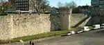 Section of wall running west from Bargate to Arundel Tower and then south to point just south of Castle Water Gate. It includes Arundel Tower, Catchcold Tower, Garderobe Tower, the 40 Steps, Castle Water Gate and Castle Vault, the town walls, Bargate Street the West Gate including portions of town walls and arcades adjoining. |
| Section of Wall Running West from Polymond Tower to Remains of Semi-circular Tower to East of Bargate and Small Part South of Polymond Tower | Southampton City Centre | Walls | Medieval | 14 July 1953 | SU4209211627 50°54′09″N 1°24′10″W |
1340006 | .jpg.webp) Section of Wall Running West from Polymond Tower to Remains of Semi-circular Tower to East of Bargate and Small Part South of Polymond Tower |
| Sections of Wall Running South Along Esplanade from South-west Corner of Simnel Street to University Air Squadron Headquarters a | Southampton City Centre | Wall | Mid 14th century | 8 October 1981 | SU4180511253 50°53′57″N 1°24′25″W |
1179282 | .jpg.webp) Sections of Wall Running South Along Esplanade from South-west Corner of Simnel Street to University Air Squadron Headquarters a |
| The Wool House | Southampton City Centre | Storehouse | 14th century | 14 July 1953 | SU4186411064 50°53′51″N 1°24′22″W |
1092060 | |
| Tudor House Museum | Southampton City Centre | Timber framed house | 1491–1518 | 14 July 1953 | SU4186911290 50°53′58″N 1°24′22″W |
1339964 | |
| Medieval Merchant's House | Southampton City Centre | Merchants house | Late 13th century or early 14th century | 14 July 1953 | SU4191711180 50°53′55″N 1°24′19″W |
1092048 | |
| Southampton Cenotaph | Southampton City Centre | Cenotaph | 1920 | 8 October 1981 | SU4191612408 50°54′35″N 1°24′19″W |
1340007 |
.jpg.webp)
.jpg.webp)
.jpg.webp)
.jpg.webp)
.jpg.webp)
.jpg.webp)
.jpg.webp)


East Hampshire
| Name | Location | Type | Completed [note 1] | Date designated | Grid ref.[note 2] Geo-coordinates |
Entry number [note 3] | Image |
|---|---|---|---|---|---|---|---|
| Parish Church of St Lawrence | Alton, East Hampshire | Parish Church | Norman | 13 March 1951 | SU7172239602 51°09′04″N 0°58′33″W |
1338903 | |
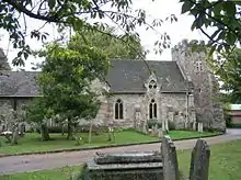
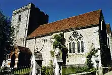
| Church of the Holy Cross | Binsted, East Hampshire | Parish Church | Early 12th century | 31 July 1963 | SU7714240938 51°09′45″N 0°53′53″W |
1302151 |  Church of the Holy Cross |
| West Court Barn | Binsted, East Hampshire | Barn | 1296–1304 | 15 August 1985 | SU7658541142 51°09′52″N 0°54′22″W |
1338987 | |
| Jane Austen's House | Chawton, East Hampshire | House | 18th century | 31 July 1963 | SU7083437579 51°07′59″N 0°59′21″W |
1178917 | |
| All Saints Church, East Meon | East Meon, East Hampshire | Parish Church | Early 12th century | 16 March 1985 | SU6806222283 50°59′45″N 1°01′53″W |
1351116 | |
| The Court House | East Meon, East Hampshire | Farmhouse | Late 16th century | 16 March 1954 | SU6813122228 50°59′44″N 1°01′50″W |
1094584 | .jpg.webp) The Court House |
| Rotherfield Park | Rotherfield Park, East Tisted, East Hampshire | Country House | 1815-21 | 18 July 1986 | SU6947732305 51°05′09″N 1°00′34″W |
1351139 | |
| Church of St Mary of the Assumption | Upper Froyle, Froyle, East Hampshire | Parish Church | Early 14th century | 31 July 1963 | SU7556842870 51°10′48″N 0°55′13″W |
1094095 | 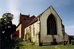 Church of St Mary of the Assumption |
| Church of the Holy Rood | Empshott, Hawkley, East Hampshire | Parish Church | 13th century | 16 March 1954 | SU7532831244 51°04′32″N 0°55′34″W |
1094477 | 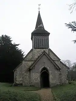 Church of the Holy Rood |
| Church of St Peter | Petersfield, East Hampshire | Church | 2nd quarter of 12th century | 29 July 1949 | SU7464823187 51°00′12″N 0°56′15″W |
1157381 | |
| Statue of William III | Petersfield, East Hampshire | Statue | 18th century | 29 July 1949 | SU7465123247 51°00′14″N 0°56′15″W |
1093567 |  Statue of William III |
| St Huberts Chapel | Idsworth, Rowlands Castle, East Hampshire | Parish Church | 1053 | 16 March 1954 | SU7427914068 50°55′17″N 0°56′41″W |
1094540 |  St Huberts Chapel |
| Church of St Mary | The Plestor, Selborne, East Hampshire | Parish Church | c. 1180 | 3 July 1963 | SU7411933780 51°05′55″N 0°56′34″W |
1351131 | 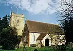 Church of St Mary |
| The Wakes (including Museum Flat and the Flat) | Selborne, Selborne, East Hampshire | Apartment | 17th century | 31 July 1963 | SU7408333677 51°05′51″N 0°56′36″W |
1174798 | 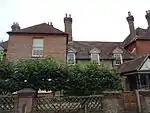 The Wakes (including Museum Flat and the Flat) |
| Bedales Memorial Library, Lupton Hall and Corridor | Steep, East Hampshire | School Library | 1922 | 16 March 1954 | SU7428925132 51°01′15″N 0°56′32″W |
1278033 | |
| Church of St James | Upper Wield, Wield, East Hampshire | Cross | c. 1150 | 31 July 1963 | SU6284138753 51°08′41″N 1°06′11″W |
1094078 |  Church of St James |

.jpg.webp)
Fareham
| Name | Location | Type | Completed [note 1] | Date designated | Grid ref.[note 2] Geo-coordinates |
Entry number [note 3] | Image |
|---|---|---|---|---|---|---|---|
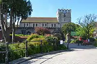
| Church of St Mary | Portchester, Fareham | Church | 1710 | 18 October 1955 | SU6253004495 50°50′12″N 1°06′48″W |
1339235 | .JPG.webp) Church of St Mary |
| Monastic Barn of Titchfield Abbey at Fern Hill Farm | Titchfield, Fareham | Tithe Barn | 15th century | 18 October 1955 | SU5395106489 50°51′19″N 1°14′06″W |
1094235 | |
| Parish Church of St Peter | Titchfield, Fareham | Parish Church | Possible C8 origins | 18 October 1955 | SU5409305785 50°50′57″N 1°13′59″W |
1351279 | _-_geograph.org.uk_-_1564629.jpg.webp) Parish Church of St Peter |
| Portchester Castle | Portchester, Fareham | Castle | During reign of Henry II | 18 October 1955 | SU6241104667 50°50′17″N 1°06′54″W |
1229190 |

Gosport
| Name | Location | Type | Completed [note 1] | Date designated | Grid ref.[note 2] Geo-coordinates |
Entry number [note 3] | Image |
|---|---|---|---|---|---|---|---|
| 'A' Magazine, Museum Buildings | Gosport | Boundary wall | 1770 to 1776 | 19 January 1990 | SU6164101237 50°48′27″N 1°07′36″W |
1276026 | 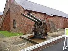 'A' Magazine, Museum Buildings |
| 'B' Magazine (north and south Stores) and attached Passage and Boundary Wall, and Main Rolling Way and Attached Foreman's Office | Gosport | Cooperage | 1773 | 19 January 1990 | SU6165501256 50°48′27″N 1°07′35″W |
1393247 | 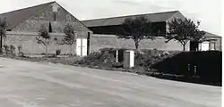 'B' Magazine (north and south Stores) and attached Passage and Boundary Wall, and Main Rolling Way and Attached Foreman's Office |
| Gunboat Sheds and Workshops | Gosport | Sheds and workshops | 1856 | 14 June 2016 | SZ6172198973 50°47′13″N 1°07′33″W |
1431190 | |
| Church of St Mary | Rowner, Gosport | Church | 13th century | 20 April 1983 | SU5840801634 50°48′41″N 1°10′20″W |
1276419 | 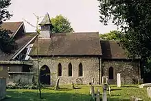 Church of St Mary |
Hart
| Name | Location | Type | Completed [note 1] | Date designated | Grid ref.[note 2] Geo-coordinates |
Entry number [note 3] | Image |
|---|---|---|---|---|---|---|---|
| Bramshill House | Bramshill, Hart | Steps | 1605–1612 | 8 July 1952 | SU7587659630 51°19′51″N 0°54′44″W |
1340025 | |
| Garden Walls and Gateways North of Bramshill House | Bramshill House, Bramshill, Hart | Garden Walls | Early 17th century | 8 July 1952 | SU7595859597 51°19′49″N 0°54′40″W |
1340026 |  Garden Walls and Gateways North of Bramshill House |
| Gateway to Bramshill House | Bramshill House, Bramshill, Hart | Gate | Early 17th century | 8 July 1952 | SU7597059697 51°19′53″N 0°54′39″W |
1091938 | |
| High Bridge | Bramshill House, Bramshill, Hart | Bridge | Early 19th century | 8 July 1952 | SU7538659347 51°19′42″N 0°55′10″W |
1091941 | 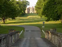 High Bridge |
| Walls and Turrets South of Bramshill House | Bramshill House, Bramshill, Hart | Tower | Early 17th century | 26 June 1987 | SU7580559566 51°19′49″N 0°54′48″W |
1091939 | |
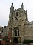
| All Saints Church, Crondall | Crondall, Hart | Church | before 1200 | 24 November 1961 | SU7947848483 51°13′48″N 0°51′47″W |
1091946 | |
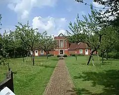
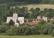
| Dogmersfield Park (house) | Dogmersfield Park, Dogmersfield, Hart | Bishops Palace | Medieval | 8 July 1952 | SU7713251599 51°15′30″N 0°53′46″W |
1092357 | 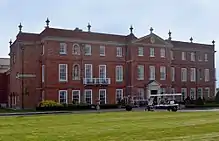 Dogmersfield Park (house) |
| Church of St Mary | Eversley, Hart | Church | Medieval | 24 November 1961 | SU7791060917 51°20′31″N 0°52′58″W |
1092339 |  Church of St Mary |
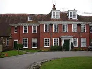
| Warbrook House | Eversley, Hart | House | 1727 | 8 July 1952 | SU7739561829 51°21′01″N 0°53′24″W |
1260096 | 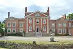 Warbrook House |
| Mattingley Church | Mattingley Green, Mattingley, Hart | Church | 15th century | 24 November 1961 | SU7363958024 51°19′00″N 0°56′41″W |
1272800 |  Mattingley Church |
| Church of All Saints | Odiham, Hart | Church | 13th century | 24 November 1961 | SU7403950923 51°15′10″N 0°56′26″W |
1092160 | |
| Odiham Castle | Odiham, Hart | Keep | 1207–1214 | 24 November 1961 | SU7255751873 51°15′41″N 0°57′41″W |
1092165 | |
| Church of St Mary | Winchfield, Hart | Church | Norman | 24 November 1961 | SU7679853603 51°16′35″N 0°54′01″W |
1244705 | 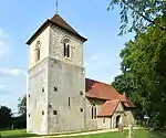 Church of St Mary |
Jun2006.jpg.webp)

Havant
| Name | Location | Type | Completed [note 1] | Date designated | Grid ref.[note 2] Geo-coordinates |
Entry number [note 3] | Image |
|---|---|---|---|---|---|---|---|
| Church of St Peter | Hayling Island, Havant | Parish Church | Transitional | 16 May 1952 | SU7308703201 50°49′25″N 0°57′49″W |
1155352 | 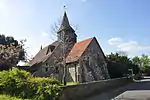 Church of St Peter |
| Church of St Thomas à Becket | Warblington, Havant | Parish Church | Saxon | 16 May 1952 | SU7290005418 50°50′37″N 0°57′57″W |
1154443 |

New Forest
| Name | Location | Type | Completed [note 1] | Date designated | Grid ref.[note 2] Geo-coordinates |
Entry number [note 3] | Image |
|---|---|---|---|---|---|---|---|
| Church of the Blessed Virgin and Child | Beaulieu, Hampshire | Church | Early/Mid 13th century | 8 October 1959 | SU3883202548 50°49′16″N 1°27′00″W |
1156943 |  Church of the Blessed Virgin and Child |
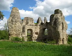
| Domus and Ruins of Lay Frater | Beaulieu Manor Estate, Beaulieu, New Forest | Abbey | Late 13th century | 8 October 1959 | SU3879602579 50°49′17″N 1°27′02″W |
1156631 | 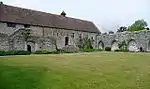 Domus and Ruins of Lay Frater |
| Palace House | Beaulieu Manor Estate, Beaulieu, New Forest | Abbey | Mid 14th century | 8 October 1959 | SU3873002445 50°49′13″N 1°27′06″W |
1094430 | |
| Remains of Outer Wall Around Cloister and Foundations of Abbey Church | Beaulieu Manor Estate, Beaulieu, New Forest | Abbey | Late 13th century | 8 October 1959 | SU3883002591 50°49′18″N 1°27′00″W |
1094429 | 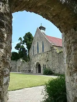 Remains of Outer Wall Around Cloister and Foundations of Abbey Church |
| Remains of St Leonard's Chapel | St Leonard's, Beaulieu, New Forest | Chapel | 14th century | 8 October 1959 | SZ4052798207 50°46′55″N 1°25′35″W |
1094415 |  Remains of St Leonard's Chapel |
| St Leonard's Barn | St Leonard's, Beaulieu, New Forest | Barn | 14th century | 8 October 1959 | SZ4064898164 50°46′54″N 1°25′29″W |
1157008 | 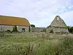 St Leonard's Barn |
| Hinton Admiral House | Hinton Park, Bransgore, New Forest | Country House | 1720 | 30 September 1964 | SZ2085395944 50°45′46″N 1°42′21″W |
1095030 | 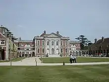 Hinton Admiral House |
| Church of St Mary | Breamore Park, Breamore, New Forest | Parish Church | Late 10th century | 30 September 1964 | SU1532818896 50°58′09″N 1°46′59″W |
1094934 | 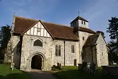 Church of St Mary |
| Church of St George | Damerham, New Forest | Parish Church | 12th century | 13 February 1987 | SU1075315809 50°56′30″N 1°50′54″W |
1094925 | 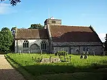 Church of St George |
| Church of St Mary | Ellingham, Hampshire | Parish Church | 13th century | 30 September 1964 | SU1442508323 50°52′27″N 1°47′47″W |
1156533 |  Church of St Mary |
| Church of All Saints | Fawley, Hampshire | Tower | c. 1175 | 8 October 1959 | SU4575403553 50°49′47″N 1°21′06″W |
1351239 |  Church of All Saints |
| Church of St Mary | Fordingbridge, New Forest | Parish Church | 12th century | 30 September 1964 | SU1451513813 50°55′25″N 1°47′41″W |
1350974 | |
| Church of St Mary | Hale Park, Hale, Hampshire | Parish Church | Medieval origins | 30 September 1964 | SU1784218655 50°58′01″N 1°44′50″W |
1094881 | 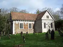 Church of St Mary |
| Hale House, Including Quadrant Passages to Pavilions | Hale Park, Hale, New Forest | Country House | 1715 | 30 April 1955 | SU1794718577 50°57′59″N 1°44′45″W |
1301070 | 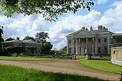 Hale House, Including Quadrant Passages to Pavilions |
| Church of St Michael and All Angels | Lyndhurst, Hampshire | Parish Church | 1858-68 | 13 May 1987 | SU2980508168 50°52′20″N 1°34′40″W |
1094725 | 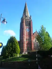 Church of St Michael and All Angels |
| Church of All Saints | Martin, Hampshire | Parish Church | 12th century | 30 September 1964 | SU0705019559 50°58′31″N 1°54′03″W |
1094828 | 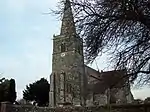 Church of All Saints |
| Church of All Saints | Milford-on-Sea, New Forest | Church | late Norman | 22 December 1973 | SZ2905592109 50°43′40″N 1°35′23″W |
1276161 | 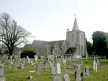 Church of All Saints |
| Church of All Saints | Minstead, New Forest | Church | Early 19th century | 8 October 1959 | SU2810510878 50°53′48″N 1°36′06″W |
1094732 | 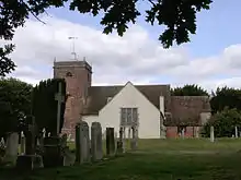 Church of All Saints |
| Barn Formerly Chapel 20 Metres East of Manor House | Manor Farm, Rockbourne, New Forest | Chapel | 13th century | 30 September 1964 | SU1156318371 50°57′53″N 1°50′12″W |
1167857 | 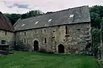 Barn Formerly Chapel 20 Metres East of Manor House |
| Church of St Andrew | Manor Farm, Rockbourne, New Forest | Parish Church | 13th century | 30 September 1964 | SU1155818319 50°57′51″N 1°50′12″W |
1296677 |  Church of St Andrew |
| Large Barn 50 Metres North East of Manor House | Manor Farm, Rockbourne, New Forest | House | 15th century | 30 September 1964 | SU1155818395 50°57′54″N 1°50′12″W |
1351003 | 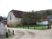 Large Barn 50 Metres North East of Manor House |
| Manor Farm and Wall Running North East | Manor Farm, Rockbourne, New Forest | Hall House | 14th century | 30 September 1964 | SU1153418341 50°57′52″N 1°50′14″W |
1351002 |  Manor Farm and Wall Running North East |
| Avon Tyrrell House | Avon Tyrrell, Sopley, New Forest | Country House | 1891 | 12 March 1987 | SU1853100257 50°48′06″N 1°44′18″W |
1350922 | 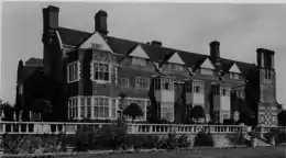 Avon Tyrrell House |
| Church of All Saints | Thorney Hill, Sopley, New Forest | Church | 1906 | 24 September 1985 | SZ1970099724 50°47′48″N 1°43′19″W |
1302198 |
Rushmoor
| Name | Location | Type | Completed [note 1] | Date designated | Grid ref.[note 2] Geo-coordinates |
Entry number [note 3] | Image |
|---|---|---|---|---|---|---|---|
| Abbey Church of St Michael | Rushmoor | Church | 1886-7 | 28 January 1959 | SU8727856078 51°17′50″N 0°44′58″W |
1155639 | |
| Building Q121 at Former Royal Aircraft Establishment Site | Rushmoor | Workshop | 1934–1935 | 4 December 1996 | SU8678754709 51°17′06″N 0°45′25″W |
1259589 |  Building Q121 at Former Royal Aircraft Establishment Site |
| Building R133 at Former Royal Aircraft Establishment site | Rushmoor | Test House | 1939–1942 | 4 December 1996 | SU8686154824 51°17′09″N 0°45′21″W |
1259586 | 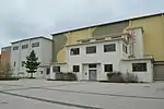 Building R133 at Former Royal Aircraft Establishment site |
| Main Building to Farnborough Hill Convent | Rushmoor | House | 1863 | 13 November 1975 | SU8718856449 51°18′02″N 0°45′03″W |
1303116 |
Test Valley
| Name | Location | Type | Completed [note 1] | Date designated | Grid ref.[note 2] Geo-coordinates |
Entry number [note 3] | Image |
|---|---|---|---|---|---|---|---|
| Church of St Mary the Virgin | Abbotts Ann, Test Valley | Parish Church | 1716 | 20 December 1960 | SU3304343575 51°11′26″N 1°31′43″W |
1228703 | 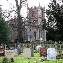 Church of St Mary the Virgin |
| Church of St Mary the Less | Chilbolton, Test Valley | Parish Church | Norman | 20 December 1960 | SU3948140219 51°09′36″N 1°26′12″W |
1339283 |  Church of St Mary the Less |
| Church of St Michael and All Angels | Knights Enham, Enham Alamein, Test Valley | Church | Norman | 24 February 1950 | SU3618048075 51°13′51″N 1°29′00″W |
1093461 | 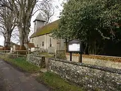 Church of St Michael and All Angels |
| Church of St Peter | Goodworth Clatford, Test Valley | Parish Church | Norman | 20 December 1960 | SU3661542533 51°10′51″N 1°28′39″W |
1339285 | 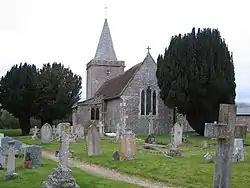 Church of St Peter |
| Church of St Leonard | Grateley, Test Valley | Parish Church | Norman | 24 October 1984 | SU2756241970 51°10′35″N 1°36′26″W |
1093259 |  Church of St Leonard |
| Church of St Peter | Hurstbourne Tarrant, Test Valley | Parish Church | Late 12th century | 20 December 1960 | SU3852452990 51°16′29″N 1°26′57″W |
1093367 |  Church of St Peter |
| Church of St Peter and St Paul | Kimpton, Hampshire | Church | 13th century | 21 December 1960 | SU2811446625 51°13′05″N 1°35′56″W |
1093222 |  Church of St Peter and St Paul |
| Marshcourt School | Marsh Court, King's Somborne, Test Valley | Country House | 1901–5 | 29 May 1957 | SU3566033594 51°06′02″N 1°29′32″W |
1093803 | |
| Church of St Nicholas | Middleton, Longparish, Test Valley | Parish Church | c. 1200 | 20 December 1960 | SU4257043907 51°11′34″N 1°23′32″W |
1339297 |  Church of St Nicholas |
| Church of St Andrew | Mottisfont, Test Valley | Parish Church | 12th century | 29 May 1957 | SU3259426749 51°02′21″N 1°32′11″W |
1172913 |  Church of St Andrew |
| Mottisfont Abbey House | Mottisfont Abbey, Mottisfont, Test Valley | Country House | 16th century | 29 May 1957 | SU3270426965 51°02′28″N 1°32′06″W |
1093730 | |
| Barn 40 Metres East of Berry Court Farmhouse | Nether Wallop, Test Valley | Farmyard | 15th century | 27 November 1984 | SU3023735638 51°07′09″N 1°34′10″W |
1339452 | |
| Church of St Andrew | Nether Wallop, Test Valley | Parish Church | 11th century | 29 May 1957 | SU3039636398 51°07′34″N 1°34′01″W |
1339423 | 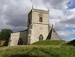 Church of St Andrew |
| Grove Place House, Northcliffe School | Grove Place, Nursling and Rownhams, Test Valley | Country House | Mid 16th century | 29 May 1957 | SU3668016759 50°56′57″N 1°28′45″W |
1339157 | |
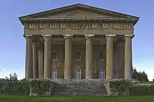
| Abbey Church of St Mary | Romsey, Test Valley | Abbey | until circa 1230 | 28 August 1951 | SU3509321257 50°59′23″N 1°30′05″W |
1092649 | |
| King John's House | Romsey, Test Valley | Abbey | Medieval | 28 August 1951 | SU3521921280 50°59′23″N 1°29′59″W |
1231745 |  King John's House |
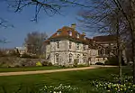
| Broadlands House | Broadlands Estate, Romsey Extra, Test Valley | Country House | Elizabethan | 29 May 1957 | SU3539120242 50°58′50″N 1°29′50″W |
1166489 | |
| Middle Bridge | Romsey Extra, Test Valley | Bridge | 1788 | 28 August 1951 | SU3492220680 50°59′04″N 1°30′14″W |
1339680 |  Middle Bridge |
| Church of St Peter and St Paul | Thruxton, Hampshire | Parish Church | 13th century | 20 December 1960 | SU2888445588 51°12′32″N 1°35′16″W |
1093204 | 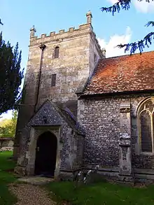 Church of St Peter and St Paul |
| Church of St Margaret | Wellow, Hampshire | Parish Church | Early 13th century | 29 May 1957 | SU3028620397 50°58′56″N 1°34′12″W |
1339214 | 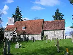 Church of St Margaret |
| Stable Block (30 Yards South of Wherwell Priory) | Wherwell, Test Valley | Abbey | 2nd quarter of 13th century | 21 March 1984 | SU3917740671 51°09′50″N 1°26′28″W |
1093391 | |
_(14740884356).jpg.webp)
Winchester
| Name | Location | Type | Completed [note 1] | Date designated | Grid ref.[note 2] Geo-coordinates |
Entry number [note 3] | Image |
|---|---|---|---|---|---|---|---|
| Church of All Saints | Bighton, Winchester | Parish Church | 12th century | 5 December 1955 | SU6101634481 51°06′23″N 1°07′47″W |
1155172 |  Church of All Saints |
| Church of St Nicholas | Bishops Sutton, Winchester | Parish Church | 12th century | 5 December 1955 | SU6059932016 51°05′03″N 1°08′10″W |
1350825 |  Church of St Nicholas |
| Church of St Nicholas | Boarhunt, Winchester | Parish Church | c. 1064 | 6 March 1967 | SU6034008281 50°52′15″N 1°08′38″W |
1350613 |  Church of St Nicholas |
| Fort Nelson | Fort Nelson, Boarhunt, Winchester | Fort | 1860s | 22 December 1971 | SU6069607203 50°51′40″N 1°08′20″W |
1350616 | |
| Church of St Michael | Cheriton, Hampshire | Church | 13th century | 5 December 1955 | SU5819328474 51°03′10″N 1°10′16″W |
1303010 |  Church of St Michael |
| Church of St Andrew | Chilcomb, Winchester | Parish Church | 1120-40 | 5 December 1955 | SU5071627919 51°02′54″N 1°16′40″W |
1095907 | 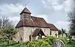 Church of St Andrew |
| Corhampton Church | Corhampton, Winchester | Parish Church | c. 1020 | 6 March 1967 | SU6100120323 50°58′45″N 1°07′57″W |
1179686 |  Corhampton Church |
| Church of St Mary and All Saints | Droxford, Winchester | Parish Church | Norman | 6 March 1967 | SU6077418210 50°57′36″N 1°08′10″W |
1095540 | |
| Church of St Peter and St Paul | Hambledon, Hampshire | Parish Church | Saxon | 24 September 1987 | SU6463315180 50°55′57″N 1°04′54″W |
1301325 |  Church of St Peter and St Paul |
| Church of St Swithun | Headbourne Worthy, Winchester | Parish Church | Saxon | 5 December 1955 | SU4874031991 51°05′07″N 1°18′20″W |
1350461 | 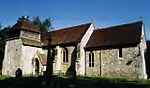 Church of St Swithun |
| Church of St John | Hursley, Winchester | Church | 12th century | 27 November 1984 | SU3973127443 51°02′42″N 1°26′05″W |
1178648 | 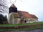 Church of St John |
| Cranbury House | Cranbury Park, Hursley, Winchester | Country House | 1790 | 27 November 1984 | SU4462523242 51°00′25″N 1°21′55″W |
1095809 | |
| Avington House | Avington, Hampshire | Country House | Late 16th century | 5 December 1955 | SU5325532323 51°05′16″N 1°14′28″W |
1095887 | |
| Church of St Mary | Easton, Hampshire | Parish Church | c. 1200 | 5 December 1955 | SU5091332258 51°05′15″N 1°16′28″W |
1095898 | 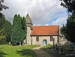 Church of St Mary |
| Church of St Mary | Avington, Hampshire | Parish Church | 1768-71 | 5 December 1955 | SU5328832252 51°05′14″N 1°14′26″W |
1350483 |  Church of St Mary |
| The Grange | Grange Park, Northington, Winchester | Country House | 1670-3 | 5 December 1955 | SU5622136154 51°07′19″N 1°11′53″W |
1095216 | |
| Godsfield Chapel adjacent to Godsfield Farmhouse | Old Alresford, Winchester | House | Late 14th century | 16 November 1983 | SU6043137048 51°07′46″N 1°08′16″W |
1350808 | |
| Marwell Hall | Marwell Zoo Park, Owslebury, Winchester | Country House | 14th century | 5 December 1955 | SU5085821779 50°59′35″N 1°16′36″W |
1350871 | |
| New Place, Shirrell Heath | Shedfield, Winchester | Country House | 1906 | 3 February 1952 | SU5665813537 50°55′07″N 1°11′43″W |
1095660 | 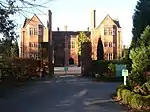 New Place, Shirrell Heath |
| Church of St Peter | Soberton, Winchester | Parish Church | Norman | 6 March 1967 | SU6108216840 50°56′52″N 1°07′55″W |
1166968 |  Church of St Peter |
| Church of St James Without the Priory Gate | Southwick, Hampshire | Church | Earlier | 6 March 1967 | SU6259408644 50°52′26″N 1°06′42″W |
1167160 | |
| Fort Southwick | Portsdown Hill, Southwick and Widley, Winchester | Fort | 1860s | 24 September 1987 | SU6287306997 50°51′33″N 1°06′29″W |
1167213 | |
| Church of St Andrew | Tichborne, Winchester | Parish Church | Mid 11th century | 5 December 1955 | SU5687230259 51°04′08″N 1°11′23″W |
1178485 | 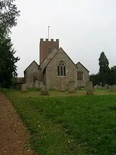 Church of St Andrew |
| Church of Our Lady | Warnford, Winchester | Parish Church | Saxon | 6 March 1967 | SU6225122659 51°00′00″N 1°06′51″W |
1296978 | 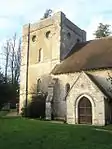 Church of Our Lady |
| St John's House | Warnford, Winchester | Aisled House | 13th century | 6 March 1967 | SU6229622647 50°59′59″N 1°06′49″W |
1350308 | 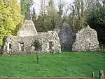 St John's House |
| Church of St Michael | Stoke Charity, Wonston, Winchester | Parish Church | c. 1190 | 5 December 1955 | SU4887839271 51°09′02″N 1°18′09″W |
1302427 | 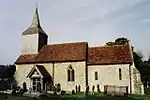 Church of St Michael |
| Avebury House | Winchester | House | 1690 | 24 March 1950 | SU4808829614 51°03′50″N 1°18′55″W |
1173668 | .jpg.webp) Avebury House |
| Cart Shed to West of Hyde Abbey Gateway and adjoining it | Winchester | Cart Shed | 12th century | 14 January 1974 | SU4814630142 51°04′07″N 1°18′51″W |
1296399 | 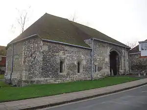 Cart Shed to West of Hyde Abbey Gateway and adjoining it |
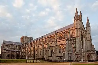
| Cathedral Church of the Holy Trinity | Winchester | Chapter House | Norman | 24 March 1950 | SU4822129254 51°03′38″N 1°18′48″W |
1095509 | |
| Cheyney Court | Winchester | Timber Framed House | 15th century | 24 March 1950 | SU4817529079 51°03′33″N 1°18′50″W |
1095517 | .jpg.webp) Cheyney Court |
| Porter's Lodge | Winchester | Lodge | 15th century | 24 March 1950 | SU4816729084 51°03′33″N 1°18′51″W |
1296925 |  Porter's Lodge |
| Church of St John the Baptist | Winchester | Church | c. 1200 | 14 January 1974 | SU4870129446 51°03′44″N 1°18′23″W |
1296158 | |
| City Bridge | Winchester | Bridge | 1813 | 24 March 1950 | SU4860229298 51°03′39″N 1°18′28″W |
1167781 | .jpg.webp) City Bridge |
| School - St Mary's College | Winchester | School | 1692 | 24 March 1950 | SU4821828918 51°03′27″N 1°18′48″W |
1167544 | |
| Sick House, St Mary's College | Winchester | School | 1656 | 24 March 1950 | SU4811328837 51°03′25″N 1°18′54″W |
1350685 | |
| Warden's Lodgings, St Mary's College | Winchester | House | Late 14th century | 24 March 1950 | SU4828028967 51°03′29″N 1°18′45″W |
1167489 | |
| Chapel, St Mary's College | Winchester | School | Late 14th century | 24 March 1950 | SU4825928940 51°03′28″N 1°18′46″W |
1350684 | 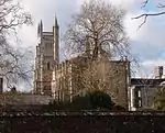 Chapel, St Mary's College |
| Chamber Court with Middle Gate, St Mary's College | Winchester | Tower | 1387 | 24 March 1950 | SU4823928980 51°03′29″N 1°18′47″W |
1296879 | 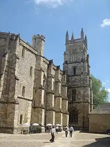 Chamber Court with Middle Gate, St Mary's College |
| Cloisters, St Mary's College | Winchester | School | Late 14th century | 24 March 1950 | SU4823528913 51°03′27″N 1°18′47″W |
1296887 | |
| College Hall, St Mary's College | Winchester | School Hall | Late 14th century | 24 March 1950 | SU4822828950 51°03′28″N 1°18′48″W |
1095484 | |
| Outer Court with Outer Gate, St Mary's College | Winchester | Gate | Late 14th century | 24 March 1950 | SU4825029013 51°03′30″N 1°18′46″W |
1095483 | 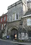 Outer Court with Outer Gate, St Mary's College |
| Fromond's Chantry, St Mary's College | Winchester | School | 15th century | 24 March 1950 | SU4825128910 51°03′27″N 1°18′46″W |
1095485 | |
| Close Boundary Walls and Gates, Priors Gate | Winchester | Gate | 15th century | 24 March 1950 | SU4814229184 51°03′36″N 1°18′52″W |
1095512 |  Close Boundary Walls and Gates, Priors Gate |
| Dome Alley | The Close, Winchester | House | Built soon after 1660 | 24 March 1950 | SU4751629417 51°03′44″N 1°19′24″W |
1095518 | |
| Great Hall, Winchester Castle | Winchester | Castle | 1232–1240 | 24 March 1950 | SU4776729477 51°03′46″N 1°19′11″W |
1351065 | |
| Hospital of St Cross and Almshouses of Noble Poverty | Winchester | Courtyard | 1136 | 24 March 1950 | SU4760727750 51°02′50″N 1°19′20″W |
1095374 | |
| Hyde Abbey Gateway | Winchester | Gate | 15th century | 24 March 1950 | SU4816030131 51°04′07″N 1°18′51″W |
1095419 |  Hyde Abbey Gateway |
| The Church of St Swithun Upon Kingsgate | Winchester | Church [note 4] | 14th century | 24 March 1950 | SU4814429092 51°03′33″N 1°18′52″W |
1095355 | |
| Minster House | Winchester | House | Early 18th century | 24 March 1950 | SU4805629355 51°03′42″N 1°18′56″W |
1350671 | .jpg.webp) Minster House |
| Garden Wall to the South of Minster House on the East and South Sides of the Garden | Winchester | Garden Wall | 18th century | 14 January 1974 | SU4805929320 51°03′40″N 1°18′56″W |
1095459 | |
| Part of the City, Palace and Castle Wall Running East from Priory Gate to Angle near to Hall above Magdalen Hospital | City Wall, Winchester | Gate | 13th century | 24 March 1950 | SU4858529256 51°03′38″N 1°18′29″W |
1095505 | |
| Pilgrims' Hall | Winchester | Meeting Hall | 13th century to 14th century | 24 March 1950 | SU4825029108 51°03′33″N 1°18′46″W |
1095516 |  Pilgrims' Hall |
| Pilgrims' School | Winchester | School | Late 17th century to early 18th century | 24 March 1950 | SU4823229083 51°03′33″N 1°18′47″W |
1167387 | |
| St John's Rooms and Chapel | Winchester | Chapel | 13th century | 24 March 1950 | SU4849229361 51°03′42″N 1°18′34″W |
1095441 | 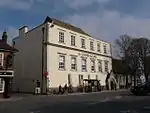 St John's Rooms and Chapel |
| The Carnery | Winchester | Charnel House | 14th century | 24 March 1950 | SU4811229288 51°03′39″N 1°18′53″W |
1350679 | |
| The Deanery, Incorporating Prior's Hall | Winchester | Deanery | 14th century to 15th century | 24 March 1950 | SU4820929173 51°03′36″N 1°18′48″W |
1095514 |  The Deanery, Incorporating Prior's Hall |
| The Judge's Lodging | Winchester | House | Late 17th century to early 18th century | 24 March 1950 | SU4817029132 51°03′34″N 1°18′51″W |
1350657 | |
| The Old Stables | Winchester | Stable | Probably Early 16th century | 24 March 1950 | SU4819029089 51°03′33″N 1°18′50″W |
1350656 | |
| War Cloister, Winchester College | Winchester | War memorial | 1924 | 24 March 1950 | SU4811928905 51°03′27″N 1°18′53″W |
1095486 | |
| The Westgate | Winchester | Gate | 13th century | 24 March 1950 | SU4781229576 51°03′49″N 1°19′09″W |
1350695 | |
| Wolvesey Castle | Winchester | Bishops Palace | 1129–1171 | 24 March 1950 | SU4845929088 51°03′33″N 1°18′36″W |
1095511 | |
| Wolvesey Palace | Winchester | Bishops Palace | 1684 | 24 March 1950 | SU4840329068 51°03′32″N 1°18′39″W |
1095510 | |
| No 4 St Peter Street | Winchester | House | 17th century | 14 January 1974 | SU4807529575 51°03′49″N 1°18′55″W |
1095390 | No 4 St Peter Street |
| No 1 The Close | Winchester | House | 1699 | 24 March 1950 | SU4827429204 51°03′37″N 1°18′45″W |
1095513 | |
| No. 9 The Close | Winchester | House | Early 17th century | 24 March 1950 | SU4813829168 51°03′35″N 1°18′52″W |
1350677 |  No. 9 The Close |
| No. 10 The Close | Winchester | House | 18th century | 24 March 1950 | SU4814329211 51°03′37″N 1°18′52″W |
1095475 | |
| No. 11 The Close | Winchester | House | mid/Late 17th century | 24 March 1950 | SU4812129266 51°03′39″N 1°18′53″W |
1350678 | .jpg.webp) No. 11 The Close |


See also
- Category:Grade I listed buildings in Hampshire
- Grade II* listed buildings in Hampshire
Notes
- The date given is the date used by Historic England as significant for the initial building or that of an important part in the structure's description.
- Sometimes known as OSGB36, the grid reference is based on the British national grid reference system used by the Ordnance Survey.
- The "List Entry Number" is a unique number assigned to each listed building and scheduled monument by Historic England.
- Kingsgate is a scheduled monument. The church above the gate is a Grade I listed building.
External links
![]() Media related to Grade I listed buildings in Hampshire at Wikimedia Commons
Media related to Grade I listed buildings in Hampshire at Wikimedia Commons
This article is issued from Wikipedia. The text is licensed under Creative Commons - Attribution - Sharealike. Additional terms may apply for the media files.