Grade I listed buildings in Cumbria
There are over 9000 Grade I listed buildings in England. This page is a list of these buildings in the county of Cumbria, sub-divided by district.
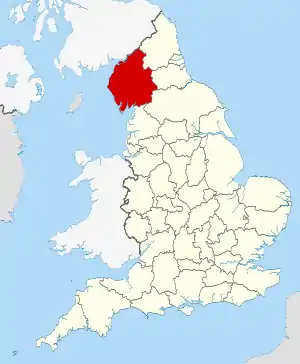
Cumbria shown in England
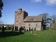
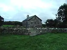
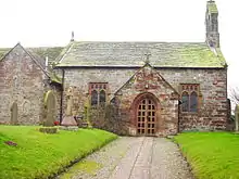
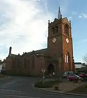
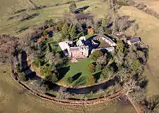
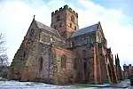
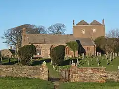
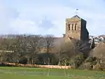
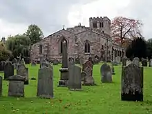
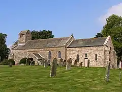
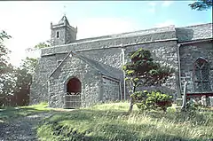
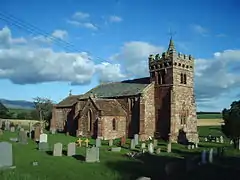
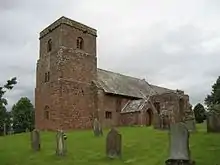
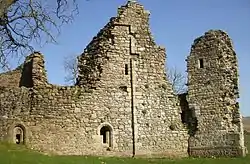
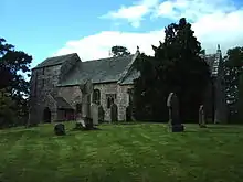
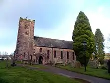
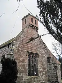
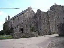
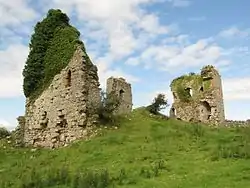
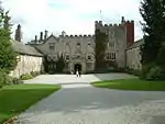
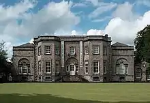
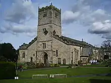
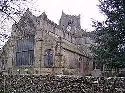
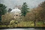
Allerdale

.jpg.webp)
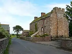


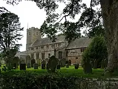
.jpg.webp)


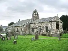

.jpg.webp)
Barrow-in-Furness
| Name | Location | Type | Completed [note 1] | Date designated | Grid ref.[note 2] Geo-coordinates |
Entry number [note 3] | Image |
|---|---|---|---|---|---|---|---|
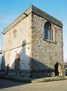
| Dalton Castle | Dalton in Furness, Dalton Town with Newton | Castle | Mid-14th century | 25 February 1950 | SD2261673944 54°09′20″N 3°11′11″W |
1218342 | |
| Furness Abbey, Capella Extra Portas with attached walls | Barrow-in-Furness | Abbey chapel | c.1300 | 6 May 1976 | SD2180171980 54°08′16″N 3°11′54″W |
1292871 |  Furness Abbey, Capella Extra Portas with attached walls |
| Furness Abbey, wall | Barrow-in-Furness | Wall | Medieval | 10 November 1949 | SD2189471453 54°07′59″N 3°11′49″W |
1355052 |  Furness Abbey, wall |
| Furness Abbey, including all medieval remains in care of English Heritage | Barrow-in-Furness | Abbey | 1127 | 10 November 1949 | SD2182671788 54°08′09″N 3°11′53″W |
1197906 | 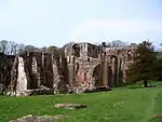 Furness Abbey, including all medieval remains in care of English Heritage |
| Furness Abbey, gateway adjoining Capella Extra Portas | Barrow-in-Furness | Gateway | 1127 | 6 May 1976 | SD2178271993 54°08′16″N 3°11′55″W |
1197907 | 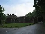 Furness Abbey, gateway adjoining Capella Extra Portas |
| Furness Abbey, remains of West Gate | Barrow-in-Furness | Abbey | 14th century | 6 May 1976 | SD2165971604 54°08′03″N 3°12′02″W |
1292045 |  |
| Piel Castle | Piel Island | Castle | 1327 | 10 November 1949 | SD2328463593 54°03′45″N 3°10′25″W |
1283004 | |
| Rampside Hall | Rampside | House | 1634 | 10 November 1949 | SD2407966307 54°05′13″N 3°09′44″W |
1197852 |

Carlisle
| Name | Location | Type | Completed [note 1] | Date designated | Grid ref.[note 2] Geo-coordinates |
Entry number [note 3] | Image |
|---|---|---|---|---|---|---|---|
| Askerton Castle | Askerton | Castle | Early 14th century | 1 April 1957 | NY5500869208 55°00′55″N 2°42′18″W |
1087531 | |
| Gatehouse east of Naworth Castle | Naworth, Brampton | Gatehouse | c.1520 | 14 September 1954 | NY5600262565 54°57′21″N 2°41′19″W |
1137508 | |
| Naworth Castle | Naworth, Brampton | Castle | Late 13th century | 14 September 1954 | NY5599562585 54°57′21″N 2°41′19″W |
1087643 | |
| Boat House, east of Naworth Castle | Naworth, Brampton | Tower | c.1520 | 16 January 1984 | NY5602062589 54°57′22″N 2°41′18″W |
1087644 | |
| Church of St Martin | Brampton | Church | 1877–78 | 16 January 1984 | NY5283261027 54°56′30″N 2°44′16″W |
1137170 | |
| Church of St Michael | Burgh by Sands | Church | 12th century | 1 April 1957 | NY3287159107 54°55′20″N 3°02′56″W |
1367134 | |
| Church of St Mary | Lanercost, Burtholme | Parish church | 1214 | 1 April 1957 | NY5558963726 54°57′58″N 2°41′43″W |
1335636 | |
| Cross base north-west of Lanercost Priory | Lanercost, Burtholme | Cross | 1214 | 1 April 1957 | NY5557563753 54°57′59″N 2°41′44″W |
1335637 | _(geograph_3184007).jpg.webp) Cross base north-west of Lanercost Priory |
| Gateway arch west of Lanercost Priory | Lanercost, Burtholme | Porters lodge | Early 13th century | 1 April 1957 | NY5545163734 54°57′58″N 2°41′50″W |
1335638 |  Gateway arch west of Lanercost Priory |
| The Vicarage, Lanercost Priory | Lanercost, Burtholme | Guest house | 13th century | 1 April 1957 | NY5555263708 54°57′58″N 2°41′45″W |
1087502 |  The Vicarage, Lanercost Priory |
| Walls to the north of Lanercost Priory | Lanercost, Burtholme | Wall | 13th century | 1 April 1957 | NY5558763802 54°58′01″N 2°41′43″W |
1087501 |  Walls to the north of Lanercost Priory |
| Dacre Hall, Lanercost Priory | Lanercost, Burtholme | House | 1559 | 1 April 1957 | NY5557963696 54°57′57″N 2°41′43″W |
1087500 | .jpg.webp) Dacre Hall, Lanercost Priory |
| Rose Castle | Dalston | Bishop's palace | 1400–19 | 1 April 1957 | NY3711046176 54°48′23″N 2°58′48″W |
1087473 | |
| Curtain walls surrounding Rose Castle | Dalston | Curtain wall | Early 14th century | 1 April 1957 | NY3712646210 54°48′24″N 2°58′47″W |
1054869 | .jpg.webp) Curtain walls surrounding Rose Castle |
| Gate with flanking lodge and tower to north of Rose Castle | Dalston | Gatehouse | Early 16th century | 19 September 1984 | NY3708746241 54°48′25″N 2°58′49″W |
1335662 | 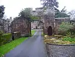 Gate with flanking lodge and tower to north of Rose Castle |
| Denton Hall and adjoining barn/stables | Nether Denton | Farmhouse | 14th century | 1 April 1957 | NY5783963049 54°57′37″N 2°39′36″W |
1051052 | |
| Churchyard cross, south of Church of St Mary | Rockcliffe | Cross | 10th or 11th century | 1 April 1957 | NY3589361616 54°56′42″N 3°00′08″W |
1138346 | .jpg.webp) Churchyard cross, south of Church of St Mary |
| Scaleby Castle | Scaleby | Castle | Late 13th century | 1 April 1957 | NY4491062454 54°57′13″N 2°51′42″W |
1311782 | |
| Roman Wall, west of former vicarage | Gilsland, Upper Denton | Wall | 124–130 | 1 April 1957 | NY6327066241 54°59′22″N 2°34′32″W |
1372254 |  Roman Wall, west of former vicarage |
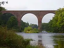
| Corby Bridge | Wetheral | Viaduct | 1851 | 1 April 1957 | NY4686454660 54°53′02″N 2°49′47″W |
1087690 | |
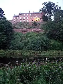
| Corby Castle | Great Corby, Wetheral | Country house | 1812–17 | 1 April 1957 | NY4708954201 54°52′47″N 2°49′34″W |
1087717 | |
| Dovecote to south-east of Corby Castle | Great Corby, Wetheral, Carlisle | Dovecote | Late 18th century | 1 April 1957 | NY4717453914 54°52′38″N 2°49′29″W |
1335536 | |
| Gate lodge to east of Corby Castle | Great Corby, Wetheral | Gate lodge | 1844 | 1 April 1957 | NY4728654276 54°52′50″N 2°49′23″W |
1335534 |  Gate lodge to east of Corby Castle |
| Kitchen garden walls to south-east of Corby Castle | Great Corby, Wetheral | Walled garden | 1812–17 | 1 April 1957 | NY4709354270 54°52′49″N 2°49′34″W |
1122629 | |
| Salmon coops to south of Corby Castle | Great Corby, Wetheral | Salmon coops | 12th century | 1 April 1957 | NY4685453687 54°52′30″N 2°49′47″W |
1087677 | |
| Cascade to west of Corby Castle | Great Corby, Wetheral | Cascade and summerhouse | 1708–29 | 1 April 1957 | NY4709254112 54°52′44″N 2°49′34″W |
1335535 |  Cascade to west of Corby Castle |
| Tempietto, Corby Castle | Great Corby, Wetheral | Temple | Early 18th century | 1 April 1957 | NY4681853562 54°52′26″N 2°49′49″W |
1335537 | |
| Wall and gate piers to east of Corby Castle | Great Corby, Wetheral | Gate piers | 1844 | 1 April 1957 | NY4729654276 54°52′50″N 2°49′23″W |
1087674 | Wall and gate piers to east of Corby Castle |
| St Constantine's Cells | River Eden, west bank south of Wetheral | Dwelling | 14th century | 1 April 1957 | NY4668053538 54°52′26″N 2°49′57″W |
1087654 |  St Constantine's Cells |
| Wetheral Priory Gatehouse | Wetheral | Gatehouse | 14th century | 1 April 1957 | NY4680454120 54°52′44″N 2°49′50″W |
1087695 | |
| Walls of east range of Wetheral Priory, east of gatehouse | Wetheral | Wall | 14th century | 22 September 1983 | NY4688354180 54°52′46″N 2°49′46″W |
1336985 | |
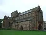
| Cathedral Church of the Holy and Undivided Trinity | The Abbey, Carlisle | Cathedral | 12th century | 1 June 1949 | NY3990555959 54°53′41″N 2°56′19″W |
1208430 | |
| Abbey Gate and Gatehouse | The Abbey, Carlisle | Gate | 19th century | 1 June 1949 | NY3981255957 54°53′41″N 2°56′24″W |
1208514 | 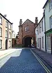 Abbey Gate and Gatehouse |
| Fratry of former Priory of St Mary | The Abbey, Carlisle | Cathedral library | 1465–90 | 1 June 1949 | NY3987255912 54°53′40″N 2°56′20″W |
1208468 | 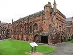 Fratry of former Priory of St Mary |
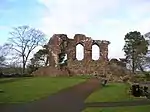
| Ruins of dormitory of former Priory of St Mary | The Abbey, Carlisle | Dormitory | Mid- to late 13th century | 13 November 1972 | NY3989655929 54°53′40″N 2°56′19″W |
1197011 | 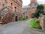 Ruins of dormitory of former Priory of St Mary |
| The Deanery and Prior's Tower | The Abbey, Carlisle | Prior's tower | Late 15th century | 1 June 1949 | NY3984455905 54°53′39″N 2°56′22″W |
1208577 |  The Deanery and Prior's Tower |
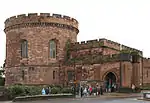
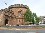
| Bridge over outer moat | Carlisle Castle | Drawbridge | Medieval | 1 June 1949 | NY3971356181 54°53′48″N 2°56′30″W |
1297365 |  Bridge over outer moat |
| Captain's Tower and inner bailey walls | Carlisle Castle | Bailey | 12th century | 1 June 1949 | NY3972256238 54°53′50″N 2°56′29″W |
1297368 | 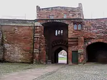 Captain's Tower and inner bailey walls |
| De Ireby's Tower and outer bailey wall | Carlisle Castle | Bailey | 12th century | 1 June 1949 | NY3970056192 54°53′48″N 2°56′30″W |
1197000 |  De Ireby's Tower and outer bailey wall |
| Inner Bailey Keep | Carlisle Castle | Keep | Early 12th century | 1 June 1949 | NY3974856224 54°53′50″N 2°56′28″W |
1208315 | .jpg.webp) Inner Bailey Keep |
| Inner Bailey Palace Range including part of Queen Mary's Tower | Carlisle Castle | Castle | Early 14th century | 1 June 1949 | NY3977456238 54°53′50″N 2°56′26″W |
1197007 | 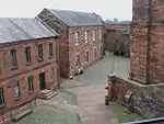 Inner Bailey Palace Range including part of Queen Mary's Tower |
| Fragment of north city walls adjoining south-east angle | Carlisle Castle | Wall | 12th century | 1 June 1949 | NY3981456210 54°53′49″N 2°56′24″W |
1197001 | |
| Outer bailey: half moon battery, flanking wall and bridge | Carlisle Castle | Battery and walls | 1542 | 1 June 1949 | NY3970556237 54°53′50″N 2°56′30″W |
1197005 |  Outer bailey: half moon battery, flanking wall and bridge |
| West City Walls and Tile Tower adjoining at south-west | Carlisle Castle | Interval tower | 12th century | 1 June 1949 | NY3963156120 54°53′46″N 2°56′34″W |
1197002 |  West City Walls and Tile Tower adjoining at south-west |
| West City Walls | Carlisle | City walls | 12th century | 1 June 1949 | NY3990255829 54°53′37″N 2°56′19″W |
1197151 | 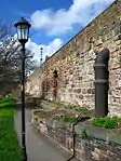 West City Walls |
| Crown Court, adjoining offices and gate arch | Carlisle | Court | 1810–17 | 1 June 1949 | NY4021255619 54°53′30″N 2°56′01″W |
1196939 | |
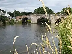
| Eden Bridge | Carlisle | Bridge | 16th century | 1 June 1949 | NY4005556571 54°54′01″N 2°56′11″W |
1297364 | 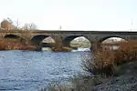 Eden Bridge |
| Market Cross | Carlisle | Cross | 1682 | 1 June 1949 | NY4008455932 54°53′40″N 2°56′09″W |
1297369 | 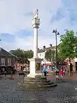 Market Cross |
| Nisi Prius Courthouse, associated offices and gate arch | Carlisle | Courthouse | 1542 | 1 June 1949 | NY4025055669 54°53′32″N 2°55′59″W |
1196940 | |
| West Walls numbers 10–22, incorporating City Walls | Carlisle | Mews | Late 19th century | 11 April 1994 | NY4002155726 54°53′34″N 2°56′12″W |
1297278 | 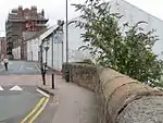 West Walls numbers 10–22, incorporating City Walls |
| Old Town Hall | Carlisle | Town hall | 1668–69 | 1 June 1949 | NY4007955964 54°53′41″N 2°56′09″W |
1218104 | |
| Tithe Barn | Carlisle | Tithe barn | c.1470s | 1 June 1949 | NY3997055796 54°53′36″N 2°56′15″W |
1218932 | |
| Tullie House and extensions | Carlisle | House | 1689 | 1 June 1949 | NY3976856027 54°53′43″N 2°56′26″W |
1297353 | 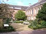 Tullie House and extensions |
| Wall, gates and railings in front of Tullie House | Carlisle | Gate | Late 17th century | 1 June 1949 | NY3977055991 54°53′42″N 2°56′26″W |
1196978 | 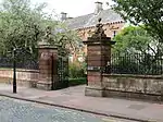 Wall, gates and railings in front of Tullie House |
| 5 and 6, Greenmarket | Carlisle | Hall house | 1396–1407 | 1 June 1949 | NY4003855976 54°53′42″N 2°56′11″W |
1210129 |

.jpg.webp)

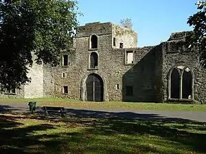
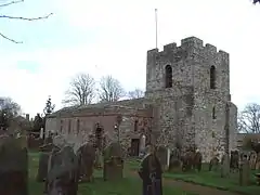
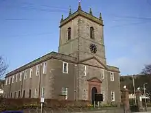
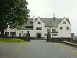
Copeland
| Name | Location | Type | Completed [note 1] | Date designated | Grid ref.[note 2] Geo-coordinates |
Entry number [note 3] | Image |
|---|---|---|---|---|---|---|---|
| Egremont Castle | Egremont | Castle | c.1120 | 9 March 1967 | NY0096810454 54°28′47″N 3°31′48″W |
1137138 | |
| Church of St Mary | Gosforth | Church | 12th century | 9 March 1967 | NY0722203591 54°25′09″N 3°25′53″W |
1063710 |  Church of St Mary |
| Church of Holy Trinity | Millom | Church | 12th century | 8 September 1967 | SD1710481299 54°13′14″N 3°16′22″W |
1086617 | |
| Millom Castle | Millom | Farmhouse | 14th century | 8 September 1967 | SD1712781333 54°13′16″N 3°16′21″W |
1086619 | |
| Church of St Michael and All Angels | Muncaster Castle | Parish church | 16th century | 8 September 1967 | SD1039296573 54°21′24″N 3°22′49″W |
1356113 | |
| Muncaster Castle | Muncaster Castle | House | 13th century | 8 September 1967 | SD1035596332 54°21′17″N 3°22′51″W |
1068780 | |
| Moresby Hall | Parton | Hall house | Late 16th/early 17th century | 9 March 1967 | NX9834220970 54°34′25″N 3°34′27″W |
1137268 | |
| Church of St Mary and St Bega | St Bees | Parish church | c.1120 | 9 March 1967 | NX9688312118 54°29′38″N 3°35′37″W |
1336027 | |
| Cross in churchyard to north of Priory Church nave | St Bees | Cross | 10th/11th century | 9 March 1967 | NX9687212142 54°29′39″N 3°35′37″W |
1336028 | 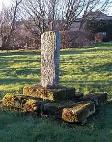 Cross in churchyard to north of Priory Church nave |
| Former chancel to Priory Church of St Mary and St Bega | St Bees | Benedictine monastery | Late 12th century | 9 August 1984 | NX9691012130 54°29′38″N 3°35′35″W |
1086681 |  Former chancel to Priory Church of St Mary and St Bega |
| Wall, to west of Priory Church nave, incorporating medieval cross and lintel | St Bees | Wall | Possibly 10th century | 9 March 1967 | NX9685612107 54°29′38″N 3°35′38″W |
1137319 | 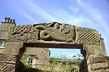 Wall, to west of Priory Church nave, incorporating medieval cross and lintel |
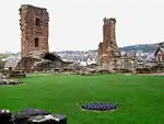
| House, incorporating monastic ruins and courtyard buildings adjoining to east | Calder Abbey, St Bridget Beckermet | Abbey | 1147 | 9 March 1967 | NY0510406361 54°26′38″N 3°27′53″W |
1336040 |  House, incorporating monastic ruins and courtyard buildings adjoining to east |
| Calder Abbey, ruins of the monastic church and east range | Calder Abbey, St Bridget Beckermet | Abbey | 1135 | 9 March 1967 | NY0511606388 54°26′38″N 3°27′53″W |
1068638 | 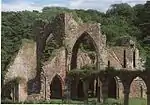 Calder Abbey, ruins of the monastic church and east range |
| Church of St James the Greater | Whitehaven | Church | 1752–53 | 20 July 1949 | NX9768018437 54°33′03″N 3°35′00″W |
1086747 |
.jpg.webp)
Eden
| Name | Location | Type | Completed [note 1] | Date designated | Grid ref.[note 2] Geo-coordinates |
Entry number [note 3] | Image |
|---|---|---|---|---|---|---|---|
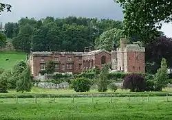
| The Nunnery | Near Staffield but in Ainstable parish | Country house | 16th century | 27 December 1967 | NY5372642849 54°46′42″N 2°43′15″W |
1312417 | 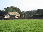 The Nunnery |
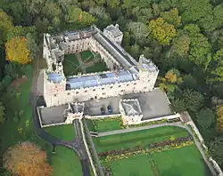
| Main building of Appleby Castle | Appleby-in-Westmorland | Castle | 13th century | 6 June 1951 | NY6861819936 54°34′25″N 2°29′13″W |
1137815 | 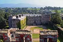 Main building of Appleby Castle |
| Caesar's Tower at Appleby Castle | Appleby-in-Westmorland | Keep | 12th century | 6 June 1951 | NY6851419930 54°34′25″N 2°29′19″W |
1145604 | 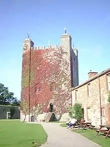 Caesar's Tower at Appleby Castle |
| Castle Moat Cottage; Gatehouse Cottage; gateway to Appleby Castle courtyard | Appleby-in-Westmorland | House | 17th century | 6 June 1951 | NY6855519940 54°34′25″N 2°29′17″W |
1145605 | .jpg.webp) Castle Moat Cottage; Gatehouse Cottage; gateway to Appleby Castle courtyard |
| Nos. 1 and 2 Castle Park; The Flat, Castle Park; former coach-houses & stables, Castle Park | Appleby-in-Westmorland | Dwelling | 1652 | 21 March 1985 | NY6848219978 54°34′26″N 2°29′21″W |
1137851 | .jpg.webp) Nos. 1 and 2 Castle Park; The Flat, Castle Park; former coach-houses & stables, Castle Park |
| Lady Anne's Bee House in copse to north-east of former stable block at Appleby Castle | Appleby-in-Westmorland | Bee garden | Mid-17th century | 21 March 1985 | NY6859620039 54°34′28″N 2°29′14″W |
1319047 | 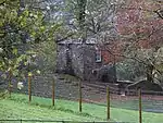 Lady Anne's Bee House in copse to north-east of former stable block at Appleby Castle |
| Parish Church of St Lawrence | Appleby-in-Westmorland | Parish church | 1150 | 6 June 1951 | NY6832920442 54°34′41″N 2°29′29″W |
1312067 | |
| Grange Hall and adjoining buildings | Asby | Farmhouse | 17th century | 6 February 1968 | NY6846010901 54°29′33″N 2°29′18″W |
1326998 |  Grange Hall and adjoining buildings |
| Askham Hall | Askham | House | 14th century | 6 February 1968 | NY5164023940 54°36′30″N 2°45′01″W |
1119606 | |
| Church of St Michael | Barton | Church | 12th century | 6 February 1968 | NY4875426368 54°37′47″N 2°47′43″W |
1326830 | |
| Church of All Saints | Bolton | Parish church | 12th century | 6 February 1968 | NY6393323407 54°36′16″N 2°33′35″W |
1213959 | |
| Church of St Ninian | Brougham | Parish church | 1660 | 3 September 1987 | NY5593629962 54°39′46″N 2°41′05″W |
1326778 | |
| Thistlewood Farmhouse | Highbridge, Castle Sowerby | Farmhouse | 16th century | 24 October 1986 | NY3961343612 54°47′02″N 2°56′26″W |
1326687 | |
| Catterlen Hall | Newton Reigny, Catterlen | Tower | Early 15th century | 27 December 1967 | NY4781032055 54°40′51″N 2°48′39″W |
1145528 |  Catterlen Hall |
| Church of St Andrew | Crosby Garrett | Church | 14th century | 21 October 1983 | NY7299409717 54°28′55″N 2°25′06″W |
1326924 | |
| Church of St Lawrence | Crosby Ravensworth | Parish church | c.1200 | 6 February 1968 | NY6214214841 54°31′39″N 2°35′11″W |
1311870 | |
| Church of St Andrew | Dacre | Parish church | 12th century | 27 December 1967 | NY4600726643 54°37′55″N 2°50′17″W |
1145531 | |
| Dacre Castle | Dacre | Fortified house | 14th century | 17 July 1957 | NY4603726488 54°37′50″N 2°50′15″W |
1221000 | |
| Dalemain | Dalemain, Dacre | House | 16th century | 27 December 1967 | NY4771226876 54°38′03″N 2°48′42″W |
1221057 | |
| Blencow Hall Farmhouse and gatehouse wing | Little Blencow, Greystoke | House | 19th century | 27 December 1967 | NY4501832603 54°41′08″N 2°51′16″W |
1145492 |  Blencow Hall Farmhouse and gatehouse wing |
| Hutton John and barn adjoining | Hutton | Tower | Late 14th century | 19 January 1955 | NY4397226953 54°38′04″N 2°52′10″W |
1326724 | 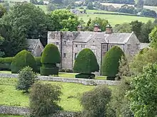 Hutton John and barn adjoining |
| The College | Kirkoswald | House | 1633–41 | 27 December 1967 | NY5545641109 54°45′47″N 2°41′38″W |
1327056 | 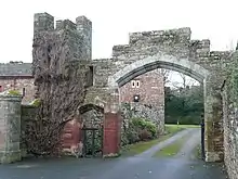 The College |
| Church of St Cuthbert | Edenhall, Langwathby | Parish church | 12th century | 27 December 1967 | NY5690332049 54°40′54″N 2°40′12″W |
1145341 | |
| Church of St Margaret and St James | Broom, Long Marton | Parish church | Pre-Conquest | 6 February 1968 | NY6665823992 54°36′36″N 2°31′04″W |
1075165 | |
| Pendragon Castle | Outhgill, Mallerstang | Tower house | 12th century | 12 September 1957 | NY7817002626 54°25′07″N 2°20′16″W |
1144890 | |
| Howgill Castle | Milburn | Hall house | 14th century | 6 February 1968 | NY6651329310 54°39′28″N 2°31′14″W |
1051098 | |
| Church of St Laurence | Morland | Parish church | 11th century | 6 February 1968 | NY5981122550 54°35′47″N 2°37′25″W |
1226108 | |
| Church of St James | Great Ormside, Ormside | Parish church | Late 11th century | 12 April 1984 | NY7013917647 54°33′11″N 2°27′47″W |
1288923 | |
| Hartsop Hall and attached farm buildings | Low Hartsop, Patterdale | Farmhouse | 16th century | 12 January 1967 | NY3984812026 54°30′00″N 2°55′49″W |
1245315 |  Hartsop Hall and attached farm buildings |
| Church of St Oswald | Ravenstonedale | Parish church | 1738 | 6 February 1968 | NY7223104265 54°25′59″N 2°25′47″W |
1311289 | |
| Hutton in the Forest Hall | Hutton in the Forest, Skelton | Country house | Early 17th century | 27 December 1967 | NY4604835763 54°42′50″N 2°50′20″W |
1210817 | |
| Garden wall and gateway east of Hutton in the Forest Hall | Hutton-in-the-Forest, Skelton | Gate | Late 17th century | 24 October 1986 | NY4608435799 54°42′51″N 2°50′18″W |
1210843 | |
| Scales Hall and barn adjoining | Scales, Skelton | Bastle | 17th century | 27 December 1967 | NY4259140014 54°45′06″N 2°53′36″W |
1210925 | |
| Gatehouse and curtain wall of Scales Hall | Scales, Skelton | Gate | Late 16th century | 24 October 1986 | NY4262140015 54°45′06″N 2°53′35″W |
1210936 | |
| Acorn Bank House | Temple Sowerby | House | 1544 | 6 February 1968 | NY6172928223 54°38′52″N 2°35′41″W |
1226225 |  Acorn Bank House |
| Parish Church of St Columba | Warcop | Parish church | 12th century | 12 September 1957 | NY7429415706 54°32′09″N 2°23′56″W |
1137446 | |
| Wharton Hall | Wharton | House | Late 14th century | 6 February 1968 | NY7709306169 54°27′01″N 2°21′17″W |
1137207 | |
| Yanwath Hall | Yanwath, Yanwath and Eamont Bridge | Fortified house | Early to mid-15th century | 6 February 1984 | NY5078928168 54°38′46″N 2°45′51″W |
1049080 |  Yanwath Hall |
| Courtyard range adjoining Yanwath Hall | Yanwath, Yanwath and Eamont Bridge | Stables | 15th and 16th century | 6 February 1968 | NY5077128190 54°38′47″N 2°45′52″W |
1145305 | |
| Eamont Bridge | Eamont Bridge, Yanwath and Eamont Bridge | Road bridge | 15th century | 24 April 1951 6 February 1968 | NY5222128745 54°39′06″N 2°44′31″W |
1145301 1145133 | |
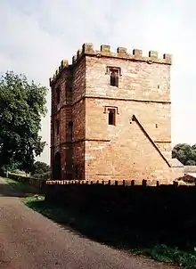
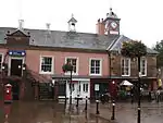
| Beacon Tower | Penrith | Tower | 1719 | 24 April 1951 | NY5212931377 54°40′31″N 2°44′38″W |
1326889 | Beacon Tower |
| Gloucester Arms | Penrith | Inn | c.1470 | 24 April 1951 | NY5148830045 54°39′47″N 2°45′13″W |
1312065 |  Gloucester Arms |
| Parish Church of St Andrew | Penrith | Parish church | 12th century | 24 April 1951 | NY5164730156 54°39′51″N 2°45′04″W |
1145048 | |
| Penrith Castle | Penrith | Castle | 1397 | 24 April 1951 | NY5126429939 54°39′44″N 2°45′25″W |
1138256 |
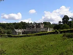

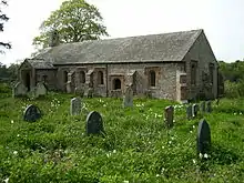
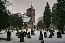
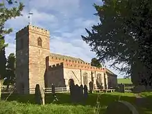

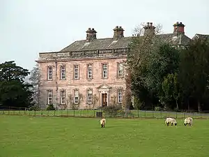
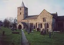
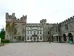
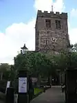
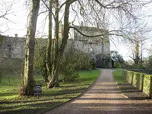
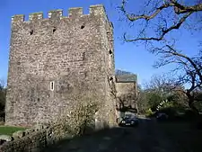
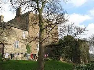
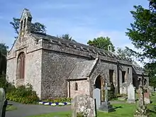
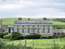
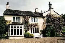
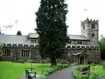
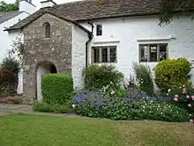
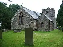
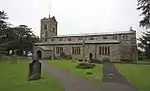
South Lakeland
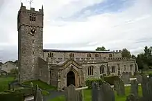
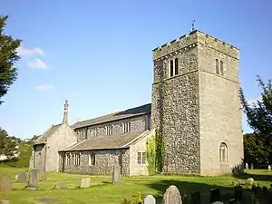
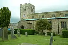
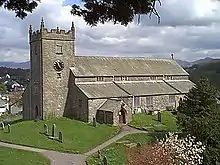
.jpg.webp)
.jpg.webp)

.jpg.webp)


Notes
- The date given is the date used by Historic England as significant for the initial building or that of an important part in the structure's description.
- Sometimes known as OSGB36, the grid reference is based on the British national grid reference system used by the Ordnance Survey.
- The "List Entry Number" is a unique number assigned to each listed building and scheduled monument by Historic England.
External links
![]() Media related to Grade I listed buildings in Cumbria at Wikimedia Commons
Media related to Grade I listed buildings in Cumbria at Wikimedia Commons
This article is issued from Wikipedia. The text is licensed under Creative Commons - Attribution - Sharealike. Additional terms may apply for the media files.