Grade I listed buildings in Cambridgeshire
There are approximately 372,905 listed buildings in England and 2.5% of these are Grade I.[1] This page is a list of these buildings in the county of Cambridgeshire,[2][3] by district.
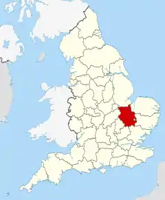
Cambridgeshire shown within England
Cambridge
City of Peterborough
| Name | Location | Type | Completed [note 1] | Date designated | Grid ref.[note 2] Geo-coordinates |
Entry number [note 3] | Image |
|---|---|---|---|---|---|---|---|
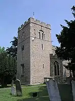
| Church of St Mary | Bainton, City of Peterborough | Church | Early 13th century | 19 March 1962 | TF0944806050 52°38′28″N 0°23′02″W |
1309975 |  Church of St Mary |
| Village Cross | Bainton, City of Peterborough | Village Cross | Medieval | 19 March 1962 | TF0941206015 52°38′27″N 0°23′04″W |
1126875 | 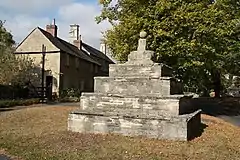 Village Cross |
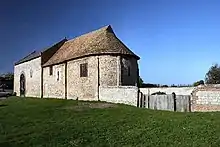
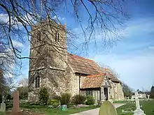
| Church of St John the Baptist | Barnack, City of Peterborough | Church | Saxon | 19 March 1962 | TF0793305060 52°37′57″N 0°24′24″W |
1126844 | |
| North Forecourt Area Railings and Gates at Burghley House | Burghley Park, Barnack, City of Peterborough | Gate | 18th century | 16 January 1956 | TF0483906166 52°38′35″N 0°27′07″W |
1331234 |  |
| Bath House or Banqueting House at Burghley House | Burghley Park, Barnack, City of Peterborough | Bath House | Circa 1756-1778 | 19 March 1962 | TF0503305806 52°38′23″N 0°26′57″W |
1331235 | 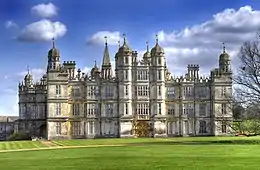 Bath House or Banqueting House at Burghley House |
| Stables with Forecourt Railings and Service Wings and Servants Wing, Brewery and Porters Lodge | Burghley Park, Barnack, City of Peterborough | Porters Lodge | 1756-79 | 16 January 1956 | TF0495606086 52°38′33″N 0°27′01″W |
1127502 |  Stables with Forecourt Railings and Service Wings and Servants Wing, Brewery and Porters Lodge |
| The Orangery, Burghley House | Burghley Park, Barnack, City of Peterborough | Orangery | 1756-63 | 16 January 1956 | TF0486006089 52°38′33″N 0°27′06″W |
1127503 | .jpg.webp) The Orangery, Burghley House |
| Church of St Kyneburgha | Castor | Church | Saxon | 15 December 1955 | TL1246898530 52°34′23″N 0°20′31″W |
1126803 | 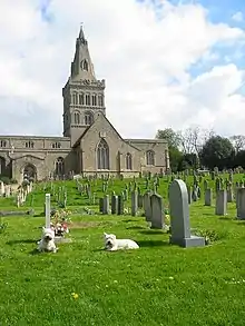 Church of St Kyneburgha |
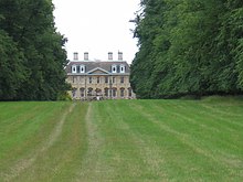
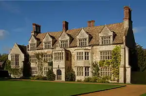
| Milton Hall | Milton Park, Castor, City of Peterborough | House | c. 1600 | 15 December 1955 | TL1448699849 52°35′04″N 0°18′42″W |
1162643 | |
| Stables Adjoining East of Milton Hall | Milton Hall, Castor, City of Peterborough | Kitchen | 1690 | 15 December 1955 | TL1454599866 52°35′04″N 0°18′39″W |
1331549 | |
| Church of St Stephen | Etton | Church | 13th century | 15 December 1955 | TF1408406591 52°38′42″N 0°18′55″W |
1126818 | 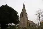 Church of St Stephen |
| Church of St Benedict | Glinton | Church | 12th century | 15 December 1955 | TF1541605974 52°38′21″N 0°17′45″W |
1163848 | 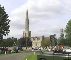 Church of St Benedict |
| Church of St Botolph | Helpston, City of Peterborough | Church | Saxon | 15 December 1955 | TF1220205528 52°38′09″N 0°20′36″W |
1164217 | 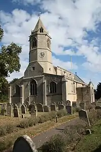 Church of St Botolph |
| Church of St Mary | Marholm, City of Peterborough | Church | 12th century | 15 December 1955 | TF1462401916 52°36′11″N 0°18′32″W |
1317603 | 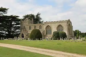 Church of St Mary |
| Church of St Peter | Maxey, City of Peterborough | Church | Early 12th century | 15 December 1955 | TF1200907932 52°39′27″N 0°20′44″W |
1331592 | 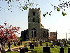 Church of St Peter |
| Church of St Andrew | Northborough | Church | Late 12th century to 13th century | 15 December 1955 | TF1525207959 52°39′26″N 0°17′51″W |
1126693 | 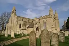 Church of St Andrew |
| Northborough Manor House | Northborough, City of Peterborough | Manor House | 1330-40 | 15 December 1955 | TF1510007829 52°39′22″N 0°17′59″W |
1126697 | .jpg.webp) Northborough Manor House |
| The Gate House and Stable Range to North of Northborough Manor House | Northborough, City of Peterborough | Gatehouse | 17th century | 15 December 1955 | TF1508007848 52°39′22″N 0°18′00″W |
1317150 |  The Gate House and Stable Range to North of Northborough Manor House |
| Church of the Holy Trinity | Orton Longueville, City of Peterborough | Church | c. 1240 | 13 December 1957 | TL1682696516 52°33′14″N 0°16′42″W |
1166191 |  Church of the Holy Trinity |
| Church of St Mary | Orton Waterville, City of Peterborough | Church | Late 13th century | 13 December 1957 | TL1563296076 52°33′01″N 0°17′46″W |
1166376 | 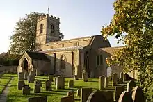 Church of St Mary |
| Church of St Pega | Peakirk, City of Peterborough | Church | 11th century | 15 December 1955 | TF1681306696 52°38′44″N 0°16′30″W |
1221288 |  Church of St Pega |
| Walcot Hall | Walcot, Southorpe, City of Peterborough | House | Circa 1674-8 | 19 March 1962 | TF0790704162 52°37′28″N 0°24′26″W |
1331241 | |
| Burghley House | Burghley Park, St Martin's Without, City of Peterborough | Country House | c. 1556 | 16 January 1956 | TF0477806074 52°38′32″N 0°27′11″W |
1127501 | |
| The Bridge | Burghley Park, St. Martin's Without, City of Peterborough | Bridge | 1775 | 29 March 1962 | TF0434506008 52°38′30″N 0°27′34″W |
1331236 | 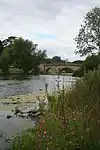 The Bridge |
| Church of St Michael | Sutton, City of Peterborough | Church | Norman | 15 December 1955 | TL0952398728 52°34′31″N 0°23′07″W |
1127517 |  Church of St Michael |
| Church of St Mary and St Botolph | Thorney, City of Peterborough | Abbey | 972 | 22 October 1952 | TF2823604205 52°37′14″N 0°06′26″W |
1331263 | |
| Thorney Abbey and Abbey House | Thorney, City of Peterborough | House | Late 16th century | 22 October 1952 | TF2819104180 52°37′13″N 0°06′28″W |
1127481 | |
| Church of St Andrew | Thornhaugh, City of Peterborough | Church | Late 12th century | 19 March 1962 | TF0698300584 52°35′33″N 0°25′20″W |
1225298 |  Church of St Andrew |
| Church of St Andrew | Ufford, City of Peterborough | Church | 13th century | 19 March 1962 | TF0933804035 52°37′23″N 0°23′10″W |
1127466 | 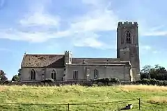 Church of St Andrew |
| Ufford Hall | Ufford, City of Peterborough | Flats | 1962 | 19 March 1962 | TF0930404339 52°37′33″N 0°23′12″W |
1357128 | |
| Church of St John the Baptist | Upton, City of Peterborough | Church | Early 12th century | 15 December 1955 | TF1102200583 52°35′30″N 0°21′45″W |
1127440 | 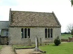 Church of St John the Baptist |
| Church of St Mary the Virgin | Wansford, City of Peterborough | Church | c. 1200 | 19 March 1962 | TL0734299258 52°34′50″N 0°25′02″W |
1127442 |  Church of St Mary the Virgin |
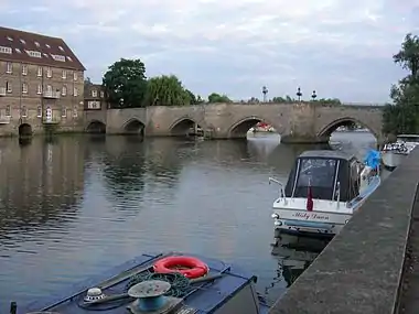
| Wansford Bridge | Wansford, City of Peterborough | Bridge | 1577 | 24 February 1982 | TL0749999118 52°34′45″N 0°24′54″W |
1127445 | |
| Church of All Saints | Wittering, City of Peterborough | Church | Saxon | 19 March 1962 | TF0563402017 52°36′20″N 0°26′30″W |
1226058 | .jpg.webp) Church of All Saints |
| Gateway and Walls to Rectangular Enclosure, North East, East and South East of Wothorpe Hall | Wothorpe, City of Peterborough | Gateway and Walls | Early 17th century | 19 March 1962 | TF0261005282 52°38′08″N 0°29′07″W |
1127450 | |
| Wothorpe Towers | Wothorpe, City of Peterborough | Country House | Circa 1600 Ruins | 19 March 1962 | TF0253405264 52°38′08″N 0°29′11″W |
1265972 | 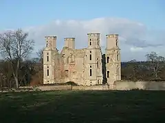 Wothorpe Towers |
| Bishops Gate | Peterborough, City of Peterborough | Gate | c. 1220 | 7 February 1952 | TL1929298626 52°34′21″N 0°14′28″W |
1126939 | .jpg.webp) Bishops Gate |
| Bishop's Palace | Peterborough, City of Peterborough | Bishops Palace | Gothic | 7 February 1952 | TL1934398572 52°34′19″N 0°14′26″W |
1331518 | |
| Canonry House | Peterborough, City of Peterborough | Clergy House | Medieval core | 7 February 1952 | TL1949898567 52°34′19″N 0°14′17″W |
1126931 | |
| Chapel of St Thomas of Canterbury | Peterborough, City of Peterborough | Chapel | 1330 | 7 February 1952 | TL1925998655 52°34′22″N 0°14′30″W |
1310088 |  Chapel of St Thomas of Canterbury |
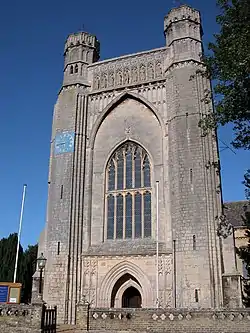
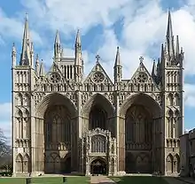
| Cathedral Church of St Peter, St Paul and St Andrew | Peterborough, City of Peterborough | Cathedral | 1118 | 7 February 1952 | TL1941698645 52°34′21″N 0°14′22″W |
1331492 | |
| Chapter Office | Peterborough, City of Peterborough | Ecclesiastical Office | 18th century | 7 February 1952 | TL1946098558 52°34′18″N 0°14′20″W |
1126933 | |
| Church of St Augustine | Peterborough, City of Peterborough | Church | 14th century | 7 February 1952 | TL1858297773 52°33′54″N 0°15′07″W |
1126964 |  Church of St Augustine |
| Church of St John the Baptist | Stanground, City of Peterborough | Church | c1300 or early 14th century | 14 November 1974 | TL1999497482 52°33′43″N 0°13′53″W |
1126699 | 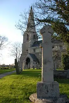 Church of St John the Baptist |
| Church of St Margaret | Fletton, City of Peterborough | Church | c. 1150 | 14 November 1974 | TL1975097086 52°33′30″N 0°14′06″W |
1309143 | 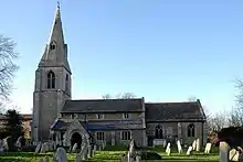 Church of St Margaret |
| Deanery Gateway and Wall | Peterborough, City of Peterborough | Gate | Early 16th century | 7 February 1952 | TL1933098683 52°34′22″N 0°14′26″W |
1331494 | .jpg.webp) Deanery Gateway and Wall |
| Diocesan House | Peterborough, City of Peterborough | Building | 14th-century origins | 7 February 1952 | TL1932498622 52°34′20″N 0°14′27″W |
1126938 | .jpg.webp) Diocesan House |
| Former Barns and Stabling to South of No 20, Precincts | Peterborough, City of Peterborough | Garage | 1952 | 7 February 1952 | TL1943598484 52°34′16″N 0°14′21″W |
1126930 | |
| Former Outbuilding to Laurel Court Facing Table Hall | Peterborough, City of Peterborough | Outbuilding | 18th century | 7 May 1973 | TL1943898600 52°34′20″N 0°14′21″W |
1161646 | |
| Former Stables to Thorpe Hall | Longthorpe, City of Peterborough | Stable | 7 February 1952 | TL1700898610 52°34′22″N 0°16′30″W |
1126913 |  Former Stables to Thorpe Hall | |
| Garden Wall and Gates to Laurel Court | Peterborough, City of Peterborough | Gate | 7 May 1973 | TL1941398600 52°34′20″N 0°14′22″W |
1331516 | | |
| Gateway from Garden to Stables of Thorpe Hall | Longthorpe, City of Peterborough | Gate | 7 February 1952 | TL1696898595 52°34′21″N 0°16′32″W |
1126914 | | |
| Great Cloister | Peterborough, City of Peterborough | Cloister | Early English | 7 May 1973 | TL1938098590 52°34′19″N 0°14′24″W |
1126937 | |
| Great Gate (Outer Gate, Marsh Foregate) | Peterborough, City of Peterborough | Gate | c1174-94 | 7 February 1952 | TL1925198640 52°34′21″N 0°14′30″W |
1161429 | .jpg.webp) Great Gate (Outer Gate, Marsh Foregate) |
| Hostry Passage and Little Dorter | Peterborough, City of Peterborough | Refectory | Ruins | 7 May 1973 | TL1940898554 52°34′18″N 0°14′22″W |
1331517 |  Hostry Passage and Little Dorter |
| King's Lodging (including Abbot's Prison) | Peterborough, City of Peterborough | Shop | 1973 | 7 February 1952 | TL1925198632 52°34′21″N 0°14′31″W |
1161737 | |
| Laurel Court | Peterborough, City of Peterborough | House | Early 18th century | 7 February 1952 | TL1943098597 52°34′20″N 0°14′21″W |
1310019 | .jpg.webp) Laurel Court |
| Longthorpe Tower House | Longthorpe, City of Peterborough | Farmhouse | c. 1263 | 7 February 1952 | TL1620298380 52°34′15″N 0°17′13″W |
1162040 | |
| Parish Church of All Saints | Paston, Peterborough | Church | 1756 | 7 February 1952 | TF1810102269 52°36′19″N 0°15′27″W |
1162114 |  Parish Church of All Saints |
| Parish Church of St Botolph | Longthorpe, Peterborough | Bell Tower | 1869 | 7 February 1952 | TL1630498389 52°34′15″N 0°17′07″W |
1331544 |  Parish Church of St Botolph |
| Parish Church of St John the Baptist | Werrington, Peterborough | Parish Church | Early 12th century | 7 February 1952 | TF1698803152 52°36′49″N 0°16′25″W |
1309749 |  Parish Church of St John the Baptist |
| Parish Church of St John the Baptist | Peterborough, City of Peterborough | Parish Church | 1402 | 7 February 1952 | TL1911198662 52°34′22″N 0°14′38″W |
1331524 | |
| Table Hall | Peterborough, City of Peterborough | House | 15th century | 7 February 1952 | TL1947198582 52°34′19″N 0°14′19″W |
1126932 | .jpg.webp) Table Hall |
| Thorpe Hall | Longthorpe, City of Peterborough | House | 1653-6 | 7 February 1952 | TL1705098600 52°34′21″N 0°16′27″W |
1126912 | |
| Walls, gatepiers and Entrance Gates to Thorpe Hall | Longthorpe, City of Peterborough | Gate | 7 May 1973 | TL1705498656 52°34′23″N 0°16′27″W |
1331545 | .jpg.webp) Walls, gatepiers and Entrance Gates to Thorpe Hall | |
| Well in the Great Cloister | Peterborough, City of Peterborough | Steps | Norman | 7 May 1973 | TL1939398612 52°34′20″N 0°14′23″W |
1161668 |  Well in the Great Cloister |
| No 16, Precincts | Peterborough, City of Peterborough | House | 1762 | 7 February 1952 | TL1947298574 52°34′19″N 0°14′19″W |
1331514 | |
| No 19, Precincts | Peterborough, City of Peterborough | House | 13th century | 7 February 1952 | TL1943598570 52°34′19″N 0°14′21″W |
1331515 | .jpg.webp) No 19, Precincts |


.jpg.webp)
East Cambridgeshire
| Name | Location | Type | Completed [note 1] | Date designated | Grid ref.[note 2] Geo-coordinates |
Entry number [note 3] | Image |
|---|---|---|---|---|---|---|---|
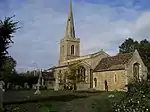
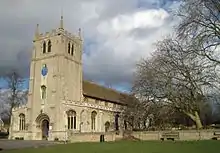
| Church of Holy Trinity | Bottisham, East Cambridgeshire | Parish Church | Early 13th century | 19 August 1959 | TL5455860489 52°13′15″N 0°15′40″E |
1127115 |  Church of Holy Trinity |
| Church of St Mary | Burwell, East Cambridgeshire | Parish Church | 12th century | 19 August 1959 | TL5895866063 52°16′11″N 0°19′41″E |
1126396 | 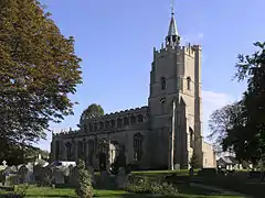 Church of St Mary |
| Parish Church of St Mary and the Holy Ghost in Heaven | Cheveley, East Cambridgeshire | Parish Church | Early 14th century | 19 August 1959 | TL6847560838 52°13′12″N 0°27′54″E |
1318059 | 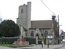 Parish Church of St Mary and the Holy Ghost in Heaven |
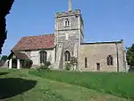
| Parish Church of St Margaret | Chippenham, East Cambridgeshire | Parish Church | 12th century | 19 August 1959 | TL6635169804 52°18′04″N 0°26′18″E |
1161953 | 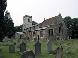 Parish Church of St Margaret |
| Church of St Peter-ad-vincula | Coveney, East Cambridgeshire | Parish Church | 13th century | 5 February 1952 | TL4894182187 52°25′03″N 0°11′19″E |
1331472 |  Church of St Peter-ad-vincula |
| Parish Church of St Leonard | Little Downham, East Cambridgeshire | Parish Church | 12th century | 5 February 1952 | TL5263584172 52°26′03″N 0°14′38″E |
1127022 |  Parish Church of St Leonard |
| Parish Church of St Mary | Dullingham, East Cambridgeshire | Parish Church | 13th century | 19 August 1959 | TL6315657697 52°11′36″N 0°23′08″E |
1318002 | 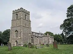 Parish Church of St Mary |
| The Almonry | Ely, East Cambridgeshire | Almonry/Restaurant | Late 12th century | 23 September 1950 | TL5424680291 52°23′56″N 0°15′56″E |
1126503 | 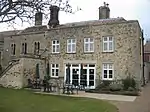 The Almonry |
| Sacristy Gate and Goldsmiths Tower | Ely, East Cambridgeshire | Gate | 1322 | 23 September 1950 | TL5419780313 52°23′57″N 0°15′54″E |
1126504 |  Sacristy Gate and Goldsmiths Tower |
| Barn and Storehouse of the Monastery | Ely, East Cambridgeshire | House | 18th century | 23 September 1950 | TL5400980000 52°23′47″N 0°15′43″E |
1126508 |  Barn and Storehouse of the Monastery |
| St John's Farmhouse | Ely, East Cambridgeshire | House | C16-C17 | 23 September 1950 | TL5350680210 52°23′54″N 0°15′17″E |
1167882 | |
| Barn to South-west of St John's Farmhouse | Ely, East Cambridgeshire | Barn | 13th century | 23 September 1950 | TL5339280178 52°23′53″N 0°15′11″E |
1126456 | |
| Barn to the North of St John's Farmhouse | Ely, East Cambridgeshire | Barn | 13th century | 23 September 1950 | TL5350580231 52°23′55″N 0°15′17″E |
1126455 | |
| Dovecote to St John's Farm | Ely, East Cambridgeshire | Dovecote/House | 13th century | 23 September 1950 | TL5352680198 52°23′54″N 0°15′18″E |
1331739 | |
| Bishop's Palace (the Palace School) | Ely, East Cambridgeshire | Bishops Palace | 1486-1501 | 23 September 1950 | TL5395580248 52°23′55″N 0°15′41″E |
1296856 | |
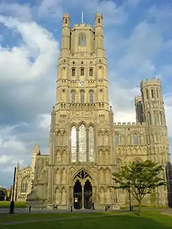
| Cathedral of the Holy Trinity | Ely, East Cambridgeshire | Cathedral | 1083 | 23 September 1950 | TL5404680281 52°23′56″N 0°15′46″E |
1331690 | |
| Cellarers House (boarding House of King's School) | Ely, East Cambridgeshire | House | 1770 | 23 September 1950 | TL5413680178 52°23′53″N 0°15′50″E |
1126510 | .jpg.webp) Cellarers House (boarding House of King's School) |
| Ely Porta | Ely, East Cambridgeshire | Gate | 1397-1418 | 23 September 1950 | TL5400880029 52°23′48″N 0°15′43″E |
1167340 | 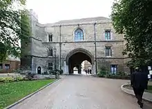 Ely Porta |
| Guest Quarters of the Monastery | Ely, East Cambridgeshire | Guest House | 14th century | 23 June 1950 | TL5401880128 52°23′51″N 0°15′44″E |
1167322 |  Guest Quarters of the Monastery |
| Parish Church of St Mary | Ely, East Cambridgeshire | Parish Church | Early 13th century | 23 September 1950 | TL5384980241 52°23′55″N 0°15′35″E |
1126519 | .JPG.webp) Parish Church of St Mary |
| Powcher's Hall | Ely, East Cambridgeshire | Monastery | 12th century | 23 September 1950 | TL5415680201 52°23′53″N 0°15′52″E |
1167407 | 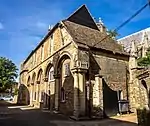 Powcher's Hall |
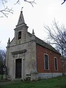
| Prior Crauden's Chapel | Ely, East Cambridgeshire | Private Chapel | 1324-1325 | 23 September 1950 | TL5404680141 52°23′51″N 0°15′46″E |
1331686 |  Prior Crauden's Chapel |
| Prior's House (boarding House of the Kings School) | Ely, East Cambridgeshire | Building | 17th century | 23 September 1950 | TL5405580149 52°23′52″N 0°15′46″E |
1167326 | .jpg.webp) Prior's House (boarding House of the Kings School) |
| Stables to Bishop's Palace | Ely, East Cambridgeshire | Stable | 13th century | 23 September 1950 | TL5400380161 52°23′52″N 0°15′43″E |
1126481 | |
| The Black Hostelry and Cellarers Chamber | Ely, East Cambridgeshire | Hostel | c1291-1292 | 23 September 1950 | TL5415680181 52°23′53″N 0°15′52″E |
1167456 |  The Black Hostelry and Cellarers Chamber |
| The Chapel of the Infirmary (deanery) | Ely, East Cambridgeshire | Deanery | 18th century | 23 September 1950 | TL5419880185 52°23′53″N 0°15′54″E |
1331688 | |
| The Dark Cloister | Ely, East Cambridgeshire | Wall | Mid 13th century | 23 September 1950 | TL5412980195 52°23′53″N 0°15′50″E |
1331687 | |
| The Great Hall (Bishop's Residence) | Ely, East Cambridgeshire | Bishops Palace | Mid 13th century | 23 September 1950 | TL5405480174 52°23′52″N 0°15′46″E |
1167260 | .jpg.webp) The Great Hall (Bishop's Residence) |
| The Painted Chamber (Walsingham House) | Ely, East Cambridgeshire | Clergy House | Early 14th century | 23 September 1950 | TL5417280194 52°23′53″N 0°15′52″E |
1126509 | .jpg.webp) The Painted Chamber (Walsingham House) |
| The Queen's Hall (headmaster's House) | Ely, East Cambridgeshire | Teachers House | 1330 | 23 September 1950 | TL5402880172 52°23′52″N 0°15′45″E |
1126505 | .jpg.webp) The Queen's Hall (headmaster's House) |
| Wall to the Garden of the Almonry and Painted Chamber | Ely, East Cambridgeshire | Gate | 14th century | 19 June 1972 | TL5426880290 52°23′56″N 0°15′58″E |
1331684 | |
| Walls to the Guest Quarters of the Monastery and Ely Porta | Ely, East Cambridgeshire | Wall | 19 June 1972 | TL5402280094 52°23′50″N 0°15′44″E |
1126506 |  Walls to the Guest Quarters of the Monastery and Ely Porta | |
| Parish Church of St Peters | Fordham, East Cambridgeshire | Parish Church | late C12-early 13th century | 19 August 1959 | TL6334870722 52°18′37″N 0°23′41″E |
1309769 | 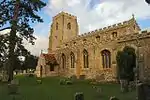 Parish Church of St Peters |
| Church of Holy Trinity | Haddenham, East Cambridgeshire | Parish Church | Late 13th century | 5 February 1952 | TL4639175638 52°21′33″N 0°08′54″E |
1331475 | 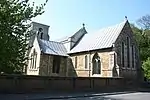 Church of Holy Trinity |
| Church of St Andrew | Isleham, East Cambridgeshire | Parish Church | Earlier | 19 August 1959 | TL6437274409 52°20′35″N 0°24′41″E |
1126475 | 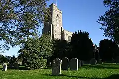 Church of St Andrew |
| Priory Church of St Margaret of Antioch | Isleham, East Cambridgeshire | Benedictine Alien Cell | c1080-1090 | 1 December 1951 | TL6424574349 52°20′33″N 0°24′35″E |
1126476 | |
| All Saints Parish Church | Kirtling, East Cambridgeshire | Parish Church | 12th century | 19 August 1959 | TL6868657616 52°11′28″N 0°27′59″E |
1126290 |  All Saints Parish Church |
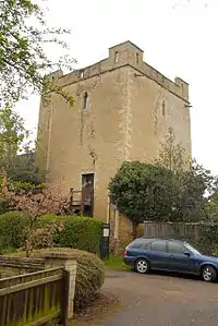
| Kirtling Tower | Kirtling, East Cambridgeshire | Castle | Saxon | 1 December 1951 | TL6868357441 52°11′22″N 0°27′59″E |
1126291 | 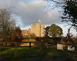 Kirtling Tower |
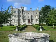
| Anglesey Abbey | Lode, East Cambridgeshire | Country House | Early 17th century | 1 December 1951 | TL5302162256 52°14′14″N 0°14′22″E |
1331433 | |
| Church of St Andrew | Soham, East Cambridgeshire | Church | c1180-1190 | 19 August 1959 | TL5932873177 52°20′01″N 0°20′13″E |
1126450 |  Church of St Andrew |
| Church of St Andrew | Sutton, East Cambridgeshire | Parish Church | Late 14th century and early 15th century | 5 February 1952 | TL4483678977 52°23′23″N 0°07′37″E |
1331496 | 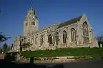 Church of St Andrew |
| The Burystead | Sutton, East Cambridgeshire | House | Medieval | 5 February 1952 | TL4331678933 52°23′23″N 0°06′17″E |
1126976 | 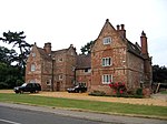 The Burystead |
| Church of St Mary the Virgin | Swaffham Bulbeck, East Cambridgeshire | Parish Church | 13th century | 19 August 1959 | TL5552862248 52°14′11″N 0°16′34″E |
1127052 | |
| The Abbey | Swaffham Bulbeck, East Cambridgeshire | House | Early 18th century | 1 December 1951 | TL5587663471 52°14′50″N 0°16′55″E |
1165597 |  The Abbey |
| Church of St Mary | Swaffham Prior, East Cambridgeshire | Parish Church | c. 1100 | 19 August 1959 | TL5680063932 52°15′04″N 0°17′44″E |
1127040 |  Church of St Mary |
| Church of St Peter | Wilburton, East Cambridgeshire | Parish Church | 13th century remains | 5 February 1952 | TL4797875000 52°21′11″N 0°10′17″E |
1302304 | 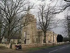 Church of St Peter |
| Church of St Martin | Witcham, East Cambridgeshire | Parish Church | 13th century | 5 February 1952 | TL4649480045 52°23′56″N 0°09′06″E |
1163097 | 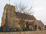 Church of St Martin |
| Parish Church of St Mary | Woodditton, East Cambridgeshire | Parish Church | Early 13th century | 19 August 1959 | TL6596859155 52°12′20″N 0°25′39″E |
1164545 |  Parish Church of St Mary |
.JPG.webp)

Fenland
| Name | Location | Type | Completed [note 1] | Date designated | Grid ref.[note 2] Geo-coordinates |
Entry number [note 3] | Image |
|---|---|---|---|---|---|---|---|
| Church of Saint Peter and Saint Paul | Chatteris, Fenland | Parish Church | 14th century | 5 July 1950 | TL3946686082 52°27′18″N 0°03′04″E |
1126000 | 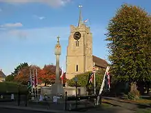 Church of Saint Peter and Saint Paul |
| Church of All Saints | Elm, Fenland | Parish Church | Early 13th century | 23 June 1952 | TF4698706880 52°38′23″N 0°10′15″E |
1331971 |  Church of All Saints |
| Church of St Leonard | Leverington, Fenland | Parish Church | Mid 13th century | 23 June 1952 | TF4448511403 52°40′52″N 0°08′09″E |
1160993 |  Church of St Leonard |
| Leverington Hall | Leverington, Fenland | House | c. 1630 | 23 June 1952 | TF4456311262 52°40′47″N 0°08′13″E |
1125948 | |
| Church of St Wendreda | March, Fenland | Parish Church | Mid 14th century | 13 March 1951 | TL4151295211 52°32′11″N 0°05′06″E |
1287740 |  Church of St Wendreda |
| Bell Tower, South East of Church of St Giles | Tydd St. Giles, Fenland | Bell Tower | Late 13th century | 31 October 1983 | TF4273316448 52°43′37″N 0°06′44″E |
1161163 | 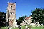 Bell Tower, South East of Church of St Giles |
| Church of St Mary | Whittlesey, Fenland | Parish Church | 13th century | 11 August 1950 | TL2699896959 52°33′20″N 0°07′42″W |
1228792 |  Church of St Mary |
| Parish Church of St Peter and Paul | Wisbech, Fenland | Church | Late 17th century | 17 July 1951 | TF4629609556 52°39′50″N 0°09′43″E |
1229992 | |
| Peckover House | Wisbech, Fenland | House | 1722 | 31 October 1983 | TF4585809662 52°39′54″N 0°09′19″E |
1331632 | |
| 14 North Brink | Wisbech, Fenland | House | Early 19th century | 31 October 1983 | TF4587709666 52°39′54″N 0°09′20″E |
1279112 | |
.jpg.webp)


Huntingdonshire
| Name | Location | Type | Completed [note 1] | Date designated | Grid ref.[note 2] Geo-coordinates |
Entry number [note 3] | Image |
|---|---|---|---|---|---|---|---|
| Church of St Andrew | Abbots Ripton, Huntingdonshire | Parish Church | 13th century | 28 January 1958 | TL2306178017 52°23′11″N 0°11′36″W |
1330505 |  Church of St Andrew |
| Church of Ss Peter and Paul | Alconbury, Huntingdonshire | Parish Church | 13th century | 28 January 1958 | TL1845776120 52°22′13″N 0°15′41″W |
1330459 |  Church of Ss Peter and Paul |
| Parish Church of St Andrew | Alwalton, Huntingdonshire | Parish Church | c. 1190 | 13 December 1951 | TL1335095943 52°32′58″N 0°19′47″W |
1330532 | .jpg.webp) Parish Church of St Andrew |
| Parish Church of St Mary | Bluntisham, Huntingdonshire | Parish Church | 14th century | 30 May 1958 | TL3724874456 52°21′04″N 0°00′49″E |
1128556 |  Parish Church of St Mary |
| Church of St Mary | Brampton, Huntingdonshire | Parish Church | 13th century | 28 January 1958 | TL2148770716 52°19′16″N 0°13′08″W |
1330448 |  Church of St Mary |
| Pepys House | Brampton, Huntingdonshire | House | 17th century | 21 July 1951 | TL2180770878 52°19′21″N 0°12′51″W |
1330472 |  Pepys House |
| Curtain Wall to Buckden Palace | Buckden, Huntingdonshire | Curtain Wall | Late 15th century | 24 October 1951 | TL1923467688 52°17′40″N 0°15′11″W |
1330444 | |
| Parish Church of St Mary | Buckden, Huntingdonshire | Parish Church | 13th century | 14 May 1959 | TL1927067660 52°17′39″N 0°15′09″W |
1330416 |  Parish Church of St Mary |
| The Great Tower | Buckden, Huntingdonshire | Bishops Palace | 1625-42 | 24 October 1951 | TL1925267685 52°17′40″N 0°15′10″W |
1130324 | The Great Tower |
| The Inner Gatehouse | Buckden, Huntingdonshire | House | 15th century | 24 October 1951 | TL1921767714 52°17′41″N 0°15′12″W |
1130290 | .jpg.webp) The Inner Gatehouse |
| Church of Holy Cross | Bury, Huntingdonshire | Parish Church | 12th century | 30 May 1958 | TL2871783774 52°26′12″N 0°06′29″W |
1309536 | 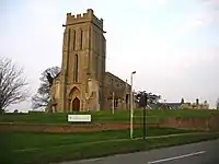 Church of Holy Cross |
| Parish Church of St John the Baptist | Keyston, Bythorn and Keyston, Huntingdonshire | Parish Church | Mid 13th century | 28 January 1958 | TL0436675445 52°22′02″N 0°28′07″W |
1267649 | _St_John_the_Baptist's_Church_-_geograph.org.uk_-_68972.jpg.webp) Parish Church of St John the Baptist |
| Parish Church of St Leonards | Catworth, Huntingdonshire | Parish Church | 13th century | 14 May 1959 | TL0887473365 52°20′51″N 0°24′11″W |
1214188 | _St_Leonard's_Church_-_geograph.org.uk_-_68969.jpg.webp) Parish Church of St Leonards |
| Parish Church of St Michael | Chesterton, Huntingdonshire | Parish Church | 12th century | 13 December 1957 | TL1264895438 52°32′43″N 0°20′25″W |
1130089 | 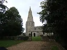 Parish Church of St Michael |
| Church of All Saints | Conington, Huntingdonshire | Parish Church | Early 15th century | 28 January 1958 | TL1804085901 52°27′30″N 0°15′51″W |
1162630 | |
| Parish Church of St Peter | Easton, Huntingdonshire | Parish Church | Early 12th century | 28 January 1958 | TL1385671574 52°19′50″N 0°19′50″W |
1165141 |  Parish Church of St Peter |
| Parish Church of All Saints | Ellington, Huntingdonshire | Parish Church | 13th century | 28 January 1958 | TL1602871782 52°19′55″N 0°17′55″W |
1165216 | 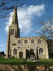 Parish Church of All Saints |
| Elton Hall | Elton, Huntingdonshire | Country House | 1662-1689 | 25 September 1951 | TL0882892960 52°31′25″N 0°23′51″W |
1164802 | |
| Parish Church of St Peter and St Paul | Fenstanton, Huntingdonshire | Parish Church | Mid 13th century | 30 May 1958 | TL3201768743 52°18′03″N 0°03′55″W |
1330754 | 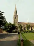 Parish Church of St Peter and St Paul |
| Parish Church of St Nicholas | Glatton, Huntingdonshire | Schoolroom | Early 19th century | 13 December 1957 | TL1536286108 52°27′39″N 0°18′13″W |
1215294 |  Parish Church of St Nicholas |
| Church of St Mary | Godmanchester, Huntingdonshire | Bell Tower | 1625 | 28 November 1950 | TL2454570716 52°19′14″N 0°10′27″W |
1128664 | |
| Huntingdon Bridge | Godmanchester, Huntingdonshire | Bridge | c. 1300 | 28 November 1950 | TL2429271467 52°19′38″N 0°10′39″W |
1128636 | |
| Church of All Saints | Grafham, Huntingdonshire | Parish Church | 13th century or early 14th century | 14 May 1959 | TL1597269154 52°18′30″N 0°18′01″W |
1288615 |  Church of All Saints |
| Church of St Bartholomew | Great Gransden, Huntingdonshire | Parish Church | Late 14th century | 14 May 1959 | TL2709455616 52°11′03″N 0°08′33″W |
1290192 | |
| Church of Holy Trinity | Great Paxton, Huntingdonshire | Church | c. 1050 | 14 May 1959 | TL2099864173 52°15′45″N 0°13′43″W |
1330413 |  Church of Holy Trinity |
| Church of St Andrew | Great Staughton, Huntingdonshire | Church | 14th century | 14 May 1959 | TL1240164686 52°16′08″N 0°21′15″W |
1214559 |  Church of St Andrew |
| Church of St Margaret | Hemingford Abbots, Huntingdonshire | Parish Church | 13th century | 30 May 1958 | TL2827471178 52°19′25″N 0°07′09″W |
1162944 | 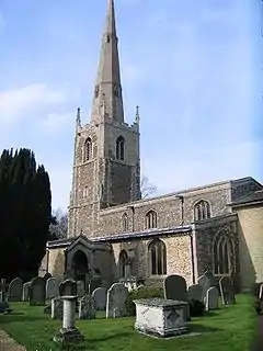 Church of St Margaret |
| Church of St James | Hemingford Grey, Huntingdonshire | Sundial | 18th century | 30 May 1958 | TL2923970868 52°19′15″N 0°06′19″W |
1330773 |  Church of St James |
| The Manor House | Hemingford Grey, Huntingdonshire | First Floor Hall House | c. 1150 | 24 October 1951 | TL2899170673 52°19′08″N 0°06′32″W |
1163135 | |
| Church of St Mary Magdalene | Hilton, Huntingdonshire | Church | Earlier | 30 May 1958 | TL2906966097 52°16′40″N 0°06′34″W |
1128440 | 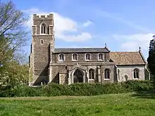 Church of St Mary Magdalene |
| Parish Church of St John the Baptist | Holywell, Holywell-cum-Needingworth, Huntingdonshire | Parish Church | 13th century | 30 May 1958 | TL3365870814 52°19′09″N 0°02′26″W |
1128422 |  Parish Church of St John the Baptist |
| Church of All Saints | Wyton, Houghton and Wyton, Huntingdonshire | Church | 1958 | 30 May 1958 | TL2778172224 52°20′00″N 0°07′34″W |
1330794 | _Churchyard_(geograph_3660760).jpg.webp) Church of All Saints |
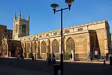
| Church of All Saints | Huntingdon, Huntingdonshire | Parish Church | 12th century or earlier | 10 January 1951 | TL2377571846 52°19′51″N 0°11′06″W |
1128592 |  Church of All Saints |
| Church of St Mary | Huntingdon, Huntingdonshire | Church | Norman | 10 January 1951 | TL2409671648 52°19′44″N 0°10′49″W |
1161910 | |
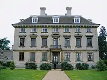
| Hinchingbrooke House | Huntingdon, Huntingdonshire | House | 1538-1627 | 10 January 1951 | TL2273971477 52°19′40″N 0°12′01″W |
1128649 | |
| Gatehouse and Walls at Hinchingbrooke House | Huntingdon, Huntingdonshire | Gatehouse | 16th century or earlier | 27 May 1977 | TL2274471535 52°19′41″N 0°12′01″W |
1128651 | |
| Church of St Andrew | Kimbolton, Huntingdonshire | Parish Church | 1086 | 14 May 1959 | TL0993067862 52°17′52″N 0°23′22″W |
1210885 |  Church of St Andrew |
| Kimbolton School | Kimbolton Castle, Kimbolton, Huntingdonshire | House/School | 16th century and 17th century | 24 October 1951 | TL1006867603 52°17′44″N 0°23′15″W |
1221022 | |
| Gatehouse to Kimbolton School | Kimbolton Castle, Kimbolton, Huntingdonshire | Pavilion | 1764-66 | 24 October 1951 | TL1000967670 52°17′46″N 0°23′18″W |
1221020 | .jpg.webp) Gatehouse to Kimbolton School |
| Parish Church of St Mary | Leighton, Huntingdonshire | Parish Church | 13th century | 28 January 1958 | TL1157175273 52°21′51″N 0°21′46″W |
1222905 | 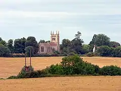 Parish Church of St Mary |
| Parish Church of St John the Evangelist | Little Gidding, Huntingdonshire | Parish Church | Medieval | 28 January 1958 | TL1270481631 52°25′16″N 0°20′39″W |
1130115 | |
| Parish Church of All Saints | Morborne, Huntingdonshire | Church | 17th century | 13 December 1957 | TL1391991500 52°30′34″N 0°19′22″W |
1222032 |  Parish Church of All Saints |
| Church of St Peter | Offord D'Arcy, Offord Cluny and Offord D'Arcy, Huntingdonshire | Church | 12th century | 14 May 1959 | TL2166766416 52°16′57″N 0°13′04″W |
1130249 | |
| Bodsey House | Ramsey, Huntingdonshire | House | 16th century | 1 May 1951 | TL2952687334 52°28′07″N 0°05′41″W |
1166717 | |
| Church of St Thomas à Becket of Canterbury | Ramsey, Huntingdonshire | Guest House | Circa 1180-90 | 1 May 1951 | TL2907085148 52°26′57″N 0°06′08″W |
1157794 | |
| Gatehouse to Ramsey Abbey | Ramsey, Huntingdonshire | Gate | Early 19th century | 1 May 1951 | TL2902585069 52°26′54″N 0°06′11″W |
1130258 | |
| Ramsey Abbey School | Ramsey, Huntingdonshire | Country House | c. 1600 | 1 May 1951 | TL2926985164 52°26′57″N 0°05′57″W |
1156544 | |
| Chapel of St Ledger | Saint Ives, Huntingdonshire | Chapel | 1930 | 24 March 1972 | TL3127671153 52°19′22″N 0°04′31″W |
1161567 | .jpg.webp) Chapel of St Ledger |
| Church of All Saints | Saint Ives, Huntingdonshire | Parish Church | 12th century | 29 September 1951 | TL3098171568 52°19′36″N 0°04′46″W |
1128725 |  Church of All Saints |
| The Bridge | Saint Ives, Huntingdonshire | Bridge | 1110 | 29 September 1951 | TL3126671145 52°19′22″N 0°04′32″W |
1161421 | |
| Stibbington Hall | Stibbington, Sibson-cum-Stibbington, Huntingdonshire | Country House | 1624 | 25 September 1951 | TL0892498739 52°34′32″N 0°23′39″W |
1222241 |  Stibbington Hall |
| Gateway and Boundary Wall to Forecourt of Stibbington Hall | Stibbington, Sibson-cum-Stibbington, Huntingdonshire | Gate | c. 1625 | 13 December 1957 | TL0890298726 52°34′32″N 0°23′40″W |
1274861 | Gateway and Boundary Wall to Forecourt of Stibbington Hall |
| Wansford Bridge (to Cambridgeshire County Boundary) | Wansford, Sibson-cum-Stibbington, Huntingdonshire | Road Bridge | 16th century | 25 September 1951 | TL0750599112 52°34′45″N 0°24′54″W |
1274654 |  Wansford Bridge (to Cambridgeshire County Boundary) |
| Church of St John the Baptist | Somersham, Huntingdonshire | Parish Church | 13th century | 30 May 1958 | TL3601977861 52°22′55″N 0°00′11″W |
1330810 |  Church of St John the Baptist |
| Church of St Leonard | Southoe and Midloe, Huntingdonshire | Church | Late 12th century | 14 May 1959 | TL1829964442 52°15′56″N 0°16′05″W |
1130254 | 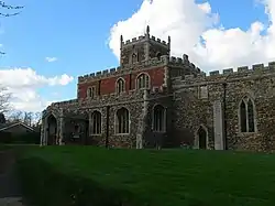 Church of St Leonard |
| Parish Church of St James | Spaldwick, Huntingdonshire | Parish Church | 12th century | 28 January 1958 | TL1275872809 52°20′30″N 0°20′47″W |
1330478 |  Parish Church of St James |
| Church of St Mary | St Neots, Huntingdonshire | Church | Early 13th century | 10 January 1971 | TL1846260160 52°13′37″N 0°16′01″W |
1128002 |  Church of St Mary |
| Church of All Saints | Tilbrook, Huntingdonshire | Parish Church | Late 12th century | 14 May 1959 | TL0806069225 52°18′38″N 0°24′59″W |
1214784 | 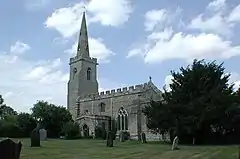 Church of All Saints |
| Church of St Peter | Upwood, Upwood and the Raveleys, Huntingdonshire | Parish Church | c. 1100 | 28 January 1958 | TL2594382687 52°25′40″N 0°08′57″W |
1130160 | 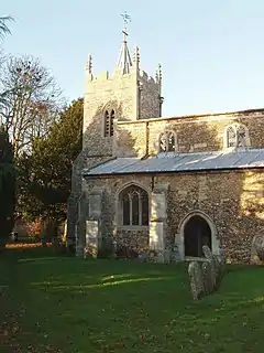 Church of St Peter |
| Church of St Mary Magdalene | Warboys, Huntingdonshire | Parish Church | 12th century | 30 May 1958 | TL3026779863 52°24′05″N 0°05′12″W |
1128398 |  Church of St Mary Magdalene |
| Church of St John the Baptist | Wistow, Huntingdonshire | Church | 18th century | 30 May 1958 | TL2786980976 52°24′43″N 0°07′17″W |
1128371 |  Church of St John the Baptist |
| Parish Church of St Peter | Yaxley, Huntingdonshire | Parish Church | 13th century | 13 December 1957 | TL1770091842 52°30′42″N 0°16′02″W |
1274392 |  Parish Church of St Peter |


.jpg.webp)


South Cambridgeshire
| Name | Location | Type | Completed [note 1] | Date designated | Grid ref.[note 2] Geo-coordinates |
Entry number [note 3] | Image |
|---|---|---|---|---|---|---|---|
| Church of St Nicholas | Arrington, South Cambridgeshire | Parish Church | 13th century | 22 November 1967 | TL3251650303 52°08′07″N 0°03′55″W |
1128196 | 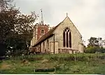 Church of St Nicholas |
| Parish Church of St Peter South West of Babraham Hall | Babraham, South Cambridgeshire | Parish Church | c. 1200 | 22 November 1967 | TL5095950529 52°07′57″N 0°12′15″E |
1331111 | 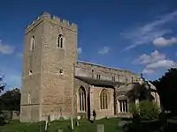 Parish Church of St Peter South West of Babraham Hall |
| Church of Holy Trinity | Balsham, South Cambridgeshire | Sculpture | Medieval | 22 November 1967 | TL5878650861 52°08′00″N 0°19′07″E |
1331425 |  Church of Holy Trinity |
| Church of All Saints | Barrington, South Cambridgeshire | Parish Church | Early 13th century | 22 November 1967 | TL3966449963 52°07′49″N 0°02′20″E |
1331176 | 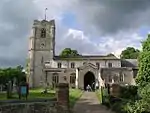 Church of All Saints |
| Church of St Mary | Bartlow, South Cambridgeshire | Parish Church | 12th century | 22 November 1967 | TL5859945184 52°04′56″N 0°18′47″E |
1318152 |  Church of St Mary |
| Parish Church of St Peter and St Paul | Bassingbourn cum Kneesworth, South Cambridgeshire | Parish Church | Early 13th century | 22 November 1967 | TL3306644073 52°04′45″N 0°03′35″W |
1330840 | 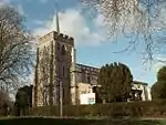 Parish Church of St Peter and St Paul |
| Bourn Mill | Bourn, South Cambridgeshire | Windmill | Early 17th century | 31 August 1962 | TL3118958004 52°12′17″N 0°04′54″W |
1162375 | |
| Parish Church of St Helen and St Mary | Bourn, South Cambridgeshire | Parish Church | 12th century | 31 August 1962 | TL3244256371 52°11′23″N 0°03′50″W |
1309659 | 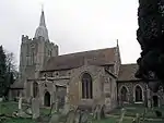 Parish Church of St Helen and St Mary |
| Church of St Mary | Comberton, South Cambridgeshire | Parish Church | Late 13th century | 31 August 1962 | TL3837655533 52°10′51″N 0°01′21″E |
1310174 | 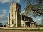 Church of St Mary |
| Church of St Peter | Coton, South Cambridgeshire | Parish Church | 12th century | 31 August 1962 | TL4088458887 52°12′37″N 0°03′38″E |
1127774 |  Church of St Peter |
| Church of All Saints | Cottenham, South Cambridgeshire | Parish Church | 13th century | 31 August 1962 | TL4552168624 52°17′47″N 0°07′57″E |
1127339 |  Church of All Saints |
| Parish Church of St John | Duxford, South Cambridgeshire | Schoolroom | Mid 17th century | 22 November 1967 | TL4781346197 52°05′40″N 0°09′23″E |
1330953 | |
| Parish Church of St Peter | Duxford, South Cambridgeshire | Parish Church | 12th century | 22 November 1967 | TL4806045982 52°05′33″N 0°09′35″E |
1162738 | |
| Parish Church of Holy Trinity | Elsworth, South Cambridgeshire | Parish Church | 13th century | 31 August 1962 | TL3185463578 52°15′16″N 0°04′11″W |
1127266 | 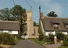 Parish Church of Holy Trinity |
| Parish Church of St Mary | Fowlmere, South Cambridgeshire | Parish Church | Early 12th century | 22 November 1967 | TL4225045932 52°05′36″N 0°04′30″E |
1128096 |  Parish Church of St Mary |
| Church of St Lawrence | Foxton, Cambridgeshire | Parish Church | late C12/early 13th century | 22 November 1967 | TL4121148335 52°06′55″N 0°03′39″E |
1162382 | 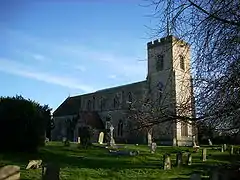 Church of St Lawrence |
| Church of St Mary the Virgin | Gamlingay, South Cambridgeshire | Parish Church | 13th century | 22 November 1967 | TL2411552293 52°09′18″N 0°11′14″W |
1330908 | 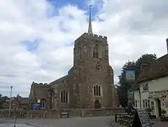 Church of St Mary the Virgin |
| Church of St Mary | Great Shelford, South Cambridgeshire | Parish Church | 12th century | 31 August 1962 | TL4587251872 52°08′45″N 0°07′50″E |
1127895 | 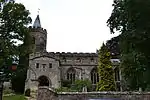 Church of St Mary |
| Odsey House | Guilden Morden, South Cambridgeshire | Country House | c. 1723 | 4 September 1986 | TL2953038053 52°01′33″N 0°06′49″W |
1330874 | |
| Parish Church of St Mary | Guilden Morden, South Cambridgeshire | Parish Church | 12th century | 22 November 1967 | TL2798044137 52°04′51″N 0°08′02″W |
1330865 | 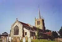 Parish Church of St Mary |
| Church of St Mary | Harlton, South Cambridgeshire | Parish Church | Late 14th century | 31 August 1962 | TL3871952529 52°09′13″N 0°01′34″E |
1127751 |  Church of St Mary |
| Church of All Saints | Haslingfield, South Cambridgeshire | Parish Church | 12th century | 31 August 1962 | TL4037352135 52°08′59″N 0°03′01″E |
1331124 |  Church of All Saints |
| Church of St Edmund | Hauxton, South Cambridgeshire | Parish Church | Early 12th century | 31 August 1962 | TL4359652172 52°08′57″N 0°05′50″E |
1164672 |  Church of St Edmund |
| Parish Church of Holy Trinity | Hildersham, South Cambridgeshire | Parish Church | c. 1200 | 22 November 1967 | TL5453548834 52°06′58″N 0°15′20″E |
1127726 | 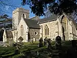 Parish Church of Holy Trinity |
| Parish Church of St Andrew | Histon, South Cambridgeshire | Parish Church | 13th century | 31 August 1962 | TL4361363987 52°15′19″N 0°06′09″E |
1127404 | |
| Church of St Peter | Horningsea, South Cambridgeshire | Church | Early 12th century | 31 August 1962 | TL4928462647 52°14′30″N 0°11′06″E |
1331295 | 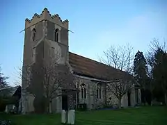 Church of St Peter |
| Church of All Saints | Horseheath, South Cambridgeshire | Parish Church | 14th century | 22 November 1967 | TL6137547447 52°06′07″N 0°21′17″E |
1127944 | 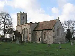 Church of All Saints |
| Parish Church of St Mary Magdalen | Ickleton, South Cambridgeshire | Parish Church | Late 11th century | 22 November 1967 | TL4947443858 52°04′23″N 0°10′46″E |
1128057 | 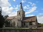 Parish Church of St Mary Magdalen |
| Church of St Andrew | Impington, South Cambridgeshire | Parish Church | Early 13th century | 31 August 1962 | TL4478663218 52°14′53″N 0°07′10″E |
1178832 | |
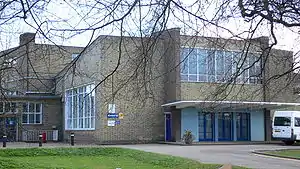
| Impington Village College | Impington, Histon and Impington, South Cambridgeshire | Assembly Hall | 1938-9 | 28 January 1971 | TL4462263170 52°14′52″N 0°07′01″E |
1331296 | |
| Church of All Saints and St Andrew | Kingston, Cambridgeshire | Parish Church | 13th century | 22 November 1967 | TL3461355430 52°10′51″N 0°01′57″W |
1127592 | 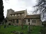 Church of All Saints and St Andrew |
| Parish Church of All Saints | Landbeach, South Cambridgeshire | Parish Church | 13th century | 31 August 1962 | TL4765865358 52°16′00″N 0°09′45″E |
1127385 | 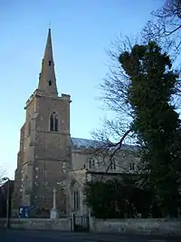 Parish Church of All Saints |
| Parish Church of St Mary the Virgin | Linton, South Cambridgeshire | Church | mediaeval and later | 22 November 1967 | TL5618746676 52°05′47″N 0°16′43″E |
1162094 | 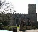 Parish Church of St Mary the Virgin |
| Church of All Saints | Longstanton, South Cambridgeshire | Parish Church | Mid-late 14th century | 31 August 1962 | TL3989966417 52°16′41″N 0°02′57″E |
1127295 | 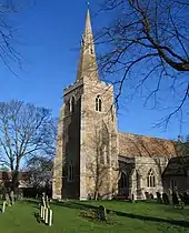 Church of All Saints |
| Madingley Hall and stable courtyard | Madingley, South Cambridgeshire | Country House | Mid and late 16th century | 31 August 1962 | TL3926460469 52°13′29″N 0°02′15″E |
1163528 | 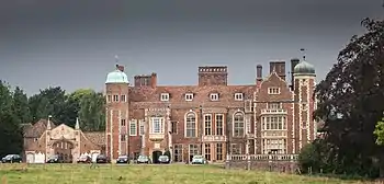 Madingley Hall and stable courtyard |
| Church of Holy Trinity | Meldreth, South Cambridgeshire | Parish Church | Mid 12th century | 22 November 1967 | TL3777746837 52°06′10″N 0°00′37″E |
1127558 |  Church of Holy Trinity |
| Church of St Andrew | Orwell, Cambridgeshire | Parish Church | 12th century | 22 November 1967 | TL3622350474 52°08′09″N 0°00′40″W |
1317573 | 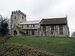 Church of St Andrew |
| Church of St Mary | Over, South Cambridgeshire | Parish Church | 13th century | 31 August 1962 | TL3724770778 52°19′05″N 0°00′44″E |
1317811 |  Church of St Mary |
| Manor House | Papworth St Agnes, South Cambridgeshire | Cross Wing House | c. 1585 | 31 August 1962 | TL2679664731 52°15′58″N 0°08′36″W |
1127243 | |
| Parish Church of St Mary | Sawston, South Cambridgeshire | Parish Church | c. 1180 | 22 November 1967 | TL4876149236 52°07′17″N 0°10′17″E |
1128065 | 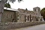 Parish Church of St Mary |
| Sawston Hall | Sawston, South Cambridgeshire | Country House | Late Medieval | 12 February 1958 | TL4884049112 52°07′13″N 0°10′21″E |
1330979 | |
| Parish Church of St Andrew | Swavesey, South Cambridgeshire | Church | 11th century | 31 August 1962 | TL3627169382 52°18′20″N 0°00′10″W |
1226375 | 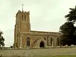 Parish Church of St Andrew |
| The Old Manor House | Swavesey, South Cambridgeshire | Double Ended Hall House | Late Medieval | 31 August 1962 | TL3636569334 52°18′19″N 0°00′05″W |
1226398 | |
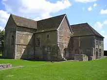
| Denny Abbey | Waterbeach, South Cambridgeshire | Abbey | c. 1150 | 31 August 1962 | TL4922168404 52°17′37″N 0°11′12″E |
1127360 | |
| Denny Abbey Refectory | Waterbeach, South Cambridgeshire | Franciscan Nunnery | c. 1340 | 31 August 1962 | TL4923368460 52°17′38″N 0°11′13″E |
1331328 | .jpg.webp) Denny Abbey Refectory |
| Parish Church of St Mary | Whaddon, South Cambridgeshire | Parish Church | Early 13th century | 22 November 1967 | TL3495746587 52°06′04″N 0°01′52″W |
1164317 | 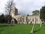 Parish Church of St Mary |
| Parish Church of St Mary and St Andrew | Whittlesford, South Cambridgeshire | Parish Church | 12th century | 22 November 1967 | TL4737748577 52°06′57″N 0°09′04″E |
1128014 | 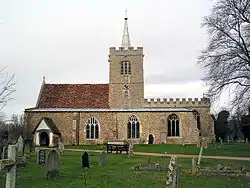 Parish Church of St Mary and St Andrew |
| Church of St Mary and All the Saints | Willingham, South Cambridgeshire | Parish Church | Early 14th century | 31 August 1962 | TL4047670501 52°18′53″N 0°03′34″E |
1127283 |  Church of St Mary and All the Saints |
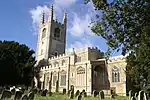
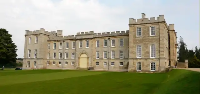
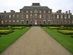
| Wimpole Hall | Wimpole, South Cambridgeshire | Country House | 17th century | 22 November 1967 | TL3355250994 52°08′28″N 0°02′59″W |
1128166 |


Notes
- The date given is the date used by Historic England as significant for the initial building or that of an important part in the structure's description.
- Sometimes known as OSGB36, the grid reference is based on the British national grid reference system used by the Ordnance Survey.
- The "List Entry Number" is a unique number assigned to each listed building and scheduled monument by Historic England.
References
- "Listed Buildings". English Heritage. 2010. Archived from the original on 24 January 2013. Retrieved 22 August 2011.
- National Heritage List for England Images of England
- http://www.heritagegateway.org.uk/Gateway/Advanced_Search.aspx?reset=true English Heritage Gateway
External links
![]() Media related to Grade I listed buildings in Cambridgeshire at Wikimedia Commons
Media related to Grade I listed buildings in Cambridgeshire at Wikimedia Commons
This article is issued from Wikipedia. The text is licensed under Creative Commons - Attribution - Sharealike. Additional terms may apply for the media files.