Grade I listed buildings in Northamptonshire
There are more than 9,000 Grade I listed buildings in England. This page is a list of these buildings in the county of Northamptonshire, by local government district.
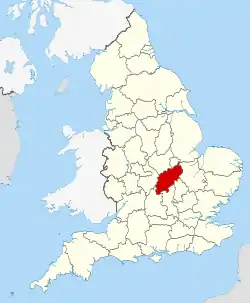
Northamptonshire shown within England
Corby
| Name | Location | Type | Completed [note 1] | Date designated | Grid ref.[note 2] Geo-coordinates |
Entry number [note 3] | Image |
|---|---|---|---|---|---|---|---|
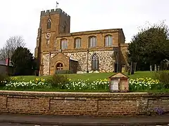
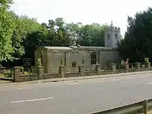
| Church of St Mary Magdalene | Cottingham, Corby | Parish Church | 12th century | 25 February 1957 | SP8461289944 52°30′03″N 0°45′18″W |
1051745 |  Church of St Mary Magdalene |
| Church of St Peter | East Carlton, Corby | Parish Church | 1788 | 25 February 1957 | SP8313689329 52°29′44″N 0°46′37″W |
1192313 |  Church of St Peter |
| Church of St James the Great | Gretton, Corby | Parish Church | Early 12th century | 25 February 1957 | SP8985494417 52°32′25″N 0°40′36″W |
1051731 |  Church of St James the Great |
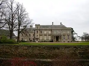
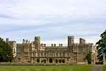
| Kirby Hall (that part in Bulwick Civil Parish) | Deene, Gretton, Corby | Country House | 1570-1575 | 17 April 1972 | SP9258492694 52°31′27″N 0°38′13″W |
1374889 | 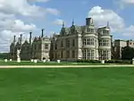 Kirby Hall (that part in Bulwick Civil Parish) |
| Kirby Hall, attached walls and archways | Gretton, Corby | Country House | 1570-75 | 17 April 1972 | SP9258092698 52°31′27″N 0°38′13″W |
1372559 | 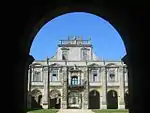 Kirby Hall, attached walls and archways |
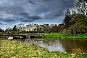
| Rockingham Castle | Rockingham, Corby | Castle | 13th century | 25 October 1951 | SP8670091375 52°30′48″N 0°43′26″W |
1193409 | |
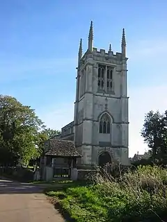
| Church of St Peter | Stanion, Corby | Parish Church | Mid 13th century | 25 February 1957 | SP9148086848 52°28′19″N 0°39′17″W |
1193621 | 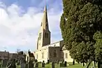 Church of St Peter |
| Church of St Mary | Weldon, Corby | Parish Church | Early 13th century | 25 February 1957 | SP9278289336 52°29′39″N 0°38′05″W |
1372577 |  Church of St Mary |

Daventry
| Name | Location | Type | Completed [note 1] | Date designated | Grid ref.[note 2] Geo-coordinates |
Entry number [note 3] | Image |
|---|---|---|---|---|---|---|---|
| Althorp House | Althorp, Daventry district | Country House | c. 1508 | 2 November 1954 | SP6817865141 52°16′49″N 1°00′07″W |
1356626 | |
| Althorp, Falconry or Hawking Tower | Althorp, Daventry | Hunting Lodge | c. 1611 | 2 November 1954 | SP6800865706 52°17′07″N 1°00′16″W |
1356628 |  |
| Church of St Leodegarius | Ashby St Ledgers, Daventry | Church | C14-C15 | 18 January 1968 | SP5732468206 52°18′32″N 1°09′38″W |
1076499 | 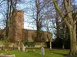 Church of St Leodegarius |
| Church of St Mary | Great Brington, Brington, Daventry | Manor House | Late 13th century | 2 November 1954 | SP6672165219 52°16′52″N 1°01′24″W |
1067622 | 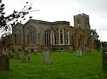 Church of St Mary |
| Church of All Saints | Brixworth, Daventry | Parish Church | 10th century | 2 November 1954 | SP7475071217 52°20′02″N 0°54′16″W |
1054866 | |
| Church of Holy Cross | Byfield, Daventry | Church | 14th century | 2 February 1964 | SP5192853000 52°10′22″N 1°14′32″W |
1343540 | 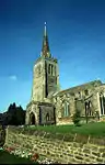 Church of Holy Cross |
| Canons Ashby House | Canons Ashby, Daventry | Country House | Earlier origins | 18 September 1953 | SP5773150655 52°09′04″N 1°09′28″W |
1075304 | |
| Church of St Mary | Canons Ashby, Daventry | Church | 13th century | 18 January 1963 | SP5779250524 52°09′00″N 1°09′24″W |
1187152 | 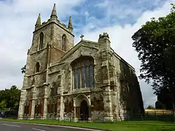 Church of St Mary |
| Church of Holy Trinity | Charwelton, Daventry | Church | 14th century | 18 January 1968 | SP5447455523 52°11′43″N 1°12′16″W |
1370027 | 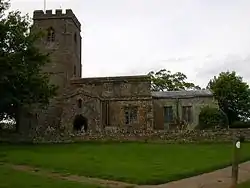 Church of Holy Trinity |
| Church of All Saints | Clipston, Daventry | Manor House | Early 13th century | 2 November 1954 | SP7138481565 52°25′39″N 0°57′06″W |
1067033 | 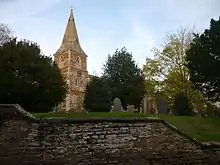 Church of All Saints |
| Church of All Saints | Cottesbrooke, Daventry | Church | Late 13th century | 2 November 1954 | SP7100973531 52°21′19″N 0°57′32″W |
1067102 |  Church of All Saints |
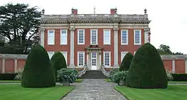
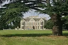
| Cottesbrooke Hall | Cottesbrooke, Daventry | Country House | c1702-13 | 2 November 1954 | SP7110874001 52°21′34″N 0°57′26″W |
1356891 | |
| Church of St Margaret | Crick, Daventry | Church | C14-C15 | 18 January 1968 | SP5882872490 52°20′50″N 1°08′16″W |
1342994 | 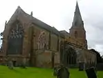 Church of St Margaret |
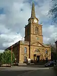
| Church of the Holy Cross | Daventry, Daventry | Church | 1752-1758 | 4 December 1953 | SP5750662571 52°15′30″N 1°09′32″W |
1067696 | |
| Church of St Mary the Virgin | Dodford, Daventry | Church | Early 12th century | 18 January 1968 | SP6124660545 52°14′23″N 1°06′16″W |
1075249 | 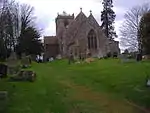 Church of St Mary the Virgin |
| Church of St John the Baptist | East Farndon, Daventry | Church | 13th century and 14th century | 2 November 1954 | SP7163984757 52°27′22″N 0°56′50″W |
1054010 | |
| East Haddon Hall | East Haddon, Daventry | Country House | c1780-1 | 2 November 1954 | SP6675968306 52°18′32″N 1°01′20″W |
1031915 | |
| Church of St Mary | Everdon, Daventry | Church | 14th century | 18 January 1968 | SP5946457434 52°12′43″N 1°07′52″W |
1076554 | 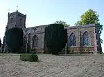 Church of St Mary |
| Church of St Mary the Virgin | Fawsley, Daventry | Church | 13th century | 18 January 1968 | SP5653756792 52°12′23″N 1°10′27″W |
1343552 | |
| Fawsley Hall | Fawsley, Daventry | Country House | Early 16th century | 18 September 1953 | SP5622456804 52°12′24″N 1°10′43″W |
1075281 | |
| Church of St Peter and St Paul | Hannington, Daventry | Manor House | Late 13th century | 2 November 1954 | SP8115770929 52°19′50″N 0°48′38″W |
1067000 | 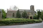 Church of St Peter and St Paul |
| Church of St Andrew | Lower Harlestone, Harlestone, Daventry | Manor House | 14th century | 2 November 1954 | SP7008464612 52°16′31″N 0°58′27″W |
1067076 | 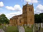 Church of St Andrew |
| Church of St Mary and All Saints | Holcot, Daventry | Church | C13,C14 | 2 November 1954 | SP7923069833 52°19′15″N 0°50′20″W |
1045863 | 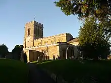 Church of St Mary and All Saints |
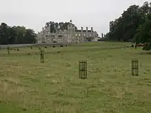
| Holdenby House, carriage arch about 130m north east | Holdenby, Daventry | Country house | 1583 | 2 November 1984 | SP6939967714 52°18′11″N 0°59′01″W |
1203593 | 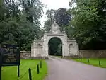 Holdenby House, carriage arch about 130m north east |
| Holdenby House, carriage arch about 130m south east | Holdenby, Daventry | Country house | 1583 | 2 November 1954 | SP6937167659 52°18′10″N 0°59′03″W |
1356907 | 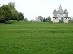 Holdenby House, carriage arch about 130m south east |
| Kelmarsh Hall | Kelmarsh, Daventry | Manor House | c1727-32 | 2 November 1954 | SP7363179602 52°24′34″N 0°55′08″W |
1067012 | |
| Church of All Saints | Lamport, Daventry | Church | Late 12th century | 2 November 1954 | SP7580974557 52°21′50″N 0°53′17″W |
1367031 | |
| Lamport Hall | Lamport Hall, Lamport, Daventry | Country House | 16th century to 19th century | 2 November 1954 | SP7588374504 52°21′48″N 0°53′13″W |
1054842 | |
| Church of All Saints | Lilbourne, Daventry | Church | 12th century | 18 January 1968 | SP5603977410 52°23′31″N 1°10′41″W |
1287539 | 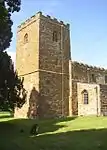 Church of All Saints |
| Church of St Nicholas | Marston Trussell, Daventry | Church | 13th century | 2 November 1954 | SP6936385929 52°28′01″N 0°58′49″W |
1216629 | |
| Church of St Peter and St Paul | Moulton, Daventry | Church | Saxon | 2 November 1954 | SP7835866419 52°17′25″N 0°51′09″W |
1356515 | 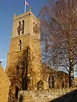 Church of St Peter and St Paul |
| Church of St Michael and All Angels | Newnham, Daventry | Church | 13th century | 18 January 1968 | SP5809759727 52°13′58″N 1°09′03″W |
1076538 |  Church of St Michael and All Angels |
| Church of All Saints | Norton, Daventry | Church | 13th century | 18 January 1968 | SP6030763701 52°16′05″N 1°07′04″W |
1076507 | 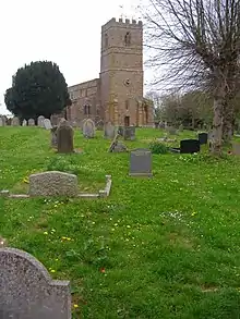 Church of All Saints |
| Church of St Andrew | Old, Daventry | Church | 13th century and 14th century | 2 November 1954 | SP7854573120 52°21′02″N 0°50′54″W |
1376651 | |
| Church of St Andrew | Spratton, Daventry | Church | 12th century | 2 November 1954 | SP7176970100 52°19′28″N 0°56′54″W |
1356914 | 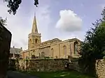 Church of St Andrew |
| Church of St Nicholas | Stanford, Daventry | Church | c. 1300 | 18 January 1968 | SP5885178853 52°24′16″N 1°08′11″W |
1228501 | 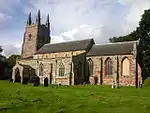 Church of St Nicholas |
| Church of St Mary | Staverton, Daventry | Church | Early C14-C15 | 18 January 1968 | SP5409361120 52°14′44″N 1°12′33″W |
1203555 |  Church of St Mary |
| Church of St Michael | Church Stowe, Stowe IX Churches, Daventry | Church | Saxon | 18 January 1968 | SP6389057684 52°12′49″N 1°03′59″W |
1343558 | 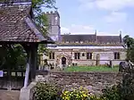 Church of St Michael |
| Church of St Peter and St Paul | Watford, Daventry | Church | Early C14-C15 | 18 January 1968 | SP6032769035 52°18′58″N 1°06′59″W |
1077018 | |
| Church of All Saints | West Haddon, Daventry | Church | 12th century to 14th century | 18 January 1968 | SP6301971834 52°20′28″N 1°04′35″W |
1229379 | |
| Church of All Saints | Yelvertoft, Daventry | Church | 13th century | 18 January 1968 | SP6025075222 52°22′18″N 1°06′59″W |
1229692 | 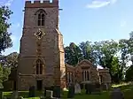 Church of All Saints |

.jpg.webp)
East Northamptonshire
| Name | Location | Type | Completed [note 1] | Date designated | Grid ref.[note 2] Geo-coordinates |
Entry number [note 3] | Image |
|---|---|---|---|---|---|---|---|
| Church of All Saints | Aldwincle | Church | 13th century | 25 May 1967 | TL0112281522 52°25′20″N 0°30′52″W |
1191528 | |
| Church of St Peter | Aldwincle | Church | Late 12th century | 23 May 1967 | TL0061681862 52°25′32″N 0°31′18″W |
1040308 | 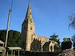 Church of St Peter |
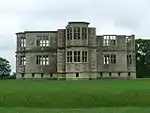
| Lyveden New Bield | Aldwincle | Summerhouse | 1604-5 | 31 July 1987 | SP9840385309 52°27′25″N 0°33′12″W |
1371907 | |
| Lyveden Old Bield and attached Outbuildings | Aldwincle | House | Earlier | 23 May 1967 | SP9816885882 52°27′43″N 0°33′24″W |
1040347 | |
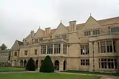
| Apethorpe Hall | Apethorpe Park, Apethorpe | Country house | 15th century | 23 May 1967 | TL0231895458 52°32′51″N 0°29′33″W |
1040083 | |
| Church of St Leonard | Apethorpe | Church | 14th century to 15th century | 23 May 1967 | TL0249695701 52°32′58″N 0°29′23″W |
1371995 | |
| Barnwell Castle | Barnwell St Andrew, Barnwell | Castle | About 1266 | 25 January 1988 | TL0491785203 52°27′17″N 0°27′27″W |
1294426 | |
| Church of St Andrew | Barnwell St Andrew, Barnwell | Church | Late 13th century | 23 May 1967 | TL0491884968 52°27′09″N 0°27′27″W |
1040245 | 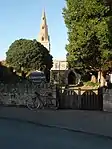 Church of St Andrew |
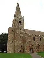
| Church of St Andrew | Brigstock | Church | Late 10th century | 23 May 1967 | SP9461385212 52°27′24″N 0°36′33″W |
1371950 | 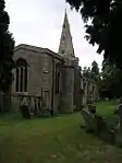 Church of St Andrew |
| Church of St Nicholas | Bulwick | Church | 13th century | 23 May 1967 | SP9628394252 52°32′15″N 0°34′55″W |
1191576 | 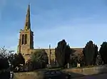 Church of St Nicholas |
| Church of St Andrew | Cotterstock | Church | Late 12th century | 23 May 1967 | TL0489890549 52°30′10″N 0°27′22″W |
1040253 | 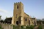 Church of St Andrew |
| Cotterstock Hall and attached Outbuildings | Cotterstock | Country House | 1658 | 1 July 1975 | TL0459290669 52°30′14″N 0°27′38″W |
1293978 | |
| Deene Hall | Deene Park, Deene | Country House | 16th century to 19th century | 23 May 1967 | SP9502392705 52°31′26″N 0°36′03″W |
1040131 | |
| Church of the Holy Trinity | Denford | Boiler House | 19th century | 23 May 1967 | SP9914676626 52°22′43″N 0°32′42″W |
1040320 | 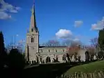 Church of the Holy Trinity |
| Church of All Saints | Easton on the Hill | Church | 12th century | 23 May 1967 | TF0110904726 52°37′51″N 0°30′27″W |
1266419 | 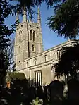 Church of All Saints |
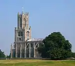
| Church of St Mary and All Saints | Fotheringhay | Church | 1434 | 23 May 1967 | TL0599593143 52°31′33″N 0°26′21″W |
1371944 | |
| Church of St John the Baptist | Harringworth | Church | Late 12th century | 23 May 1967 | SP9166097444 52°34′02″N 0°38′57″W |
1040119 | 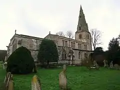 Church of St John the Baptist |
| Market Cross, approx. 10 Metres North West of Cross Farmhouse | Harringworth | Market Cross | 14th century | 23 May 1967 | SP9172697318 52°33′57″N 0°38′53″W |
1192445 | 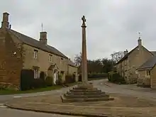 Market Cross, approx. 10 Metres North West of Cross Farmhouse |
| Bede House | Higham Ferrers | Church Hall | 19th century | 23 September 1950 | SP9614068486 52°18′22″N 0°35′29″W |
1191999 | .jpg.webp) Bede House |
| Chantry Chapel of All Souls | Higham Ferrers | Chapel | Early 15th century | 23 September 1950 | SP9610368527 52°18′23″N 0°35′31″W |
1040359 |  Chantry Chapel of All Souls |
| Chichele College, North Range and attached Foundations | Higham Ferrers | Theological College | c. 1422 | 17 June 1987 | SP9599468665 52°18′28″N 0°35′36″W |
1371908 | 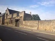 Chichele College, North Range and attached Foundations |
| Chichele College, South and East Ranges and attached Foundations | Higham Ferrers | Gate | c. 1422 | 17 June 1987 | SP9602168645 52°18′27″N 0°35′35″W |
1040390 | 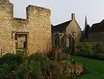 Chichele College, South and East Ranges and attached Foundations |
| Church of St Mary | Higham Ferrers | Church | 13th century | 23 September 1950 | SP9614068527 52°18′23″N 0°35′29″W |
1191957 |  Church of St Mary |
| Churchyard Cross approx. 8 Metres West of Chantry Chapel of All Souls | Higham Ferrers | Cross | Early 14th century | 23 September 1950 | SP9608868519 52°18′23″N 0°35′32″W |
1040360 | .jpg.webp) Churchyard Cross approx. 8 Metres West of Chantry Chapel of All Souls |
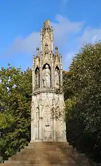
| Market Cross 56 Metres North of Town Hall | Higham Ferrers | Market Cross | 14th century | 23 September 1950 | SP9604168497 52°18′22″N 0°35′34″W |
1192024 | 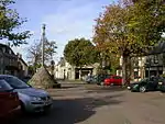 Market Cross 56 Metres North of Town Hall |
| Church of St Peter | Irthlingborough | Church | 1889-1893 | 8 May 1950 | SP9478770648 52°19′33″N 0°36′38″W |
1040366 | 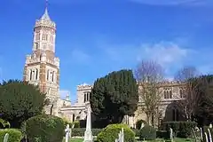 Church of St Peter |
| Irthlingborough Old Bridge and attached Causeway (that Part in Irthlingborough Civil Parish) | Irthlingborough | Bridge | Mid 14th century | 8 May 1950 | SP9569370612 52°19′31″N 0°35′50″W |
1040368 | 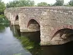 Irthlingborough Old Bridge and attached Causeway (that Part in Irthlingborough Civil Parish) |
| Market Cross at Junction of Station and Finedon Roads | Irthlingborough | Market Cross | Mid 14th century | 8 May 1950 | SP9473170763 52°19′36″N 0°36′41″W |
1192144 | 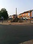 Market Cross at Junction of Station and Finedon Roads |
| Church of St Nicholas | Islip | Church | 14th century | 23 May 1967 | SP9867178911 52°23′58″N 0°33′04″W |
1040326 |  Church of St Nicholas |
| Church of All Saints | King's Cliffe | Church | Early 12th century | 23 May 1967 | TL0069497080 52°33′44″N 0°30′58″W |
1225733 |  Church of All Saints |
| Lilford Hall | Lilford Park, Lilford-cum-Wigsthorpe | Country House | 18th century | 23 May 1967 | TL0292884069 52°26′42″N 0°29′13″W |
1189554 | |
| Church of St Mary | Little Addington | Church | Late 13th century | 23 May 1967 | SP9589373563 52°21′06″N 0°35′37″W |
1040336 |  Church of St Mary |
| Church of St Peter | Lowick | Church | Early 14th century | 23 May 1967 | SP9776381006 52°25′06″N 0°33′50″W |
1040265 | |
| Drayton House | Drayton Park, Lowick | Country House | Late C13/Early 14th century | 23 May 1967 | SP9629980019 52°24′35″N 0°35′09″W |
1040293 | |
| Gates, Gatepiers and attached Screens approx. 600 Metres South East of South Front of Drayton House | Drayton Park, Lowick | Gate | Early 18th century | 23 May 1967 | SP9673379737 52°24′26″N 0°34′46″W |
1040294 | 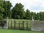 Gates, Gatepiers and attached Screens approx. 600 Metres South East of South Front of Drayton House |
| Gates, Gatepiers and Screen approx. 70 Metres South East of South Front of Drayton House | Drayton Park, Lowick | Gate | 1701 | 23 May 1967 | SP9640379993 52°24′34″N 0°35′03″W |
1371919 | 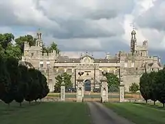 Gates, Gatepiers and Screen approx. 70 Metres South East of South Front of Drayton House |
| Church of St Peter | Lutton | Church | Saxon | 23 May 1967 | TL1121087789 52°28′36″N 0°21′50″W |
1040231 | |
| Church of St Mary the Virgin and All Saints | Nassington | Cross | Saxon | 23 May 1967 | TL0632996174 52°33′11″N 0°25′59″W |
1065930 | .jpg.webp) Church of St Mary the Virgin and All Saints |
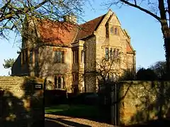
| Prebendal Manor House | Nassington | Farmhouse | Until 1836 | 23 May 1967 | TL0629096126 52°33′09″N 0°26′02″W |
1065975 | 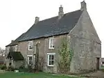 Prebendal Manor House |
| Church of St Peter | Newton Bromswold | Church | Mid 13th century to mid 14th century | 28 May 1954 | SP9981865858 52°16′55″N 0°32′18″W |
1371900 | 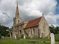 Church of St Peter |
| Berrystead | Oundle | House | c. 1700 | 18 June 1955 | TL0427888208 52°28′55″N 0°27′57″W |
1190983 | .jpg.webp) Berrystead |
| Cobthorne | Oundle | House | 1700 | 18 June 1955 | TL0403088059 52°28′50″N 0°28′11″W |
1372161 | |
| Parish Church of St Peter | Oundle | Parish Church | Norman | 18 June 1955 | TL0419988196 52°28′54″N 0°28′02″W |
1190787 | 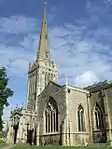 Parish Church of St Peter |
| The Talbot Hotel, incl. Ranges of Stables and Barns at rear, Mounting Block near main Carriage Entrance | Oundle | Stables | 1552 | 18 June 1955 | TL0406688126 52°28′52″N 0°28′09″W |
1372145 | 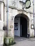 The Talbot Hotel, incl. Ranges of Stables and Barns at rear, Mounting Block near main Carriage Entrance |
| Church of All Saints | Polebrook | Church | Late 12th century | 23 May 1967 | TL0684087060 52°28′16″N 0°25′43″W |
1040232 |  Church of All Saints |
| Church of St Peter | Raunds | Church | 12th century | 26 April 1950 | TL0004073087 52°20′48″N 0°31′58″W |
1192206 | |
| Church of the Nativity of the Blessed Virgin Mary | Ringstead | Church | 12th century | 23 May 1967 | SP9860875125 52°21′55″N 0°33′12″W |
1286678 | .jpg.webp) Church of the Nativity of the Blessed Virgin Mary |
| Church of St Mary | Rushden | Church | Early 13th century | 9 December 1949 | SP9577266536 52°17′19″N 0°35′50″W |
1266098 |  Church of St Mary |
| Southwick Hall, attached Walls and Stable Block | Southwick | Hall | 16th century | 23 May 1967 | TL0213692177 52°31′04″N 0°29′46″W |
1040240 |  Southwick Hall, attached Walls and Stable Block |
| Church of St Laurence | Stanwick | Church | 13th century | 26 April 1950 | SP9801771457 52°19′57″N 0°33′47″W |
1192232 | .jpg.webp) Church of St Laurence |
| Castle Barn approx. 50 Metres North East of Thorpe Castle House | Thorpe Waterville, Thorpe Achurch | Barn | Early 14th century | 23 May 1967 | TL0225881433 52°25′17″N 0°29′52″W |
1040149 | |
| Church of St Mary the Virgin | Titchmarsh | Church | Mid 12th century | 23 May 1967 | TL0220579866 52°24′26″N 0°29′56″W |
1265555 | 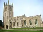 Church of St Mary the Virgin |
| Church of St John the Baptist | Wakerley | Church | 12th century | 23 May 1967 | SP9567299218 52°34′57″N 0°35′22″W |
1234011 | .jpg.webp) Church of St John the Baptist |
| Church of St Mary the Virgin | Warmington | Church | Late 12th century | 23 May 1967 | TL0773691010 52°30′23″N 0°24′51″W |
1191333 | 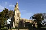 Church of St Mary the Virgin |
| Church of St Mary | Woodford | Church | Mid 12th century | 23 May 1967 | SP9693876732 52°22′48″N 0°34′38″W |
1225983 | 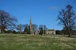 Church of St Mary |
| Glebe Farmhouse | Woodford | Farmhouse | c1260-1320 | 23 May 1967 | SP9692876759 52°22′49″N 0°34′39″W |
1225981 | |
Kettering
| Name | Location | Type | Completed [note 1] | Date designated | Grid ref.[note 2] Geo-coordinates |
Entry number [note 3] | Image |
|---|---|---|---|---|---|---|---|
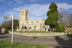
| Church of St Mary | Ashley, Kettering | Church | Late 13th century | 25 February 1957 | SP7942291014 52°30′40″N 0°49′52″W |
1052127 | 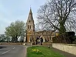 Church of St Mary |
| Church of Saint Botolph | Barton Seagrave, Kettering | Church | Early 12th century | 27 February 1950 | SP8883677087 52°23′05″N 0°41′46″W |
1051640 | 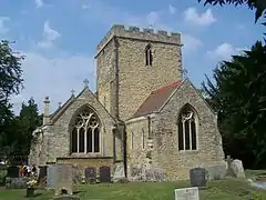 Church of Saint Botolph |
| Church of St Mary | Brampton Ash, Kettering | Church | 13th century | 25 February 1957 | SP7886687480 52°28′46″N 0°50′25″W |
1052135 | |
| Burton Latimer Hall and Wall attached to South | Burton Latimer, Kettering | Country House | Medieval | 18 January 1950 | SP8984875286 52°22′06″N 0°40′54″W |
1372367 | .jpg.webp) Burton Latimer Hall and Wall attached to South |
| Church of St Mary | Burton Latimer, Kettering | Parish Church | 12th century | 18 January 1950 | SP9031475017 52°21′57″N 0°40′30″W |
1372364 | 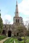 Church of St Mary |
| Church of St Andrew | Cransley, Kettering | Parish Church | Early 14th century | 25 February 1957 | SP8284576523 52°22′50″N 0°47′04″W |
1213539 | 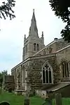 Church of St Andrew |
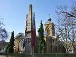
| Anglican and Methodist Church of St Giles | Desborough, Kettering | Cross | Anglo-Saxon | 24 January 1950 | SP8030683056 52°26′23″N 0°49′12″W |
1213584 |  Anglican and Methodist Church of St Giles |
| Flats 1, 2, 3, Porch House, Bell Tower, Cloisters, South Wing, Pediment, Corner House and Tower House at Dingley Hall | Dingley, Kettering | Apartment | Late C20 | 25 October 1951 | SP7710387782 52°28′57″N 0°51′58″W |
1294135 | |
| Church of St Mary Magdalene | Geddington, Kettering | Parish Church | Anglo-Saxon | 25 February 1957 | SP8952483027 52°26′16″N 0°41′04″W |
1052076 | |
| Queen Eleanor's Cross | Geddington, Kettering | Statue | Shortly after 1290 | 25 February 1957 | SP8944683024 52°26′16″N 0°41′08″W |
1286992 | 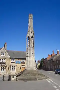 Queen Eleanor's Cross |
| Church of St James | Grafton Underwood, Kettering | Parish Church | Late C12/Early 13th century | 25 February 1957 | SP9219880226 52°24′44″N 0°38′45″W |
1052049 |  Church of St James |
| Dovecote, circa 160 Metres North East of Newton Field Centre | Newton and Little Oakley, Kettering | Dovecote | Late C16/Early 17th century | 25 February 1957 | SP8856083412 52°26′29″N 0°41′55″W |
1192042 | |
| Church of All Saints | Pytchley, Kettering | Church | 19th century | 25 February 1957 | SP8600374776 52°21′51″N 0°44′18″W |
1288885 |  Church of All Saints |
| Church of Holy Trinity | Rothwell, Kettering | Parish Church | 12th century | 12 June 1950 | SP8162081144 52°25′20″N 0°48′04″W |
1288778 |  Church of Holy Trinity |
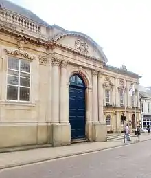
| Rothwell Market House | Rothwell, Kettering | Local Government Office | 1895 | 12 June 1950 | SP8166981209 52°25′22″N 0°48′02″W |
1288812 | 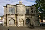 Rothwell Market House |
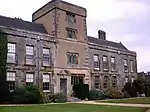
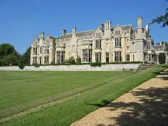
| Rushton Hall School | Rushton, Kettering | Courtyard House | Early 16th century | 25 October 1951 | SP8364682758 52°26′11″N 0°46′16″W |
1192160 | |
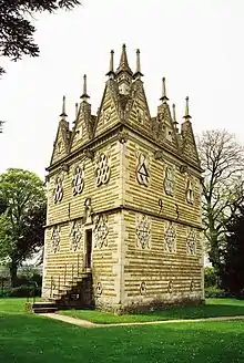
| Rushton Triangular Lodge | Rushton, Kettering | Lodge | 1593-5 | 25 February 1957 | SP8304083072 52°26′22″N 0°46′47″W |
1052038 | |
| Church of St Edmund | Warkton, Kettering | Parish Church | 12th century | 25 February 1957 | SP8930779835 52°24′33″N 0°41′19″W |
1192374 | 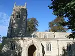 Church of St Edmund |
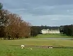
| Boughton House | Boughton Park, Weekley, Kettering | Great House | Early 16th century | 25 October 1951 | SP8997681532 52°25′28″N 0°40′42″W |
1192643 | |
| Church of St Mary | Weekley, Kettering | Parish Church | c. 1100 | 25 February 1957 | SP8883580990 52°25′11″N 0°41′43″W |
1192452 | .jpg.webp) Church of St Mary |
| Stable Block at Boughton House | Boughton Park, Weekley, Kettering | Stable | 1700-4 | 25 October 1951 | SP9007381577 52°25′29″N 0°40′37″W |
1372406 | |
| Church of St Peter and St Paul | Kettering | Church | c. 1300 | 27 February 1950 | SP8673978414 52°23′49″N 0°43′36″W |
1051642 | |
| Orangery at Barton Seagrave Hall | Barton Seagrave, Kettering | Orangery | Late 18th century | 27 February 1950 | SP8868077336 52°23′13″N 0°41′54″W |
1051650 | |
.jpg.webp)
Northampton
| Name | Location | Type | Completed [note 1] | Date designated | Grid ref.[note 2] Geo-coordinates |
Entry number [note 3] | Image |
|---|---|---|---|---|---|---|---|
| Church of St Andrew | Great Billing, Billing, Northampton | Church | 12th century or earlier | 3 May 1968 | SP8081062910 52°15′30″N 0°49′03″W |
1039722 | .jpg.webp) Church of St Andrew |
| Church of Saint Luke | Duston, Northampton | Church | 12th century | 9 December 1968 | SP7249561050 52°14′34″N 0°56′23″W |
1039755 | 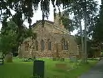 Church of Saint Luke |
| Church of Saint Michael | Upton, Northampton | Church | 12th century | 3 May 1968 | SP7174760235 52°14′08″N 0°57′03″W |
1372152 | |
| Upton Hall (Quinton House School) | Upton, Northampton | Country House | Mid 18th century | 3 May 1968 | SP7165660210 52°14′08″N 0°57′08″W |
1039760 | 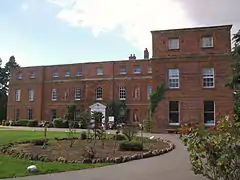 Upton Hall (Quinton House School) |
| Church of St George | Wootton, Northampton | Church | 13th century | 3 May 1968 | SP7624056530 52°12′06″N 0°53′09″W |
1293986 | 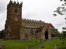 Church of St George |
| Abington Abbey (museum) | Abington Park, Northampton | House | Early 16th century | 19 January 1952 | SP7747861497 52°14′46″N 0°52′00″W |
1039763 | 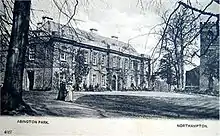 Abington Abbey (museum) |
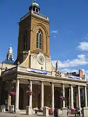
| Church of All Saints | Northampton | Church | Medieval | 19 January 1952 | SP7545760447 52°14′13″N 0°53′47″W |
1372129 | |
| Church of St Giles | Northampton | Church | 12th century | 19 January 1952 | SP7591260576 52°14′17″N 0°53′23″W |
1052403 | 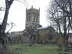 Church of St Giles |
| Church of St John the Baptist | Kingsthorpe, Northampton | Church | LATE SAXON OR EARLY NORMAN | 19 January 1952 | SP7466863116 52°15′40″N 0°54′27″W |
1190502 | 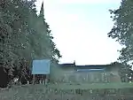 Church of St John the Baptist |
| Church of St Peter | Northampton | Church | SAXON ORIGINS | 19 January 1952 | SP7497960376 52°14′11″N 0°54′12″W |
1052417 | 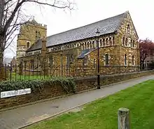 Church of St Peter |
| Church of the Holy Sepulchre | Northampton | Parish Church | About 1100 | 19 January 1952 | SP7539160939 52°14′29″N 0°53′50″W |
1052407 | |
| Sessions House | Northampton | House | 1676-1678 | 19 January 1952 | SP7551060426 52°14′13″N 0°53′44″W |
1039664 | |
| St John's Hall | Northampton | Church Hall | 14th century | 19 January 1952 | SP7541360176 52°14′05″N 0°53′50″W |
1039750 | 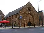 St John's Hall |
| St John's Roman Catholic Church | Northampton | Roman Catholic Church | 15th century | 19 January 1952 | SP7542660187 52°14′05″N 0°53′49″W |
1039749 | 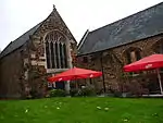 St John's Roman Catholic Church |
| The Eleanor Cross | Northampton | Cross | 1877 | 9 December 1968 | SP7542458222 52°13′01″N 0°53′51″W |
1039797 | |
| The Town and County War Memorial | Northampton | War memorial | 1926 | 28 October 2015 | SP7549660465 52°14′14″N 0°53′45″W |
1191327 |
South Northamptonshire
| Name | Location | Type | Completed [note 1] | Date designated | Grid ref.[note 2] Geo-coordinates |
Entry number [note 3] | Image |
|---|---|---|---|---|---|---|---|
| Church of St Leonard | Aston Le Walls, South Northamptonshire | Church | C12/C13 | 4 February 1969 | SP4955550808 52°09′12″N 1°16′38″W |
1040412 | 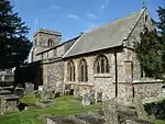 Church of St Leonard |
| Aynhoe Park | Aynho, South Northamptonshire | Country house | Early 17th century | 11 September 1953 | SP5136633030 51°59′36″N 1°15′12″W |
1040532 | |
| Church of St Michael | Aynho, South Northamptonshire | Parish Church | 14th century | 4 February 1969 | SP5145133060 51°59′37″N 1°15′07″W |
1371796 | .jpg.webp) Church of St Michael |
| Church of St John the Baptist | Upper Boddington, Boddington, South Northamptonshire | Church | 13th century | 4 February 1969 | SP4824453189 52°10′29″N 1°17′45″W |
1041214 | 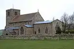 Church of St John the Baptist |
| Church of St Peter | Brackley, South Northamptonshire | Parish Church | Norman | 22 April 1950 | SP5917837303 52°01′52″N 1°08′20″W |
1371808 | 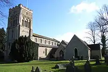 Church of St Peter |
| Castle Ashby | Castle Ashby Park, Castle Ashby, South Northamptonshire | Country House | 1574-c1600 | 3 May 1968 | SP8626959249 52°13′29″N 0°44′18″W |
1371298 | |
| Church of St Mary Magdalen | Castle Ashby Park, Castle Ashby, South Northamptonshire | Church | 14th century | 3 May 1968 | SP8636659137 52°13′25″N 0°44′13″W |
1294095 |  Church of St Mary Magdalen |
| Church of St Peter and St Paul | Chacombe, South Northamptonshire | Church | Early 14th century | 4 February 1969 | SP4907443947 52°05′30″N 1°17′06″W |
1041190 | 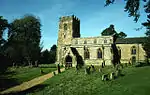 Church of St Peter and St Paul |
| Church of St James | Chipping Warden and Edgcote, South Northamptonshire | Church | Early 13th century | 4 February 1969 | SP5050247906 52°07′38″N 1°15′49″W |
1041169 | 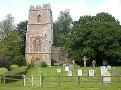 Church of St James |
| Church of St Peter and St Paul | Chipping Warden and Edgcote, South Northamptonshire | Church | Late 13th century | 4 February 1969 | SP4989248700 52°08′04″N 1°16′21″W |
1041206 | 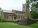 Church of St Peter and St Paul |
| Edgcote House | Chipping Warden and Edgcote, South Northamptonshire | Country House | 1748-54 | 11 September 1953 | SP5053147958 52°07′39″N 1°15′48″W |
1041170 | |
| Church of St Mary the Virgin | Whiston, Cogenhoe and Whiston, South Northamptonshire | Church | Early 16th century pre 1534 | 3 May 1968 | SP8519360520 52°14′11″N 0°45′14″W |
1190018 | 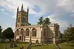 Church of St Mary the Virgin |
| Church of St Peter and St Paul | Cosgrove, South Northamptonshire | Church | 13th century | 17 May 1960 | SP7909242457 52°04′29″N 0°50′51″W |
1040847 | 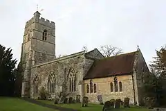 Church of St Peter and St Paul |
| Church of All Saints | Croughton, South Northamptonshire | Parish Church | 12th century | 4 February 1969 | SP5458333550 51°59′52″N 1°12′23″W |
1192503 | 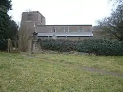 Church of All Saints |
| Church of St Mary | Easton Neston Park, Easton Neston, South Northamptonshire | Church | 13th century | 17 May 1960 | SP7021449182 52°08′11″N 0°58′32″W |
1189210 | 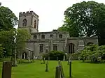 Church of St Mary |
| Easton Neston House, and Attached Wing | Easton Neston Park, Easton Neston, South Northamptonshire | House | c1685-1695 | 1 December 1951 | SP7015749303 52°08′15″N 0°58′35″W |
1189225 | 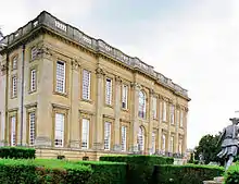 Easton Neston House, and Attached Wing |
| Garden House at Easton Neston House | Easton Neston Park, Easton Neston, South Northamptonshire | Garden House | 1641 | 1 December 1951 | SP7031649449 52°08′20″N 0°58′26″W |
1040989 | |
| Left Gatepier of Original Entry to West of Easton Neston House | Easton Neston Park, Easton Neston, South Northamptonshire | Gate Pier | Mid 17th century | 1 December 1951 | SP6989749348 52°08′17″N 0°58′48″W |
1040990 | |
| Right Gatepier of Original Entry to West of Easton Neston House | Easton Neston Park, Easton Neston, South Northamptonshire | Gate Pier | Mid 17th century | 1 December 1951 | SP6990349304 52°08′15″N 0°58′48″W |
1294338 | |
| Eydon Hall | Eydon, South Northamptonshire | Country House | 1789-91 | 11 September 1953 | SP5397849791 52°08′38″N 1°12′45″W |
1040463 | |
| Chapel of St Peter | Steane, Farthinghoe, South Northamptonshire | Chapel | 13th century | 4 February 1969 | SP5545339020 52°02′49″N 1°11′34″W |
1371825 | |
| Church of St Michael | Farthinghoe, South Northamptonshire | Church | 1654 | 4 February 1969 | SP5361939791 52°03′14″N 1°13′10″W |
1192622 | 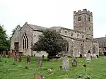 Church of St Michael |
| Gayton Manor House | Gayton, South Northamptonshire | House | mid-late 16th century | 1 December 1951 | SP7056754833 52°11′14″N 0°58′09″W |
1293835 | |
| Church of St Bartholomew | Greens Norton, South Northamptonshire | Church | Mid 10th century to 11th century | 17 May 1960 | SP6690849902 52°08′36″N 1°01′25″W |
1040874 | .jpg.webp) Church of St Bartholomew |
| Church of Holy Trinity | Hinton-in-the-Hedges, South Northamptonshire | Church | 12th century | 4 February 1969 | SP5580636941 52°01′41″N 1°11′17″W |
1040479 | 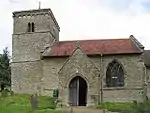 Church of Holy Trinity |
| Church of St Peter and St Paul | Kings Sutton, South Northamptonshire | Church | 12th century | 4 February 1969 | SP4974836114 52°01′16″N 1°16′35″W |
1226135 |  Church of St Peter and St Paul |
| Church of St Luke | Kislingbury, South Northamptonshire | Parish Church | 14th century | 3 May 1968 | SP6972159655 52°13′50″N 0°58′50″W |
1041048 | 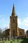 Church of St Luke |
| Church of St Lawrence | Marston St. Lawrence, South Northamptonshire | Parish Church | 13th century and 14th century | 4 February 1969 | SP5362242075 52°04′28″N 1°13′09″W |
1371489 | 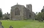 Church of St Lawrence |
| Church of All Saints | Middleton Cheney, South Northamptonshire | Church | Early 14th century | 4 February 1969 | SP4985142032 52°04′28″N 1°16′27″W |
1371514 | 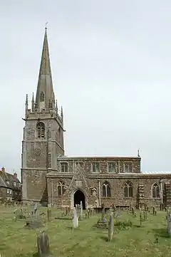 Church of All Saints |
| Church of St Guthlac | Passenham, Old Stratford, South Northamptonshire | Church | 13th century | 17 May 1960 | SP7803139438 52°02′52″N 0°51′49″W |
1041642 | 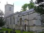 Church of St Guthlac |
| Two Barns at the Manor House | Passenham, Old Stratford, South Northamptonshire | Barn | Early 17th century | 1 December 1951 | SP7798539514 52°02′55″N 0°51′51″W |
1293550 | |
| The Chain Gate and Lodges and Attached Walls, Piers, Standards and Chains | Paulerspury, South Northamptonshire | Gate Lodge | 1822-3 | 1 December 1951 | SP7042947618 52°07′21″N 0°58′22″W |
1041106 | |
| Church of St Lawrence | Radstone, South Northamptonshire | Church | 12th century | 4 February 1969 | SP5879340523 52°03′36″N 1°08′38″W |
1190302 | 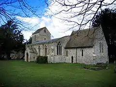 Church of St Lawrence |
| The Monastery | Shutlanger, South Northamptonshire | Farmhouse | Early 14th century | 1 December 1951 | SP7311449973 52°08′36″N 0°55′59″W |
1189534 | |
| Church of St Botolph | Slapton, South Northamptonshire | Church | Early 13th century | 17 May 1960 | SP6401246885 52°07′00″N 1°04′00″W |
1189807 | 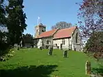 Church of St Botolph |
| The Manor House and attached Brewhouse | Sulgrave, South Northamptonshire | Farmhouse | Late 18th century | 4 February 1969 | SP5607945589 52°06′21″N 1°10′57″W |
1371865 | 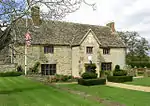 The Manor House and attached Brewhouse |
| Church of St Mary | Thenford, South Northamptonshire | Church | Late 12th century | 4 February 1969 | SP5189741533 52°04′11″N 1°14′39″W |
1371503 | _St_Mary's_Church_-_geograph.org.uk_-_69024.jpg.webp) Church of St Mary |
| Thenford House | Thenford, South Northamptonshire | Country House | 1761-5 | 11 September 1953 | SP5218641797 52°04′20″N 1°14′24″W |
1190951 | |
| Church of St John the Baptist | Thorpe Mandeville, South Northamptonshire | Church | 14th century | 4 February 1969 | SP5322044954 52°06′01″N 1°13′28″W |
1293503 |  Church of St John the Baptist |
| Church of St Lawrence | Towcester, South Northamptonshire | Church | 13th century | 17 May 1960 | SP6941048704 52°07′56″N 0°59′15″W |
1371638 | 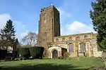 Church of St Lawrence |
| The Court Parlour | Yardley Hastings, South Northamptonshire | Cross Passage House | Late 14th century | 3 May 1968 | SP8661457091 52°12′19″N 0°44′02″W |
1190579 | |
.jpg.webp)
.jpg.webp)
.jpg.webp)
Wellingborough
| Name | Location | Type | Completed [note 1] | Date designated | Grid ref.[note 2] Geo-coordinates |
Entry number [note 3] | Image |
|---|---|---|---|---|---|---|---|
| Church of St Mary | Bozeat, Wellingborough | Church | 12th century | 28 May 1954 | SP9061659204 52°13′25″N 0°40′29″W |
1040795 |  Church of St Mary |
| Church of All Saints | Earls Barton, Wellingborough | Church | Late 10th century | 28 May 1954 | SP8519063814 52°15′57″N 0°45′11″W |
1294226 |  Church of All Saints |
| Church of St Peter and St Paul | Easton Maudit, Wellingborough | Church | Late 13th century | 28 May 1954 | SP8886458819 52°13′14″N 0°42′02″W |
1189610 | 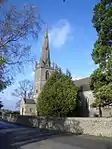 Church of St Peter and St Paul |
| Church of St Mary Magdalene | Ecton, Wellingborough | Church | 13th century | 28 May 1954 | SP8286163547 52°15′50″N 0°47′14″W |
1294128 |  Church of St Mary Magdalene |
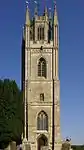
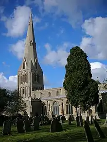
| Church of St Mary the Virgin | Finedon, Wellingborough | Church | Mid 14th century | 23 September 1950 | SP9123971966 52°20′18″N 0°39′44″W |
1371745 |  Church of St Mary the Virgin |
| The Old Vicarage | Great Doddington, Wellingborough | Manor House | 16th century | 28 May 1954 | SP8817164825 52°16′28″N 0°42′33″W |
1371672 | |
| Harrowden Hall (Wellingborough Golf Club) | The Slips, Great Harrowden, Wellingborough | Country House | 15th century | 28 May 1954 | SP8819470855 52°19′43″N 0°42′26″W |
1040730 |  Harrowden Hall (Wellingborough Golf Club) |
| Church of St Katherine | Irchester, Wellingborough | Church | Late 12th century | 28 May 1954 | SP9256466010 52°17′04″N 0°38′40″W |
1040713 | .jpg.webp) Church of St Katherine |
| Church of All Hallows | Wellingborough | Church | c. 1070 | 23 September 1950 | SP8918067960 52°18′09″N 0°41′37″W |
1371761 | 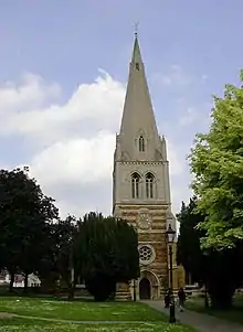 Church of All Hallows |
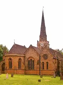
| Church of St Mary the Virgin | Wellingborough | Village Hall | 1908 TO 1930 | 9 June 1970 | SP9013068043 52°18′11″N 0°40′47″W |
1371787 | 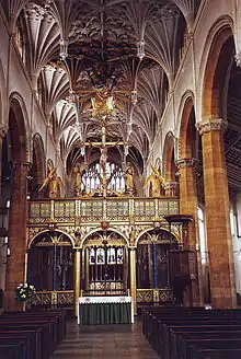 Church of St Mary the Virgin |
| Tithe Barn | Wellingborough | Public Hall | C20 | 23 September 1950 | SP8912567744 52°18′02″N 0°41′40″W |
1293485 |  Tithe Barn |
Notes
- The date given is the date used by Historic England as significant for the initial building or that of an important part in the structure's description.
- Sometimes known as OSGB36, the grid reference is based on the British national grid reference system used by the Ordnance Survey.
- The "List Entry Number" is a unique number assigned to each listed building and scheduled monument by Historic England.
References
External links
![]() Media related to Grade I listed buildings in Northamptonshire at Wikimedia Commons
Media related to Grade I listed buildings in Northamptonshire at Wikimedia Commons
This article is issued from Wikipedia. The text is licensed under Creative Commons - Attribution - Sharealike. Additional terms may apply for the media files.