Grade I listed buildings in Staffordshire
There are over 9000 Grade I listed buildings in England. This page is a list of these buildings in the county of Staffordshire, by district.
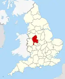
Staffordshire shown within England
City of Stoke-on-Trent
| Name | Location | Type | Completed [note 1] | Date designated | Grid ref.[note 2] Geo-coordinates |
Entry number [note 3] | Image |
|---|---|---|---|---|---|---|---|
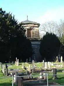
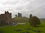
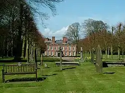
| Trentham Mausoleum | Trentham | Mausoleum | c. 1808 | 19 April 1972 | SJ8680441062 52°58′00″N 2°11′53″W |
1210451 |
East Staffordshire

Aug2006.jpg.webp)


Lichfield District


.JPG.webp)
Newcastle-under-Lyme
| Name | Location | Type | Completed [note 1] | Date designated | Grid ref.[note 2] Geo-coordinates |
Entry number [note 3] | Image |
|---|---|---|---|---|---|---|---|
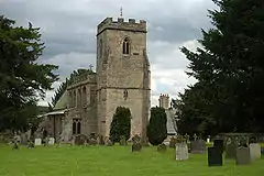
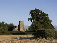
| Church of St Margaret | Betley | Parish Church | 17th century | 17 November 1966 | SJ7556348459 53°01′58″N 2°21′57″W |
1038581 | 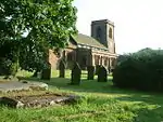 Church of St Margaret |
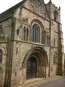
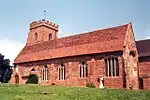
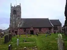
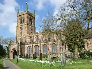
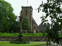
| Church of All Saints | Madeley | Parish Church | 12th century | 17 November 1966 | SJ7730144377 52°59′46″N 2°20′23″W |
1206195 | 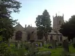 Church of All Saints |
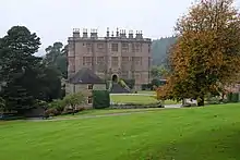
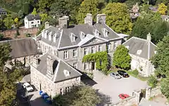
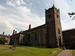
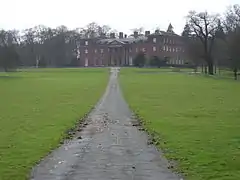
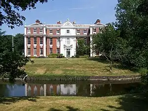
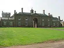
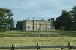
| Whitmore Hall | Whitmore | House | Late 19th century | 2 December 1952 | SJ8109041266 52°58′06″N 2°16′59″W |
1206579 |
South Staffordshire

.jpg.webp)

Stafford Borough


.jpg.webp)
.jpg.webp)
.jpg.webp)
.jpg.webp)


_All_Saints_Church_-_geograph.org.uk_-_69760.jpg.webp)
.jpg.webp)
Staffordshire Moorlands
| Name | Location | Type | Completed [note 1] | Date designated | Grid ref.[note 2] Geo-coordinates |
Entry number [note 3] | Image |
|---|---|---|---|---|---|---|---|
| Church of St Peter | Alstonefield | Cross | 12th century | 1 February 1967 | SK1328055347 53°05′43″N 1°48′11″W |
1038158 | |
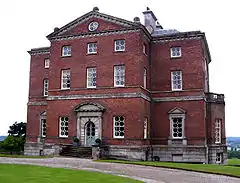
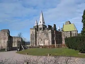
| Alton Castle | Alton | Castle | Late 12th century | 3 January 1967 | SK0725342455 52°58′46″N 1°53′36″W |
1374687 | |
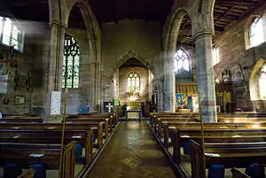
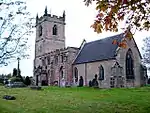
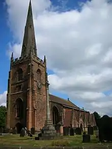
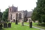
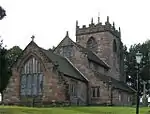
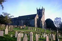
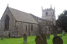
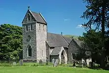
| Church of St Bartholomew | Blore | Parish Church | 13th century | 3 January 1967 | SK1373949324 53°02′28″N 1°47′48″W |
1191405 | 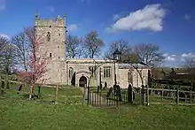 Church of St Bartholomew |
| Caverswall Castle, screen walls, gatehouse and bridge | Caverswall | Castle | 1615 | 2 May 1953 | SJ9508342808 52°58′57″N 2°04′29″W |
1038000 | 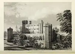 Caverswall Castle, screen walls, gatehouse and bridge |
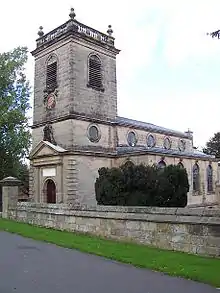
| St. Giles' Catholic Church, Cheadle | Cheadle | Roman Catholic Church | 1841-6 | 3 January 1967 | SK0083643189 52°59′10″N 1°59′20″W |
1038008 | |
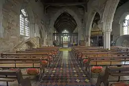
| St Mary's and All Saints' Church | Checkley | Parish Church | 12th century | 3 January 1967 | SK0279837889 52°56′18″N 1°57′35″W |
1037959 | |
| Church of the Holy Cross | Ilam Park, Ilam | Parish Church | 11th century | 1 February 1967 | SK1326950697 53°03′12″N 1°48′13″W |
1038155 | |
| Cross shaft approximately 15 yards south of south porch of Church of the Holy Cross | Ilam Park, Ilam | Cross | 10th century | 1 February 1967 | SK1326250676 53°03′11″N 1°48′13″W |
1038113 |  Cross shaft approximately 15 yards south of south porch of Church of the Holy Cross |
| Cross shaft approximately 7 yards south of St Bertrams Chapel, Church of the Holy Cross | Ilam Park, Ilam | Cross | 10th century | 1 February 1967 | SK1327550681 53°03′12″N 1°48′12″W |
1188671 |  |
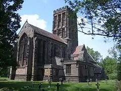
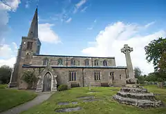
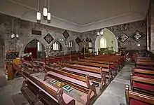
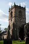
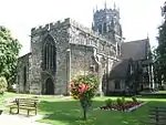
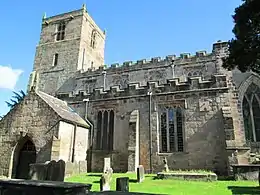
| Parish Church of All Saints | Leek | Parish Church | 1887 | 13 April 1951 | SJ9849956125 53°06′08″N 2°01′26″W |
1268538 |

.jpg.webp)
Tamworth
| Name | Location | Type | Completed [note 1] | Date designated | Grid ref.[note 2] Geo-coordinates |
Entry number [note 3] | Image |
|---|---|---|---|---|---|---|---|
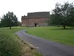
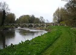
| Causeway walls to north east of Tamworth Castle | Tamworth | Wall | Late 11th century | 11 May 1950 | SK2066703928 52°37′58″N 1°41′46″W |
1297334 | 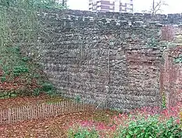 Causeway walls to north east of Tamworth Castle |
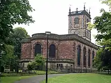
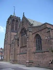
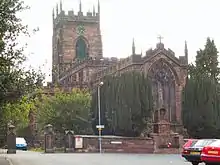
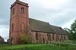
| Church of St Editha | Tamworth | Church | Late 14th century | 11 May 1950 | SK2078404090 52°38′03″N 1°41′40″W |
1207856 | |
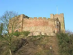
| Tamworth Castle | Tamworth | Castle | Late 11th century | 11 May 1950 | SK2061303913 52°37′57″N 1°41′49″W |
1197020 |

References
Notes
- The date given is the date used by Historic England as significant for the initial building or that of an important part in the structure's description.
- Sometimes known as OSGB36, the grid reference is based on the British national grid reference system used by the Ordnance Survey.
- The "List Entry Number" is a unique number assigned to each listed building and scheduled monument by Historic England.
External links
![]() Media related to Grade I listed buildings in Staffordshire at Wikimedia Commons
Media related to Grade I listed buildings in Staffordshire at Wikimedia Commons
This article is issued from Wikipedia. The text is licensed under Creative Commons - Attribution - Sharealike. Additional terms may apply for the media files.