Grade I listed buildings in Surrey
Over six thousand Grade I listed buildings are in England (the top grade). This page lists the 105 in the county of Surrey, ordered by district. Of the eleven districts comprising Surrey, Epsom and Ewell has none. Such items which are bridges, are a 13th century set of four, sponsored by Waverley Abbey, Tilford, Elstead and Eashing bridges.
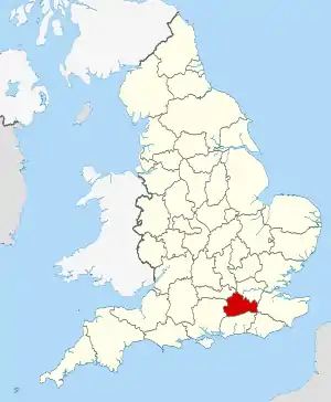
Surrey shown within England
Nine Grade I listed parks and gardens are in Surrey; not listed on this tally and page.
Elmbridge

.jpg.webp)

Guildford
| Name | Location | Type | Completed [note 1] | Date designated | Grid ref.[note 2] Geo-coordinates |
Entry number [note 3] | Image |
|---|---|---|---|---|---|---|---|
| Old St Peter and St Paul's Church, Albury | Albury, GUILDFORD | Parish Church | 14th century | 14 June 1967 | TQ0632047848 51°13′12″N 0°28′44″W |
1294958 | |
| Chapel of St Catherine | Artington, GUILDFORD | Chapel | Early 14th century | 14 June 1967 | SU9934348190 51°13′27″N 0°34′44″W |
1377750 | |
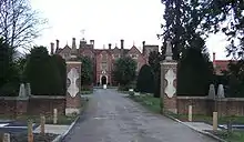
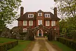
| Loseley House | Artington, GUILDFORD | Country House | 1562-1569 | 18 February 1958 | SU9749547149 51°12′55″N 0°36′20″W |
1029573 | |
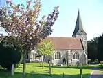
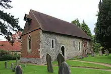
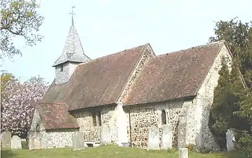
| Church of St Nicholas | Compton, GUILDFORD | Church | 11th century | 14 June 1967 | SU9544547021 51°12′52″N 0°38′06″W |
1188621 |  Church of St Nicholas |
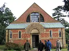
| Watts Mortuary Chapel | Compton, GUILDFORD | Chapel | 1896-1898 | 14 June 1967 | SU9563147397 51°13′04″N 0°37′56″W |
1029541 | |
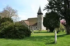
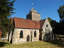
| Church of St Thomas of Canterbury | East Clandon, GUILDFORD | Church | 13th century | 14 June 1967 | TQ0601751736 51°15′18″N 0°28′56″W |
1029446 |  Church of St Thomas of Canterbury |
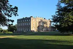
| Hatchlands Park | East Clandon, GUILDFORD | Country House | 1756-7 | 14 June 1967 | TQ0673352009 51°15′26″N 0°28′19″W |
1294970 | |
| Church of All Saints | Ockham, WOKING | Church | 14th century | 14 June 1967 | TQ0665056538 51°17′53″N 0°28′18″W |
1188424 | 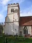 Church of All Saints |
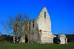
| Newark Priory | Ripley, WOKING | Priory | 13th century | 14 June 1967 | TQ0417257699 51°18′32″N 0°30′25″W |
1377835 | |
| Eashing Bridge | Lower Eashing, Shackleford, GODALMING | Bridge | 13th century | 14 June 1967 | SU9466843811 51°11′09″N 0°38′49″W |
1377743 | |
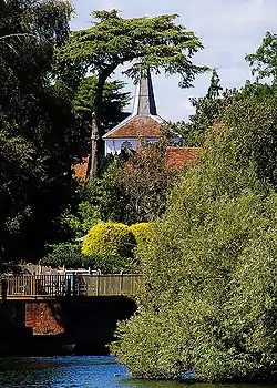
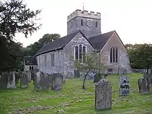
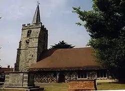
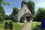
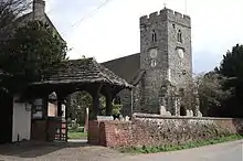
| Church of St Mary | Holmbury St Mary, Shere, GUILDFORD | Church | 1879 | 14 June 1967 | TQ1098944426 51°11′18″N 0°24′48″W |
1029485 | _(2).jpg.webp) Church of St Mary |
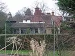
| Holmdale | Holmbury St Mary, Shere, GUILDFORD | Country House | 1873 | 14 June 1967 | TQ1107343800 51°10′58″N 0°24′44″W |
1029481 |  |
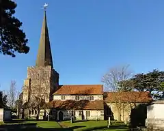
| Church of St James | Shere, GUILDFORD | Church | 12th century | 14 June 1967 | TQ0743647781 51°13′09″N 0°27′47″W |
1377794 | 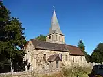 Church of St James |
| Church of St Bartholomew | Wanborough, GUILDFORD | Church | 12th-century origin | 14 June 1967 | SU9349048903 51°13′54″N 0°39′45″W |
1287038 | |
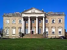
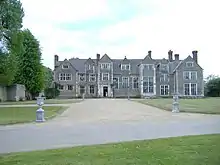
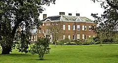
| Clandon Park | West Clandon, GUILDFORD | Country House | 1725-31 | 14 June 1967 | TQ0421051218 51°15′02″N 0°30′30″W |
1294591 | |
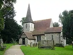
| Church of St Mary the Virgin | West Horsley, GUILDFORD | Church | 12th century | 14 June 1967 | TQ0883352643 51°15′45″N 0°26′30″W |
1377828 | 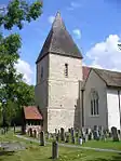 Church of St Mary the Virgin |
| West Horsley Place | West Horsley, GUILDFORD | House | Early 17th century | 14 June 1967 | TQ0880053011 51°15′57″N 0°26′31″W |
1188949 | |
| Wisley Church | Wisley, WOKING | Church | 12th century | 14 June 1967 | TQ0568759610 51°19′33″N 0°29′04″W |
1294423 | 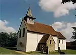 Wisley Church |
| Church of St Mary the Virgin | Worplesdon, GUILDFORD | Church | 13th century | 14 June 1967 | SU9729253574 51°16′23″N 0°36′24″W |
1377735 | 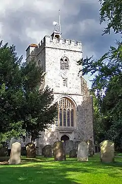 Church of St Mary the Virgin |
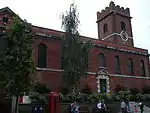
| Church of Holy Trinity | Guildford | Church | c. 1540 | 1 May 1953 | SU9988149499 51°14′09″N 0°34′15″W |
1029258 | |
| Church of St Mary | Guildford | Church | c. 1040 | 1 May 1953 | SU9961449344 51°14′05″N 0°34′28″W |
1377918 | 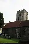 Church of St Mary |
| Former royal apartments at Guildford Castle | Guildford | Castle | Late 12th century | 1 May 1953 | SU9972049256 51°14′02″N 0°34′23″W |
1029306 | .jpg.webp) Former royal apartments at Guildford Castle |
| Guildford Castle Keep | Guildford | Castle | Mid-12th century | 1 May 1953 | SU9976849312 51°14′03″N 0°34′21″W |
1377881 | 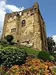 Guildford Castle Keep |
| Remains of shell keep at Guildford Castle | Guildford | Shell Keep | Early 12th century | 1 May 1953 | SU9976149297 51°14′03″N 0°34′21″W |
1177988 | .jpg.webp) Remains of shell keep at Guildford Castle |
| Guildford Castle gateway and walls adjoining to the east and south | Guildford | Castle | Mid-13th century | 1 May 1953 | SU9969649237 51°14′01″N 0°34′24″W |
1029253 | .jpg.webp) Guildford Castle gateway and walls adjoining to the east and south |
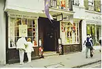
| Guildford House | Guildford | Jettied House | c. 1660 | 1 May 1953 | SU9982549515 51°14′10″N 0°34′17″W |
1180153 | |
| Hospital of the Blessed Holy Trinity | Guildford | Almshouse | 1619-1622 | 1 May 1953 | SU9986149532 51°14′10″N 0°34′16″W |
1029289 | |
| Somerset House | Guildford | Town House | Late 17th century | 1 May 1953 | TQ0003949602 51°14′13″N 0°34′06″W |
1029265 | .jpg.webp) Somerset House |
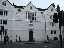
| Guildford Grammar School | Guildford | School | 1557 | 1 May 1953 | TQ0001149575 51°14′12″N 0°34′08″W |
1294936 | |
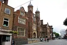
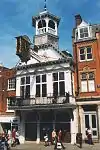
| Guildford Guildhall | Guildford | Guildhall | c. 1550 | 1 May 1953 | SU9976449492 51°14′09″N 0°34′21″W |
1180101 |


Mole Valley
| Name | Location | Type | Completed [note 1] | Date designated | Grid ref.[note 2] Geo-coordinates |
Entry number [note 3] | Image |
|---|---|---|---|---|---|---|---|
| Church of St Michael | Betchworth, REIGATE | Church | 13th century | 11 November 1966 | TQ2105949702 51°14′01″N 0°16′03″W |
1378131 | |
| Church of Saint Nicholas | Charlwood, HORLEY | Church | 15th century | 11 November 1966 | TQ2405041111 51°09′21″N 0°13′39″W |
1248610 | |
| Church of St John the Evangelist | Wotton, DORKING | Church | 13th century | 11 November 1966 | TQ1256847977 51°13′12″N 0°23′22″W |
1294098 | 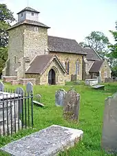 Church of St John the Evangelist |
| Church of St Nicholas | Great Bookham, LEATHERHEAD | Church | 15th century | 7 September 1951 | TQ1350454660 51°16′47″N 0°22′26″W |
1028641 | .JPG.webp) Church of St Nicholas |
| Slyfield Farmhouse, with attached garden wall | Fetcham (extreme north), LEATHERHEAD | Farmhouse | 18th century | 7 September 1951 | TQ1332757904 51°18′32″N 0°22′32″W |
1028670 | 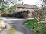 Slyfield Farmhouse, with attached garden wall |
| Slyfield Manor or House, with attached garden walls | Fetcham (extreme north), LEATHERHEAD | House | 17th century | 7 September 1951 | TQ1335857878 51°18′31″N 0°22′30″W |
1294510 | 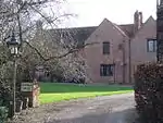 Slyfield Manor or House, with attached garden walls |

Reigate and Banstead
| Name | Location | Type | Completed [note 1] | Date designated | Grid ref.[note 2] Geo-coordinates |
Entry number [note 3] | Image |
|---|---|---|---|---|---|---|---|
| Church of St Bartholomew | Horley | Church | Early 14th century | 11 November 1966 | TQ2763342758 51°10′11″N 0°10′33″W |
1378035 | _(May_2012).JPG.webp) Church of St Bartholomew |
| Church of Jesus Christ and the Wisdom of God | Lower Kingswood, TADWORTH | Church | 1891 | 29 September 1983 | TQ2486353750 51°16′09″N 0°12′42″W |
1029052 | |
| Church of St Andrew | Merstham, REDHILL | Church | 13th century | 19 October 1951 | TQ2753152875 51°15′39″N 0°10′25″W |
1294726 | |
| Church of St Margaret | Hooley, COULSDON | Church | 12th century | 24 July 1954 | TQ2833956401 51°17′32″N 0°09′39″W |
1029041 | 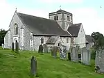 Church of St Margaret |
| Reigate Priory | Reigate | Priory | 13th century | 19 October 1951 | TQ2531850004 51°14′08″N 0°12′23″W |
1188089 | 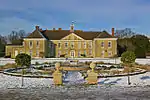 Reigate Priory |
| Tadworth Court | Tadworth | Country House | c. 1700 | 12 August 1983 | TQ2387056468 51°17′38″N 0°13′29″W |
1029004 |
.jpg.webp)
Runnymede
| Name | Location | Type | Completed [note 1] | Date designated | Grid ref.[note 2] Geo-coordinates |
Entry number [note 3] | Image |
|---|---|---|---|---|---|---|---|
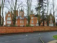
| Former Holloway Sanatorium (Crossland House, Virginia Park) | Virginia Water | Sanatorium | 1873-1885 | 17 November 1986 | TQ0026168257 51°24′16″N 0°33′36″W |
1189632 | |
| Great Fosters | Stroude, EGHAM | House | c. 1550-1600 | 11 July 1951 | TQ0130569674 51°25′01″N 0°32′40″W |
1294166 | |
| Founder's Building, Royal Holloway College | Englefield Green, EGHAM | Courtyard | 1879-87 | 17 November 1986 | SU9974870506 51°25′29″N 0°34′00″W |
1028946 | 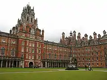 Founder's Building, Royal Holloway College |
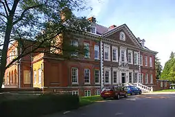
| Runnymede Park | Englefield Green, EGHAM | Country House | 1789-92 | 17 November 1986 | TQ0021471343 51°25′56″N 0°33′35″W |
1028921 | |
Spelthorne
| Name | Location | Type | Completed [note 1] | Date designated | Grid ref.[note 2] Geo-coordinates |
Entry number [note 3] | Image |
|---|---|---|---|---|---|---|---|
| Church of All Saints | Laleham, STAINES-UPON-THAMES | Church | Norman | 11 August 1952 | TQ0512968878 51°24′33″N 0°29′23″W |
1298923 | 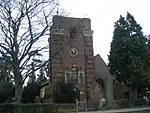 Church of All Saints |
| Church of St Mary | Stanwell, STAINES-UPON-THAMES | Church | 13th century | 11 August 1952 | TQ0571174136 51°27′23″N 0°28′48″W |
1187042 | |
| Church of St Mary Magdalene | Littleton, SHEPPERTON | Church | 12th century | 11 September 1951 | TQ0706868639 51°24′24″N 0°27′43″W |
1377699 | .jpg.webp) Church of St Mary Magdalene |
Surrey Heath
| Name | Location | Type | Completed [note 1] | Date designated | Grid ref.[note 2] Geo-coordinates |
Entry number [note 3] | Image |
|---|---|---|---|---|---|---|---|
| Church of St Lawrence | Chobham, WOKING | Church | 12th century | 28 February 1955 | SU9738061797 51°20′49″N 0°36′11″W |
1377490 |
Tandridge
| Name | Location | Type | Completed [note 1] | Date designated | Grid ref.[note 2] Geo-coordinates |
Entry number [note 3] | Image |
|---|---|---|---|---|---|---|---|
| Brewer Street Farm House | Bletchingley, REDHILL | Farmhouse | 16th century | 11 June 1958 | TQ3238851933 51°15′04″N 0°06′16″W |
1281258 | 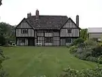 Brewer Street Farm House |
| Church of St Mary the Virgin | Bletchingley, REDHILL | Church | 11th century | 11 June 1958 | TQ3276450849 51°14′29″N 0°05′58″W |
1029972 | 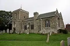 Church of St Mary the Virgin |
| Pendell House | Bletchingley, REDHILL | House | 1636 | 11 June 1958 | TQ3151151890 51°15′04″N 0°07′01″W |
1029987 | |
| Church of St Bartholemew | Burstow, HORLEY | Church | 12th century | 11 June 1958 | TQ3124041296 51°09′21″N 0°07′29″W |
1204775 | 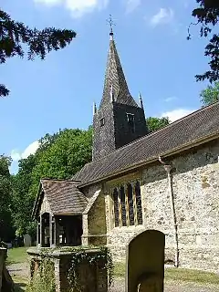 Church of St Bartholemew |
| Church of St Lawrence | Caterham (Caterham-on-the-Hill) | Church | Norman | 21 September 1954 | TQ3358455397 51°16′55″N 0°05′10″W |
1377607 | .JPG.webp) Church of St Lawrence |
| Church of St Peter and St Paul | Chaldon, CATERHAM | Church | 11th century | 21 September 1954 | TQ3087455694 51°17′07″N 0°07′29″W |
1029813 | |
| Church of St Mary the Virgin | Farleigh, Chelsham and Farleigh, CATERHAM | Church | c. 1100 | 19 November 1984 | TQ3723860076 51°19′24″N 0°01′55″W |
1377637 | |
| Crowhurst Place | Crowhurst, LINGFIELD | Country House | 15th century | 9 March 1982 | TQ3864246365 51°11′59″N 0°01′01″W |
1280991 | 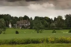 Crowhurst Place |
| Old Surrey Hall | Dormansland, LINGFIELD | Country House | 15th century | 9 March 1982 | TQ4202039958 51°08′29″N 0°01′44″E |
1029883 | |
| Church of St Nicholas | Godstone | Church | 13th century | 11 June 1958 | TQ3572851506 51°14′48″N 0°03′24″W |
1188347 | .JPG.webp) Church of St Nicholas |
| Church of St Peter | Limpsfield, OXTED | Church | 12th century | 11 June 1958 | TQ4050453238 51°15′40″N 0°00′44″E |
1188814 | 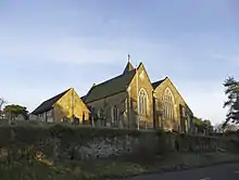 Church of St Peter |
| Old Court Cottage | Limpsfield, OXTED | House | Late 14th century | 11 June 1958 | TQ4049153361 51°15′44″N 0°00′44″E |
1029729 | |
| Stockenden | Limpsfield, OXTED | House | 16th century | 11 June 1958 | TQ4175150087 51°13′57″N 0°01′44″E |
1377651 |  Stockenden |
| Church of St Peter and St Paul | Lingfield | Church | 14th century | 11 June 1958 | TQ3888943775 51°10′35″N 0°00′52″W |
1029906 | |
| Pollard Cottage & Pollard House | Lingfield | House | C20 | 11 June 1958 | TQ3890943719 51°10′33″N 0°00′51″W |
1029911 | |
| St Peter's Cross and Village Cage | Lingfield | Cross and cage | 1773 | 11 June 1958 | TQ3859243570 51°10′28″N 0°01′08″W |
1205403 | |
| Outwood Post Mill | Outwood, REDHILL | Mill | 1665 | 11 June 1958 | TQ3277045551 51°11′38″N 0°06′05″W |
1029961 | |
| Barrow Green Court | Oxted | House | Early 17th century | 11 June 1958 | TQ3800753046 51°15′36″N 0°01′25″W |
1189488 | |
| Church of St Mary the Virgin | Oxted | Church | 12th century | 11 June 1958 | TQ3904552984 51°15′33″N 0°00′31″W |
1189608 | 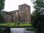 Church of St Mary the Virgin |
| Church of St Peter | Tandridge, OXTED | Church | 12th century | 11 June 1958 | TQ3746151163 51°14′35″N 0°01′55″W |
1189811 | .JPG.webp) Church of St Peter |


.jpg.webp)

.jpg.webp)
Waverley
| Name | Location | Type | Completed [note 1] | Date designated | Grid ref.[note 2] Geo-coordinates |
Entry number [note 3] | Image |
|---|---|---|---|---|---|---|---|
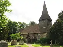
| Church of St Nicholas | Alfold, CRANLEIGH | Church | c. 1100 | 9 March 1960 | TQ0372033973 51°05′45″N 0°31′13″W |
1352752 |  Church of St Nicholas |
| Orchards | Bramley, GUILDFORD | House | 1899 | 9 March 1960 | SU9925843282 51°10′49″N 0°34′53″W |
1378318 | |
| Munstead Wood | Busbridge, GODALMING | Jettied House | 1897 | 9 March 1960 | SU9821142703 51°10′31″N 0°35′47″W |
1261159 | |
| Church of St Mary | Chiddingfold, GODALMING | Church | 17th century | 9 March 1960 | SU9600035394 51°06′35″N 0°37′48″W |
1378327 | 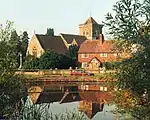 Church of St Mary |
| Church of St Mary and All Saints | Dunsfold, GODALMING | Church | c1270-1290 | 9 March 1960 | SU9983036345 51°07′04″N 0°34′30″W |
1044388 | 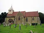 Church of St Mary and All Saints |
| Elstead Bridge | Elstead, GODLAMING | Bridge | 13th century | 9 March 1960 | SU9054143804 51°11′11″N 0°42′21″W |
1044453 | 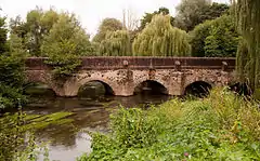 Elstead Bridge |
| Church of St Peter and St Paul | Ewhurst, CRANLEIGH | Church | 12th century | 9 March 1960 | TQ0913640472 51°09′11″N 0°26′27″W |
1190455 |  Church of St Peter and St Paul |
| Church of St Andrew | Farnham | Church | 12th century | 29 December 1972 | SU8386446680 51°12′48″N 0°48′03″W |
1044627 | |
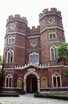
| Farnham Castle (comprising castle buildings to the south only) | Farnham | Castle | 12th century | 26 April 1950 | SU8374447271 51°13′07″N 0°48′08″W |
1044677 | 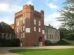 Farnham Castle (comprising castle buildings to the south only) |
| Outer curtain wall and gatehouse at Farnham Castle | Farnham | Gatehouse | Late 12th century to early 13th century | 26 April 1950 | SU8366447340 51°13′09″N 0°48′12″W |
1242110 | 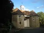 Outer curtain wall and gatehouse at Farnham Castle |
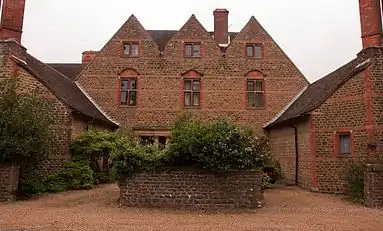
| The Grange | Farnham | House | c.1710 | 26 April 1950 | SU8359447391 51°13′11″N 0°48′16″W |
1044678 | 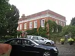 The Grange |
| Willmer House | Farnham | House | 1718 | 26 April 1950 | SU8359746681 51°12′48″N 0°48′16″W |
1258470 | 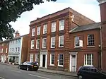 Willmer House |
| Church of St Peter and St Paul | Godalming | Church | 11th century | 18 December 1947 | SU9681444000 51°11′13″N 0°36′58″W |
1044546 | |
| The Almshouses | Wyatt's Close, Godalming | Alms Houses | 1622 | 18 December 1947 | SU9818444808 51°11′39″N 0°35′47″W |
1293743 | 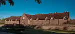 The Almshouses |
| Tigbourne Court | Wormley & Hambledon, GODALMING | House | 1899-1901 | 9 March 1960 | SU9567537910 51°07′57″N 0°38′02″W |
1240229 | |
| Granary at Home Farm | Peper Harow Park, Peper Harow, GODALMING | Granary | 17th century | 9 March 1960 | SU9345944178 51°11′21″N 0°39′51″W |
1294589 | 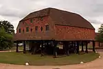 Granary at Home Farm |
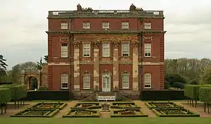
| Peper Harow House | Peper Harow Park, Peper Harow, GODALMING | Country House | 1765-8 | 9 March 1960 | SU9356743929 51°11′13″N 0°39′45″W |
1044443 | |
| Church of St Michael and All Angels | Thursley, GODALMING | Church | Mid-11th century | 9 March 1960 | SU9010139378 51°08′48″N 0°42′48″W |
1260876 | 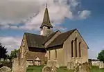 Church of St Michael and All Angels |
| Bridge over the River Wey to North East Side of Green | Tilford, FARNHAM | Bridge | 13th century | 9 March 1960 | SU8738643449 51°11′01″N 0°45′04″W |
1189159 | 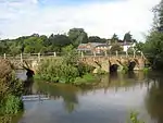 Bridge over the River Wey to North East Side of Green |
| Bridge over the River Wey to the North West Corner of Tilford Green | Tilford, FARNHAM | Bridge | 13th century | 9 March 1960 | SU8717443524 51°11′04″N 0°45′15″W |
1044414 | 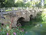 Bridge over the River Wey to the North West Corner of Tilford Green |
| Church of All Saints | Witley, GODALMING | Church | 11th century | 9 March 1960 | SU9466739698 51°08′55″N 0°38′53″W |
1260732 | _-_geograph.org.uk_-_1543211.jpg.webp) Church of All Saints |
| Great Tangley Manor | Wonersh, GUILDFORD | Hall House | 15th century | 9 March 1960 | TQ0196046574 51°12′33″N 0°32′30″W |
1241457 |
_(14740855736).jpg.webp)
_(1).jpg.webp)
_(4).JPG.webp)
Woking
| Name | Location | Type | Completed [note 1] | Date designated | Grid ref.[note 2] Geo-coordinates |
Entry number [note 3] | Image |
|---|---|---|---|---|---|---|---|
| Church of St Mary the Virgin | Byfleet, WEST BYFLEET | Church | 13th century | 22 July 1953 | TQ0628860407 51°19′58″N 0°28′33″W |
1378241 | |
| Church of St Nicholas | Pyrford, WOKING | Church | 12th century | 22 July 1953 | TQ0398758231 51°18′49″N 0°30′34″W |
1044721 | |
| Church of St Peter | Old Woking, WOKING | Church | 1776 | 22 July 1953 | TQ0208456845 51°18′06″N 0°32′13″W |
1044724 | |
| Sutton Place including the service court yard | Woking | House | 17th century | 22 July 1953 | TQ0119553518 51°16′19″N 0°33′03″W |
1236810 | 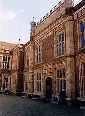 Sutton Place including the service court yard |
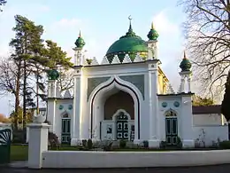
| Shah Jahan Mosque | Woking | Mosque | 1889 | 6 January 1984 | TQ0151459180 51°19′22″N 0°32′40″W |
1264438 |
See also
- Category:Grade I listed buildings in Surrey
- Grade II* listed buildings in Surrey
Notes
- The date given is the date used by Historic England as significant for the initial building or that of an important part in the structure's description.
- Sometimes known as OSGB36, the grid reference is based on the British national grid reference system used by the Ordnance Survey.
- The "List Entry Number" is a unique number assigned to each listed building and scheduled monument by Historic England.
References
External links
![]() Media related to Grade I listed buildings in Surrey at Wikimedia Commons
Media related to Grade I listed buildings in Surrey at Wikimedia Commons
This article is issued from Wikipedia. The text is licensed under Creative Commons - Attribution - Sharealike. Additional terms may apply for the media files.