Grade I listed buildings in Plymouth
There are over 9,000 Grade I listed buildings in England. This page is a list of these buildings in the district of Plymouth in Devon.
City of Plymouth
| Name | Location | Type | Completed [note 1] | Date designated | Grid ref.[note 2] Geo-coordinates |
Entry number [note 3] | Image |
|---|---|---|---|---|---|---|---|
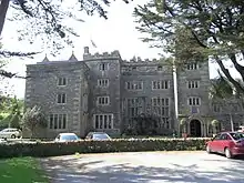
| Boringdon Hall | Boringdon, City of Plymouth | Great House | Medieval | 20 February 1952 | SX5393157780 50°24′06″N 4°03′24″W |
1330575 | |
| Brewhouse Royal William Victualling Yard | Stonehouse, Plymouth | Ordnance Factory | 1929 | 13 August 1999 | SX4601653553 50°21′42″N 4°09′59″W |
1378528 | 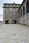 Brewhouse Royal William Victualling Yard |
| Charles Church | City of Plymouth | Parish Church | 1640–1658 | 25 January 1954 | SX4821654605 50°22′18″N 4°08′09″W |
1130021 | |
| Church of St Andrew | City of Plymouth | Parish Church | Mid to Late 15th century | 25 January 1954 | SX4792054395 50°22′11″N 4°08′24″W |
1130012 | 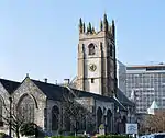 Church of St Andrew |
| Clarence Steps South West Quay Wall and 2 Bollards Royal William Victualling Yard | Stonehouse, Plymouth | Gate | 1826–1831 | 13 August 1999 | SX4595153405 50°21′37″N 4°10′02″W |
1378526 | 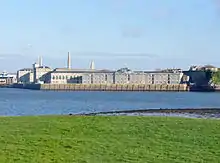 Clarence Steps South West Quay Wall and 2 Bollards Royal William Victualling Yard |
| Clarence Store Royal William Victualling Yard | Stonehouse, Plymouth | Naval Storehouse | 1829–1831 | 13 August 1999 | SX4597153460 50°21′39″N 4°10′01″W |
1378527 | 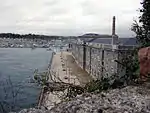 Clarence Store Royal William Victualling Yard |
| Devonport Column | Devonport, City of Plymouth | Column | 1824 | 25 January 1954 | SX4531654402 50°22′09″N 4°10′35″W |
1322008 | |
| Devonport Guildhall and Attached Walls | Devonport, City of Plymouth | Wall | 1821–1822 | 25 January 1954 | SX4532854385 50°22′08″N 4°10′35″W |
1322009 | 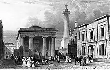 Devonport Guildhall and Attached Walls |
| Dock Basin Walls and 6 Associated Bollards, Royal William Victualling Yard | Stonehouse, Plymouth | Mooring Bollard | 1826–1832 | 13 August 1999 | SX4612253626 50°21′45″N 4°09′53″W |
1378529 | 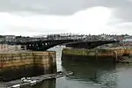 Dock Basin Walls and 6 Associated Bollards, Royal William Victualling Yard |
| East Ropery, Formerly Spinning House (s 132), and Attached Retaining Walls | Devonport Dockyard, City of Plymouth | Fireproof Factory | Rebuilt 1813–1817 | 13 August 1999 | SX4518854215 50°22′03″N 4°10′41″W |
1388400 |  |
| Main Gate, Royal William Victualling Yard | Stonehouse, Plymouth | Gate | 1829–1833 | 13 August 1999 | SX4626053635 50°21′45″N 4°09′46″W |
1378530 | 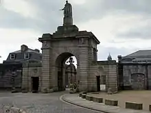 Main Gate, Royal William Victualling Yard |
| Melville, Royal William Victualling Yard | Stonehouse, Plymouth | Fireproof Building | 1828–1832 | 13 August 1999 | SX4616253536 50°21′42″N 4°09′51″W |
1378531 | 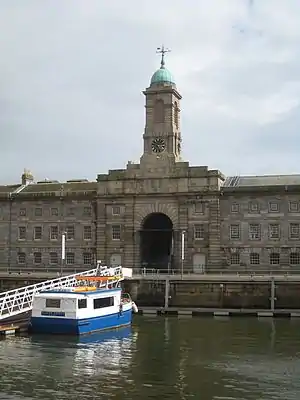 Melville, Royal William Victualling Yard |
| Mills and Bakery, Royal William Victualling Yard | Stonehouse, Plymouth | Bakery | 1830–1834 | 13 August 1999 | SX4618553628 50°21′45″N 4°09′50″W |
1378532 | 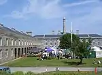 Mills and Bakery, Royal William Victualling Yard |
| North East Quay Wall and 2 Bollards, Royal William Victualling Yard | Stonehouse, Plymouth | Wall | 1826–1831 | 13 August 1999 | SX4612353659 50°21′46″N 4°09′53″W |
1378533 | 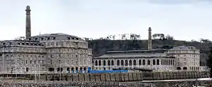 North East Quay Wall and 2 Bollards, Royal William Victualling Yard |
| Oddfellows Hall | Devonport, City of Plymouth | Oddfellows Hall | 1823 | 21 January 1954 | SX4538054413 50°22′09″N 4°10′32″W |
1322006 | |
| Old Cooperage Royal William Victualling Yard | Stonehouse, Plymouth | Ordnance Factory | 1891 | 13 August 1999 | SX4604253476 50°21′40″N 4°09′57″W |
1378536 | 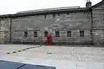 Old Cooperage Royal William Victualling Yard |
| Plympton House | Plympton St Maurice | Country House | 1952 | 23 April 1952 | SX5466055896 50°23′06″N 4°02′45″W |
1113363 | |
| Police Buildings Royal William Victualling Yard | Stonehouse, Plymouth | House | Before 1891 | 13 August 1999 | SX4625653615 50°21′44″N 4°09′47″W |
1378534 |  Police Buildings Royal William Victualling Yard |
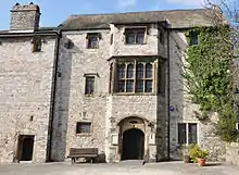
| Prysten House | City of Plymouth | Merchants House | c. 1498 | 25 January 1954 | SX4792354371 50°22′10″N 4°08′23″W |
1067152 | |
| Royal Albert Bridge (that Part in Plymouth Civil Parish) | St Budeaux, City of Plymouth | Railway Bridge | 1857–1859 | 25 January 1954 | SX4366258711 50°24′27″N 4°12′05″W |
1386355 | 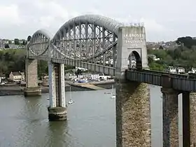 Royal Albert Bridge (that Part in Plymouth Civil Parish) |
| Royal Albert Bridge and 17 Approach Spans | Riverside | Suspension Bridge | 1848 | 17 January 1952 | SX4351558740 50°24′28″N 4°12′13″W |
1159292 | 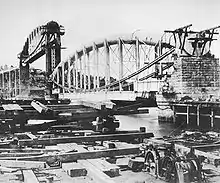 Royal Albert Bridge and 17 Approach Spans |
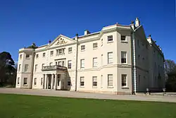
| Saltram House | Saltram Park, City of Plymouth | Country House | 18th century | 23 April 1952 | SX5203855605 50°22′54″N 4°04′57″W |
1386230 | |
| Slaughterhouse and Attached Yard Wall, Royal William Victualling Yard | Stonehouse, Plymouth | Wall | 1830–1831 | 13 August 1999 | SX4620853669 50°21′46″N 4°09′49″W |
1378535 | Slaughterhouse and Attached Yard Wall, Royal William Victualling Yard |
| The Quadrangle (n 173-177, 186-191, 203) | Devonport Dockyard, City of Plymouth | Boiler House | 1852–1861 | 13 August 1999 | SX4490255661 50°22′49″N 4°10′58″W |
1378566 |  The Quadrangle (n 173-177, 186-191, 203) |
| Smeaton's Tower | Hoe, City of Plymouth | Lighthouse | 1759 | 25 January 1954 | SX4776253799 50°21′52″N 4°08′31″W |
1386470 |


Notes
- The date given is the date used by Historic England as significant for the initial building or that of an important part in the structure's description.
- Sometimes known as OSGB36, the grid reference is based on the British national grid reference system used by the Ordnance Survey.
- The "List Entry Number" is a unique number assigned to each listed building and scheduled monument by Historic England.
External links
This article is issued from Wikipedia. The text is licensed under Creative Commons - Attribution - Sharealike. Additional terms may apply for the media files.