Grade I listed buildings in Teignbridge
There are over 9,000 Grade I listed buildings in England. This page is a list of these buildings in the district of Teignbridge in Devon.
Teignbridge
| Name | Location | Type | Completed [note 1] | Date designated | Grid ref.[note 2] Geo-coordinates |
Entry number [note 3] | Image |
|---|---|---|---|---|---|---|---|
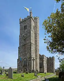
| Church of St Andrew | Ashburton, Teignbridge | Tower | before 1449 | 7 August 1951 | SX7552669760 50°30′52″N 3°45′25″W |
1201040 | 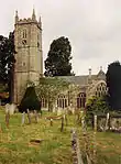 Church of St Andrew |
| Parish Church of St Nectan | Ashcombe, Teignbridge | Parish Church | 13th century | 30 June 1961 | SX9121879559 50°36′20″N 3°32′19″W |
1308702 |  Parish Church of St Nectan |
| Church of St John the Baptist | Higher Ashton, Ashton, Teignbridge | Parish Church | Early 15th century | 30 June 1961 | SX8561484684 50°39′02″N 3°37′10″W |
1097856 | 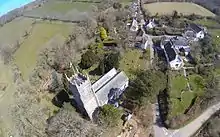 Church of St John the Baptist |
| Church of St Mary the Virgin | Bickington, Teignbridge | Church | late 19th century or early C20 | 23 August 1955 | SX7997072679 50°32′29″N 3°41′43″W |
1097150 | |
| Church of St John the Baptist | Bishopsteignton, Teignbridge | Parish Church | 12th century | 23 August 1955 | SX9109773502 50°33′04″N 3°32′19″W |
1147247 |  Church of St John the Baptist |
| Church of St Peter and St Paul and St Thomas of Canterbury | Bovey Tracey, Teignbridge | Tower | 14th century | 23 August 1955 | SX8207278611 50°35′43″N 3°40′03″W |
1334077 |  Church of St Peter and St Paul and St Thomas of Canterbury |
| Bridford Barton | Bridford, Teignbridge | Farmhouse | Circa early-mid 14th century | 9 March 1988 | SX8162286423 50°39′55″N 3°40′35″W |
1318200 |  |
| Church of St Thomas a Becket | Bridford, Teignbridge | Gate | 19th century | 30 June 1961 | SX8160186381 50°39′54″N 3°40′36″W |
1097825 |  Church of St Thomas a Becket |
| Church of St Peter and St Paul | Broadhempston, Teignbridge | Parish Church | 13th century | 17 July 1987 | SX8011866276 50°29′02″N 3°41′28″W |
1317828 |  Church of St Peter and St Paul |
| Canonteign Barton | Christow, Teignbridge | Manor House | Circa late 16th century | 11 November 1952 | SX8379183124 50°38′10″N 3°38′41″W |
1097834 | |
| Church of Saint James the Apostle | Christow, Teignbridge | Parish Church | 15th century | 30 June 1961 | SX8361385039 50°39′12″N 3°38′52″W |
1163790 | 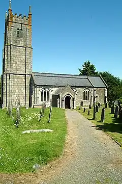 Church of Saint James the Apostle |
| Hill | Christow, Teignbridge | Farmhouse | Former | 9 October 1980 | SX8353184246 50°38′46″N 3°38′55″W |
1097796 | |
| Church of St Mary and St Martin | Chudleigh, Teignbridge | Church | At least 1225 | 23 August 1955 | SX8671479407 50°36′12″N 3°36′08″W |
1164590 |  Church of St Mary and St Martin |
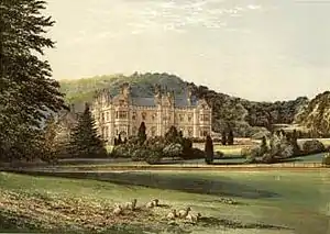
| Ugbrooke Park | Chudleigh, Teignbridge | Country House | Late 16th century | 23 August 1955 | SX8756978053 50°35′29″N 3°35′23″W |
1097135 | |
| Church of St Barthelomew | Coffinswell, Teignbridge | Parish Church | Probably 13th century | 23 August 1955 | SX8912068430 50°30′18″N 3°33′54″W |
1164557 |  Church of St Barthelomew |
| Chapel of St Alban, Luscombe Castle, Including Attached Stables and Other Outbuildings | Dawlish, Teignbridge | Castle | 1800 | 17 July 1951 | SX9429576811 50°34′53″N 3°29′40″W |
1164298 | 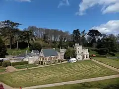 Chapel of St Alban, Luscombe Castle, Including Attached Stables and Other Outbuildings |
| Church of St Mary the Virgin | Denbury, Denbury and Torbryan, Teignbridge | Parish Church | Early 14th century | 15 October 1984 | SX8237668853 50°30′27″N 3°39′37″W |
1170197 |  Church of St Mary the Virgin |
| Church of the Holy Trinity | Torbryan Hamlet, Denbury and Torbryan, Teignbridge | Parish Church | Early 15th century | 23 August 1955 | SX8198466832 50°29′22″N 3°39′54″W |
1249658 | |
| Church of St Michael | Doddiscombsleigh, Teignbridge | Parish Church | 15th century | 30 June 1961 | SX8575786556 50°40′03″N 3°37′05″W |
1333908 |  Church of St Michael |
| Church of St Michael | Dunchideock, Teignbridge | Parish Church | 13th century | 30 June 1961 | SX8761287675 50°40′40″N 3°35′31″W |
1334285 | 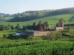 Church of St Michael |
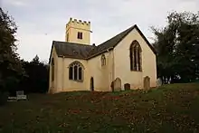
| Church of St Mary | Dunsford, Teignbridge | Church | early 19th century or earlier | 30 June 1961 | SX8130389204 50°41′25″N 3°40′54″W |
1215069 |  Church of St Mary |
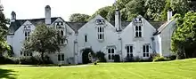
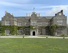
| Great Fulford House | Dunsford, Teignbridge | Kitchen | 16th century | 11 November 1952 | SX7907291710 50°42′45″N 3°42′51″W |
1214302 | 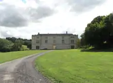 Great Fulford House |
| Church of St Martin | Exminster, Teignbridge | Parish Church | Late 14th century | 30 June 1961 | SX9455787708 50°40′46″N 3°29′38″W |
1334270 | 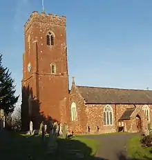 Church of St Martin |
| Church of St Blaise | Haccombe, Haccombe with Combe, Teignbridge | Collegiate Church | 13th century | 23 August 1955 | SX8980670198 50°31′16″N 3°33′21″W |
1168193 |  Church of St Blaise |
| Church of St Mary | Hennock, Teignbridge | Parish Church | 15th century | 23 August 1955 | SX8301680923 50°36′58″N 3°39′18″W |
1166001 |  Church of St Mary |
| Church of St Michael | Ilsington, Teignbridge | Parish Church | Late 13th century or early 14th century | 23 August 1955 | SX7853476144 50°34′21″N 3°43′00″W |
1240794 |  Church of St Michael |
| Church of St Andrew | Ipplepen, Teignbridge | Church | 1713 | 23 August 1955 | SX8340866554 50°29′14″N 3°38′42″W |
1334135 |  Church of St Andrew |
| Church of St Andrew | Kenn, Teignbridge | Parish Church | Early 14th century | 30 June 1961 | SX9219785696 50°39′39″N 3°31′36″W |
1097721 |  Church of St Andrew |
| Church of All Saints | Kenton, Teignbridge | Parish Church | Circa 1360-70 | 30 June 1961 | SX9579783311 50°38′25″N 3°28′30″W |
1169255 |  Church of All Saints |
| Church of St John the Baptist | Lustleigh, Teignbridge | Parish Church | 13th century | 23 August 1955 | SX7850081274 50°37′07″N 3°43′08″W |
1334119 | |
| Uphill, the Great Hall, and Oaknuve | Mapstone, Lustleigh, Teignbridge | Cruck House | Late medieval | 23 August 1955 | SX7824581652 50°37′19″N 3°43′21″W |
1334122 | |
| Mamhead House | Mamhead, Teignbridge | Country House | 1827-1833 | 11 November 1952 | SX9304081092 50°37′11″N 3°30′48″W |
1170130 | |
| Church of St Winifrid | Manaton, Teignbridge | Parish Church | 15th century | 23 August 1955 | SX7493581280 50°37′04″N 3°46′09″W |
1097224 |  Church of St Winifrid |
| Neadon Upper Hall | Manaton, Teignbridge | House | 1982-1983 | 23 August 1955 | SX7504982433 50°37′41″N 3°46′05″W |
1097260 | |
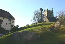
| Almshouses | Moretonhampstead, Teignbridge | Cruck House | Late Medieval | 23 August 1955 | SX7554586031 50°39′38″N 3°45′44″W |
1334200 |  Almshouses |
| Church of St Andrew | Moretonhampstead, Teignbridge | Church | 15th century | 23 August 1955 | SX7553286092 50°39′40″N 3°45′45″W |
1334222 | |
| Bradley Manor | Newton Abbot, Teignbridge | First Floor Hall House | Early 13th century | 16 July 1949 | SX8485070859 50°31′34″N 3°37′33″W |
1256765 | |
| Forde House | Newton Abbot, Teignbridge | Lobby Entry House | c. 1550 | 16 July 1949 | SX8699670940 50°31′38″N 3°35′44″W |
1256796 | |
| Parish Church of All Saints | Highweek, Newton Abbot, Teignbridge | Chapel of Ease | 15th century | 16 July 1949 | SX8514572092 50°32′14″N 3°37′20″W |
1257209 |  Parish Church of All Saints |
| Parish Church of St Mary the Virgin | Newton Abbot, Teignbridge | Parish Church | Before 15th century | 16 July 1949 | SX8549270375 50°31′19″N 3°37′00″W |
1256897 |  Parish Church of St Mary the Virgin |
| Church of St John the Baptist | North Bovey, Teignbridge | Parish Church | 13th century | 23 August 1955 | SX7393583832 50°38′26″N 3°47′03″W |
1097172 |  Church of St John the Baptist |
| Sanders | Lettaford, North Bovey, Teignbridge | Cross Passage House | Early 16th century | 6 November 1972 | SX7019184058 50°38′30″N 3°50′14″W |
1307005 | 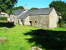 Sanders |
| Church of St Bartholomew | East Ogwell, Ogwell, Teignbridge | Boiler House | C20 | 23 August 1955 | SX8381170054 50°31′07″N 3°38′25″W |
1096697 | 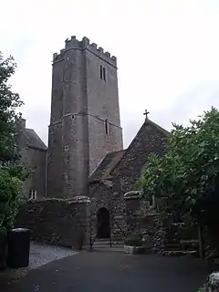 Church of St Bartholomew |
| West Ogwell Church | West Ogwell, Ogwell, Teignbridge | Parish Church | Late 13th century | 23 August 1955 | SX8186770046 50°31′06″N 3°40′04″W |
1334475 | |
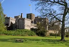
| Powderham Castle | Powderham, Teignbridge | Fortified Manor House | Medieval | 11 November 1952 | SX9682483604 50°38′35″N 3°27′38″W |
1097666 | |
| Church of St Peter | Shaldon, Teignbridge | Church | 1932 | 30 June 1949 | SX9315272451 50°32′31″N 3°30′33″W |
1269235 |  Church of St Peter |
| The Starcross Pumping House | Starcross, Teignbridge | Railway Engine House | 1845 | 11 November 1952 | SX9774181752 50°37′35″N 3°26′50″W |
1097684 | 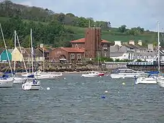 The Starcross Pumping House |
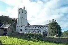
| Church of St Catherine of Alexandria | Church Town, Whitestone, Devon | Parish Church | Medieval | 4 September 1986 | SX8687294355 50°44′16″N 3°36′16″W |
1216459 |  Church of St Catherine of Alexandria |
| Church of St Pancras | Widecombe-in-the-Moor, Teignbridge | Parish Church | 15th century | 23 August 1955 | SX7187976791 50°34′36″N 3°48′39″W |
1242571 |  Church of St Pancras |
| Higher Uppacott, Uppacott | Widecombe-in-the-Moor, Teignbridge | House | 1955 | 23 August 1955 | SX7013172879 50°32′28″N 3°50′03″W |
1241837 | .jpg.webp) Higher Uppacott, Uppacott |
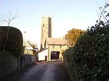
| Church of St John the Baptist | Woodland Hamlet, Woodland, Teignbridge | Parish Church | 15th century | 23 August 1955 | SX7912868758 50°30′22″N 3°42′21″W |
1263572 | .jpg.webp) Church of St John the Baptist |

Notes
- The date given is the date used by Historic England as significant for the initial building or that of an important part in the structure's description.
- Sometimes known as OSGB36, the grid reference is based on the British national grid reference system used by the Ordnance Survey.
- The "List Entry Number" is a unique number assigned to each listed building and scheduled monument by Historic England.
External links
This article is issued from Wikipedia. The text is licensed under Creative Commons - Attribution - Sharealike. Additional terms may apply for the media files.