Grade I listed buildings in West Lindsey
There are over 9,000 Grade I listed buildings in England. This page is a list of these buildings in the district of West Lindsey in Lincolnshire.
West Lindsey
| Name | Location | Type | Completed [note 1] | Date designated | Grid ref.[note 2] Geo-coordinates |
Entry number [note 3] | Image |
|---|---|---|---|---|---|---|---|
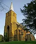
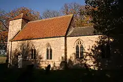
| Church of St Lawrence | Bardney | Parish Church | c1434-End 15th century | 30 November 1966 | TF1193969367 53°12′35″N 0°19′31″W |
1359500 |  Church of St Lawrence |
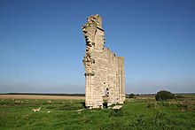
| Fragment of Barlings Abbey Church | Barlings | Abbey | Early 14th century | 30 November 1966 | TF0896073544 53°14′52″N 0°22′07″W |
1064017 | |
| Church of All Saints | Bigby | Parish Church | 12th century | 1 November 1966 | TA0597807472 53°33′11″N 0°24′06″W |
1063405 | |
| Norton Place | Bishop Norton | Country House | 1776 | 25 October 1951 | SK9720790891 53°24′21″N 0°32′21″W |
1359423 | 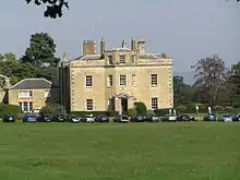 Norton Place |
| Church of St Alkmund | Blyborough | Parish Church | Early 13th century | 16 December 1964 | SK9339794556 53°26′22″N 0°35′44″W |
1063375 | 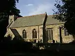 Church of St Alkmund |
| Church of St Martin | Blyton | Parish Church | 11th century | 16 December 1964 | SK8532494798 53°26′35″N 0°43′01″W |
1064159 | 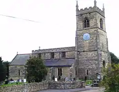 Church of St Martin |
| Brocklesby Hall | Brocklesby Park, Brocklesby | Country House | 16th century | 25 October 1951 | TA1373011356 53°35′11″N 0°17′00″W |
1359800 |  |
| Church of All Saints | Brocklesby Park, Brocklesby | Church | 14th century | 1 November 1966 | TA1397111315 53°35′10″N 0°16′47″W |
1165503 | |
| Holgate Monument | Brocklesby Park, Brocklesby | Commemorative Monument | 1785 | 1 November 1966 | TA1394111160 53°35′05″N 0°16′49″W |
1063417 | |
| Hunt Kennels and House | Brocklesby Park, Brocklesby | House | 1810 | 1 November 1966 | TA1406411108 53°35′03″N 0°16′42″W |
1166049 | |
| Newsham Bridge | Brocklesby Park, Brocklesby | Bridge | c. 1772 | 1 November 1966 | TA1318913451 53°36′19″N 0°17′27″W |
1063419 | |
| The Hermitage | Brocklesby Park, Brocklesby | Root House | Late 18th century | 24 January 1985 | TA1377310548 53°34′45″N 0°16′59″W |
1063418 | .jpg.webp) The Hermitage |
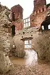
| Mausoleum, Wall and Screen | Brocklesby Park, Great Limber | Wall | 1792 | 25 October 1951 | TA1332808901 53°33′52″N 0°17′25″W |
1063361 |  Mausoleum, Wall and Screen |
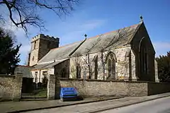
| Church of Saint Peter and Saint Paul | Caistor | Church | 1835 | 1 November 1966 | TA1167701274 53°29′47″N 0°19′05″W |
1063382 | 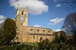 Church of Saint Peter and Saint Paul |
| Roman Wall | Caistor | Wall | C4 | 1 November 1966 | TA1165601223 53°29′45″N 0°19′06″W |
1063421 | |
| Church of St Peter and St Paul | Cherry Willingham | Parish Church | 1753 | 30 November 1966 | TF0318372410 53°14′19″N 0°27′19″W |
1064018 |  Church of St Peter and St Paul |
| Church of St Mary | Claxby | Parish Church | 13th century | 1 November 1966 | TF1112494583 53°26′11″N 0°19′43″W |
1359789 | 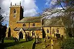 Church of St Mary |
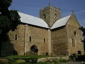
| Church of St Lawrence | Corringham | Parish Church | 11th century | 15 December 1954 | SK8714791657 53°24′52″N 0°41′25″W |
1064162 | 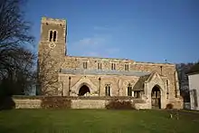 Church of St Lawrence |
| Church of St Chad | Dunholme | Parish Church | Early 13th century | 30 November 1966 | TF0247679420 53°18′07″N 0°27′49″W |
1064139 |  Church of St Chad |
| Fillingham Castle | Fillingham | Country House | 18th century | 25 October 1951 | SK9566186026 53°21′45″N 0°33′50″W |
1166045 |  Fillingham Castle |
| Church of St Clement | Fiskerton | Parish Church | 11th century | 30 November 1966 | TF0482571986 53°14′04″N 0°25′51″W |
1064020 | 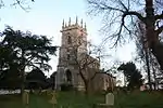 Church of St Clement |
| Parish Church of All Saints | Gainsborough | Parish Church | 14th century | 14 April 1964 | SK8144990110 53°24′06″N 0°46′35″W |
1147378 |  Parish Church of All Saints |
| The Old Hall | Gainsborough | Hall House | 1471-1484 | 4 April 1964 | SK8132090012 53°24′02″N 0°46′42″W |
1359773 | 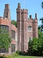 The Old Hall |
| Church of St Peter and St Paul | Glentham | Parish Church | 13th century | 1 November 1966 | TF0031090462 53°24′05″N 0°29′34″W |
1165045 | 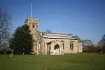 Church of St Peter and St Paul |
| Grange de Lings House | Grange de Lings | Farmhouse | 19th century | 30 November 1966 | SK9869977283 53°17′00″N 0°31′16″W |
1359448 | |
| Church of Saint Peter | Great Limber | Parish Church | 12th century | 1 November 1966 | TA1350108628 53°33′43″N 0°17′16″W |
1359817 |  Church of Saint Peter |
| 2 Grave Slabs Under Eaves on South Side of Nave at Church of St Michael | Hackthorn | Gravestones | 10th century | 21 June 1985 | SK9911782346 53°19′44″N 0°30′48″W |
1064145 | |
| Grave Marker at Church of St Michael 14 Paces from South East Angle of Nave | Hackthorn | Gravestone | 10th century | 21 June 1985 | SK9911182344 53°19′43″N 0°30′48″W |
1165706 | |
| Hackthorn Hall | Hackthorn | Country House | Shown in drawing of 1795 | 30 November 1966 | SK9905482361 53°19′44″N 0°30′51″W |
1064144 |  Hackthorn Hall |
| Church of St Chad | Harpswell | Parish Church | Late 11th century | 16 December 1964 | SK9358789959 53°23′53″N 0°35′38″W |
1309029 | |
| Church of All Saints | Heapham | Parish Church | Mid 11th century | 16 December 1964 | SK8779988513 53°23′10″N 0°40′53″W |
1064048 | 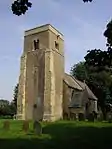 Church of All Saints |
| Church of All Saints | Holton cum Beckering | Parish Church | 13th century | 30 November 1966 | TF1163081285 53°19′00″N 0°19′33″W |
1064035 | 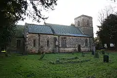 Church of All Saints |
| Church of Saint Bartholomew | Keelby | Church | 13th century | 1 November 1966 | TA1650309949 53°34′24″N 0°14′31″W |
1063367 | 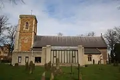 Church of Saint Bartholomew |
| No 9 Shop and Church End Farmhouse | Keelby | House | c. 1200 | 4 October 1972 | TA1662909977 53°34′24″N 0°14′25″W |
1359820 | |
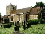
| Church of All Saints | Laughton | Parish Church | 12th century | 16 December 1964 | SK8491197300 53°27′56″N 0°43′21″W |
1317208 | 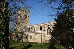 Church of All Saints |
| Church of St Helen | Lea | Parish Church | 13th century | 16 December 1964 | SK8308286678 53°22′14″N 0°45′10″W |
1146567 | 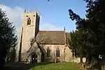 Church of St Helen |
| Church of St Cornelius | Linwood | Parish Church | Late 12th century | 1 November 1966 | TF1140585687 53°21′23″N 0°19′39″W |
1166212 | 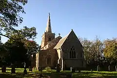 Church of St Cornelius |
| Church of St Margaret of Antioch | Marton | Church | Anglo Saxon | 16 December 1964 | SK8397081759 53°19′34″N 0°44′27″W |
1359484 | .jpg.webp) Church of St Margaret of Antioch |
| Church of All Saints | Nettleham | Parish Church | Early 12th century | 30 November 1966 | TF0077175323 53°15′55″N 0°29′26″W |
1064111 | 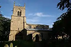 Church of All Saints |
| Gates and Piers to Nettleham Hall | Nettleham | Gate | c. 1720 | 31 January 1952 | SK9934575916 53°16′15″N 0°30′42″W |
1165868 | 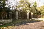 Gates and Piers to Nettleham Hall |
| Church of St Peter | Normanby by Spital | Parish Church | 12th century | 30 November 1966 | TF0011388110 53°22′49″N 0°29′47″W |
1064189 | |
| North Carlton Hall | North Carlton | Country House | Late 16th century | 31 January 1952 | SK9429277686 53°17′16″N 0°35′13″W |
1147235 | 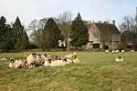 North Carlton Hall |
| Church of St John the Baptist | Northorpe | Parish Church | 12th century | 16 December 1964 | SK8946997157 53°27′49″N 0°39′14″W |
1165812 | 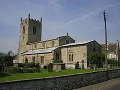 Church of St John the Baptist |
| Church of St. Peter | Kingerby, Osgodby | Parish Church | 11th century | 1 November 1966 | TF0573392855 53°25′19″N 0°24′37″W |
1063432 | |
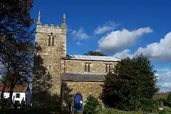
| Church of St Peter and St Paul | Owmby-by-Spital | Parish Church | 12th century | 30 November 1966 | TF0001887349 53°22′25″N 0°29′53″W |
1165122 | 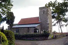 Church of St Peter and St Paul |
| Church of St Mary Magdalene | Rothwell | Parish Church | Late 11th century | 1 November 1966 | TF1495799356 53°28′42″N 0°16′09″W |
1165336 | 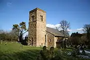 Church of St Mary Magdalene |
| Church of St Helen | Saxby | Parish Church | 1775 | 30 November 1966 | TF0045286127 53°21′45″N 0°29′31″W |
1064193 | 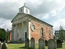 Church of St Helen |
| Church of St Botolph | Saxilby, Saxilby with Ingleby | Parish Church | 12th century | 30 November 1966 | SK8951476151 53°16′29″N 0°39′33″W |
1359490 | 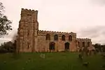 Church of St Botolph |
| Gateway at Scampton House Farm in Field to West of House | Scampton | Gate | Early 17th century | 31 January 1952 | SK9449879481 53°18′14″N 0°35′00″W |
1147274 | |
| Church of St Peter | Scotter | Parish Church | 12th century | 16 December 1964 | SE8875400823 53°29′48″N 0°39′49″W |
1064133 | 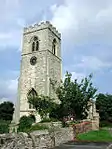 Church of St Peter |
| Church of St Genwys | Scotton | Parish Church | 12th century | 16 December 1964 | SK8903899099 53°28′52″N 0°39′35″W |
1165912 | 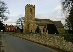 Church of St Genwys |
| Church of St Laurence | Snarford | Parish Church | 12th century | 30 November 1966 | TF0506382432 53°19′42″N 0°25′26″W |
1165955 | |
| Church of St John the Baptist and Monson Mausoleum | South Carlton | Church | 18th century | 30 November 1966 | SK9508476671 53°16′43″N 0°34′32″W |
1359493 | 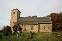 Church of St John the Baptist and Monson Mausoleum |
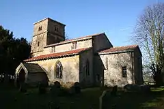
| Church of St Lawrence and St George | Springthorpe | Parish Church | 11th century | 16 December 1964 | SK8756689756 53°23′51″N 0°41′04″W |
1146616 | 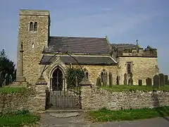 Church of St Lawrence and St George |
| Church of St Edith | Stow | Church | Mid 12th century | 16 December 1964 | SK9080683096 53°20′13″N 0°38′16″W |
1146742 | 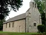 Church of St Edith |
| Church of St Mary | Stow | Parish Church | 1034-1049 | 16 December 1964 | SK8819081999 53°19′39″N 0°40′38″W |
1146624 | |
| Church of All Saints | Tealby | Parish Church | 12th century | 1 November 1966 | TF1571290896 53°24′08″N 0°15′40″W |
1063475 |  Church of All Saints |
| Torksey Castle | Torksey | Country House | 1560 | 16 December 1964 | SK8361478781 53°17′58″N 0°44′49″W |
1064079 | |
| Church of All Saints | Walesby | Church | c. 1175 | 1 November 1966 | TF1382492396 53°24′58″N 0°17′20″W |
1063484 | 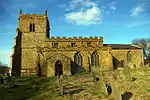 Church of All Saints |
| Church of All Saints | West Rasen | Parish Church | 11th century | 1 November 1966 | TF0649589304 53°23′23″N 0°24′00″W |
1063400 | 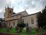 Church of All Saints |
.jpg.webp)
Notes
- The date given is the date used by Historic England as significant for the initial building or that of an important part in the structure's description.
- Sometimes known as OSGB36, the grid reference is based on the British national grid reference system used by the Ordnance Survey.
- The "List Entry Number" is a unique number assigned to each listed building and scheduled monument by Historic England.
External links
![]() Media related to Grade I listed buildings in Lincolnshire at Wikimedia Commons
Media related to Grade I listed buildings in Lincolnshire at Wikimedia Commons
This article is issued from Wikipedia. The text is licensed under Creative Commons - Attribution - Sharealike. Additional terms may apply for the media files.