Grade II* listed buildings in Cornwall (Q–Z)
There are over 20,000 Grade II* listed buildings in England. This article comprises a list of these buildings in the county of Cornwall.
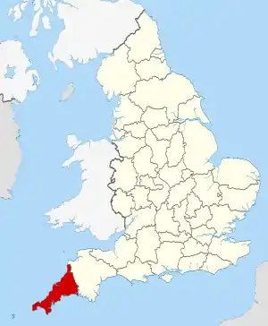
Cornwall shown in England
List of buildings
| Name | Location | Type | Completed [note 1] | Date designated | Grid ref.[note 2] Geo-coordinates |
Entry number [note 3] | Image |
|---|---|---|---|---|---|---|---|
| Radford | Werrington | Farmhouse | 15th century | 11 February 1988 | SX3180588999 50°40′35″N 4°22′55″W |
1309960 |  |
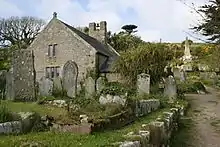
| Rectory Farmhouse | Morwenstow | Farmhouse | 14th century | 18 October 1984 | SS2055715219 50°54′31″N 4°33′13″W |
1231523 | 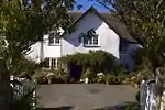 Rectory Farmhouse |
| Red Cross Stone in Pleasaunce to the east of Tonacombe Manor | Tonacombe Manor, Morwenstow | Cross | c.Late 12th century | 29 September 1961 | SS2095014507 50°54′08″N 4°32′52″W |
1231905 | |
| Redevallen | Trevalga | House | Probably 1642 | 19 January 1952 | SX0994088562 50°39′56″N 4°41′27″W |
1267261 | |
| Remains of Carclew House | Mylor | Country house | c.1720s | 30 May 1967 | SW7896738159 50°12′07″N 5°05′55″W |
1160291 | |
| Remains of St Thomas Priory | St Thomas, Launceston | Augustinian monastery | 13th century | 13 September 1972 | SX3281485016 50°38′27″N 4°21′57″W |
1206706 | |
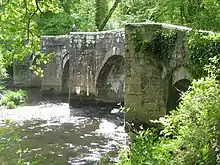
| Respryn Bridge | Lanhydrock, St Winnow | Bridge | 15th century | 6 June 1969 | SX0994463488 50°26′25″N 4°40′41″W |
1143087 | |
| Respryn Bridge | St. Winnow | Bridge | 15th century | 21 August 1964 | SX0994463487 50°26′25″N 4°40′41″W |
1329286 |  Respryn Bridge |
| Rialton Manor | Colan | House | Early 16th century | 10 February 1967 | SW8476762233 50°25′14″N 5°01′53″W |
1137187 | |
| Rose in Vale Country House Hotel | Rose in Vale, Perranzabuloe | Country house | c.Late 18th century | 30 May 1967 | SW7467750674 50°18′46″N 5°09′58″W |
1141527 | |
| Rosecadgehill House | Penzance | House | 1699 | 29 July 1950 | SW4603530828 50°07′23″N 5°33′16″W |
1143171 | |
| Rosehill Manor | Penzance | Country house | 1814 | 7 February 1974 | SW4575630541 50°07′13″N 5°33′29″W |
1327861 | |
| Rosemerryn House | Budock | House | c.1720 | 10 July 1957 | SW7834030026 50°07′44″N 5°06′10″W |
1146478 | |
| Rosemorran House and front garden walls | Rosemorran, Madron | Cottage ornee | Late 18th century | 10 June 1954 | SW4760732513 50°08′20″N 5°32′01″W |
1136807 | 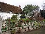 Rosemorran House and front garden walls |
| Rosewarne House | Camborne | House | c.1815 | 1 December 1951 | SW6483740411 50°13′01″N 5°17′52″W |
1142639 | |
| Roskruge Barton Farmhouse and rear garden walls | St Anthony-in-Meneage | Farmhouse | Late Medieval | 10 July 1957 | SW7756523575 50°04′14″N 5°06′35″W |
1141681 | |
| Rosteague House and stable block | Gerrans | Country house | 15th/16th century | 28 February 1952 | SW8734333547 50°09′49″N 4°58′44″W |
1141012 | |
| Round Cottage | Philleigh | House | c.1800 | 30 May 1967 | SW8709639370 50°12′57″N 4°59′08″W |
1140987 | 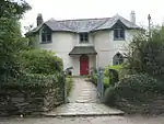 Round Cottage |
| Row of 3 cottages and wash-house about 150m west of Penheale Manor | Penheale, Egloskerry | Estate cottage | Early 20th century | 11 January 1989 | SX2666388001 50°39′57″N 4°27′15″W |
1142920 | |
| Royal Albert Bridge and 17 Approach Spans | Saltash | Railway bridge | 19th century | 17 January 1952 | SX4351558740 50°24′28″N 4°12′16″W |
1159292 | 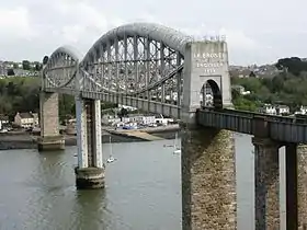 Royal Albert Bridge and 17 Approach Spans |
| Ruins of the Chapel of St Thomas Becket | Bodmin | Chapel | Licensed 1377 | 8 June 1972 | SX0736267025 50°28′17″N 4°42′58″W |
1195280 | 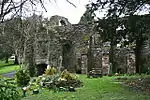 Ruins of the Chapel of St Thomas Becket |
| Ruthern Bridge | Ruthernbridge, Lanivet | Bridge | c.1450 | 6 June 1969 | SX0130066830 50°28′03″N 4°48′05″W |
1327925 |  Ruthern Bridge |
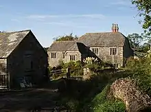
| Sara's Foundry, Town Mill | Redruth | Corn mill | 19th century | 12 September 1989 | SW6914142586 50°14′17″N 5°14′20″W |
1142573 |  Sara's Foundry, Town Mill |
| Saveock Manor Farmhouse | Kea | Farmhouse | c.Mid-18th century | 12 March 1986 | SW7672644435 50°15′27″N 5°08′01″W |
1140855 | |
| Sea lock, lock gates and hand winches | Bude, Bude–Stratton | Lock | Early 19th century | 9 September 1985 | SS2040906415 50°49′46″N 4°33′05″W |
1328520 | 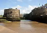 Sea lock, lock gates and hand winches |
| Service building in the stable yard about 10m south of Lanhydrock House | Lanhydrock Park, Lanhydrock | House | c.1882 | 15 April 1988 | SX0856763548 50°26′26″N 4°41′50″W |
1157977 | 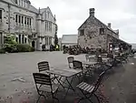 Service building in the stable yard about 10m south of Lanhydrock House |
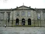
| Shire Hall | Bodmin | Town hall | 1837–38 | 26 March 1949 | SX0717266922 50°28′13″N 4°43′07″W |
1025049 | |
| Shire House | Bodmin | Judges lodgings | c.1840 | 26 March 1949 | SX0720366911 50°28′13″N 4°43′06″W |
1298216 | |
| Sir William Moyle's Almshouses | St Germans | House | 1583 | 21 July 1951 | SX3546957922 50°23′53″N 4°18′59″W |
1140548 | 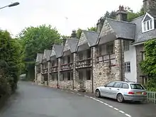 Sir William Moyle's Almshouses |
| South entrance to Prideaux Place | Prideaux Place, Padstow | Arch | c.18th century, before 1758 | 20 May 1988 | SW9140375432 50°32′29″N 4°56′43″W |
1212204 | |
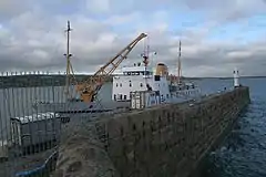
| South harbour pier, quay and walls on south-west side of harbour | Boscastle, Forrabury and Minster | Harbour | c.1584 | 17 December 1962 | SX0951391496 50°41′31″N 4°41′54″W |
1143473 | 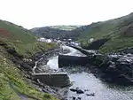 South harbour pier, quay and walls on south-west side of harbour |
| South Pier | Penzance | Lighthouse | Before 1512 | 6 March 2003 | SW4779030044 50°07′00″N 5°31′46″W |
1096159 | |
| South Terrace with grotto niche to south of Prideaux Place | Prideaux Place, Padstow | Terrace | c.1740 | 20 May 1988 | SW9139575491 50°32′31″N 4°56′44″W |
1212202 | |
| St Benet's Abbey | Lanivet | Abbey | 1411 | 25 October 1951 | SX0381963652 50°26′23″N 4°45′51″W |
1143103 | |
| St Breock Place | St Breock | House | c.Late 17th century | 4 November 1988 | SW9771471868 50°30′42″N 4°51′16″W |
1143038 | |
| St Catherine's Castle | Fowey | Castle | Early 16th century | 11 March 1974 | SX1178450958 50°19′42″N 4°38′45″W |
1218875 |  St Catherine's Castle |
| St Julian's Well | Mount Edgcumbe Country Park, Maker-with-Rame | Holy well | 14th/15th century | 23 January 1968 | SX4464552165 50°20′56″N 4°11′06″W |
1329144 | 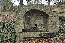 St Julian's Well |
| St Mellor's Well | Linkinhorne | Holy well | 15th century | 21 August 1964 | SX3190573147 50°32′02″N 4°22′24″W |
1159088 | |
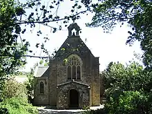
| St Michael's Church | Baldhu, Kea | Anglican church | 1847 | 12 March 1986 | SW7720743178 50°14′47″N 5°07′35″W |
1329026 | 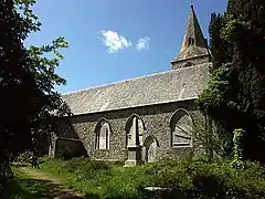 St Michael's Church |
| St Piran's and surrounding garden walls | Trethevy, Tintagel | House | c.Late 16th century | 17 December 1962 | SX0762089166 50°40′13″N 4°43′26″W |
1223492 | |
| Stable about 35m west of Lancarffe | Lancarffe, Helland | Stable | Late 17th/early 18th century | 6 June 1969 | SX0818568963 50°29′20″N 4°42′20″W |
1143120 | |
| Stables adjoining Trenethick Barton Farmhouse | Trenethick, Wendron | Stable | Late 17th century | 17 June 1988 | SW6680629115 50°06′58″N 5°15′48″W |
1309611 | |
| Stables and coach-house WSW of Trewardreva House | Trewardreva, Constantine | Stable | Probably 1719 | 17 June 1988 | SW7257730143 50°07′40″N 5°11′00″W |
1142138 | |
| Stables and gate piers, Port Eliot | St Germans | Stable | 1802–06 | 23 January 1968 | SX3580257971 50°23′55″N 4°18′42″W |
1329204 | |
| Stamps engine house and attached stamps approx 75m south-east of Count House at King Edward Mine | Camborne | Engine house | 1902 | 12 September 1989 | SW6638338917 50°12′15″N 5°16′31″W |
1159218 | 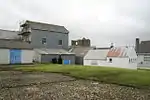 Stamps engine house and attached stamps approx 75m south-east of Count House at King Edward Mine |
| Stanbury Manor and garden wall about 6m south of the south front | Stanbury Manor, Morwenstow | Farmhouse | Late 16th and 17th century | 26 September 1951 | SS2098913909 50°53′49″N 4°32′49″W |
1231145 | |
| Statue about 5m west of Pentillie Castle | Pillaton | Statue | Late 17th century | 19 October 1987 | SX4098164554 50°27′33″N 4°14′30″W |
1140190 | |
| Stithians Methodist Church (formerly Penmennor Methodist Church) | Hendra, Stithians | Church | 1865 | 17 June 1988 | SW7241537057 50°11′23″N 5°11′23″W |
1161993 | 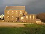 Stithians Methodist Church (formerly Penmennor Methodist Church) |
| Stoke Climsland Church | Stokeclimsland | Church | 15th century | 22 November 1960 | SX3605174386 50°32′46″N 4°18′55″W |
1220632 | 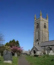 Stoke Climsland Church |
| Stone cross at SX07856754 at junction with Old Callywith Road | Bodmin | Preaching cross | Pre-Conquest or medieval | 26 March 1949 | SX0785467539 50°28′34″N 4°42′34″W |
1195252 | 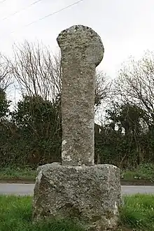 Stone cross at SX07856754 at junction with Old Callywith Road |
| Stone cross at SX088656, Carminow (Carminow Cross) | Bodmin | Cross | Pre-Conquest or medieval | 26 March 1949 | SX0884065689 50°27′35″N 4°41′40″W |
1298242 | 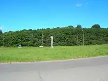 Stone cross at SX088656, Carminow (Carminow Cross) |
| Stone Cross in cemetery immediately west of Berry Tower | Bodmin | Preaching cross | Possibly pre-Conquest | 8 June 1972 | SX0724067468 50°28′31″N 4°43′05″W |
1195254 | |
| Stone cross in churchyard, immediately south of St Uny's Church | Lelant, St. Ives | Cross | 4 June 1952 | SW5482537695 50°11′18″N 5°26′10″W |
1143355 | 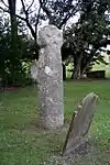 Stone cross in churchyard, immediately south of St Uny's Church | |
| Stone cross in furthermost southern churchyard south of St Uny's Church | Lelant, St. Ives | Cross | 4 June 1952 | SW5482637652 50°11′17″N 5°26′10″W |
1136866 | | |
| Stone cross in western cemetery (at crossing of paths) west of St Uny's Church | Lelant, St. Ives | Cross | 4 June 1952 | SW5475637726 50°11′19″N 5°26′13″W |
1143354 | | |
| Stone cross near junction with Church Street | Helston | Preaching cross | Probably pre-Conquest | 24 March 1950 | SW6585027650 50°06′10″N 5°16′33″W |
1297699 | 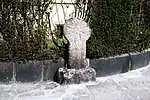 Stone cross near junction with Church Street |
| Stuart House | Liskeard | House | 17th century | 23 September 1950 | SX2511164490 50°27′15″N 4°27′54″W |
1203150 | 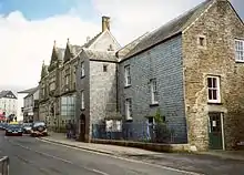 Stuart House |
| Summerhouse about 120m north of the Downs | Hayle | Summerhouse | c.1880 | 14 January 1988 | SW5553336849 50°10′52″N 5°25′32″W |
1327604 | |
| Summerhouse about 20m north-east of the Downs | Hayle | Summerhouse | c.1880 | 14 January 1988 | SW5557736760 50°10′49″N 5°25′30″W |
1143672 | |
| Survey Office about 100m south of Count House at King Edward Mine | Camborne | Drawing office | c.1899 | 12 September 1989 | SW6636138879 50°12′13″N 5°16′32″W |
1311128 |  Survey Office about 100m south of Count House at King Edward Mine |
| Temple of Milton | Mount Edgcumbe Country Park, Maker-with-Rame | Temple | Late 18th century | 23 January 1968 | SX4571452625 50°21′12″N 4°10′12″W |
1140616 | 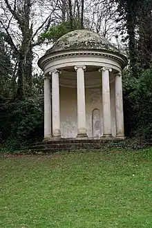 Temple of Milton |
| Terrace walls about 40m north of the Downs | Hayle, Hayle | Wall | c.1880 | 14 January 1988 | SW5554136780 50°10′50″N 5°25′32″W |
1160465 | |
| Terrace walls immediately north of the Downs | Hayle | Wall | c.1880 | 14 January 1988 | SW5552936744 50°10′49″N 5°25′32″W |
1143671 | |
| The Church of St Piran and St Michael | Churchtown Perranuthnoe, Perranuthnoe | Parish church | Mostly rebuilt c.1470 | 10 June 1954 | SW5375229551 50°06′53″N 5°26′45″W |
1310512 | 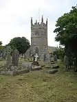 The Church of St Piran and St Michael |
| The City Hall | Truro | Town hall | 1846 | 8 January 1971 | SW8268544781 50°15′47″N 5°03′02″W |
1201442 | 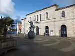 The City Hall |
| The Coach House | Mylor | Stable | c.Late 18th century | 30 May 1967 | SW7885438011 50°12′03″N 5°06′01″W |
1141660 | |
| The Coach House, including courtyard walls and gate piers immediately north-west of Trewinnard Manor farmhouse | St Erth | Coach house | Mid-18th century | 14 January 1988 | SW5460534031 50°09′20″N 5°26′12″W |
1327655 | |
| The Culver House | Bussow, St Ives | Dovecote | Medieval | 4 June 1952 | SW4985338738 50°11′44″N 5°30′23″W |
1143307 | |
| The Day Mark | St Martin's, Isles of Scilly | Day mark | 1683 | 6 April 1959 | SV9418616093 49°57′59″N 6°15′58″W |
1141204 |  The Day Mark |
| The Donald Thomas Centre, with forecourt railings | Camborne | Literary institute | 1842 | 1 December 1951 | SW6469340052 50°12′49″N 5°17′58″W |
1142652 | |
| The Eagle House Hotel | Launceston | Detached house | 1764 | 27 February 1950 | SX3304084709 50°38′17″N 4°21′45″W |
1297884 | 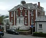 The Eagle House Hotel |
| The East Round House | Veryan | House | c.1820 | 30 May 1967 | SW9151839414 50°13′04″N 4°55′26″W |
1291400 | 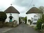 The East Round House |
| The Fisherman's Arms | East Looe, Looe | Merchants house | 1611 | 19 March 1951 | SX2559453231 50°21′11″N 4°27′11″W |
1201112 | 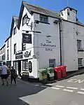 The Fisherman's Arms |
| The French Gun Battery (north-west corner) | St Michael's Mount | Battery | Probably early 19th century | 9 October 1987 | SW5142729859 50°07′00″N 5°28′43″W |
1310674 | 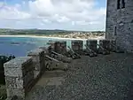 The French Gun Battery (north-west corner) |
| The Glebe Country House | Philleigh | House | 1727 | 30 May 1967 | SW8714139335 50°12′56″N 4°59′06″W |
1328938 | |
| The Glebe House | St Columb Major | House | 1638 | 7 January 1952 | SW9130163632 50°26′07″N 4°56′25″W |
1144067 | 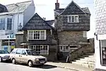 The Glebe House |
| The Golden Guinea Restaurant | East Looe, Looe | Cross passage house | Early 17th century | 19 March 1951 | SX2553253336 50°21′14″N 4°27′14″W |
1282859 | 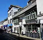 The Golden Guinea Restaurant |
| The Guard House | Hugh Town, St. Mary's, Isles of Scilly | House | Early 17th century | 12 February 1975 | SV9006410653 49°54′56″N 6°19′08″W |
1218940 | |
| The Harbour Walls and Bollards | St Michael's Mount | Harbour | Early 15th century | 9 October 1987 | SW5145230153 50°07′09″N 5°28′42″W |
1143786 | 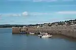 The Harbour Walls and Bollards |
| The Ignioc Stone, 2m south of St Clement Church | St Clement | Cross/incised stone | 3rd century | 30 May 1967 | SW8506643869 50°15′20″N 5°01′00″W |
1141078 | 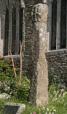 The Ignioc Stone, 2m south of St Clement Church |
| The Keep, about 50m east of Golden Manor | Probus | House | 16th century | 17 October 1984 | SW9210846847 50°17′06″N 4°55′10″W |
1141133 | |
| The Left Round House and adjoining wall to west side | Veryan Green, Veryan | House | c.1820 | 30 May 1967 | SW9213940036 50°13′25″N 4°54′55″W |
1291361 |  The Left Round House and adjoining wall to west side |
| The Lighthouse | St Agnes, Isles of Scilly | Lighthouse | c.1680 | 6 April 1959 | SV8802008202 49°53′33″N 6°20′44″W |
1328835 |  The Lighthouse |
| The Manor Office | Marazion | House | c.1775 | 9 October 1987 | SW5173030793 50°07′31″N 5°28′29″W |
1143767 | 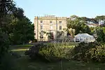 The Manor Office |
| The Mansion House and attached forecourt railings | Truro | Town house | c.1760 | 29 December 1950 | SW8274344787 50°15′47″N 5°02′59″W |
1280474 | 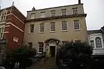 The Mansion House and attached forecourt railings |
| The Old Church of St Mary | Old Town, St. Mary's, Isles of Scilly | Church | 12th century | 6 April 1959 | SV9110910045 49°54′38″N 6°18′14″W |
1141210 | |
| The Old College, outbuilding adjoining left gable end of college, wall adjoining right front of college | Week St Mary | House | 1508 | 29 September 1961 | SX2381097674 50°45′07″N 4°29′57″W |
1142422 | |
| The Old Guildhall (now Museum) | East Looe, Looe | Guildhall | 16th century | 19 March 1951 | SX2559253213 50°21′11″N 4°27′11″W |
1201113 | 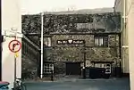 The Old Guildhall (now Museum) |
| The Old Harbour pier and walls | Newlyn, Penzance | Harbour | Before 1435 | 29 July 1950 | SW4647628515 50°06′09″N 5°32′48″W |
1143190 | .jpg.webp) The Old Harbour pier and walls |
| The Old Manor House | St Austell | House | Late 17th century | 28 November 1950 | SX0136252480 50°20′19″N 4°47′34″W |
1212189 | |
| The Old Manor House or Chy-an-eglos and stables at rear | Marazion | Town house | c.1775 | 9 October 1987 | SW5199030600 50°07′25″N 5°28′16″W |
1159421 | |
| The Old Rectory | St Mawgan, Mawgan-in-Pydar | House | 1858 | 12 May 1988 | SW8748965920 50°27′16″N 4°59′42″W |
1312299 | |
| The Old Rectory | St Columb Major | Bishops palace | 1851 | 16 April 1986 | SW9117063919 50°26′16″N 4°56′32″W |
1144096 | |
| The Old Standard | Mousehole, Penzance | House | Early 17th century | 8 April 1970 | SW4690226275 50°04′57″N 5°32′21″W |
1327838 | 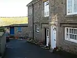 The Old Standard |
| The Old Town Hall | Falmouth | Town hall | 18th century | 10 September 1968 | SW8060833130 50°09′27″N 5°04′22″W |
1270068 | |
| The Post Office and dwelling house adjoining at south, the Drangway and part of passage to the east between Church Sq and Gibraltar Sq | Stratton, Bude–Stratton | House | 16th century | 5 March 1952 | SS2309606445 50°49′50″N 4°30′48″W |
1328514 | |
| The Prospect Tower | Calstock | Tower | Late 18th century | 19 October 1987 | SX4219868926 50°29′56″N 4°13′35″W |
1311985 | 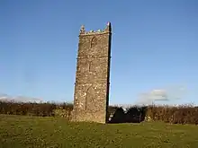 The Prospect Tower |
| The Rectory | St Just in Roseland | Vicarage | Mid-18th century | 30 May 1967 | SW8479835631 50°10′54″N 5°00′56″W |
1328968 | |
| The Right Round House | Veryan Green, Veryan | House | c.1820 | 30 May 1967 | SW9213140050 50°13′26″N 4°54′56″W |
1291360 | 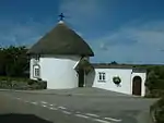 The Right Round House |
| The Round House | Sennen Cove, Sennen | Capstan house | Possibly 18th century | 15 December 1988 | SW3507726309 50°04′40″N 5°42′15″W |
1143807 | 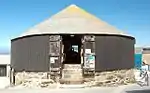 The Round House |
| The Sentry Box | St Michael's Mount | Wall | 15th century | 9 October 1987 | SW5142729880 50°07′01″N 5°28′43″W |
1327573 | .jpg.webp) The Sentry Box |
| The Ship Inn | Fowey | Merchant's house | 15th century | 13 March 1951 | SX1256151674 50°20′06″N 4°38′07″W |
1210721 | 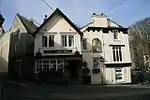 The Ship Inn |
| The Stables | Prideaux Place, Padstow | Stables | Probably 18th century | 24 April 1953 | SW9135775628 50°32′35″N 4°56′46″W |
1212011 | |
| The Storehouse, Pendennis Castle | Pendennis Castle, Falmouth | Storehouse | Early 18th century | 21 January 1973 | SW8232831898 50°08′50″N 5°02′53″W |
1270101 | 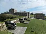 The Storehouse, Pendennis Castle |
| The Town Hall, Museum and attached walls and railings | Penryn | Town hall | 18th century | 28 January 1949 | SW7848834403 50°10′05″N 5°06′12″W |
1280314 | 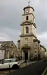 The Town Hall, Museum and attached walls and railings |
| The Union Hotel | Penzance | Assembly rooms | 1791 | 29 July 1950 | SW4733430204 50°07′05″N 5°32′09″W |
1143962 | 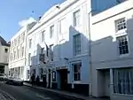 The Union Hotel |
| The Viaduct | Calstock | Railway viaduct | 1908 | 23 January 1968 | SX4336068658 50°29′48″N 4°12′36″W |
1138329 | 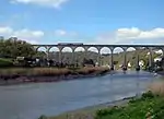 The Viaduct |
| The Vicarage | Morwenstow | House | 1837 | 29 September 1961 | SS2058815362 50°54′35″N 4°33′12″W |
1141780 | 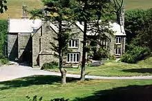 The Vicarage |
| The Vicarage | Penzance | Vicarage | 1701 | 29 July 1950 | SW4746630054 50°07′00″N 5°32′02″W |
1143152 | |
| The White Hart Hotel | Hayle | Public house | c.1838 | 14 January 1988 | SW5586137095 50°11′00″N 5°25′16″W |
1310761 |  The White Hart Hotel |
| Threshing barn and horse engine house 12m east of Radford Farmhouse | Werrington | Horse engine house | Early 19th century | 11 February 1988 | SX3182789023 50°40′35″N 4°22′54″W |
1142850 | |
| Threshing barn on north side of yard at Trebartha Barton | Trebartha, North Hill | Barn | c.Mid-19th century | 10 May 1989 | SX2658277855 50°34′29″N 4°27′02″W |
1250152 | |
| Timber-cutting building and office about 20m south of Count House at King Edward Mine | Camborne | Storehouse | 1900–09 | 12 September 1989 | SW6633938917 50°12′15″N 5°16′33″W |
1159182 | |
| Tor House and terrace walls and piers | Torpoint | House | 1792 | 6 February 1974 | SX4389755051 50°22′29″N 4°11′48″W |
1162315 | |
| Tower about 15m west of St Benet's Abbey | Lanivet | Tower | 15th century | 6 June 1969 | SX0380163642 50°26′23″N 4°45′52″W |
1158186 |  Tower about 15m west of St Benet's Abbey |
| Tower of former Church of Saint Kea | Old Kea, Kea | Tower | 15th century | 30 May 1967 | SW8442341701 50°14′09″N 5°01′28″W |
1141656 |  Tower of former Church of Saint Kea |
| Town Hall | St Columb Major | Town hall | 1848 | 10 February 1967 | SW9131663618 50°26′07″N 4°56′24″W |
1144107 | |
| Town Lodge | St Germans | Lodge | c.1840 | 23 January 1968 | SX3586057753 50°23′48″N 4°18′39″W |
1311300 |  Town Lodge |
| Trebarfoote Manor including barn adjoining at north-east | Trebarfoote Manor, Poundstock | Farmhouse | Early 17th century | 26 September 1951 | SX1864099202 50°45′50″N 4°34′23″W |
1231610 | |
| Trebartha Barton and service range to east | Trebartha, North Hill | Farmhouse | Late 18th or early 19th century | 10 May 1989 | SX2657377810 50°34′27″N 4°27′02″W |
1250150 | |
| Trebrea Lodge and flanking pavilions | Tintagel | House | Probably mid-17th century | 17 December 1962 | SX0696887610 50°39′22″N 4°43′56″W |
1267415 | |
| Tredown Farmhouse | South Petherwin | Farmhouse | Late 15th or early 16th century | 17 October 1983 | SX3027782613 50°37′06″N 4°24′02″W |
1303487 | |
| Tredrea Manor Farmhouse including garden wall and railings at front | St Erth | Manor house | 17th century | 14 January 1988 | SW5436534786 50°09′44″N 5°26′26″W |
1160602 | |
| Treduan Farmhouse | St Germans | Farmhouse | Early 17th century | 27 June 1977 | SX3445559929 50°24′57″N 4°19′53″W |
1158784 | |
| Treffry Farmhouse | Lanhydrock | Farmhouse | c.1710 | 15 April 1988 | SX0785363717 50°26′30″N 4°42′27″W |
1143088 | |
| Tregaminion Church | Polkerris, Fowey | Church | Early 19th century | 7 October 1986 | SX0967051911 50°20′11″N 4°40′33″W |
1212500 | |
| Tregarden | St Mabyn | House | 1631 | 4 November 1988 | SX0292472922 50°31′22″N 4°46′54″W |
1143003 | |
| Tregembo Farmhouse | St Hilary | Farmhouse | 17th century | 9 October 1987 | SW5699431781 50°08′10″N 5°24′07″W |
1310348 | |
| Tregithew Farmhouse | Manaccan | Farmhouse | 17th century | 10 July 1957 | SW7519824669 50°04′46″N 5°08′36″W |
1158239 | 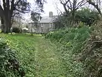 Tregithew Farmhouse |
| Treglith Farmhouse | Treneglos | House | Early 17th century | 1 December 1951 | SX2140788972 50°40′23″N 4°31′44″W |
1161194 | |
| Tregrehan House and attached steps and parterre walls with urns | St Blaise | Country house | 1689 | 28 November 1950 | SX0516253542 50°20′58″N 4°44′24″W |
1212091 | _(geograph_4997604).jpg.webp) Tregrehan House and attached steps and parterre walls with urns |
| Treguddick | South Petherwin | Farmhouse | Late 16th century | 1 December 1951 | SX2787782143 50°36′49″N 4°26′03″W |
1142741 | |
| Tregunnick Farmhouse | Deviock | Farmhouse | Probably late 15th/early 16th century | 21 July 1951 | SX3090155352 50°22′25″N 4°22′46″W |
1140541 | |
| Trekelland Bridge | South Petherwin, Lewannick | Road bridge | Probably 1504 | 25 February 1991 | SX3004479845 50°35′37″N 4°24′09″W |
1155188 | 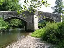 Trekelland Bridge |
| Trekelland Bridge | River Inney, Lewannick | Road bridge | Probably 1504 | 1 December 1951 | SX3004479846 50°35′37″N 4°24′09″W |
1277714 | 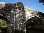 Trekelland Bridge |
| Trelawne House | Pelynt | House | 1450s | 27 August 1952 | SX2199453953 50°21′31″N 4°30′14″W |
1140729 | .jpg.webp) Trelawne House |
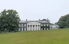
| Trelissick House and walls surrounding | Trelissick, Feock | Country house | c.1750 | 28 February 1952 | SW8375539518 50°12′58″N 5°01′57″W |
1159398 | |
| Trelissick Manor House, Farmhouse and Cottage, including front and rear garden wall, summerhouse, gate piers and gate | St Erth | Farmhouse | Remodelled 1668 | 14 January 1988 | SW5558435946 50°10′23″N 5°25′28″W |
1327629 | |
| Treludick | Egloskerry | House | Late 16th century | 1 December 1951 | SX2538788129 50°40′00″N 4°28′20″W |
1142950 | |
| Trenearne | Trenearne, Padstow | Farmhouse | c.Early 17th century | 24 April 1953 | SW8908174820 50°32′06″N 4°58′40″W |
1211508 | |
| Treneere Manor | Heamoor, Penzance | Country house | 1758 | 7 February 1974 | SW4677131265 50°07′38″N 5°32′40″W |
1143271 | |
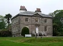
| Trereife Manor | Stable Hobba, Penzance | House | 17th/18th century | 29 July 1950 | SW4520629581 50°06′41″N 5°33′55″W |
1210364 | 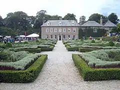 Trereife Manor |
| Trerithick and garden walls to front | Altarnun | House | 16th century | 1 December 1951 | SX2478982125 50°36′45″N 4°28′40″W |
1328056 | |
| Treslea Cross | Treslea, Cardinham | Cross | Probably pre-Conquest | 6 June 1969 | SX1305168862 50°29′23″N 4°38′13″W |
1138292 | 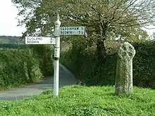 Treslea Cross |
| Tresungers | St Endellion | House | c.1660 | 25 October 1951 | SX0068479170 50°34′41″N 4°49′00″W |
1320611 |  Tresungers |
| Tretawn | St Kew | House | c.Late 16th century | 25 October 1951 | SX0393875750 50°32′55″N 4°46′08″W |
1129869 | |
| Tretheague House including ice house, well, closet and walled garden at rear | Tretheague, Stithians | Country house | Early 18th century | 17 June 1988 | SW7287936190 50°10′56″N 5°10′58″W |
1328463 | |
| Trethennal Manor Farmhouse and adjoining wall, gate piers and mounting block | Veryan | Farmhouse | 17th century | 27 November 1985 | SW9331940038 50°13′27″N 4°53′56″W |
1141044 | |
| Trethevy Farmhouse | St Cleer | Farmhouse | Late 16th/early 17th century | 5 November 1987 | SX2633968876 50°29′38″N 4°26′59″W |
1159487 | |
| Trethin | Advent | House | c.Late 16th/early 17th century | 19 January 1952 | SX1040881914 50°36′22″N 4°40′51″W |
1142720 |  Trethin |
| Trevego | St Winnow | Farmhouse | Late 16th century | 30 April 1985 | SX1383259863 50°24′33″N 4°37′17″W |
1329287 | |
| Trevelloe House | Paul | Country house | 1911 | 15 December 1988 | SW4451526287 50°04′54″N 5°34′21″W |
1143918 | |
| Trevelver and arch reset in wall on north-east | St Minver Highlands | Farmhouse | c.Late 16th or early 17th century | 25 October 1951 | SW9588475004 50°32′21″N 4°52′55″W |
1211636 |  Trevelver and arch reset in wall on north-east |
| Treveor Farmhouse with attached front wall and gateway | St Stephen-in-Brannel | Farmhouse | Early 17th century | 20 December 1988 | SW9496453597 50°20′47″N 4°53′00″W |
1312571 | |
| Treverbyn Old Bridge | St Cleer | Bridge | 1412–13 | 21 August 1964 | SX2063867444 50°28′45″N 4°31′46″W |
1159878 | 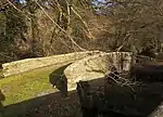 Treverbyn Old Bridge |
| Treverbyn Vean | Two Waters Foot, St Neot | House | c.1858–62 | 5 November 1987 | SX1845765168 50°27′29″N 4°33′32″W |
1140489 | |
| Treverran | Tywardreath, Tywardreath and Par | House | Early 18th century | 11 March 1974 | SX0955556377 50°22′35″N 4°40′47″W |
1212514 | |
| Treviades Barton including garden area walls adjoining south | Treviades, Constantine | Farmhouse | Late 16th century | 10 October 1985 | SW7478928811 50°07′00″N 5°09′06″W |
1236766 | |
| Trevider Farmhouse including front garden walls | St Buryan | Farmhouse | 17th century | 15 December 1988 | SW4309126249 50°04′51″N 5°35′33″W |
1143899 | |
| Trevithick's Cottage | Penponds, Camborne | Farmhouse | 18th century | 29 October 1965 | SW6373638908 50°12′11″N 5°18′44″W |
1310895 | |
| Trevoyan Farmhouse | Trevoyan, St Merryn | Farmhouse | Late 16th century or earlier | 20 May 1988 | SW8695472518 50°30′49″N 5°00′23″W |
1212746 | |
| Trewan Hall with attached garden walls | St Columb Major | House | 1635 | 7 January 1952 | SW9115664688 50°26′41″N 4°56′34″W |
1144124 | 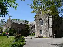 Trewan Hall with attached garden walls |
| Trewane | St Kew | House | Possibly early 17th century | 25 October 1951 | SX0403178583 50°34′27″N 4°46′08″W |
1290773 | |
| Trewardale | Blisland | House | 1773 | 6 June 1969 | SX1034971611 50°30′49″N 4°40′35″W |
1311725 | |
| Trewardreva House | Trewardreva, Constantine | Country house | c.1600 | 10 July 1957 | SW7260930164 50°07′40″N 5°10′58″W |
1311177 | |
| Trewince House | Gerrans | Country house | Mid-18th century | 30 May 1967 | SW8674033827 50°09′58″N 4°59′15″W |
1141017 | |
| Trewinnard Manor Farmhouse, including garden walls and gate piers adjoining to north | St Erth | Manor house | Early 18th century | 14 January 1988 | SW5461234010 50°09′19″N 5°26′12″W |
1143620 | |
| Trewitten | Trewitten, Trevalga | House | c.Early 17th century | 20 July 1987 | SX0896788702 50°40′00″N 4°42′17″W |
1143418 | |
| Trewornan including wall to rear of courtyard | St Minver Highlands | Manor house | c.Early 17th century | 26 June 1987 | SW9853074424 50°32′05″N 4°50′40″W |
1124739 | |
| Trinity Methodist Chapel | Newlyn, Penzance | Wesleyan Methodist chapel | 1834 | 14 April 1999 | SW4619428830 50°06′19″N 5°33′03″W |
1386515 | 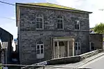 Trinity Methodist Chapel |
| Triumphal Arch at Higher Lodge | Mount Edgcumbe Country Park, Maker-with-Rame | Arch | c.1790 | 23 January 1968 | SX4490752930 50°21′21″N 4°10′54″W |
1310227 | 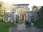 Triumphal Arch at Higher Lodge |
| Truthall | Sithney | Cruck house | c.Late 15th century | 10 July 1957 | SW6545930211 50°07′32″N 5°16′58″W |
1142177 | 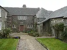 Truthall |
| Tudor Block House | Mount Edgcumbe Country Park, Maker-with-Rame | Blockhouse | c.1540 | 23 January 1968 | SX4561153173 50°21′29″N 4°10′18″W |
1161267 | 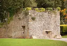 Tudor Block House |
| Tullimaar | Perranarworthal | Country house | c.1828 | 30 May 1967 | SW7824838853 50°12′29″N 5°06′33″W |
1161008 | |
| Two statues on terraces 100m south of Newton Ferrers House | Newton Ferrers, St Mellion | Statue | Probably 18th century | 26 November 1985 | SX3465165833 50°28′08″N 4°19′53″W |
1137482 | |
| Unidentified monument in the churchyard about 1m south of south aisle of Church of St Nivet | Lanivet | Tombstone | Probably 10th century | 15 April 1988 | SX0394564197 50°26′41″N 4°45′46″W |
1143068 | |
| Viaduct about 180m north-east of Woolston Farmhouse | Poundstock | Railway viaduct | 1898 | 9 September 1985 | SS2283102107 50°47′29″N 4°30′54″W |
1328572 |  Viaduct about 180m north-east of Woolston Farmhouse |
| Moorswater Viaduct including adjacent piers to earlier viaduct | Moorswater, Dobwalls and Trewidland | Railway viaduct | 1859 | 26 November 1985 | SX2367563957 50°26′56″N 4°29′06″W |
1312723 | 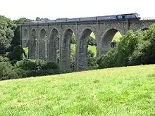 Moorswater Viaduct including adjacent piers to earlier viaduct |
| Viaduct including adjacent Piers to earlier Viaduct (that Part in Liskeard CP) | Moorswater, Liskeard | Railway viaduct | 1881 | 22 July 1981 | SX2382163972 50°26′57″N 4°28′59″W |
1203142 | 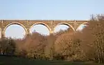 Viaduct including adjacent Piers to earlier Viaduct (that Part in Liskeard CP) |
| Vogue Beloth Methodist Church with forecourt walls and railings | Illogan | Methodist church | 1866 | 12 September 1989 | SW6771143426 50°14′42″N 5°15′34″W |
1161246 |  Vogue Beloth Methodist Church with forecourt walls and railings |
| Wadebridge Bridge | Wadebridge | Road bridge | c.1468 | 6 June 1969 | SW9913172464 50°31′03″N 4°50′05″W |
1142975 | 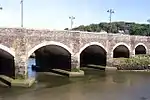 Wadebridge Bridge |
| Walled garden and pavilions to west of gatehouse and Penheale Manor | Penheale, Egloskerry | Garden wall | 18th century | 11 January 1989 | SX2680788028 50°39′58″N 4°27′08″W |
1365636 | |
| Walls and gates enclosing the garden to east and north of Lanhydrock House | Lanhydrock Park, Lanhydrock | Garden wall | 1857 | 15 April 1988 | SX0864063627 50°26′28″N 4°41′47″W |
1143090 | 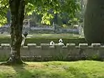 Walls and gates enclosing the garden to east and north of Lanhydrock House |
| Walls at Place House | Fowey | Gate | 15th/16th century | 11 March 1974 | SX1250751723 50°20′08″N 4°38′10″W |
1144302 | |
| Warehouse | Perran Wharf, Mylor | Iron foundry | c.Mid-19th century | 30 May 1967 | SW7756038479 50°12′16″N 5°07′07″W |
1141642 | |
| Well House about 4m east of the Old College | Week St Mary | Well house | c.1508 | 12 October 1984 | SX2381797683 50°45′07″N 4°29′56″W |
1142423 | |
| Well of St Guron, about 1m west of west end of Church of St Petroc | Bodmin | Well head | 15th century | 8 June 1972 | SX0728867037 50°28′17″N 4°43′02″W |
1355184 | |
| Welltown Manor | Forrabury and Minster | House | Possibly c.early 16th century | 19 January 1952 | SX0882490348 50°40′53″N 4°42′27″W |
1239319 | |
| Wesleyan Chapel | Porkellis, Wendron | Chapel | 1866 | 17 June 1988 | SW6910433430 50°09′21″N 5°14′02″W |
1162569 | |
| Wesleyan Chapel and attached schoolrooms | St. Austell Bay | Methodist Church | 1827 | 11 March 1974 | SX0377851807 50°20′00″N 4°45′31″W |
1144292 | 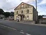 Wesleyan Chapel and attached schoolrooms |
| West Penwith RDC offices including railings | Penzance | Local government office | Dated 1834 | 7 February 1974 | SW4749330077 50°07′01″N 5°32′01″W |
1143157 | |
| Westcott | Linkinhorne | Farmhouse | Late 16th/early 17th century | 8 August 1983 | SX2942373691 50°32′17″N 4°24′31″W |
1140496 | |
| Westnorth Manor and well house 1m to east | Duloe, Duloe | Farmhouse | c.Late 16th century | 18 December 1985 | SX2427758057 50°23′46″N 4°28′25″W |
1140260 | |
| Wetherham | St Tudy | House | Probably late 17th/early 18th century | 4 November 1988 | SX0573475652 50°32′54″N 4°44′36″W |
1142982 | |
| Wheal Busy Chapel and attached walls, gate-piers and railings | Wheal Busy, Chacewater | Chapel | 1863 | 14 April 1999 | SW7382445238 50°15′49″N 5°10′30″W |
1386521 | 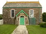 Wheal Busy Chapel and attached walls, gate-piers and railings |
| Winding Engine House at south-east corner of King Edward Mine | Camborne | Engine house | Late 19th century | 12 September 1989 | SW6640438895 50°12′14″N 5°16′30″W |
1159235 | 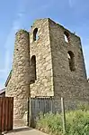 Winding Engine House at south-east corner of King Edward Mine |
| Winnacott Farmhouse and garden wall to front | North Petherwin | House | 16th century | 11 January 1989 | SX2586390135 50°41′05″N 4°27′59″W |
1160463 | |
| World War II tunnels at Porthcurno Telegraph Station | Porthcurno | Tunnel | Cut 1940–41 | 17 September 2008 | SW3844122742 50°02′50″N 5°39′18″W |
1392862 | 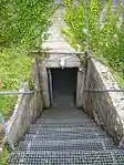 World War II tunnels at Porthcurno Telegraph Station |
| Worthyvale Manor and garden wall to front | Worthyvale Manor, Forrabury and Minster | Cross-passage house | Early 17th century | 19 January 1952 | SX1077086017 50°38′35″N 4°40′40″W |
1143494 | |
| Ye Old Cottage | East Looe, Looe | Jettied house | Mid-16th century | 19 March 1951 | SX2553653248 50°21′12″N 4°27′14″W |
1280647 | 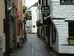 Ye Old Cottage |
.jpg.webp)
See also
Notes
- The date given is the date used by Historic England as significant for the initial building or that of an important part in the structure's description.
- Sometimes known as OSGB36, the grid reference is based on the British national grid reference system used by the Ordnance Survey.
- The "List Entry Number" is a unique number assigned to each listed building and scheduled monument by Historic England.
External links
![]() Media related to Grade II* listed buildings in Cornwall at Wikimedia Commons
Media related to Grade II* listed buildings in Cornwall at Wikimedia Commons
This article is issued from Wikipedia. The text is licensed under Creative Commons - Attribution - Sharealike. Additional terms may apply for the media files.