Grade II* listed buildings in North Dorset
There are over 20,000 Grade II* listed buildings in England. This page is a list of these buildings in the district of North Dorset in the county of Dorset.
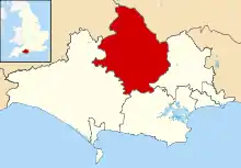
North Dorset shown in Dorset
North Dorset
| Name | Location | Type | Completed [note 1] | Date designated | Grid ref.[note 2] Geo-coordinates |
Entry number [note 3] | Image |
|---|---|---|---|---|---|---|---|
| Tomson Farmhouse | Winterborne Tomson, Anderson | Farmhouse | Early 17th century | 14 July 1955 | SY8856897403 50°46′34″N 2°09′49″W |
1324258 | |
| Dale House | Blandford Forum | Detached house | c. 1690–1700 | 27 October 1950 | ST8856106639 50°51′33″N 2°09′50″W |
1153057 |  |
| Eastway House | Blandford Forum | House | Possibly after 1731 | 27 October 1950 | ST8879406373 50°51′24″N 2°09′38″W |
1108704 | 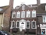 Eastway House |
| Lime Tree House | Blandford Forum | House | Early to mid-18th century | 27 October 1950 | ST8850806407 50°51′25″N 2°09′53″W |
1108653 | 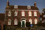 Lime Tree House |
| Lyston House | Blandford Forum | House | Probably post-1731 to mid-18th century | 27 October 1950 | ST8868606350 50°51′24″N 2°09′44″W |
1108679 | |
| Ryves Almshouses | Blandford Forum | Almshouse | 1682 | 27 October 1950 | ST8853006518 50°51′29″N 2°09′52″W |
1108628 | |
| 1 Market Place | Blandford Forum | House | Post-1731 | 27 October 1950 | ST8842906291 50°51′22″N 2°09′57″W |
1108683 | |
| 9 Market Place | Blandford Forum | House | Probably late 18th century | 27 October 1950 | ST8845506307 50°51′22″N 2°09′55″W |
1304602 | |
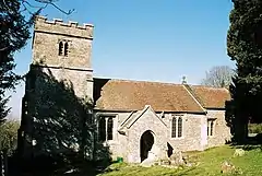
| Church of St Mary | Lower Blandford St Mary, Blandford St Mary | Anglican parish church | 14th century tower | 14 July 1955 | ST8916805271 50°50′49″N 2°09′19″W |
1110176 | 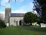 Church of St Mary |
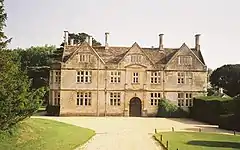
| The Manor House | Lower Blandford St Mary, Blandford St. Mary | Manor house | Early 17th century | 14 July 1955 | ST8909205536 50°50′57″N 2°09′23″W |
1171679 | 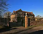 The Manor House |
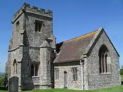
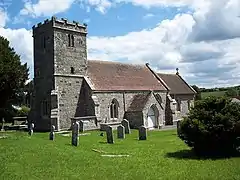
| Church of St John | Buckhorn Weston | Anglican parish church | 14th-century origin | 3 January 1985 | ST7569024717 51°01′17″N 2°20′53″W |
1324559 | 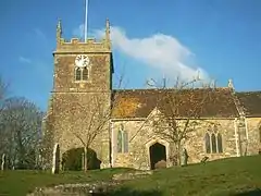 Church of St John |
| Church of St Mary | Chettle | Anglican parish church | Early 16th-century tower | 14 July 1955 | ST9515813283 50°55′08″N 2°04′13″W |
1324295 | 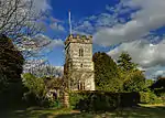 Church of St Mary |
| Church of St Nicholas | Child Okeford | Anglican parish church | Late 15th or early 16th-century tower | 4 October 1960 | ST8355312750 50°54′50″N 2°14′07″W |
1110263 | 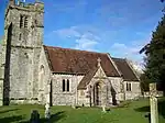 Church of St Nicholas |
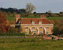
| Fontmell Parva House | Fontmell Parva, Child Okeford | House | c. 1665 | 12 October 1978 | ST8269014550 50°55′48″N 2°14′52″W |
1324593 | 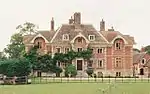 Fontmell Parva House |
| Church of St Nicholas | Durweston | Anglican parish church | 15th-century tower | 14 July 1955 | ST8587308523 50°52′34″N 2°12′08″W |
1110271 | 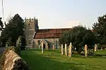 Church of St Nicholas |
| Durweston Bridge | Durweston | Road bridge | 1795 | 14 July 1955 | ST8635808628 50°52′37″N 2°11′43″W |
1110240 |  Durweston Bridge |
| Church of St Lawrence | Farnham | Anglican parish church | Probably 12th-century origin | 14 July 1955 | ST9578315050 50°56′06″N 2°03′41″W |
1172411 | 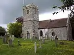 Church of St Lawrence |
| Church of All Saints | Fifehead Neville | Anglican parish church | c. 1500 | 4 October 1960 | ST7679911001 50°53′53″N 2°19′53″W |
1324503 | 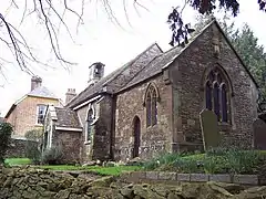 Church of All Saints |
| Footbridge over the River Divelish | Fifehead Neville | Packhorse bridge | Medieval | 4 October 1960 | ST7718911146 50°53′58″N 2°19′33″W |
1110485 | 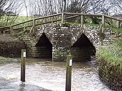 Footbridge over the River Divelish |
| Church of St Andrew | Fontmell Magna | Anglican parish church | 15th-century origin | 16 August 1960 | ST8654016985 50°57′08″N 2°11′35″W |
1305380 | 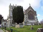 Church of St Andrew |
| Parish Church of St Mary | Glanvilles Wootton | Anglican parish church | South chapel c. 1344 | 4 October 1960 | ST6802508155 50°52′19″N 2°27′21″W |
1110491 | 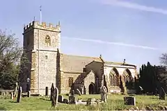 Parish Church of St Mary |
| Round Chimneys Farmhouse | Glanvilles Wootton | House | c. 1590s | 4 October 1960 | ST6819009457 50°53′01″N 2°27′13″W |
1324467 | 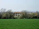 Round Chimneys Farmhouse |
| Manor House | Hammoon | Manor house | 16th century | 4 October 1960 | ST8173614612 50°55′50″N 2°15′41″W |
1110215 | _-_geograph.org.uk_-_741735.jpg.webp) Manor House |
| Church of St Michael and All Angels | Hanford | Anglican parish church | 17th century | 4 October 1960 | ST8456411178 50°54′00″N 2°13′15″W |
1110147 | 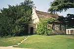 Church of St Michael and All Angels |
| Hanford School | Hanford | Country house | 1623 | 14 October 1960 | ST8448011111 50°53′57″N 2°13′19″W |
1110146 | |
| Church of St Peter | Hinton St Mary | Anglican parish church | 15th-century tower | 4 October 1960 | ST7867816099 50°56′38″N 2°18′18″W |
1110423 | 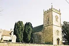 Church of St Peter |
| Dalton's Farmhouse Including Front Garden Walls | Hinton St Mary | House | Early to mid-18th century | 4 October 1960 | ST7868716280 50°56′44″N 2°18′17″W |
1110428 | 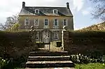 Dalton's Farmhouse Including Front Garden Walls |
| Stable block 40m south of St Peter's Church | Hinton St Mary | Stable | Probably 16th century | 4 October 1960 | ST7869216049 50°56′37″N 2°18′17″W |
1324511 | |
| The Manor House | Hinton St Mary | Manor house | Possibly 13th century | 4 October 1960 | ST7870316121 50°56′39″N 2°18′16″W |
1110420 | 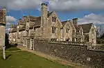 The Manor House |
| Tithe Barn Approximately 100 Metres South of Hinton St Mary Manor House | Hinton St Mary | Tithe barn | Probably 15th century | 4 October 1960 | ST7872816032 50°56′36″N 2°18′15″W |
1110422 | |
| Parish Church of St Eustace | Ibberton | Anglican parish church | 15th century | 4 October 1960 | ST7893407562 50°52′02″N 2°18′03″W |
1287985 | |
| The Chantry | Iwerne Minster | House | 17th century | 16 August 1960 | ST8679514414 50°55′44″N 2°11′21″W |
1172228 | 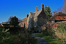 The Chantry |
| Church of St Mary | Iwerne Stepleton | Anglican parish church | 11th century | 14 July 1955 | ST8628211246 50°54′02″N 2°11′47″W |
1324643 | |
| Church of All Saints | Kington Magna | Anglican parish church | Late 15th-century tower | 16 August 1960 | ST7681423135 51°00′26″N 2°19′55″W |
1324579 | 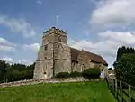 Church of All Saints |
| Parish Church of St Thomas a Beckett | Lydlinch | Anglican parish church | 15th-century tower | 4 October 1960 | ST7424013364 50°55′09″N 2°22′04″W |
1110465 | 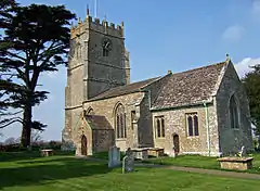 Parish Church of St Thomas a Beckett |
| Stock Gaylard House | Stock Gaylard, Lydlinch | Country house | Late 18th century | 4 October 1960 | ST7220513007 50°54′57″N 2°23′48″W |
1324496 | 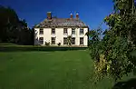 Stock Gaylard House |
| Mappowder Court | Mappowder | Country house | Mid-18th century | 4 October 1960 | ST7389105800 50°51′04″N 2°22′20″W |
1324499 | 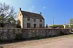 Mappowder Court |
| Church of St Margaret | Margaret Marsh | Anglican parish church | 15th-century tower | 16 August 1960 | ST8235218632 50°58′01″N 2°15′10″W |
1305445 | 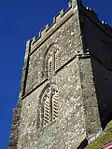 Church of St Margaret |
| Pope's Farmhouse | Marnhull | Farmhouse | 17th century | 4 October 1960 | ST7713818189 50°57′46″N 2°19′37″W |
1110410 | 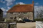 Pope's Farmhouse |
| Senior's Farmhouse and Attached Barn | Marnhull | House | c. 1500 | 4 October 1960 | ST7810218710 50°58′03″N 2°18′48″W |
1172057 | 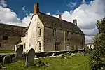 Senior's Farmhouse and Attached Barn |
| Stable/dwelling Range Approximately 10 M South-west of Pope's Farmhouse | Marnhull | Stable/dwelling | 17th century | 4 October 1960 | ST7715018163 50°57′45″N 2°19′36″W |
1172053 | |
| Church of St Thomas | Melbury Abbas | Anglican parish church | 1852 | 16 August 1960 | ST8821020076 50°58′48″N 2°10′10″W |
1304933 | _St_Thomas's_Church_-_geograph.org.uk_-_70165.jpg.webp) Church of St Thomas |
| Parish Church of Saint Andrew | Milborne St Andrew | Anglican parish church | 15th-century tower | 14 July 1955 | SY8011897401 50°46′33″N 2°17′00″W |
1118618 | 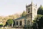 Parish Church of Saint Andrew |
| Almshouses and the Reading Room | Milton Abbas | Almshouse | 1674, relocated in 1779 | 14 July 1955 | ST8062501822 50°48′56″N 2°16′35″W |
1118594 | 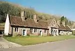 Almshouses and the Reading Room |
| Delcombe Manor | Delcombe, Milton Abbas | Country house | c. 1750 | 14 July 1955 | ST7929004846 50°50′34″N 2°17′44″W |
1324251 | |
| Garden House, Delcombe Manor | Delcombe, Milton Abbas | House | c. 1750 | 14 July 1985 | ST7931404812 50°50′33″N 2°17′43″W |
1151968 | |
| Parish Church of St James | Milton Abbas | Anglican parish church | c. 1786 | 14 July 1955 | ST8064801785 50°48′55″N 2°16′34″W |
1118560 | 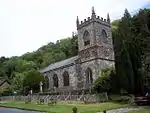 Parish Church of St James |
| The Old Rectory | Milton Abbas | House | c. 1780 | 14 July 1955 | ST8033501708 50°48′52″N 2°16′50″W |
1304949 | |
| The Stone Lodge, and the Gatehouse, with Gatepiers and Gates | Milton Abbas | Lodges | Probably c. 1775 | 2 August 1979 | ST8057202958 50°49′33″N 2°16′38″W |
1151927 | |
| Church of St Mary | Motcombe | Anglican parish church | 1846 | 16 August 1960 | ST8490925238 51°01′35″N 2°13′00″W |
1152195 | 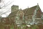 Church of St Mary |
| North End Farmhouse | North End, Motcombe | Farmhouse | 17th century | 3 January 1985 | ST8456827524 51°02′49″N 2°13′17″W |
1324606 | |
| Church of St Aldhelm | Belchalwell, Okeford Fitzpaine | Anglican parish church | 15th century | 4 October 1960 | ST7924709803 50°53′14″N 2°17′47″W |
1216309 | |
| Parish Church of St Andrew | Greenhayes, Okeford Fitzpaine | Anglican parish church | 15th century | 4 September 1960 | ST8073210816 50°53′47″N 2°16′31″W |
1216617 | 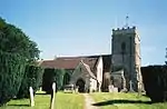 Parish Church of St Andrew |
| Church of St Peter | Pimperne | Anglican parish church | Mid 15th century | 26 June 1953 | ST9037009415 50°53′03″N 2°08′18″W |
1110839 | 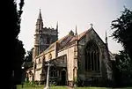 Church of St Peter |
| Parish Church of St Thomas a Becket | Pulham | Anglican parish church | 15th century | 4 October 1960 | ST7116908518 50°52′32″N 2°24′40″W |
1228063 | 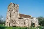 Parish Church of St Thomas a Becket |
| The Old Rectory | Pulham | House | Late 18th century | 7 June 1973 | ST7121208465 50°52′30″N 2°24′38″W |
1228064 | 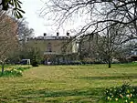 The Old Rectory |
| Church of St Peter | Shaftesbury | Anglican parish church | Late 15th and early 16th century | 20 June 1952 | ST8628722946 51°00′21″N 2°11′49″W |
1292132 | 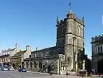 Church of St Peter |
| Ox House | Shaftesbury | House | Probably late 16th to early 17th century | 20 June 1952 | ST8598222919 51°00′20″N 2°12′04″W |
1108758 | |
| Pensbury House | Shaftesbury | House | 18th and 19th century | 15 October 1973 | ST8634023552 51°00′40″N 2°11′46″W |
1218389 | |
| The Grosvenor Arms Hotel | Shaftesbury | Hotel | Early 19th century | 20 June 1952 | ST8618822993 51°00′22″N 2°11′54″W |
1218032 | |
| Cedar Court | Spetisbury | House | 1716 | 14 July 1955 | ST9104302837 50°49′30″N 2°07′43″W |
1110160 | |
| Church of St Mary | Stalbridge | Anglican parish church | Late 14th century | 4 October 1960 | ST7334618190 50°57′45″N 2°22′51″W |
1108611 | 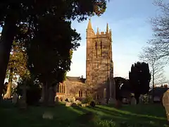 Church of St Mary |
| Market Cross | Stalbridge | Market cross | Second half of 15th century | 4 October 1960 | ST7349218002 50°57′39″N 2°22′44″W |
1153032 | 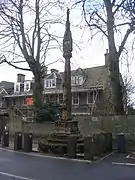 Market Cross |
| Thornhill House | Thornhill, Stalbridge | Country house | c. 1730 | 4 October 1960 | ST7405814936 50°56′00″N 2°22′14″W |
1324460 | 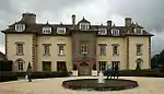 Thornhill House |
| The Manor House | Stoke Wake | House | c. 1700 | 4 October 1960 | ST7645006404 50°51′24″N 2°20′09″W |
1228071 | |
| Jolliffe's Farmhouse Including Attached Barn | Stour Provost | House | 17th century | 16 August 1960 | ST8316821805 50°59′43″N 2°14′28″W |
1324535 | 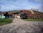 Jolliffe's Farmhouse Including Attached Barn |
| Church of the Holy Trinity | Stourpaine | Anglican parish church | 15th-century tower | 24 June 1985 | ST8603209372 50°53′01″N 2°12′00″W |
1305170 | 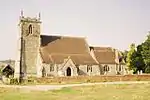 Church of the Holy Trinity |
| Chapel, Approximately 90 Metres West of Manor Farmhouse | Stourton Caundle | Chapel | 13th century | 4 October 1960 | ST7132514929 50°55′59″N 2°24′34″W |
1287276 | |
| Sturminster Newton Castle | Sturminster Newton | Manor house | Probably 14th century | 4 October 1960 | ST7846913498 50°55′14″N 2°18′28″W |
1324461 | |
| Sturminster Newton Mill | Sturminster Newton | Gristmill | 16th or 17th century | 4 October 1960 | ST7819713519 50°55′15″N 2°18′42″W |
1153666 | 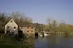 Sturminster Newton Mill |
| Church of Saint Bartholomew | Sutton Waldron | Anglican parish church | 1847 | 16 August 1960 | ST8620815705 50°56′26″N 2°11′52″W |
1110209 | 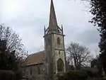 Church of Saint Bartholomew |
| Barn and Outbuilding Range 100 Metres North East of Tarrant Abbey House | Tarrant Crawford | Barn | Late 15th century | 26 June 1953 | ST9213103398 50°49′48″N 2°06′47″W |
1110841 | |
| Tarrant Abbey House | Tarrant Crawford | Box-frame house | 15th century | 26 June 1953 | ST9206103301 50°49′45″N 2°06′51″W |
1153838 | |
| Church of St Mary | Tarrant Gunville | Anglican parish church | Late 14th century | 14 July 1955 | ST9251912670 50°54′48″N 2°06′28″W |
1305101 | 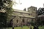 Church of St Mary |
| Church of All Saints | Tarrant Keyneston | Anglican parish church | 15th-century tower | 26 June 1953 | ST9251604059 50°50′10″N 2°06′28″W |
1153944 | |
| Church of All Saints | Tarrant Monkton | Anglican parish church | 15th century | 14 July 1955 | ST9439308820 50°52′44″N 2°04′52″W |
1172540 | 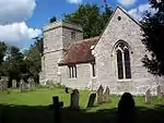 Church of All Saints |
| Church of St Mary | Tarrant Rawston | Anglican parish church | 14th century | 26 June 1953 | ST9390506666 50°51′34″N 2°05′17″W |
1154056 | 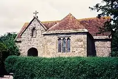 Church of St Mary |
| Rawston Farmhouse | Tarrant Rawston | Farmhouse | Late 16th or early 17th century | 26 June 1953 | ST9387106663 50°51′34″N 2°05′18″W |
1324322 | 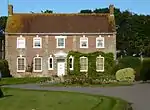 Rawston Farmhouse |
| Church of St Mary | Tarrant Rushton | Anglican parish church | 12th century | 26 June 1953 | ST9374306058 50°51′14″N 2°05′25″W |
1118488 | 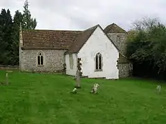 Church of St Mary |
| Church of St Mary | Turnworth | Anglican parish church | 15th-century tower | 14 July 1955 | ST8211707490 50°52′00″N 2°15′20″W |
1110163 | 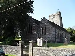 Church of St Mary |
| Church of St Mary | West Stour | Anglican parish church | 13th century | 16 August 1960 | ST7846422907 51°00′19″N 2°18′30″W |
1152142 | 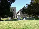 Church of St Mary |
| Church of St Nicholas | Winterborne Clenston | Anglican parish church | 1840 | 14 July 1955 | ST8398002796 50°49′28″N 2°13′44″W |
1324267 | 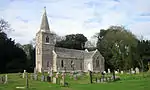 Church of St Nicholas |
| Church of St Nicholas | Winterborne Kingston | Anglican parish church | 14th century | 14 July 1955 | SY8622597599 50°46′40″N 2°11′48″W |
1152548 | 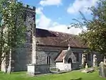 Church of St Nicholas |
| Muston Manor | Winterborne Muston | House | Late 17th century | 10 October 1985 | SY8734097673 50°46′43″N 2°10′51″W |
1304719 | |
| Quarleston Farmhouse | Winterborne Stickland | Farmhouse | 15th century | 14 July 1955 | ST8366303992 50°50′07″N 2°14′00″W |
1172390 | 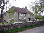 Quarleston Farmhouse |
| Whatcombe House | Whatcombe, Winterborne Whitechurch | Country house | 1750 | 14 July 1955 | ST8373501295 50°48′40″N 2°13′56″W |
1118543 | 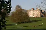 Whatcombe House |
See also
Notes
- The date given is the date used by Historic England as significant for the initial building or that of an important part in the structure's description.
- Sometimes known as OSGB36, the grid reference is based on the British national grid reference system used by the Ordnance Survey.
- The "List Entry Number" is a unique number assigned to each listed building and scheduled monument by Historic England.
External links
![]() Media related to Grade II* listed buildings in Dorset at Wikimedia Commons
Media related to Grade II* listed buildings in Dorset at Wikimedia Commons
This article is issued from Wikipedia. The text is licensed under Creative Commons - Attribution - Sharealike. Additional terms may apply for the media files.