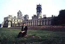
Grade I listed buildings in Selby (district)
There are over 9,000 Grade I listed buildings in England. This page is a list of these buildings in the district of Selby in North Yorkshire.
Selby
| Name | Location | Type | Completed [note 1] | Date designated | Grid ref.[note 2] Geo-coordinates |
Entry number [note 3] | Image |
|---|---|---|---|---|---|---|---|
| Church of St Mary | Birkin | Church | 12th century | 11 December 1967 | SE5303426511 53°43′56″N 1°11′51″W |
1316671 | 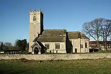 Church of St Mary |
| Church of All Saints | Bolton Percy | Church | Early 14th century | 3 February 1967 | SE5317541275 53°51′54″N 1°11′34″W |
1296630 |  Church of All Saints |
| Church of St Wilfrid | Brayton | Church | 12th century | 17 November 1966 | SE6041930997 53°46′19″N 1°05′05″W |
1132537 |  Church of St Wilfrid |
| Ferry Bridge | Brotherton | Bridge | 1797 | 11 December 1967 | SE4835224640 53°42′57″N 1°16′08″W |
1167483 |  Ferry Bridge |
| Cambleforth Hall | Camblesforth | House | c. 1700 | 17 November 1966 | SE6467826140 53°43′40″N 1°01′16″W |
1173983 |  |
| Carlton Towers | Carlton | Country House | Early 17th century | 17 November 1966 | SE6497623798 53°42′24″N 1°01′02″W |
1295955 | |
| Cawood Castle gatehouse | Cawood | Castle | 1426-1451 | 17 November 1966 | SE5739437698 53°49′57″N 1°07′46″W |
1132508 | 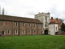 Cawood Castle gatehouse |
| Banqueting Hall Adjoining East Side of Cawood Castle gatehouse | Cawood | Castle | 1426-1451 | 17 November 1966 | SE5740837687 53°49′56″N 1°07′45″W |
1174558 |  Banqueting Hall Adjoining East Side of Cawood Castle gatehouse |
| Church of All Saints | Cawood | Church | C20 | 17 November 1966 | SE5777937790 53°49′59″N 1°07′25″W |
1316657 |  Church of All Saints |
| Church of St Mary the Virgin | Church Fenton | Church | 13th century | 3 February 1967 | SE5143136764 53°49′29″N 1°13′13″W |
1148436 |  Church of St Mary the Virgin |
| Church of St Peter and St Paul | Drax | Church | 12th century | 17 November 1986 | SE6758726371 53°43′46″N 0°58′37″W |
1148397 |  Church of St Peter and St Paul |
| Church of St Mary the Virgin | Hemingbrough | Church | Late 12th century | 17 November 1966 | SE6735130619 53°46′03″N 0°58′47″W |
1148462 | 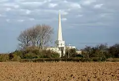 Church of St Mary the Virgin |
| Church of St Edmund | Kellington | Church | Norman | 11 December 1967 | SE5479224561 53°42′53″N 1°10′17″W |
1148402 | |
| Church of St Wilfrid | Monk Fryston | Church | 13th century | 11 December 1967 | SE5052429746 53°45′42″N 1°14′06″W |
1296769 |  Church of St Wilfrid |
| Church of St Andrew | Newton Kyme | Church | 12th century | 12 July 1985 | SE4658044879 53°53′53″N 1°17′33″W |
1132464 | 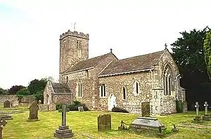 Church of St Andrew |
| Church of St Mary | Riccall | Church | Mid - Late 12th century | 17 November 1966 | SE6195937836 53°49′59″N 1°03′36″W |
1148464 |  Church of St Mary |
| Church of All Saints | Ryther cum Ossendyke | Church | late Saxon/early Norman | 3 February 1967 | SE5550139409 53°50′53″N 1°09′28″W |
1148428 | 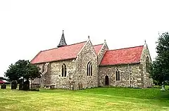 Church of All Saints |
| Church of All Saints | Saxton | Church | 11th century | 3 February 1967 | SE4757536883 53°49′34″N 1°16′43″W |
1168016 | 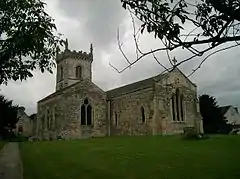 Church of All Saints |
| Church of St Mary and St Germain (Selby Abbey) | Selby | Abbey | 1069 | 16 December 1952 | SE6156832376 53°47′03″N 1°04′01″W |
1132591 | 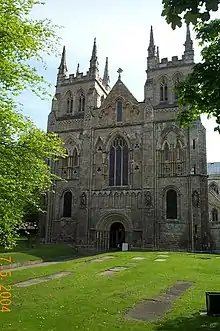 Church of St Mary and St Germain (Selby Abbey) |
| Church of All Saints | Sherburn-in-Elmet | Church | 15th century | 3 February 1967 | SE4880333525 53°47′45″N 1°15′38″W |
1148444 | 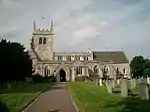 Church of All Saints |
| Church of Saint Helen | Skipwith | Church | Anglo Saxon | 17 November 1966 | SE6572638504 53°50′19″N 1°00′10″W |
1148467 | 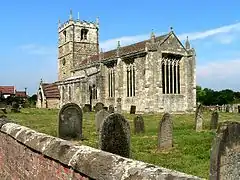 Church of Saint Helen |
| Gatehouse to Steeton Hall and Walls Adjoining | South Milford | Gatehouse | Late 14th century | 3 February 1967 | SE4840331432 53°46′37″N 1°16′01″W |
1148546 |  |
| Steeton Hall | South Milford | House | Early 14th century | 4 July 1952 | SE4833831401 53°46′36″N 1°16′05″W |
1167763 |  Steeton Hall |
| Church of St Helen | Stillingfleet | Church | c. 1145 | 17 November 1966 | SE5932541003 53°51′43″N 1°05′58″W |
1296904 |  Church of St Helen |
| Hazlewood Castle | Hazlewood Castle Estate, Stutton with Hazlewood | Castle | Late 13th century | 18 February 1958 | SE4488339770 53°51′08″N 1°19′09″W |
1148386 | |
| Roman Catholic Chapel of St Leonard | Hazlewood Castle Estate, Stutton with Hazlewood | Chapel | 1609 | 3 February 1967 | SE4492139795 53°51′09″N 1°19′07″W |
1316353 |  |
| Church of St Helen | Thorganby | Church | 15th century | 17 November 1966 | SE6896341641 53°51′59″N 0°57′10″W |
1148469 |  Church of St Helen |
| Church of All Saints | Wistow | Church | 13th century | 17 November 1966 | SE5923035655 53°48′50″N 1°06′07″W |
1174776 |  Church of All Saints |
| Church of St Martin | Womersley | Church | 12th century | 11 December 1967 | SE5323118984 53°39′53″N 1°11′45″W |
1174486 | 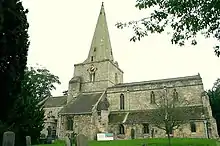 Church of St Martin |
Notes
- The date given is the date used by Historic England as significant for the initial building or that of an important part in the structure's description.
- Sometimes known as OSGB36, the grid reference is based on the British national grid reference system used by the Ordnance Survey.
- The "List Entry Number" is a unique number assigned to each listed building and scheduled monument by Historic England.
External links
![]() Media related to Grade I listed buildings in Selby District at Wikimedia Commons
Media related to Grade I listed buildings in Selby District at Wikimedia Commons
This article is issued from Wikipedia. The text is licensed under Creative Commons - Attribution - Sharealike. Additional terms may apply for the media files.
