Rush County, Indiana
Rush County is a county in the U.S. state of Indiana. In the 2010 United States Census, the population was 17,392.[1] The county seat (and only city) is Rushville.[2]
Rush County | |
|---|---|
.jpg.webp) The Rush County Courthouse in Rushville | |
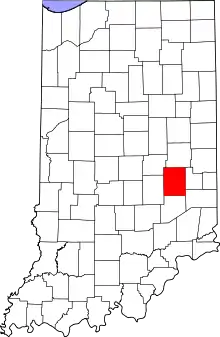 Location within the U.S. state of Indiana | |
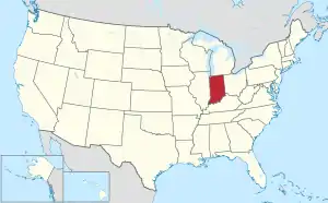 Indiana's location within the U.S. | |
| Coordinates: 39°37′N 85°28′W | |
| Country | |
| State | |
| Founded | 1822 |
| Named for | Benjamin Rush |
| Seat | Rushville |
| Largest city | Rushville |
| Area | |
| • Total | 408.46 sq mi (1,057.9 km2) |
| • Land | 408.12 sq mi (1,057.0 km2) |
| • Water | 0.34 sq mi (0.9 km2) 0.08%% |
| Population | |
| • Estimate (2018) | 16,663 |
| • Density | 40.8/sq mi (15.8/km2) |
| Time zone | UTC−5 (Eastern) |
| • Summer (DST) | UTC−4 (EDT) |
| Congressional district | 6th |
| Website | rushcounty |
| Indiana county number 70 | |

History
When the Indiana Territory was granted statehood (20 December 1816), there were no settlers on the lands of the future Rush County. However, this changed quickly, and by 1821 the newly founded settlements were desirous of being organized into a county unit. Accordingly, the state legislature passed an act dated 31 December 1821 which authorized Rush County, effective 1 April, and further authorized the first commissioners (pro tem) to begin organizing the county's governing structure on 3 June 1822. The act also authorized six townships to cover the county; subsequent growth through the years has caused the number of townships to double.[3] It was named for Dr. Benjamin Rush, one of the signers of the 1776 Declaration of Independence.[4] That same summer (1822) the future town (and county seat) of Rushville was platted and laid out.
Geography
In the 1820s the low rolling hills of Rush County were generously covered with trees, usually walnut and sugar maples. By 1879 Rush County was the state's largest producer of maple syrup.[5] However, logging and clearing for agriculture have completely removed the trees, except for stands in drainages, and the available land is completely devoted to agriculture or urban development.[6] The Big Blue River drains the upper part of the county, flowing to the southwest. The Little Blue River flows southwest to drain the central part of the county, and Flatrock River flows south-southwest through the lower central part of the county.[7][8] The terrain's highest point (1,135 feet/346 m ASL) is an isolated rise at the county's east boundary, 1.4 mile (2.2 km) SSW of Glenwood.[9] According to the 2010 census, the county has a total area of 408.46 square miles (1,057.9 km2), of which 408.12 square miles (1,057.0 km2) (or 99.92%) is land and 0.34 square miles (0.88 km2) (or 0.08%) is water.[10]
Adjacent counties
- Henry County - north
- Fayette County - east
- Franklin County - southeast
- Decatur County - south
- Shelby County - west
- Hancock County - northwest
Unincorporated towns
Townships
Climate and weather
| Rushville, Indiana | ||||||||||||||||||||||||||||||||||||||||||||||||||||||||||||
|---|---|---|---|---|---|---|---|---|---|---|---|---|---|---|---|---|---|---|---|---|---|---|---|---|---|---|---|---|---|---|---|---|---|---|---|---|---|---|---|---|---|---|---|---|---|---|---|---|---|---|---|---|---|---|---|---|---|---|---|---|
| Climate chart (explanation) | ||||||||||||||||||||||||||||||||||||||||||||||||||||||||||||
| ||||||||||||||||||||||||||||||||||||||||||||||||||||||||||||
| ||||||||||||||||||||||||||||||||||||||||||||||||||||||||||||
In recent years, average temperatures in Rushville have ranged from a low of 17 °F (−8 °C) in January to a high of 84 °F (29 °C) in July, although a record low of −28 °F (−33 °C) was recorded in January 1994 and a record high of 108 °F (42 °C) was recorded in July 1901. Average monthly precipitation ranged from 2.55 inches (65 mm) in February to 5.06 inches (129 mm) in May.[11]
Government
The county government is a constitutional body, and is granted specific powers by the Constitution of Indiana, and by the Indiana Code.
County Council: The legislative branch of the county government; controls spending and revenue collection in the county. Representatives are elected to four-year terms from county districts. They set salaries, the annual budget, and special spending. The council has limited authority to impose local taxes, in the form of an income and property tax that is subject to state level approval, excise taxes, and service taxes.[12][13]
Board of Commissioners: The executive body of the county; commissioners are elected county-wide to staggered four-year terms. One commissioner serves as president. The commissioners execute acts legislated by the council, collect revenue, and manage the county government.[12][13]
County Officials: The county has other elected offices, including sheriff, coroner, auditor, treasurer, recorder, surveyor and circuit court clerk. These officers are elected to four-year terms. Members elected to county government positions are required to declare party affiliations and to be residents of the county.[13]
| Year | Republican | Democratic | Third parties |
|---|---|---|---|
| 2016 | 73.4% 5,292 | 21.1% 1,525 | 5.5% 397 |
| 2012 | 65.9% 4,633 | 31.6% 2,221 | 2.5% 172 |
| 2008 | 56.0% 4,271 | 42.3% 3,229 | 1.7% 129 |
| 2004 | 72.3% 5,363 | 27.0% 2,000 | 0.8% 58 |
| 2000 | 65.2% 4,749 | 32.5% 2,370 | 2.3% 165 |
| 1996 | 51.5% 3,827 | 34.7% 2,578 | 13.8% 1,023 |
| 1992 | 48.4% 3,873 | 27.1% 2,168 | 24.6% 1,967 |
| 1988 | 67.4% 5,112 | 32.3% 2,451 | 0.3% 20 |
| 1984 | 69.9% 5,429 | 29.7% 2,307 | 0.5% 35 |
| 1980 | 64.3% 4,829 | 31.8% 2,388 | 3.9% 294 |
| 1976 | 60.3% 4,723 | 39.0% 3,052 | 0.7% 55 |
| 1972 | 77.0% 5,965 | 22.8% 1,764 | 0.3% 23 |
| 1968 | 59.4% 5,004 | 31.3% 2,636 | 9.3% 781 |
| 1964 | 49.9% 4,507 | 49.3% 4,450 | 0.8% 68 |
| 1960 | 63.5% 6,215 | 35.9% 3,516 | 0.5% 51 |
| 1956 | 64.7% 6,202 | 34.9% 3,346 | 0.4% 39 |
| 1952 | 66.8% 6,918 | 32.3% 3,348 | 0.8% 87 |
| 1948 | 57.5% 5,362 | 40.9% 3,814 | 1.6% 145 |
| 1944 | 59.6% 5,853 | 39.6% 3,891 | 0.8% 77 |
| 1940 | 60.0% 6,486 | 39.6% 4,282 | 0.4% 39 |
| 1936 | 47.5% 5,457 | 52.2% 5,999 | 0.4% 44 |
| 1932 | 49.5% 5,094 | 49.1% 5,056 | 1.4% 140 |
| 1928 | 68.4% 6,640 | 30.9% 2,996 | 0.8% 75 |
| 1924 | 62.6% 5,958 | 35.9% 3,415 | 1.6% 148 |
| 1920 | 56.6% 6,113 | 41.8% 4,513 | 1.6% 177 |
| 1916 | 51.2% 2,950 | 44.6% 2,569 | 4.2% 241 |
| 1912 | 34.6% 1,931 | 41.4% 2,312 | 24.0% 1,343 |
| 1908 | 53.0% 3,102 | 43.4% 2,544 | 3.6% 211 |
| 1904 | 54.1% 3,082 | 41.5% 2,363 | 4.4% 250 |
| 1900 | 52.2% 2,913 | 44.9% 2,503 | 2.9% 163 |
| 1896 | 51.9% 2,891 | 46.7% 2,602 | 1.4% 80 |
| 1892 | 51.3% 2,566 | 44.2% 2,210 | 4.6% 230 |
| 1888 | 52.5% 2,713 | 44.3% 2,292 | 3.2% 167 |
Demographics
| Historical population | |||
|---|---|---|---|
| Census | Pop. | %± | |
| 1830 | 9,707 | — | |
| 1840 | 16,456 | 69.5% | |
| 1850 | 16,445 | −0.1% | |
| 1860 | 16,193 | −1.5% | |
| 1870 | 17,626 | 8.8% | |
| 1880 | 19,238 | 9.1% | |
| 1890 | 19,034 | −1.1% | |
| 1900 | 20,148 | 5.9% | |
| 1910 | 19,349 | −4.0% | |
| 1920 | 19,241 | −0.6% | |
| 1930 | 19,412 | 0.9% | |
| 1940 | 18,927 | −2.5% | |
| 1950 | 19,799 | 4.6% | |
| 1960 | 20,393 | 3.0% | |
| 1970 | 20,352 | −0.2% | |
| 1980 | 19,604 | −3.7% | |
| 1990 | 18,129 | −7.5% | |
| 2000 | 18,261 | 0.7% | |
| 2010 | 17,392 | −4.8% | |
| 2018 (est.) | 16,663 | [15] | −4.2% |
| US Decennial Census[16] 1790-1960[17] 1900-1990[18] 1990-2000[19] 2010-2013[1] | |||
2010 Census
As of the 2010 United States Census, there were 17,392 people, 6,767 households, and 4,803 families in the county.[20] The population density was 42.6 inhabitants per square mile (16.4/km2). There were 7,508 housing units at an average density of 18.4 per square mile (7.1/km2).[10] The racial makeup of the county was 97.4% white, 0.8% black or African American, 0.3% Asian, 0.2% American Indian, 0.5% from other races, and 0.8% from two or more races. Those of Hispanic or Latino origin made up 1.1% of the population.[20] In terms of ancestry, 23.4% were German, 16.8% were American, 12.0% were Irish, and 11.9% were English.[21]
Of the 6,767 households, 32.8% had children under the age of 18 living with them, 54.9% were married couples living together, 10.9% had a female householder with no husband present, 29.0% were non-families, and 24.5% of all households were made up of individuals. The average household size was 2.54 and the average family size was 2.99. The median age was 40.6 years.[20]
The median income for a household in the county was $47,697 and the median income for a family was $52,874. Males had a median income of $41,581 versus $30,035 for females. The per capita income for the county was $21,215. About 10.3% of families and 12.8% of the population were below the poverty line, including 17.4% of those under age 18 and 9.3% of those age 65 or over.[22]
See also
- National Register of Historic Places listings in Rush County, Indiana
- Edward E. Moore, Indiana state senator and Los Angeles City Council member
References
- "Rush County QuickFacts". US Census Bureau. Retrieved 25 September 2011.
- "Find a County". National Association of Counties. Retrieved 7 June 2011.
- History of Rush County, Indiana. Chicago IL: Brant & Fuller. 1888. pp. 284–5.
- De Witt Clinton Goodrich & Charles Richard Tuttle (1875). An Illustrated History of the State of Indiana. Indiana: R. S. Peale & Co. p. 572].
- History of Rush County, Indiana. Chicago IL: Brant & Fuller. 1888. pp. 271–3.
- Rush County, Indiana (Google Maps, accessed 6 August 2020)
- Ripley, George; Dana, Charles A., eds. (1879). . The American Cyclopædia.
- AAA World Atlas. Hammond Inc. 1992. p. 227.
- Rush County High Point, Indiana (PeakBagger.com, accessed 6 August 2020)
- "Population, Housing Units, Area, and Density: 2010 - County". US Census Bureau. Archived from the original on 12 February 2020. Retrieved 10 July 2015.
- "Monthly Averages for Rushville IN". The Weather Channel. Retrieved 27 January 2011.
- Indiana Code. "Title 36, Article 2, Section 3". IN.gov. Retrieved 16 September 2008.
- Indiana Code. "Title 2, Article 10, Section 2" (PDF). IN.gov. Retrieved 16 September 2008.
- Leip, David. "Atlas of US Presidential Elections". uselectionatlas.org. Retrieved 20 May 2018.
- "Population and Housing Unit Estimates". Retrieved July 26, 2019.
- "US Decennial Census". US Census Bureau. Retrieved July 10, 2014.
- "Historical Census Browser". University of Virginia Library. Retrieved July 10, 2014.
- "Population of Counties by Decennial Census: 1900 to 1990". US Census Bureau. Retrieved July 10, 2014.
- "Census 2000 PHC-T-4. Ranking Tables for Counties: 1990 and 2000" (PDF). US Census Bureau. Retrieved July 10, 2014.
- "Profile of General Population and Housing Characteristics: 2010 Demographic Profile Data". US Census Bureau. Archived from the original on 13 February 2020. Retrieved 10 July 2015.
- "Selected Social Characteristics in the US – 2006-2010 American Community Survey 5-Year Estimates". US Census Bureau. Archived from the original on 14 February 2020. Retrieved 10 July 2015.
- "Selected Economic Characteristics – 2006-2010 American Community Survey 5-Year Estimates". US Census Bureau. Archived from the original on 14 February 2020. Retrieved 10 July 2015.
External links
Places adjacent to Rush County, Indiana | ||||||||||
|---|---|---|---|---|---|---|---|---|---|---|
| ||||||||||
Municipalities and communities of Rush County, Indiana, United States | ||
|---|---|---|
| City | Map of Indiana highlighting Rush County | |
| Towns | ||
| Townships | ||
| CDPs | ||
| Other unincorporated communities | ||
| Footnotes | ‡This populated place also has portions in an adjacent county or counties | |
| ||

| Authority control |
|---|