Decatur County, Indiana
Decatur County is a county in the U.S. state of Indiana. As of the 2010 United States Census, the population was 25,740.[1] The county seat (and only incorporated city) is Greensburg.[2]
Decatur County | |
|---|---|
.jpg.webp) Decatur County Courthouse in Greensburg | |
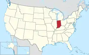
 Location within the U.S. state of Indiana | |
 Indiana's location within the U.S. | |
| Coordinates: 39°18′N 85°30′W | |
| Country | |
| State | |
| Founded | 12 December 1821 (authorized) 1822 (organized) |
| Named for | Stephen Decatur, Jr. |
| Seat | Greensburg |
| Largest city | Greensburg |
| Area | |
| • Total | 373.32 sq mi (966.9 km2) |
| • Land | 372.57 sq mi (965.0 km2) |
| • Water | 0.76 sq mi (2.0 km2) 0.20%% |
| Population | |
| • Estimate (2018) | 26,794 |
| • Density | 71.9/sq mi (27.8/km2) |
| Congressional district | 6th |
| Website | www |
| Indiana county number 16 | |
History
In 1787, the US defined the Northwest Territory which included the area of present-day Indiana. In 1800, Congress separated Ohio from the Northwest Territory, designating the rest of the land as the Indiana Territory.[3] President Thomas Jefferson chose William Henry Harrison as the governor of the territory, and Vincennes was established as the capital.[4] After the Michigan Territory was separated and the Illinois Territory was formed, Indiana was reduced to its current size and geography.[3] By December 1816 the Indiana Territory was admitted to the Union as a state.
Starting in 1794, Native American titles to Indiana lands were extinguished by usurpation, purchase, or war and treaty. The United States acquired land from the Native Americans in the 1809 treaty of Fort Wayne, and by the treaty of St. Mary's in 1818 considerably more territory became property of the government. This included the future Decatur County, which was authorized by the state legislature on 12 December 1821. No settler was allowed in the area until the government survey was completed in 1820.
The Decatur County governing structure was formed in 1822. The county was named for Commodore Stephen Decatur, Jr., naval officer in the First and Second Barbary Wars, and in the War of 1812.[5] Decatur was killed in a duel in 1820.[6]
Geography
The low rolling hills are devoted to agriculture or urban development, with only the areas carved by drainages still wooded.[7] The highest point (1,097 feet/334 meters ASL) is a hillock 0.8 mile (1.3 km) SSE from Kingston.[8] The Flatrock River flows westward through the upper part of the county, continuing into Shelby County. Clifty Creek flows southwestward through the central part of the county, continuing into Bartholomew, and Sand Creek flows south-southwestward through the lower center of the county, continuing into Jennings County.
According to the 2010 census, the county has a total area of 373.32 square miles (966.9 km2), of which 372.57 square miles (965.0 km2) (or 99.80%) is land and 0.76 square miles (2.0 km2) (or 0.20%) is water.[9]
.jpg.webp)
Adjacent counties
- Rush County – north
- Franklin County – east
- Ripley County – southeast
- Jennings County – south
- Bartholomew County – west
- Shelby County – northwest
City and towns
- Greensburg (city/county seat)
- Millhousen
- New Point
- St. Paul (part)
- Westport
Census-designated places
Unincorporated places
- Adams
- Alert
- Burney
- Craig
- Downeyville
- Ewington
- Forest Hill
- Gaynorsville
- Germantown
- Harper
- Harris City
- Horace
- Kingston
- Knarr Corner
- Letts
- Letts Corner
- McCoy
- Mechanicsburg
- Milford
- New Pennington
- Pinhook
- Rossburg
- Saint Maurice
- Saint Omer
- Sandusky
- Sardinia
- Slabtown
- Smyrna
- Tarkeo Corner
- Waynesburg
- Williamstown
Townships
Major highways
Protected areas
- Greenburg Reservoir State Fishing Area[7]
Lakes
- Greenburg Reservoir
- Lake McCoy
- Lake Santee[7]
Climate and weather
| Greensburg, Indiana | ||||||||||||||||||||||||||||||||||||||||||||||||||||||||||||
|---|---|---|---|---|---|---|---|---|---|---|---|---|---|---|---|---|---|---|---|---|---|---|---|---|---|---|---|---|---|---|---|---|---|---|---|---|---|---|---|---|---|---|---|---|---|---|---|---|---|---|---|---|---|---|---|---|---|---|---|---|
| Climate chart (explanation) | ||||||||||||||||||||||||||||||||||||||||||||||||||||||||||||
| ||||||||||||||||||||||||||||||||||||||||||||||||||||||||||||
| ||||||||||||||||||||||||||||||||||||||||||||||||||||||||||||
In recent years, average temperatures in Greensburg have ranged from a low of 19 °F (−7 °C) in January to a high of 85 °F (29 °C) in July, although a record low of −24 °F (−31 °C) was recorded in January 1985 and a record high of 105 °F (41 °C) was recorded in July 1954. Average monthly precipitation ranged from 2.42 inches (61 mm) in February to 5.03 inches (128 mm) in May.[10]
Government
The county government is a constitutional body, and is granted specific powers by the Constitution of Indiana, and by the Indiana Code.
County Council: The legislative branch of the county government; controls spending and revenue collection in the county. Representatives are elected to four-year terms from county districts. They set salaries, the annual budget, and special spending. The council has limited authority to impose local taxes, in the form of an income and property tax that is subject to state level approval, excise taxes, and service taxes.[11][12]
Board of Commissioners: The executive body of the county; commissioners are elected county-wide to staggered four-year terms. One commissioner serves as president. The commissioners execute acts legislated by the council, collect revenue, and manage the county government.[11][12]
Court: The county maintains a small claims court that handles civil cases. The judge on the court is elected to a term of four years and must be a member of the Indiana Bar Association. The judge is assisted by a constable who is also elected to a four-year term. In some cases, court decisions can be appealed to the state level circuit court.[12]
County Officials: The county has other elected offices, including sheriff, coroner, auditor, treasurer, recorder, surveyor, and circuit court clerk. These officers are elected to four-year terms. Members elected to county government positions are required to declare a party affiliation and to be residents of the county.[12]
Decatur County is part of Indiana's 6th congressional district; Indiana Senate district 42;[13] and Indiana House of Representatives district 67.[14]
| Year | Republican | Democratic | Third parties |
|---|---|---|---|
| 2020 | 77.9% 9,575 | 19.9% 2,439 | 2.2% 273 |
| 2016 | 76.0% 8,490 | 19.0% 2,121 | 5.1% 567 |
| 2012 | 68.9% 7,119 | 28.5% 2,941 | 2.6% 267 |
| 2008 | 61.4% 6,449 | 37.1% 3,892 | 1.5% 162 |
| 2004 | 73.5% 7,499 | 25.7% 2,621 | 0.8% 79 |
| 2000 | 66.7% 6,115 | 31.5% 2,889 | 1.8% 167 |
| 1996 | 50.8% 4,782 | 33.9% 3,190 | 15.3% 1,437 |
| 1992 | 50.5% 5,195 | 27.0% 2,774 | 22.6% 2,322 |
| 1988 | 67.4% 6,245 | 32.1% 2,979 | 0.5% 48 |
| 1984 | 70.0% 6,551 | 29.5% 2,766 | 0.5% 46 |
| 1980 | 58.5% 5,819 | 36.6% 3,646 | 4.9% 486 |
| 1976 | 55.6% 5,555 | 43.7% 4,365 | 0.7% 65 |
| 1972 | 68.8% 6,761 | 30.5% 2,994 | 0.7% 67 |
| 1968 | 55.7% 5,474 | 36.6% 3,602 | 7.7% 757 |
| 1964 | 45.6% 4,702 | 53.9% 5,564 | 0.5% 49 |
| 1960 | 60.2% 6,240 | 39.3% 4,080 | 0.5% 50 |
| 1956 | 64.9% 6,390 | 34.8% 3,427 | 0.4% 34 |
| 1952 | 65.2% 6,490 | 34.1% 3,393 | 0.8% 78 |
| 1948 | 57.0% 5,163 | 42.0% 3,808 | 1.1% 95 |
| 1944 | 60.9% 5,479 | 38.6% 3,471 | 0.6% 53 |
| 1940 | 57.7% 6,087 | 41.9% 4,417 | 0.4% 43 |
| 1936 | 50.7% 5,126 | 48.4% 4,887 | 0.9% 94 |
| 1932 | 45.6% 4,646 | 53.3% 5,437 | 1.1% 115 |
| 1928 | 58.4% 5,400 | 41.0% 3,791 | 0.6% 55 |
| 1924 | 52.9% 4,907 | 44.2% 4,092 | 2.9% 270 |
| 1920 | 57.7% 5,516 | 40.7% 3,896 | 1.6% 154 |
| 1916 | 51.4% 2,717 | 44.9% 2,374 | 3.7% 196 |
| 1912 | 24.4% 1,263 | 43.4% 2,246 | 32.1% 1,661 |
| 1908 | 50.6% 2,838 | 45.7% 2,564 | 3.7% 205 |
| 1904 | 55.5% 3,178 | 40.9% 2,341 | 3.7% 209 |
| 1900 | 51.6% 2,900 | 46.2% 2,598 | 2.2% 124 |
| 1896 | 52.6% 2,848 | 46.5% 2,520 | 0.9% 51 |
| 1892 | 49.4% 2,519 | 46.2% 2,355 | 4.4% 226 |
| 1888 | 51.9% 2,663 | 46.7% 2,400 | 1.4% 72 |
Demographics
| Historical population | |||
|---|---|---|---|
| Census | Pop. | %± | |
| 1830 | 5,887 | — | |
| 1840 | 12,171 | 106.7% | |
| 1850 | 15,107 | 24.1% | |
| 1860 | 17,294 | 14.5% | |
| 1870 | 19,053 | 10.2% | |
| 1880 | 19,779 | 3.8% | |
| 1890 | 19,277 | −2.5% | |
| 1900 | 19,518 | 1.3% | |
| 1910 | 18,793 | −3.7% | |
| 1920 | 17,813 | −5.2% | |
| 1930 | 17,308 | −2.8% | |
| 1940 | 17,722 | 2.4% | |
| 1950 | 18,218 | 2.8% | |
| 1960 | 20,019 | 9.9% | |
| 1970 | 22,738 | 13.6% | |
| 1980 | 23,841 | 4.9% | |
| 1990 | 23,645 | −0.8% | |
| 2000 | 24,555 | 3.8% | |
| 2010 | 25,740 | 4.8% | |
| 2018 (est.) | 26,794 | [16] | 4.1% |
| US Decennial Census[17] 1790–1960[18] 1900–1990[19] 1990–2000[20] 2010–2013[1] | |||
2010 Census
As of the 2010 United States Census, there were 25,740 people, 9,977 households, and 6,995 families in the county.[21] The population density was 69.1 inhabitants per square mile (26.7/km2). There were 11,209 housing units at an average density of 30.1 per square mile (11.6/km2).[9] The racial makeup of the county was 97.3% white, 0.7% Asian, 0.3% black or African American, 0.2% American Indian, 0.6% from other races, and 0.9% from two or more races. Those of Hispanic or Latino origin made up 1.7% of the population.[21] In terms of ancestry, In terms of ancestry, 35.5% were of English ancestry, 35.1% were of German, and 9.0% were of Irish ancestry according to 2010 American Community Survey.
Of the 9,977 households, 33.8% had children under the age of 18 living with them, 54.6% were married couples living together, 10.6% had a female householder with no husband present, 29.9% were non-families, and 25.0% of all households were made up of individuals. The average household size was 2.54 and the average family size was 3.02. The median age was 38.7 years.[21]
The median income for a household in the county was $47,697 and the median income for a family was $52,308. Males had a median income of $41,143 versus $30,226 for females. The per capita income for the county was $22,719. About 8.3% of families and 10.8% of the population were below the poverty line, including 17.3% of those under age 18 and 6.8% of those age 65 or over.[22]
References
- "Decatur County QuickFacts". United States Census Bureau. Archived from the original on 7 June 2011. Retrieved 17 September 2011.
- "Find a County". National Association of Counties. Archived from the original on 31 May 2011. Retrieved 7 June 2011.
- "Government at Crossroads: An Indiana chronology". The Herald Bulletin. 5 January 2008. Retrieved 22 July 2009.
- Brill, Marlene Targ (2005). Indiana. Marshall Cavendish. p. 35. ISBN 978-0-7614-2020-0.
- Gannett, Henry (1905). The Origin of Certain Place Names in the United States. Govt. Print. Off. p. 102.
- De Witt Clinton Goodrich & Charles Richard Tuttle (1875). An Illustrated History of the State of Indiana. Indiana: R. S. Peale & co. p. 555.
- Decatur County IN (Google Maps, accessed 13 August 2020)
- Decatur County High Point, Indiana (PeakBagger.com, accessed 13 August 2020)
- "Population, Housing Units, Area, and Density: 2010 – County". US Census Bureau. Archived from the original on 12 February 2020. Retrieved 10 July 2015.
- "Monthly Averages for Greensburg IN". The Weather Channel. Retrieved 27 January 2011.
- Indiana Code. "Title 36, Article 2, Section 3". IN.gov. Retrieved 16 September 2008.
- Indiana Code. "Title 2, Article 10, Section 2" (PDF). IN.gov. Archived (PDF) from the original on 27 December 2004. Retrieved 16 September 2008.
- "Indiana Senate Districts". State of Indiana. Retrieved 23 January 2011.
- "Indiana House Districts". State of Indiana. Retrieved 23 January 2011.
- Leip, David. "Atlas of US Presidential Elections". uselectionatlas.org. Retrieved 14 May 2018.
- "Population and Housing Unit Estimates". Retrieved July 26, 2019.
- "US Decennial Census". US Census Bureau. Retrieved July 10, 2014.
- "Historical Census Browser". University of Virginia Library. Archived from the original on December 12, 2009. Retrieved July 10, 2014.
- "Population of Counties by Decennial Census: 1900 to 1990". US Census Bureau. Retrieved July 10, 2014.
- "Census 2000 PHC-T-4. Ranking Tables for Counties: 1990 and 2000" (PDF). US Census Bureau. Retrieved July 10, 2014.
- "Profile of General Population and Housing Characteristics: 2010 Demographic Profile Data". US Census Bureau. Archived from the original on 13 February 2020. Retrieved 10 July 2015.
- "Selected Economic Characteristics – 2006–2010 American Community Survey 5-Year Estimates". US Census Bureau. Archived from the original on 14 February 2020. Retrieved 10 July 2015.
External links
Places adjacent to Decatur County, Indiana | ||||||||||
|---|---|---|---|---|---|---|---|---|---|---|
| ||||||||||
Municipalities and communities of Decatur County, Indiana, United States | ||
|---|---|---|
| City | Map of Indiana highlighting Decatur County | |
| Towns | ||
| Townships | ||
| CDPs | ||
| Other unincorporated communities |
| |
| Ghost town | ||
| Footnotes | ‡This populated place also has portions in an adjacent county or counties | |
| ||

| Authority control |
|---|