Sullivan County, Indiana
Sullivan County is a county in the U.S. state of Indiana, and determined by the US Census Bureau to include the mean center of U.S. population in 1940.[1] As of 2010, the population was 21,475.[2] The county seat (and the county's only incorporated city) is Sullivan.[3]
Sullivan County | |
|---|---|
 Sullivan County Courthouse | |
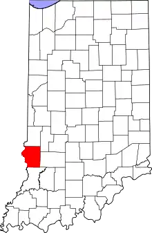 Location within the U.S. state of Indiana | |
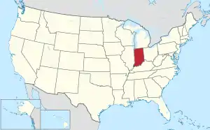 Indiana's location within the U.S. | |
| Coordinates: 39°05′N 87°25′W | |
| Country | |
| State | |
| Founded | January 15, 1817 (created) February 1817 (organized) |
| Named for | General Daniel Sullivan |
| Seat | Sullivan |
| Largest city | Sullivan |
| Area | |
| • Total | 454.12 sq mi (1,176.2 km2) |
| • Land | 447.14 sq mi (1,158.1 km2) |
| • Water | 6.97 sq mi (18.1 km2) 1.53%% |
| Population | |
| • Estimate (2018) | 20,690 |
| • Density | 46.3/sq mi (17.9/km2) |
| Congressional district | 8th |
| Website | www |
| Indiana county number 77 | |
Sullivan County is included in the Terre Haute, Indiana, metropolitan statistical area.
History
On February 25, 1779, Col. George Rogers Clark captured Fort Sackville at Vincennes from the British. About six miles (10 km) west at Pointe Coupee on the Wabash River on March 2, 1779, Capt. Leonard Helm commanding three boats and 50 volunteers from Vincennes captured a reinforcement fleet of seven boats carrying 40 soldiers and valuable supplies and Indian trade goods. This small naval battle completed the destruction of British military strength in the Wabash Valley.
The county's first settlement occurred between 1808 and 1812, by a religious society of celibates known as Shakers. The 400 members of this communal group occupied 1,300 acres (5 km2), seven miles (11 km) west of Carlisle.
General William Henry Harrison’s army made its last camp in Sullivan County at Big Springs on September 29, 1811. Harrison used Benjamin Turman's fort as his headquarters. With spring water available, it was an ideal location for 1000 men, including 160 dragoons and 60 mounted riflemen. A Kentucky soldier killed a fellow Kentuckian, Clark, either accidentally or in a grudge fight. The deceased was buried at the top of a hill that became the Mann Turman Cemetery. General Harrison and his troops continued north on the Wea Indiana Trail to build Fort Harrison and then proceeded to the Battle of Tippecanoe.
A War of 1812 military action occurred in September 1812, three miles (5 km) west−southwest of Sullivan County. While escorting supplies from Fort Knox near Vincennes to Fort Harrison at Terre Haute, Sergeant Nathan Fairbanks and approximately a dozen soldiers were ambushed - and most killed - by Indians.
In 1815, Carlisle was founded.
An act of the Indiana legislature dated December 30, 1916, created Sullivan County, with areas partitioned from Knox County. The effective date of the new government was 15 January 1817, with interim commissioners charged to begin organizing the new government in February.[4][5][6] It was named for Daniel Sullivan, said by some sources to have been a Revolutionary War general killed by Native Americans while carrying a dispatch between Fort Vincennes and Louisville.
A log courthouse in Merom served as Sullivan County's first county seat from 1819 to 1842. Merom was an important river port and a stop on the stage route known as The Old Harrison Trail. William Henry Harrison's troops camped near here on their 1811 march to the Battle of Tippecanoe.
Pioneer heroine of abdominal surgery Jane Todd is buried in Sullivan County. Born in Virginia in 1763, she and her husband, Thomas Crawford, moved to Green County, Kentucky, in 1805. Suffering from a huge abdominal tumor, she rode 60 miles (100 km) to Danville, Kentucky, to submit to a never−before−performed surgical procedure. On Christmas Day 1809, Dr. Ephraim McDowell performed the first ovariotomy, in his home. The ordeal lasted 25 minutes. There was no anesthesia. Mrs. Crawford recovered completely and years later came to Graysville to live with her son, Thomas, a Presbyterian minister. She died in 1842 at age 78. The restored McDowell home in Danville, Kentucky, is a surgical shrine.
Sullivan was founded in 1853 and became the county seat.
Dedicated in 1862, Union Christian College served as a preparatory school and college until 1924. In 1936 it became Merom Institute—a rural enrichment center. Now owned by the United Church of Christ, it serves as a camp, conference, and retreat center.
Numerous violent conflicts erupted in Sullivan County during the American Civil War over differing war sentiments. On July 14, 1864, anti-war Democrat John Drake was fatally shot at a community picnic near here.
Organized nationally to bring culture to rural communities, Merom's 10-day religious and educational Chautauqua event featured concerts, debates, plays, and lectures. Carrie Nation, William Jennings Bryan, William Howard Taft, Warren G. Harding, and Billy Sunday were among its speakers.
In 1968, the Sullivan County Park and Lake was created. It contains a 468-acre (1.9 km2) reservoir for swimming, boating, and fishing. The lake is stocked with crappie, hybrid saugeye, bass, bluegill, and channel catfish. Water skiing is popular. Sullivan County Park and Lake has 400 acres (1.6 km2) of land for camping and a 9-hole golf course. The campground offers sites ranging from primitive camping to space for motor homes.
Geography
Sullivan County lies on the west edge of Indiana; its western border abuts the state of Illinois (across the Wabash River). The meanders of the Wabash delineate the county's west border. The upper part of the county is drained by Turtle Creek, which flows southwestward into the river. The lower part of the county is similarly drained by Busseron Creek.
The county's abundant woods were largely cleared and devoted to agriculture during the nineteenth century. At present only the drainages remain wooded.[7] Its highest point (640 feet/195 meters ASL) is a small rise six miles (10 km) east of Carlisle.[8]
According to the 2010 census, the county has a total area of 454.12 square miles (1,176.2 km2), of which 447.14 square miles (1,158.1 km2) (or 98.46%) is land and 6.97 square miles (18.1 km2) (or 1.53%) is water.[9]
Adjacent counties
- Vigo County − north
- Clay County − northeast
- Greene County − east
- Knox County − south
- Crawford County, Illinois − west
- Clark County, Illinois − northwest
Protected areas
- Elliott Woods State Nature Preserve
- Greene-Sullivan State Forest (part)
- Redbird State Recreation Area (part)
- Shakamak State Park (part)
- Sullivan County Park and Lake
- Turtle Creek Reservoir
City
- Sullivan - county seat
Unincorporated communities
- Baker
- Baldridge
- Benefiel Corner
- Bucktown
- Campbell Corner
- Cass
- Curryville
- Dodds Bridge
- East Shelburn
- Fairbanks
- Gambill
- Gilmour − part
- Glendora
- Graysville
- Greenville
- Hawton
- Jackson Hill
- Jericho
- Lewis − part
- Massacre
- Merom Station
- New Lebanon
- Paxton
- Pleasantville
- Riverton
- Riverview
- Scotchtown
- Scott City
- Shiloh
- Standard
- Stringtown
- Wilfred
Ghost towns
Transportation
Major highways
 U.S. Route 41
 U.S. Route 150
 State Road 48
 State Road 54
 State Road 58
 State Road 63
 State Road 154
 State Road 159
Airport
The county contains one public-use airport, the Sullivan County Airport (SIV) at Sullivan.[10]
Economy
Peabody Energy Corporation The Bear Run mine is the largest surface mine in the eastern U.S. and was expected to produce 12 million tons of coal per year. The mine employed 500 employees in 2012.[11] However, as national coal demand declined, its production was cut back (to 7.2 million tons in 2016 and 2017, to 6.8 in 2018), and in November 2019 there were further reductions and layoffs.[12]
Education
Sullivan County is served by two school corporations, the Southwest School Corporation and the Northeast School Corporation. The former's high school is Sullivan High School in Sullivan, and the latter's high schools are North Central High School in Farmersburg and Union High School in Dugger. Union Christian College formerly operated in Merom.
Climate and weather
| Sullivan, Indiana | ||||||||||||||||||||||||||||||||||||||||||||||||||||||||||||
|---|---|---|---|---|---|---|---|---|---|---|---|---|---|---|---|---|---|---|---|---|---|---|---|---|---|---|---|---|---|---|---|---|---|---|---|---|---|---|---|---|---|---|---|---|---|---|---|---|---|---|---|---|---|---|---|---|---|---|---|---|
| Climate chart (explanation) | ||||||||||||||||||||||||||||||||||||||||||||||||||||||||||||
| ||||||||||||||||||||||||||||||||||||||||||||||||||||||||||||
| ||||||||||||||||||||||||||||||||||||||||||||||||||||||||||||
In recent years, average temperatures in Sullivan have ranged from a low of 18 °F (−8 °C) in January to a high of 85 °F (29 °C) in July, although a record low of −33 °F (−36 °C) was recorded in January 1994 and a record high of 98 °F (37 °C) was recorded in July 1999. Average monthly precipitation ranged from 2.58 inches (66 mm) in February to 4.69 inches (119 mm) in July.[13]
Government
The county government is a constitutional body, and is granted specific powers by the Constitution of Indiana, and by the Indiana Code.
County Council: The legislative branch of the county government; controls spending and revenue collection in the county. Representatives are elected to four-year terms from county districts. They set salaries, the annual budget, and special spending. The council has limited authority to impose local taxes, in the form of an income and property tax that is subject to state level approval, excise taxes, and service taxes.[14][15]
Board of Commissioners: The executive body of the county; commissioners are elected county-wide to staggered four-year terms. One commissioner serves as president. The commissioners execute acts legislated by the council, collect revenue, and manage the county government.[14][15]
Court: The county maintains a small claims court that handles civil cases. The judge on the court is elected to a term of four years and must be a member of the Indiana Bar Association. The judge is assisted by a constable who is also elected to a four-year term. In some cases, court decisions can be appealed to the state level circuit court.[15]
County Officials: The county has other elected offices, including sheriff, coroner, auditor, treasurer, recorder, surveyor, and circuit court clerk. These officers are elected to four-year terms. Members elected to county government positions are required to declare party affiliations and to be residents of the county.[15]
| Year | Republican | Democratic | Third parties |
|---|---|---|---|
| 2016 | 71.7% 6,138 | 24.7% 2,113 | 3.6% 308 |
| 2012 | 59.1% 4,902 | 38.5% 3,191 | 2.4% 197 |
| 2008 | 49.5% 4,343 | 48.8% 4,284 | 1.8% 155 |
| 2004 | 59.6% 4,999 | 39.8% 3,341 | 0.6% 54 |
| 2000 | 52.3% 4,319 | 46.4% 3,833 | 1.3% 110 |
| 1996 | 37.1% 3,207 | 47.2% 4,076 | 15.7% 1,359 |
| 1992 | 33.3% 3,052 | 45.9% 4,211 | 20.8% 1,905 |
| 1988 | 49.4% 4,246 | 50.3% 4,320 | 0.4% 31 |
| 1984 | 54.1% 4,771 | 45.5% 4,006 | 0.4% 36 |
| 1980 | 49.1% 4,465 | 47.6% 4,335 | 3.3% 303 |
| 1976 | 41.6% 3,747 | 57.7% 5,198 | 0.7% 61 |
| 1972 | 59.3% 5,338 | 40.3% 3,624 | 0.4% 39 |
| 1968 | 43.2% 4,266 | 45.1% 4,453 | 11.7% 1,155 |
| 1964 | 34.3% 3,867 | 65.3% 7,351 | 0.4% 42 |
| 1960 | 49.9% 6,012 | 49.5% 5,975 | 0.6% 73 |
| 1956 | 48.8% 5,829 | 50.6% 6,048 | 0.6% 69 |
| 1952 | 45.7% 5,929 | 53.6% 6,964 | 0.7% 95 |
| 1948 | 40.9% 4,824 | 56.8% 6,705 | 2.3% 272 |
| 1944 | 47.2% 5,855 | 51.8% 6,420 | 1.0% 122 |
| 1940 | 42.3% 6,471 | 56.7% 8,667 | 1.0% 151 |
| 1936 | 30.9% 4,685 | 67.3% 10,203 | 1.8% 266 |
| 1932 | 29.4% 3,667 | 62.8% 7,835 | 7.8% 975 |
| 1928 | 51.1% 6,199 | 46.5% 5,642 | 2.4% 293 |
| 1924 | 42.6% 5,139 | 43.3% 5,213 | 14.1% 1,701 |
| 1920 | 41.4% 5,376 | 47.4% 6,160 | 11.2% 1,455 |
| 1916 | 35.2% 2,630 | 52.0% 3,880 | 12.8% 953 |
| 1912 | 18.5% 1,406 | 48.8% 3,707 | 32.7% 2,480 |
| 1908 | 35.7% 2,942 | 56.5% 4,657 | 7.9% 649 |
| 1904 | 42.2% 3,076 | 49.9% 3,641 | 7.9% 578 |
| 1900 | 35.3% 2,326 | 60.8% 4,008 | 3.9% 257 |
| 1896 | 36.2% 2,317 | 62.6% 4,010 | 1.3% 82 |
| 1892 | 32.7% 1,784 | 57.8% 3,159 | 9.5% 519 |
| 1888 | 35.6% 1,902 | 63.2% 3,382 | 1.2% 64 |
Demographics
| Historical population | |||
|---|---|---|---|
| Census | Pop. | %± | |
| 1820 | 3,498 | — | |
| 1830 | 4,630 | 32.4% | |
| 1840 | 8,315 | 79.6% | |
| 1850 | 10,141 | 22.0% | |
| 1860 | 15,064 | 48.5% | |
| 1870 | 18,453 | 22.5% | |
| 1880 | 20,336 | 10.2% | |
| 1890 | 21,877 | 7.6% | |
| 1900 | 26,005 | 18.9% | |
| 1910 | 32,439 | 24.7% | |
| 1920 | 31,630 | −2.5% | |
| 1930 | 28,133 | −11.1% | |
| 1940 | 27,014 | −4.0% | |
| 1950 | 23,667 | −12.4% | |
| 1960 | 21,721 | −8.2% | |
| 1970 | 19,889 | −8.4% | |
| 1980 | 21,107 | 6.1% | |
| 1990 | 18,993 | −10.0% | |
| 2000 | 21,751 | 14.5% | |
| 2010 | 21,475 | −1.3% | |
| 2018 (est.) | 20,690 | [17] | −3.7% |
| US Decennial Census[18] 1790-1960[19] 1900-1990[20] 1990-2000[21] 2010-2013[2] | |||
2010 census
As of the 2010 United States Census, there were 21,475 people, 7,823 households, and 5,422 families in the county.[22] The population density was 48.0 inhabitants per square mile (18.5/km2). There were 8,939 housing units at an average density of 20.0 per square mile (7.7/km2).[9] The racial makeup of the county was 93.7% white, 4.5% black or African American, 0.3% American Indian, 0.2% Asian, 0.3% from other races, and 1.0% from two or more races. Those of Hispanic or Latino origin made up 1.4% of the population.[22] In terms of ancestry, 20.8% were German, 19.8% were American, 10.3% were Irish, and 9.7% were English.[23]
Of the 7,823 households, 31.7% had children under the age of 18 living with them, 53.4% were married couples living together, 10.8% had a female householder with no husband present, 30.7% were non-families, and 26.7% of all households were made up of individuals. The average household size was 2.45 and the average family size was 2.94. The median age was 39.8 years.[22]
The median income for a household in the county was $47,697 and the median income for a family was $52,558. Males had a median income of $44,645 versus $26,335 for females. The per capita income for the county was $20,093. About 8.5% of families and 11.9% of the population were below the poverty line, including 12.9% of those under age 18 and 11.7% of those age 65 or over.[24]
.png.webp) Turtle Creek Reservoir
Turtle Creek Reservoir.jpg.webp) Sullivan County Park & Lake
Sullivan County Park & Lake Sullivan County Farm
.jpg.webp) Merom Power Station
Merom Power Station Sullivan Public Library
External links
References
- "Mean Center of Population for the United States: 1790 to 2000" (PDF). US Census Bureau. Archived from the original (PDF) on November 3, 2001. Retrieved September 17, 2011.
- "Sullivan County QuickFacts". US Census Bureau. Retrieved September 25, 2011.
- "Find a County". National Association of Counties. Retrieved June 7, 2011.
- Thomas J. Wolfe (editor) (1909). "A History of Sullivan County, Indiana". Retrieved November 4, 2020.CS1 maint: extra text: authors list (link)
- "Organization Of Sullivan County". Sullivan County, Indiana. Sullivan County Historical Society. Retrieved July 12, 2014.
- "Sullivan County, Indiana". STATS Indiana. Indiana Business Research Center. Retrieved July 12, 2014.
- Sullivan County IN (Google Maps, accessed 4 November 2020)
- Sullivan County High Point, Indiana (PeakBagger.com, accessed 4 November 2020)
- "Population, Housing Units, Area, and Density: 2010 - County". US Census Bureau. Archived from the original on February 12, 2020. Retrieved July 10, 2015.
- Public and Private Airports, Sullivan County, Indiana
- Peabody Energy Earnings Report 2011
- "Miners To Be Laid Off As Peabody Scales Back Production". Inside Indiana Business. November 6, 2019. Retrieved November 4, 2020.
- "Monthly Averages for Sullivan, Indiana". The Weather Channel. Retrieved January 27, 2011.
- Indiana Code. "Title 36, Article 2, Section 3". IN.gov. Retrieved September 16, 2008.
- Indiana Code. "Title 2, Article 10, Section 2" (PDF). IN.gov. Retrieved September 16, 2008.
- Leip, David. "Atlas of US Presidential Elections". uselectionatlas.org. Retrieved May 20, 2018.
- "Population and Housing Unit Estimates". Retrieved July 26, 2019.
- "US Decennial Census". US Census Bureau. Retrieved July 10, 2014.
- "Historical Census Browser". University of Virginia Library. Retrieved July 10, 2014.
- "Population of Counties by Decennial Census: 1900 to 1990". US Census Bureau. Retrieved July 10, 2014.
- "Census 2000 PHC-T-4. Ranking Tables for Counties: 1990 and 2000" (PDF). US Census Bureau. Retrieved July 10, 2014.
- "Profile of General Population and Housing Characteristics: 2010 Demographic Profile Data". US Census Bureau. Archived from the original on February 13, 2020. Retrieved July 10, 2015.
- "Selected Social Characteristics in the US – 2006-2010 American Community Survey 5-Year Estimates". US Census Bureau. Archived from the original on February 14, 2020. Retrieved July 10, 2015.
- "Selected Economic Characteristics – 2006-2010 American Community Survey 5-Year Estimates". US Census Bureau. Archived from the original on February 14, 2020. Retrieved July 10, 2015.
Places adjacent to Sullivan County, Indiana | ||||||||||
|---|---|---|---|---|---|---|---|---|---|---|
| ||||||||||
Municipalities and communities of Sullivan County, Indiana, United States | ||
|---|---|---|
| Cities | Map of Indiana highlighting Sullivan County | |
| Towns | ||
| Townships | ||
| Unincorporated communities |
| |
| Ghost towns | ||
| Footnotes | ‡This populated place also has portions in an adjacent county or counties | |
| ||

| Authority control |
|---|