Shelby County, Indiana
Shelby County is a county in the U.S. state of Indiana. As of the 2010 United States Census, the population was 44,436.[1] The county seat (and only incorporated city) is Shelbyville.[2]
Shelby County | |
|---|---|
 Shelby County Courthouse in Shelbyville | |
 Location within the U.S. state of Indiana | |
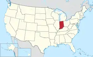 Indiana's location within the U.S. | |
| Coordinates: 39°31′N 85°47′W | |
| Country | |
| State | |
| Founded | 31 December 1821 (authorized) 1822 (organized) |
| Named for | Isaac Shelby |
| Seat | Shelbyville |
| Largest city | Shelbyville |
| Area | |
| • Total | 412.76 sq mi (1,069.0 km2) |
| • Land | 411.15 sq mi (1,064.9 km2) |
| • Water | 1.61 sq mi (4.2 km2) 0.39%% |
| Population | |
| • Estimate (2018) | 44,593 |
| • Density | 108.5/sq mi (41.9/km2) |
| Time zone | UTC−5 (Eastern) |
| • Summer (DST) | UTC−4 (EDT) |
| Congressional district | 6th |
| Website | www |
| Indiana county number 73 | |
History
After the American Revolutionary War established US sovereignty over the territory of the upper midwest, the new federal government defined the Northwest Territory in 1787, which included the area of present-day Indiana. In 1800, Congress separated Ohio from the Northwest Territory, designating the rest of the land as the Indiana Territory. President Thomas Jefferson chose William Henry Harrison as the governor of the territory, and Vincennes was established as the capital. After the Michigan Territory was separated and the Illinois Territory was formed, Indiana was reduced to its current size and geography. By December 1816 the Indiana Territory was admitted to the Union as a state.
The Native people who inhabited these areas prior to arrival of European settlers were generally resistant to the loss of their lands. As settlers pushed into the area, treaties signed by some leaders with United States representatives ceded large areas of their territory to the US. Starting in 1794, Native American titles to Indiana lands were extinguished by usurpation, purchase, or war and treaty. The United States acquired land from the Native Americans in the 1809 treaty of Fort Wayne, and by the treaty of St. Mary's in 1818, which included the future Shelby County.
The Indiana State Legislature passed a bill on 31 December 1821 that authorized the creation of four counties,[3] including Shelby. On 1 July 1822 the county was organized, beginning with selecting a site for the county seat.[4]
The new county was named for Gen. Isaac Shelby, who defeated the British at the Battle of Kings Mountain in the Revolutionary War. Shelby then became the first Governor of Kentucky. During the War of 1812, he led the army of Kentucky into Canada, and defeated the British at the decisive Battle of the Thames in 1813.
Geography
The low, rolling hills of Shelby County are lightly carved by drainages, but are otherwise completely devoted to agriculture or urban development. The western edge of the county is drained by Sugar Creek, flowing south-southwestward into Johnson County. The central and SW parts of the county are drained by Big Blue River, flowing south-southwestward into Johnson County. The lower part of the county is drained by Flatrock River, flowing southwestward into Bartholomew County.[5] The terrain slopes to the southwest, with its highest elevations (930 feet/283 meters ASL) along the eastern part of its northern border with Hancock County.[6] According to the 2010 census, the county has a total area of 412.76 square miles (1,069.0 km2), of which 411.15 square miles (1,064.9 km2) (or 99.61%) is land and 1.61 square miles (4.2 km2) (or 0.39%) is water.[7]
City and towns
- Edinburgh
- Fairland
- Morristown
- St. Paul (part)
- Shelbyville (city/county seat)
Unincorporated communities
- Beech Brook
- Bengal
- Blue Ridge
- Boggstown
- Brookfield
- Candleglo Village
- Clover Village
- Fenns
- Flat Rock
- Fountaintown
- Freeport
- Geneva
- Green Meadows
- Gwynneville
- Knighthood Grove
- Knighthood Village
- Lewis Creek
- London
- London Heights
- Marietta
- Marion
- Meiks
- Meltzer
- Middletown
- Morven
- Mount Auburn
- Norristown
- Pleasant View
- Pleasure Valley
- Prescott
- Rays Crossing
- Rolling Ridge
- Sleepy Hollow
- Smithland
- Sugar Creek
- Waldron (census-designated place)
- Walkerville
- Wilson Corner
Townships
Adjacent counties
- Hancock County - north
- Rush County - east
- Decatur County - southeast
- Bartholomew County - south
- Johnson County - west
- Marion County - northwest
Climate and weather
| Shelbyville, Indiana | ||||||||||||||||||||||||||||||||||||||||||||||||||||||||||||
|---|---|---|---|---|---|---|---|---|---|---|---|---|---|---|---|---|---|---|---|---|---|---|---|---|---|---|---|---|---|---|---|---|---|---|---|---|---|---|---|---|---|---|---|---|---|---|---|---|---|---|---|---|---|---|---|---|---|---|---|---|
| Climate chart (explanation) | ||||||||||||||||||||||||||||||||||||||||||||||||||||||||||||
| ||||||||||||||||||||||||||||||||||||||||||||||||||||||||||||
| ||||||||||||||||||||||||||||||||||||||||||||||||||||||||||||
In recent years, average temperatures in Shelbyville have ranged from a low of 18 °F (−8 °C) in January to a high of 86 °F (30 °C) in July, although a record low of −25 °F (−32 °C) was recorded in January 1994 and a record high of 105 °F (41 °C) was recorded in July 1954. Average monthly precipitation ranged from 2.38 inches (60 mm) in January to 4.47 inches (114 mm) in May.[8]
2010 Census
As of the 2010 United States Census, there were 44,436 people, 17,302 households, and 12,221 families in the county.[9] The population density was 108.1 inhabitants per square mile (41.7/km2). There were 19,080 housing units at an average density of 46.4 per square mile (17.9/km2).[7] The racial makeup of the county was 95.4% white, 1.0% black or African American, 0.5% Asian, 0.2% American Indian, 1.6% from other races, and 1.2% from two or more races. Those of Hispanic or Latino origin made up 3.7% of the population.[9] In terms of ancestry, 28.5% were German, 13.1% were American, 12.2% were Irish, and 9.0% were English.[10]
Of the 17,302 households, 33.8% had children under the age of 18 living with them, 54.4% were married couples living together, 10.5% had a female householder with no husband present, 29.4% were non-families, and 24.5% of all households were made up of individuals. The average household size was 2.53 and the average family size was 2.98. The median age was 39.9 years.[9]
The median income for a household in the county was $47,697 and the median income for a family was $60,824. Males had a median income of $46,325 versus $32,416 for females. The per capita income for the county was $26,398. About 7.4% of families and 10.0% of the population were below the poverty line, including 13.7% of those under age 18 and 10.5% of those age 65 or over.[11]
Government
The county government is a constitutional body, and is granted specific powers by the Constitution of Indiana, and by the Indiana Code.
County Council: The legislative branch of the county government; controls spending and revenue collection in the county. Representatives are elected to four-year terms from county districts. They set salaries, the annual budget, and special spending. The council has limited authority to impose local taxes, in the form of an income and property tax that is subject to state level approval, excise taxes, and service taxes.[12][13]
Board of Commissioners: The executive body of the county; commissioners are elected county-wide to staggered four-year terms. One commissioner serves as president. The commissioners execute the acts legislated by the council, collect revenue, and manage the county government.[12][13]
Court: Three State Trial Courts sit in the Courthouse located at 407 S. Harrison Street, Shelbyville, Indiana 46176. Shelby Circuit Court was established by the Indiana Constitution. Shelby Superior Courts 1 and 2 were created by Acts of the Legislature. Shelby Superior Court 2 handles the small claims. Cases are allocated between the Courts by Local Court Rules. The judges of the Shelby Cirucit and Superior Courts are elected to six (6) year terms and must be admitted to practice law in the State of Indiana. Appeals from Shelby County Trial Courts are made to the Indiana Court of Appeals.
County Officials: The county has other elected offices, including sheriff, coroner, auditor, treasurer, recorder, surveyor, and circuit court clerk. These officials are elected to four-year terms. Members elected to county government positions are required to declare party affiliations and to be residents of the county.[13]
Political Culture
| Year | Republican | Democratic | Third parties |
|---|---|---|---|
| 2020 | 72.9% 14,568 | 25.1% 5,023 | 2.0% 400 |
| 2016 | 70.7% 12,718 | 23.6% 4,247 | 5.7% 1,029 |
| 2012 | 65.5% 10,978 | 32.0% 5,359 | 2.5% 423 |
| 2008 | 58.7% 10,333 | 39.7% 6,987 | 1.6% 282 |
| 2004 | 71.1% 11,397 | 28.2% 4,519 | 0.7% 111 |
| 2000 | 62.6% 9,590 | 35.1% 5,374 | 2.3% 346 |
| 1996 | 51.4% 7,778 | 35.5% 5,374 | 13.2% 1,990 |
| 1992 | 49.8% 8,075 | 28.1% 4,560 | 22.1% 3,576 |
| 1988 | 65.1% 10,176 | 34.5% 5,382 | 0.4% 63 |
| 1984 | 66.9% 11,056 | 32.4% 5,357 | 0.7% 109 |
| 1980 | 61.2% 10,496 | 34.2% 5,861 | 4.6% 793 |
| 1976 | 55.2% 8,918 | 44.0% 7,098 | 0.8% 134 |
| 1972 | 72.4% 10,794 | 27.0% 4,028 | 0.5% 78 |
| 1968 | 52.8% 8,574 | 33.4% 5,417 | 13.8% 2,235 |
| 1964 | 44.4% 7,310 | 55.2% 9,078 | 0.4% 67 |
| 1960 | 56.8% 9,421 | 42.8% 7,111 | 0.4% 70 |
| 1956 | 58.0% 9,170 | 41.5% 6,561 | 0.5% 80 |
| 1952 | 57.2% 8,961 | 41.8% 6,552 | 1.0% 158 |
| 1948 | 45.5% 6,068 | 52.5% 6,992 | 2.0% 264 |
| 1944 | 49.6% 6,816 | 49.5% 6,798 | 0.9% 119 |
| 1940 | 47.0% 7,216 | 52.2% 8,015 | 0.8% 117 |
| 1936 | 41.0% 6,026 | 58.1% 8,552 | 0.9% 139 |
| 1932 | 38.1% 5,410 | 60.1% 8,552 | 1.8% 257 |
| 1928 | 56.1% 7,516 | 43.2% 5,790 | 0.6% 83 |
| 1924 | 51.5% 6,664 | 46.2% 5,976 | 2.3% 296 |
| 1920 | 47.2% 6,336 | 50.9% 6,845 | 1.9% 256 |
| 1916 | 42.9% 3,201 | 52.3% 3,900 | 4.8% 360 |
| 1912 | 17.3% 1,254 | 47.5% 3,432 | 35.2% 2,544 |
| 1908 | 44.5% 3,529 | 50.9% 4,035 | 4.5% 359 |
| 1904 | 48.2% 3,660 | 46.8% 3,550 | 5.0% 382 |
| 1900 | 44.8% 3,291 | 52.3% 3,846 | 2.9% 216 |
| 1896 | 44.6% 3,219 | 53.1% 3,828 | 2.3% 167 |
| 1892 | 40.7% 2,664 | 53.3% 3,490 | 6.1% 399 |
| 1888 | 44.4% 2,877 | 52.6% 3,409 | 3.0% 192 |
Demographics
| Historical population | |||
|---|---|---|---|
| Census | Pop. | %± | |
| 1830 | 6,295 | — | |
| 1840 | 12,005 | 90.7% | |
| 1850 | 15,502 | 29.1% | |
| 1860 | 19,569 | 26.2% | |
| 1870 | 21,892 | 11.9% | |
| 1880 | 25,257 | 15.4% | |
| 1890 | 25,454 | 0.8% | |
| 1900 | 26,491 | 4.1% | |
| 1910 | 26,802 | 1.2% | |
| 1920 | 25,982 | −3.1% | |
| 1930 | 26,552 | 2.2% | |
| 1940 | 25,953 | −2.3% | |
| 1950 | 28,026 | 8.0% | |
| 1960 | 34,093 | 21.6% | |
| 1970 | 37,797 | 10.9% | |
| 1980 | 39,887 | 5.5% | |
| 1990 | 40,307 | 1.1% | |
| 2000 | 43,445 | 7.8% | |
| 2010 | 44,436 | 2.3% | |
| 2018 (est.) | 44,593 | [15] | 0.4% |
| US Decennial Census[16] 1790-1960[17] 1900-1990[18] 1990-2000[19] 2010-2013[1] | |||
Notable People
- Isaac Colton Ash, Los Angeles, California, City Council member, 1925–27
- George W. Clarke, governor of Iowa, 1913–1917
- Edith Jones Woodward, astronomer, born in Waldron in 1914
- Kid Quill, hip hop/rap
References
- "Shelby County QuickFacts". US Census Bureau. Retrieved 25 September 2011.
- "Find a County". National Association of Counties. Retrieved 7 June 2011.
- The counties authorized on 31 December 1821 were Henry, Marion, Rush, and Shelby.
- Shelby County Indiana History (1876), pp. 6-9 (accessed 14 August 2020)
- Shelby County IN (Google Maps, accessed 14 August 2020)
- Shelby County High Point, Indiana (PeakBagger.com, accessed 14 August 2020)
- "Population, Housing Units, Area, and Density: 2010 - County". US Census Bureau. Archived from the original on 12 February 2020. Retrieved 10 July 2015.
- "Monthly Averages for Shelbyville IN". The Weather Channel. Retrieved 27 January 2011.
- "Profile of General Population and Housing Characteristics: 2010 Demographic Profile Data". US Census Bureau. Archived from the original on 13 February 2020. Retrieved 10 July 2015.
- "Selected Social Characteristics in the US – 2006-2010 American Community Survey 5-Year Estimates". US Census Bureau. Archived from the original on 14 February 2020. Retrieved 10 July 2015.
- "Selected Economic Characteristics – 2006-2010 American Community Survey 5-Year Estimates". US Census Bureau. Archived from the original on 14 February 2020. Retrieved 10 July 2015.
- Indiana Code. "Title 36, Article 2, Section 3". IN.gov. Retrieved 16 September 2008.
- Indiana Code. "Title 2, Article 10, Section 2" (PDF). IN.gov. Retrieved 16 September 2008.
- Leip, David. "Atlas of US Presidential Elections". uselectionatlas.org.
- "Population and Housing Unit Estimates". Retrieved July 26, 2019.
- "US Decennial Census". US Census Bureau. Retrieved July 10, 2014.
- "Historical Census Browser". University of Virginia Library. Retrieved July 10, 2014.
- "Population of Counties by Decennial Census: 1900 to 1990". US Census Bureau. Retrieved July 10, 2014.
- "Census 2000 PHC-T-4. Ranking Tables for Counties: 1990 and 2000" (PDF). US Census Bureau. Retrieved July 10, 2014.
- Young, Julie (2010). A brief history of Shelby County, Indiana. Charleston SC: History Press. ISBN 978-1-59629-846-0.
Places adjacent to Shelby County, Indiana | ||||||||||
|---|---|---|---|---|---|---|---|---|---|---|
| ||||||||||
Municipalities and communities of Shelby County, Indiana, United States | ||
|---|---|---|
| City | Map of Indiana highlighting Shelby County | |
| Towns | ||
| Townships | ||
| CDP | ||
| Other unincorporated communities |
| |
| Footnotes | ‡This populated place also has portions in an adjacent county or counties | |
| ||
.jpg.webp)

| Authority control |
|---|