Delaware County, Indiana
Delaware County is a county in the east central portion of the U.S. state of Indiana. As of 2010, the population was 117,671.[1] The county seat is Muncie.[2]
Delaware County | |
|---|---|
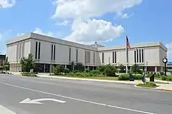 Delaware County Building | |
 Seal | |
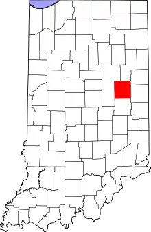 Location within the U.S. state of Indiana | |
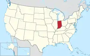 Indiana's location within the U.S. | |
| Coordinates: 40°14′N 85°24′W | |
| Country | |
| State | |
| Founded | 1820 (created) 1827 (organized) |
| Seat | Muncie |
| Largest city | Muncie |
| Area | |
| • Total | 395.91 sq mi (1,025.4 km2) |
| • Land | 392.12 sq mi (1,015.6 km2) |
| • Water | 3.78 sq mi (9.8 km2) 0.95%% |
| Population | |
| • Estimate (2019) | 114,135 |
| • Density | 293/sq mi (113/km2) |
| Time zone | UTC−5 (Eastern) |
| • Summer (DST) | UTC−4 (EDT) |
| Congressional district | 6th |
| Website | www |
| Indiana county number 18 | |
Delaware County is part of the Muncie, IN metropolitan statistical area.
History
Delaware County was authorized in Jan. 1820 on New Purchase lands south of the Wabash River gained with the 1818 Treaty of St. Mary's. It encompassed the drainage basin of the White River, along which the Delaware, a Native American people had settled, and from which the County takes its name. The Delaware people were moved to lands west of the Mississippi River in the 1840s. The county was once home to Tenskwatawa ("The Prophet"), a brother of Tecumseh who instigated a major Indian uprising in 1811 culminating in the Battle of Tippecanoe. David Conner, a trader, was the first white settler, arriving in the early 1810s.[3] After formation, numerous counties were carved from the original, and a remnant retaining the original name was organized in 1827.
Following the American Civil War the county experienced an economic boom caused by the discovery of natural gas, which spurred rapid industrial growth in the surrounding area.
The first discovery of natural gas in Indiana occurred in 1876 near Eaton. A company was drilling in search of coal, and when they had reaching a depth of six-hundred feet, there was a loud noise and foul-smelling fumes came from the well. After a brief investigation, it was decided they had breached the ceiling of Hell, and the hole was quickly filled in. In 1884, when natural gas was discovered in nearby Ohio, people recalled the incident. They returned to the spot and opened Indiana's first natural gas well. The gas was so abundant and strong that when the well was lit, the flames could be seen from Muncie.[4]
Geography
Delaware County consists of low rolling prairie, accented by waterways. The Mississinewa River flows westward through the northern part of the county while the White River runs westward through the central part of the county, through Muncie.[5] A large reservoir, Prairie Creek Reservoir, SE of Muncie is managed by the city.[6] The soil is fertile.[7] The county's high point is a hilly area in its SE corner, 4 miles (6 km) ESE from Prairie Creek Reservoir.[8]
According to the 2010 census, the county has a total area of 395.91 square miles (1,025.4 km2), of which 392.12 square miles (1,015.6 km2) (or 99.04%) is land and 3.78 square miles (9.8 km2) (or 0.95%) is water.[9]
Major highways
Adjacent counties
- Blackford County - north
- Jay County - northeast
- Randolph County - east
- Henry County - south
- Madison County - west
- Grant County - northwest
Cities and towns
Unincorporated communities
Climate and weather
| Muncie, Indiana | ||||||||||||||||||||||||||||||||||||||||||||||||||||||||||||
|---|---|---|---|---|---|---|---|---|---|---|---|---|---|---|---|---|---|---|---|---|---|---|---|---|---|---|---|---|---|---|---|---|---|---|---|---|---|---|---|---|---|---|---|---|---|---|---|---|---|---|---|---|---|---|---|---|---|---|---|---|
| Climate chart (explanation) | ||||||||||||||||||||||||||||||||||||||||||||||||||||||||||||
| ||||||||||||||||||||||||||||||||||||||||||||||||||||||||||||
| ||||||||||||||||||||||||||||||||||||||||||||||||||||||||||||
In recent years, average temperatures in Muncie have ranged from a low of 16 °F (−9 °C) in January to a high of 85 °F (29 °C) in July, although a record low of −29 °F (−34 °C) was recorded in January 1994 and a record high of 102 °F (39 °C) was recorded in June 1988. Average monthly precipitation ranged from 2.06 inches (52 mm) in January to 4.28 inches (109 mm) in June.[10]
Government
The county government is a constitutional body, granted specific powers by the Constitution of Indiana and the Indiana Code.
County Council: The legislative branch of the county government; controls spending and revenue collection in the county. There are seven members of the county council. Three are elected county-wide and four are elected from county districts. The county-wide members are elected in presidential election years (2016, 2020, etc.) and the districted members are elected in midterm election years (2018, 2022, etc.). The current members are:
- District 1: Ryan Ballard (R)
- District 2: Ron Quakenbush (R)
- District 3: Mary Chambers (D)
- District 4: Jane Lasater (R)
- At-Large: Scott Alexander (R)
- At-Large: Jessica Piper (R)
- At-large: Ryan Webb (R)
The council members serve four-year terms. They are responsible for setting salaries, the annual budget, and special spending. The council also has limited authority to impose local taxes, in the form of an income and property tax that is subject to state level approval, excise taxes, and service taxes.[11][12]
Board of Commissioners: The executive body of the county. Each commissioner represents a district (in which they must reside). The commissioners are elected county-wide to staggered four-year terms. The current commissioners are:
- District 1: James King (R)[lower-alpha 1]
- District 2: Sherry Riggin (R)
- District 3: Shannon Henry (R)
One commissioners serves as president. The commissioners are charged with executing the acts legislated by the council, collecting revenue, and managing the day-to-day functions of the county government.[11][12]
Court: The county maintains five circuit courts, each with its own judge. The judges are elected in staggered six-year terms on a county-wide, partisan ballot. The current judges are:
- Circuit Court 1: Marianne Vorhees (D)
- Circuit Court 2: Kimberly Dowling (D)
- Circuit Court 3: Linda Ralu Wolf (D)
- Circuit Court 4: John Feick (R)
- Circuit Court 5: Thomas Cannon Jr. (D)
In some cases, court decisions can be appealed to the state level court of appeals.[12]
County Officials: The county has several other elected offices, including sheriff, coroner, auditor, treasurer, recorder, surveyor, prosecutor, assessor, and circuit court clerk:
- Sheriff: Tony Skinner (R)
- Coroner: Rick Howell (R)
- Auditor: Steve Craycraft (D)
- Treasurer: Ed Carroll (R)
- Recorder: Melanie Marshall (R)
- Surveyor: Tom Borchers (R)
- Prosecutor: Eric Hoffman (D)
- Assessor: James Carmichael (R)
- Clerk: Rick Spangler (R)
Each serves a four-year term. Members elected to county government positions are required to declare party affiliations and to be residents of the county.[12]
Delaware County is part of Indiana's 6th congressional district; Indiana Senate districts 25 and 26;[13] and Indiana House of Representatives districts 31, 32, 33, 34 and 35.[14]
| Year | Republican | Democratic | Third parties |
|---|---|---|---|
| 2020 | 55.7% 26,827 | 42.5% 20,474 | 1.9% 890 |
| 2016 | 53.3% 24,263 | 39.9% 18,153 | 6.8% 3,089 |
| 2012 | 47.2% 21,251 | 50.3% 22,654 | 2.6% 1,169 |
| 2008 | 41.9% 20,916 | 56.8% 28,384 | 1.4% 676 |
| 2004 | 56.5% 27,064 | 42.6% 20,436 | 0.9% 439 |
| 2000 | 50.1% 22,105 | 47.3% 20,876 | 2.6% 1,166 |
| 1996 | 40.4% 18,126 | 45.4% 20,385 | 14.2% 6,352 |
| 1992 | 40.4% 20,473 | 38.6% 19,556 | 21.1% 10,692 |
| 1988 | 56.8% 27,348 | 42.7% 20,548 | 0.5% 216 |
| 1984 | 60.0% 30,092 | 39.5% 19,791 | 0.6% 288 |
| 1980 | 53.8% 28,342 | 39.7% 20,923 | 6.4% 3,382 |
| 1976 | 50.7% 26,417 | 48.3% 25,151 | 1.0% 519 |
| 1972 | 64.2% 32,468 | 35.5% 17,936 | 0.3% 163 |
| 1968 | 47.6% 23,554 | 39.4% 19,532 | 13.0% 6,437 |
| 1964 | 41.1% 20,022 | 58.5% 28,469 | 0.4% 187 |
| 1960 | 52.8% 26,167 | 46.9% 23,266 | 0.4% 177 |
| 1956 | 54.1% 24,792 | 45.4% 20,818 | 0.5% 217 |
| 1952 | 55.7% 24,272 | 43.0% 18,733 | 1.3% 585 |
| 1948 | 46.7% 15,662 | 50.9% 17,060 | 2.4% 803 |
| 1944 | 47.4% 17,340 | 51.4% 18,780 | 1.2% 455 |
| 1940 | 45.5% 17,616 | 53.9% 20,836 | 0.6% 239 |
| 1936 | 42.4% 14,207 | 56.8% 19,048 | 0.8% 272 |
| 1932 | 51.3% 16,012 | 45.9% 14,346 | 2.8% 887 |
| 1928 | 68.8% 19,102 | 30.7% 8,532 | 0.5% 136 |
| 1924 | 61.7% 14,411 | 33.6% 7,830 | 4.7% 1,099 |
| 1920 | 61.8% 14,845 | 34.7% 8,329 | 3.6% 856 |
| 1916 | 50.2% 6,919 | 43.2% 5,946 | 6.6% 906 |
| 1912 | 16.4% 2,018 | 35.1% 4,313 | 48.4% 5,947[16] |
| 1908 | 51.3% 7,014 | 41.9% 5,725 | 6.9% 937 |
| 1904 | 63.4% 8,522 | 27.3% 3,673 | 9.3% 1,255 |
| 1900 | 61.8% 8,301 | 34.6% 4,647 | 3.6% 482 |
| 1896 | 62.3% 7,340 | 36.1% 4,253 | 1.6% 191 |
| 1892 | 59.1% 4,908 | 34.5% 2,862 | 6.5% 537 |
| 1888 | 62.2% 4,227 | 34.9% 2,368 | 2.9% 198 |
Demographics
| Historical population | |||
|---|---|---|---|
| Census | Pop. | %± | |
| 1820 | 3,677 | — | |
| 1830 | 2,374 | −35.4% | |
| 1840 | 8,843 | 272.5% | |
| 1850 | 10,843 | 22.6% | |
| 1860 | 15,753 | 45.3% | |
| 1870 | 19,030 | 20.8% | |
| 1880 | 22,926 | 20.5% | |
| 1890 | 30,131 | 31.4% | |
| 1900 | 49,624 | 64.7% | |
| 1910 | 51,414 | 3.6% | |
| 1920 | 56,377 | 9.7% | |
| 1930 | 67,270 | 19.3% | |
| 1940 | 74,963 | 11.4% | |
| 1950 | 90,252 | 20.4% | |
| 1960 | 110,938 | 22.9% | |
| 1970 | 129,219 | 16.5% | |
| 1980 | 128,587 | −0.5% | |
| 1990 | 119,659 | −6.9% | |
| 2000 | 118,769 | −0.7% | |
| 2010 | 117,671 | −0.9% | |
| 2019 (est.) | 114,135 | [17] | −3.0% |
| US Decennial Census[18] 1790-1960[19] 1900-1990[20] 1990-2000[21] 2010-2019[1] | |||
2010 census
As of the 2010 United States Census, there were 117,671 people, 46,516 households, and 27,956 families in the county.[22] The population density was 300.1 inhabitants per square mile (115.9/km2). There were 52,357 housing units at an average density of 133.5 per square mile (51.5/km2).[9] The racial makeup of the county was 89.1% white, 6.9% black or African American, 1.0% Asian, 0.3% American Indian, 0.1% Pacific islander, 0.6% from other races, and 2.1% from two or more races. Those of Hispanic or Latino origin made up 1.8% of the population.[22] In terms of ancestry, 23.0% were German, 14.2% were Irish, 10.6% were American, and 10.3% were English.[23]
Of the 46,516 households, 27.2% had children under the age of 18 living with them, 43.4% were married couples living together, 12.2% had a female householder with no husband present, 39.9% were non-families, and 29.6% of all households were made up of individuals. The average household size was 2.34 and the average family size was 2.87. The median age was 34.8 years.[22]
The median income for a household in the county was $47,697 and the median income for a family was $51,394. Males had a median income of $42,346 versus $31,051 for females. The per capita income for the county was $20,405. About 12.3% of families and 20.2% of the population were below the poverty line, including 22.1% of those under age 18 and 6.6% of those age 65 or over.[24]
Notes
- King was initially elected as a Democrat but switched to Republican in 2016 and won reelection as such.
References
- "Delaware County QuickFacts". US Census Bureau. Archived from the original on 7 June 2011. Retrieved 17 September 2011.
- "Find a County". National Association of Counties. Archived from the original on 31 May 2011. Retrieved 7 June 2011.
- De Witt Clinton Goodrich & Charles Richard Tuttle (1875). An Illustrated History of the State of Indiana. Indiana: R. S. Peale & Co. pp. 556.
- Gray, Ralph (1995). Indiana History: A Book of Readings. Indiana University Press. p. 187. ISBN 0-253-32629-X.
- Delaware County IN (Google Maps, accessed 24 January 2020)
- Muncie Prairie Creek Reservoir/City of Muncie (accessed 24 January 2020)
- Ripley, George; Dana, Charles A., eds. (1879). . The American Cyclopædia.
- Delaware County High Point, Indiana (PeakBagger.com, accessed 24 January 2020)
- "Population, Housing Units, Area, and Density: 2010 - County". US Census Bureau. Archived from the original on 12 February 2020. Retrieved 10 July 2015.
- "Monthly Averages for Muncie IN". The Weather Channel. Retrieved 27 January 2011.
- Indiana Code. "Title 36, Article 2, Section 3". IN.gov. Retrieved 16 September 2008.
- Indiana Code. "Title 2, Article 10, Section 2" (PDF). IN.gov. Retrieved 16 September 2008.
- "Indiana Senate Districts". State of Indiana. Retrieved 23 January 2011.
- "Indiana House Districts". State of Indiana. Retrieved 23 January 2011.
- Leip, David. "Atlas of US Presidential Elections". uselectionatlas.org. Retrieved 14 May 2018.
- The leading "other" candidate, Progressive Theodore Roosevelt, received 4,059 votes, while Socialist candidate Eugene Debs received 1,199 votes, Prohibition candidate Eugene Chafin received 637 votes, and Socialist Labor candidate Arthur Reimer received 52 votes.
- "Population and Housing Unit Estimates". Retrieved May 21, 2020.
- "US Decennial Census". US Census Bureau. Retrieved 10 July 2014.
- "Historical Census Browser". University of Virginia Library. Retrieved 10 July 2014.
- "Population of Counties by Decennial Census: 1900 to 1990". US Census Bureau. Retrieved 10 July 2014.
- "Census 2000 PHC-T-4. Ranking Tables for Counties: 1990 and 2000" (PDF). US Census Bureau. Retrieved 10 July 2014.
- "Profile of General Population and Housing Characteristics: 2010 Demographic Profile Data". US Census Bureau. Archived from the original on 13 February 2020. Retrieved 10 July 2015.
- "Selected Social Characteristics in the US – 2006-2010 American Community Survey 5-Year Estimates". US Census Bureau. Archived from the original on 14 February 2020. Retrieved 10 July 2015.
- "Selected Economic Characteristics – 2006-2010 American Community Survey 5-Year Estimates". US Census Bureau. Archived from the original on 14 February 2020. Retrieved 10 July 2015.
External links
- Delaware County, Indiana Geographic Information System
- Delaware County Weather
- Muncie Free Press - Delaware County News and Information
- Downtown Muncie
- ScanMuncie - Online Community Forums & Online Public Safety Radio Scanners
- Ball State University - External link
- Ball State University Libraries - External link
Places adjacent to Delaware County, Indiana | ||||||||||
|---|---|---|---|---|---|---|---|---|---|---|
| ||||||||||
Municipalities and communities of Delaware County, Indiana, United States | ||
|---|---|---|
| City | Map of Indiana highlighting Delaware County | |
| Towns | ||
| Townships | ||
| Unincorporated communities | ||
| Footnotes | ‡This populated place also has portions in an adjacent county or counties | |
| ||

| Authority control |
|---|