Union County, Indiana
Union County is a county in the U.S. state of Indiana. As of the 2010 United States Census, the population was 7,516.[1] The county seat is Liberty.[2]
Union County | |
|---|---|
.jpg.webp) Union County Courthouse in Liberty | |
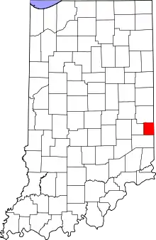 Location within the U.S. state of Indiana | |
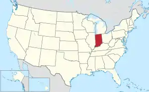 Indiana's location within the U.S. | |
| Coordinates: 39°37′N 84°55′W | |
| Country | |
| State | |
| Founded | 5 January 1821 (created) 1 February 1821 (organized) |
| Seat | Liberty |
| Largest town | Liberty |
| Area | |
| • Total | 165.18 sq mi (427.8 km2) |
| • Land | 161.22 sq mi (417.6 km2) |
| • Water | 3.95 sq mi (10.2 km2) 2.39%% |
| Population | |
| • Estimate (2018) | 7,037 |
| • Density | 43.6/sq mi (16.8/km2) |
| Time zone | UTC−5 (Eastern) |
| • Summer (DST) | UTC−4 (EDT) |
| Congressional district | 6th |
| Website | www |
| Indiana county number 81 | |

History
The future state of Indiana was first regulated by passage of the Northwest Ordinance in 1787. In 1790 the Territory was divided into two counties, with Knox covering much of present-day Indiana. In 1810, a portion of Knox was partitioned to create Wayne County; in 1811 a portion further south was partitioned to create Franklin. The area between those two counties was partitioned in 1818 to create Fayette, and by the 1820s the eastern part of Fayette County was populated sufficiently to warrant separate representation. Thus on 5 January 1821 the state legislature authorized the creation of Union County, with areas ceded from Wayne, Fayette, and Franklin counties. The organization of the new county's governing structure began on 1 February 1821.[3] It was so named because it is a union of parts of Fayette, Franklin and Wayne counties. The first settlers were from Laurens District, South Carolina. John Templeton was the first settler to enter land at the Cincinnati land office in what would become Harmony Township, Union County Indiana. The first county seat was Brownsville, a small community on the East Fork of the Whitewater River. The seat was moved in 1824 to Liberty, a central location. The primary industry of Union County was and is farming.
Geography
Union County lies on the east side of Indiana; its east border abuts the state of Ohio. Its low rolling hills have now been cleared of timber, although drainage areas are still largely brush-filled. The area is devoted to agricultural or recreational uses.[4] The highest point on the terrain (1140 feet/347 meters ASL) is a rise near the county's north border, 1.0 mile (1.6 km) ENE from Witts Station.[5]
Silver Creek flows southwestward through the northeastern part of the county, discharging into Whitewater Lake. The East Fork of Whitewater River flows southward through the upper western part of the county, discharging into Brookville Lake. The lower part of the county is drained by Dubois Creek, flowing westward into Brookville Lake.[4]
According to the 2010 census, the county has a total area of 165.18 square miles (427.8 km2), of which 161.22 square miles (417.6 km2) (or 97.60%) is land and 3.95 square miles (10.2 km2) (or 2.39%) is water.[6]
Adjacent counties
- Wayne County - north
- Preble County, Ohio - east
- Butler County, Ohio - southeast
- Franklin County - south
- Fayette County - west
Lakes
- Brookville Lake (part)
- Whitewater Lake
Protected areas
Incorporated towns
- Liberty (county seat)
- West College Corner
Unincorporated communities
Climate and weather
| Liberty, Indiana | ||||||||||||||||||||||||||||||||||||||||||||||||||||||||||||
|---|---|---|---|---|---|---|---|---|---|---|---|---|---|---|---|---|---|---|---|---|---|---|---|---|---|---|---|---|---|---|---|---|---|---|---|---|---|---|---|---|---|---|---|---|---|---|---|---|---|---|---|---|---|---|---|---|---|---|---|---|
| Climate chart (explanation) | ||||||||||||||||||||||||||||||||||||||||||||||||||||||||||||
| ||||||||||||||||||||||||||||||||||||||||||||||||||||||||||||
| ||||||||||||||||||||||||||||||||||||||||||||||||||||||||||||
In recent years, average temperatures in Liberty have ranged from a low of 17 °F (−8 °C) in January to a high of 87 °F (31 °C) in July, although a record low of −31 °F (−35 °C) was recorded in January 1994 and a record high of 104 °F (40 °C) was recorded in September 1951. Average monthly precipitation ranged from 2.68 inches (68 mm) in September to 4.90 inches (124 mm) in May.[7]
Government
The county government is a constitutional body, and is granted specific powers by the Constitution of Indiana, and by the Indiana Code.
County Council: The legislative branch of the county government; controls spending and revenue collection in the county. Representatives are elected to four-year terms from county districts. They set salaries, the annual budget, and special spending. The council has limited authority to impose local taxes, in the form of an income and property tax that is subject to state level approval, excise taxes, and service taxes.[8][9]
Board of Commissioners: The executive body of the county. Commissioners are elected county-wide to staggered four-year terms. One commissioner serves as president. The commissioners execute acts legislated by the council, collect revenue, and manage county government.[8][9]
Court: The county maintains a circuit court that can handle all case types. The judge of the court is elected to a term of six years and must be a member of the Indiana Bar Association. In some cases, court decisions can be appealed to the state level appeals court.[9]
County Officials: The county has other elected offices, including sheriff, coroner, auditor, treasurer, recorder, surveyor, and circuit court clerk. These officers are elected to four-year terms. People elected to county government positions are required to be residents of the county.[9]
| Year | Republican | Democratic | Third parties |
|---|---|---|---|
| 2016 | 74.3% 2,445 | 21.7% 715 | 4.0% 131 |
| 2012 | 65.1% 2,022 | 32.8% 1,018 | 2.1% 64 |
| 2008 | 61.4% 2,061 | 36.5% 1,224 | 2.1% 70 |
| 2004 | 67.8% 2,266 | 31.3% 1,045 | 1.0% 33 |
| 2000 | 65.0% 1,838 | 32.8% 927 | 2.2% 63 |
| 1996 | 48.9% 1,334 | 37.3% 1,019 | 13.8% 377 |
| 1992 | 47.0% 1,394 | 30.3% 898 | 22.8% 676 |
| 1988 | 65.5% 1,814 | 34.2% 946 | 0.4% 10 |
| 1984 | 70.4% 1,970 | 29.1% 816 | 0.5% 14 |
| 1980 | 63.5% 1,766 | 32.3% 898 | 4.2% 116 |
| 1976 | 58.3% 1,631 | 41.4% 1,160 | 0.3% 9 |
| 1972 | 72.5% 2,043 | 27.2% 765 | 0.4% 10 |
| 1968 | 56.0% 1,691 | 30.5% 920 | 13.5% 408 |
| 1964 | 51.0% 1,531 | 48.7% 1,463 | 0.4% 11 |
| 1960 | 63.7% 2,087 | 36.0% 1,180 | 0.2% 8 |
| 1956 | 63.5% 2,026 | 36.3% 1,157 | 0.3% 9 |
| 1952 | 67.2% 2,159 | 32.1% 1,029 | 0.7% 23 |
| 1948 | 63.3% 1,859 | 35.7% 1,049 | 1.1% 31 |
| 1944 | 63.1% 1,998 | 36.4% 1,154 | 0.5% 17 |
| 1940 | 58.4% 2,009 | 41.1% 1,415 | 0.6% 19 |
| 1936 | 49.2% 1,630 | 50.2% 1,662 | 0.6% 21 |
| 1932 | 50.4% 1,658 | 48.3% 1,587 | 1.3% 44 |
| 1928 | 66.0% 2,101 | 33.6% 1,069 | 0.4% 14 |
| 1924 | 58.8% 1,907 | 39.6% 1,284 | 1.7% 54 |
| 1920 | 58.3% 1,984 | 40.4% 1,375 | 1.3% 44 |
| 1916 | 53.0% 997 | 43.9% 826 | 3.2% 60 |
| 1912 | 35.9% 643 | 39.3% 705 | 24.8% 444 |
| 1908 | 54.3% 1,066 | 41.1% 808 | 4.6% 91 |
| 1904 | 57.5% 1,156 | 37.7% 758 | 4.8% 96 |
| 1900 | 52.7% 1,060 | 44.6% 897 | 2.7% 55 |
| 1896 | 54.1% 1,118 | 44.3% 915 | 1.7% 35 |
| 1892 | 51.8% 981 | 44.3% 839 | 3.9% 74 |
| 1888 | 54.7% 1,108 | 42.9% 868 | 2.4% 48 |
Demographics
| Historical population | |||
|---|---|---|---|
| Census | Pop. | %± | |
| 1830 | 7,944 | — | |
| 1840 | 8,017 | 0.9% | |
| 1850 | 6,944 | −13.4% | |
| 1860 | 7,109 | 2.4% | |
| 1870 | 6,341 | −10.8% | |
| 1880 | 7,673 | 21.0% | |
| 1890 | 7,006 | −8.7% | |
| 1900 | 6,748 | −3.7% | |
| 1910 | 6,260 | −7.2% | |
| 1920 | 6,021 | −3.8% | |
| 1930 | 5,880 | −2.3% | |
| 1940 | 6,017 | 2.3% | |
| 1950 | 6,412 | 6.6% | |
| 1960 | 6,457 | 0.7% | |
| 1970 | 6,582 | 1.9% | |
| 1980 | 6,860 | 4.2% | |
| 1990 | 6,976 | 1.7% | |
| 2000 | 7,349 | 5.3% | |
| 2010 | 7,516 | 2.3% | |
| 2018 (est.) | 7,037 | [11] | −6.4% |
| US Decennial Census[12] 1790-1960[13] 1900-1990[14] 1990-2000[15] 2010-2013[1] | |||
2010 Census
As of the 2010 United States Census, there were 7,516 people, 2,938 households, and 2,117 families in the county.[16] The population density was 46.6 inhabitants per square mile (18.0/km2). There were 3,239 housing units at an average density of 20.1 per square mile (7.8/km2).[6] The racial makeup of the county was 97.5% white, 0.4% black or African American, 0.3% Asian, 0.3% American Indian, 0.1% Pacific islander, 0.3% from other races, and 1.1% from two or more races. Those of Hispanic or Latino origin made up 1.1% of the population.[16] In terms of ancestry, 26.2% were German, 16.0% were Irish, 11.9% were English, and 11.6% were American.[17]
Of the 2,938 households, 34.4% had children under the age of 18 living with them, 56.0% were married couples living together, 11.7% had a female householder with no husband present, 27.9% were non-families, and 23.9% of all households were made up of individuals. The average household size was 2.54 and the average family size was 2.99. The median age was 40.3 years.[16]
The median income for a household in the county was $47,697 and the median income for a family was $49,815. Males had a median income of $39,603 versus $27,394 for females. The per capita income for the county was $19,243. About 8.2% of families and 11.9% of the population were below the poverty line, including 21.2% of those under age 18 and 10.0% of those age 65 or over.[18]
Education
Union County is served by the Union County–College Corner Joint School District, the only joint state school district in the state.
Notable people
- Ambrose Everett Burnside (1824-1881), soldier, railroad executive, inventor, industrialist, politician
- Thomas W. Bennett (territorial governor) (1831-1893), governor of Idaho Territory 1871–1875; born in Union County
- Hiram Rhodes Revels (1827-1901), first African-American member of the US Senate, representing Mississippi 1870–1871; attended the Union County Quaker Seminary.
- Bill Bartlett (fl. 1970s-2010s), musician, guitarist for Ram Jam
- Jay Hall Connaway (1893-1970), Realist painter
- Mary Alice Smith (1850-_), aka Little Orphant Annie
- Bob Jenkins (b. 1947), former television and radio sports announcer for ESPN/ABC Sports
- Edward E. Moore (1866-1940), Indiana state senator and Los Angeles City Council member
References
- "Union County QuickFacts". US Census Bureau. Retrieved 25 September 2011.
- "Find a County". National Association of Counties. Retrieved 7 June 2011.
- Union County History (ReferenceDesk.com, accessed 8 August 2020)
- Union County IN (Google Maps, accessed 8 August 2020)
- Union County High Point, Indiana (PeakBagger.com, accessed 7 August 2020)
- "Population, Housing Units, Area, and Density: 2010 - County". US Census Bureau. Archived from the original on 12 February 2020. Retrieved 10 July 2015.
- "Monthly Averages for Liberty IN". The Weather Channel. Retrieved 27 January 2011.
- Indiana Code. "Title 36, Article 2, Section 3". IN.gov. Retrieved 16 September 2008.
- Indiana Code. "Title 2, Article 10, Section 2" (PDF). IN.gov. Retrieved 16 September 2008.
- Leip, David. "Atlas of US Presidential Elections". uselectionatlas.org. Retrieved 20 May 2018.
- "Population and Housing Unit Estimates". Retrieved July 26, 2019.
- "U.S. Decennial Census". US Census Bureau. Retrieved July 10, 2014.
- "Historical Census Browser". University of Virginia Library. Retrieved July 10, 2014.
- "Population of Counties by Decennial Census: 1900 to 1990". US Census Bureau. Retrieved July 10, 2014.
- "Census 2000 PHC-T-4. Ranking Tables for Counties: 1990 and 2000" (PDF). US Census Bureau. Retrieved July 10, 2014.
- "Profile of General Population and Housing Characteristics: 2010 Demographic Profile Data". US Census Bureau. Archived from the original on 13 February 2020. Retrieved 10 July 2015.
- "Selected Social Characteristics in the US – 2006-2010 American Community Survey 5-Year Estimates". US Census Bureau. Archived from the original on 14 February 2020. Retrieved 10 July 2015.
- "Selected Economic Characteristics – 2006-2010 American Community Survey 5-Year Estimates". US Census Bureau. Archived from the original on 14 February 2020. Retrieved 10 July 2015.
Places adjacent to Union County, Indiana | ||||||||||
|---|---|---|---|---|---|---|---|---|---|---|
| ||||||||||
Municipalities and communities of Union County, Indiana, United States | ||
|---|---|---|
| Towns | Map of Indiana highlighting Union County | |
| Townships | ||
| Unincorporated communities | ||
| ||

| Authority control |
|---|