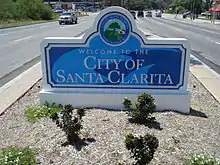
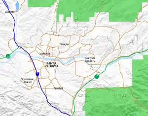
Santa Clarita, California
Santa Clarita (/ˌsæntə kləˈriːtə/) is a city in northwestern Los Angeles County, California. With an estimated 2019 population of 212,979, it is the third-largest city by population in Los Angeles County, and the 21st-largest in the state of California.[7][8] It is located about 30 miles (48 km) northwest of downtown Los Angeles, and occupies 70.75 square miles (183.2 km2)[5] of land in the Santa Clarita Valley, along the Santa Clara River. It is a noted example of a U.S. edge city,[10] satellite city,[11] or boomburb.[12]
Santa Clarita, California | |
|---|---|
City | |
| City of Santa Clarita | |
.jpg.webp) 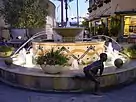 .jpg.webp) .jpg.webp)  Clockwise: Aerial view of Santa Clarita; Packard Humanities Institute; Brideport Lake Park; La Loma de los Vientos historic estate; Westfield Valencia Town Center. | |
 Flag  Seal | |
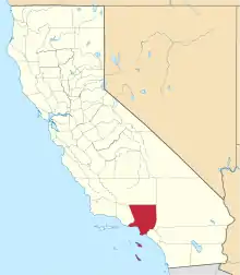
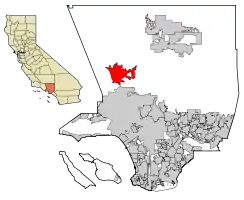 Location of Santa Clarita in California and Los Angeles County | |
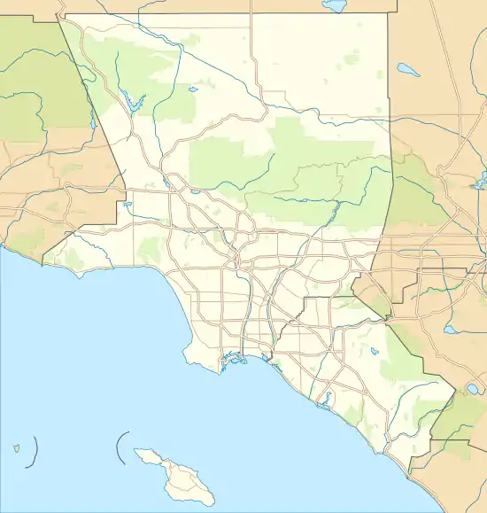 Santa Clarita Location in the United States  Santa Clarita Santa Clarita (California)  Santa Clarita Santa Clarita (the United States) | |
| Coordinates: 34.42°N 118.52°W | |
| Country | |
| State | |
| County | |
| Incorporated | December 15, 1987[1] |
| Named for | Santa Clara River |
| Government | |
| • Type | Council-Manager |
| • Mayor | Bill Miranda[2] |
| • Mayor Pro-Tem | Laurene Weste |
| • City council[3] | Jason Gibbs Cameron Smyth Marsha McLean |
| • City manager | Ken Striplin[4] |
| Area | |
| • City | 70.82 sq mi (183.42 km2) |
| • Land | 70.75 sq mi (183.26 km2) |
| • Water | 0.06 sq mi (0.16 km2) 0.099% |
| Elevation | 1,207 ft (368 m) |
| Population | |
| • City | 176,320 |
| • Estimate (2019)[8] | 212,979 |
| • Rank | 3rd in Los Angeles County 21st in California 107th in the United States |
| • Density | 3,010.09/sq mi (1,162.20/km2) |
| • Metro | 13,155,788 (Los Angeles Metropolitan Area) |
| Demonym(s) | Santa Claritan |
| Time zone | UTC−08:00 (Pacific) |
| • Summer (DST) | UTC−07:00 (PDT) |
| ZIP Codes[9] | 91310, 91321–91322, 91350–91351, 91354–91355, 91380–91387, 91390 |
| Area code | 661 |
| FIPS code | 06-69088 |
| GNIS feature IDs | 1662338, 2411819 |
| Website | www |
Human settlement of the Santa Clarita Valley dates back to the arrival of the Tataviam tribe circa 450 AD. Many Native American tribes occupied the valley in the coming centuries. Spanish colonists arrived in the area in the late 18th century. When Mexico took control of Alta California, the Rancho San Francisco was established, covering much of the Santa Clarita Valley. Henry Mayo Newhall purchased the Rancho San Francisco in 1875 and established the communities of Saugus and Newhall. The Newhall Land and Farming Company played a major role in the city's development. In December 1987, the city of Santa Clarita was incorporated, encompassing the communities of Canyon Country, Newhall, Saugus, and Valencia.[13] The four communities retain separate identities, and residents commonly refer to one of them when asked where they are from. Santa Clarita is bounded on the west by the Golden State Freeway (I-5). The Antelope Valley Freeway (CA-14) runs northeast–southwest forming part of the city's irregular east boundary. The two freeways meet at Newhall Pass, near the city's southernmost point.
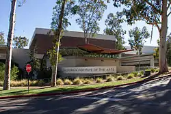
The city is home to three institutions of higher education: California Institute of the Arts, an internationally renowned art university; The Master's University, a Christian liberal arts university; and College of the Canyons, a community college. Santa Clarita has a low crime rate and high-ranking schools, and is one of the state's fastest-growing cities. Six Flags Magic Mountain amusement park and Stevenson Ranch are both commonly associated with Santa Clarita. However, they are both located west of Interstate 5 and are thus outside the Santa Clarita city limits.
Name
The Santa Clara River was named by Spanish explorers for Saint Clare of Assisi. The valley and the settlement later became known as "little Santa Clara," ("Santa Clarita", in the Spanish diminutive), to distinguish it from the Northern Californian city of Santa Clara[14] and its accompanying Mission Santa Clara. The Santa Clarita Valley similarly differentiates itself from the Santa Clara Valley in Northern California. The region was not widely referred to as Santa Clarita until the 1950s; before this it was unofficially referred to as the "Newhall-Saugus area" and the "Bonelli tract."[15]
History
The Santa Clarita Valley has been settled for centuries before European settlement. About AD 450, the Tataviam arrived, numbering around 2,000 at their zenith. Other indigenous cultures occupied the area in succession.
In the 18th century, Spanish colonists arrived in southern California including Santa Clarita, founding mission settlements. The Mission San Fernando was founded in 1797 in present-day Mission Hills, just 9 miles (14 km) south of Newhall.[16] In 1822, Alta California, which included most of the present-day southwestern United States including all of California, became a territory of the newly independent country of Mexico.
The 48,612-acre (196.73 km2) Rancho San Francisco land grant was issued by Juan Bautista Alvarado, governor of Alta California, to Mexican army officer Antonio del Valle.[17] It was an agricultural area serving the nearby Mission San Fernando.
In 1842, Francisco Lopez made the first documented discovery of gold in California, when it was still part of Mexico. The event is memorialized in an 1842 mining claim issued by Governor Alvarado. The discovery was made in Placerita Canyon.[18] The Oak of the Golden Dream remains an attraction for tourists. Beginning in the mid-20th century, this area was used as Hollywood's original back lot when the area was developed by movie studios. (see Santa Clarita, California#Movie ranches)
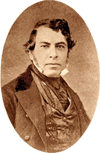
The United States acquired California in 1848, after winning the Mexican-American War. The community of Newhall is named after Henry Newhall,[19] an American businessman who made his fortune during the California Gold Rush. He founded the H.M. Newhall & Company, a successful auction house in San Francisco. Newhall's next business interest was railroads. He invested in rail companies that would connect San Francisco to other cities and became president of the San Francisco and San Jose Railroad. In 1870, he and his partners sold the company to Southern Pacific Railroad, and he served on SPR's board of directors.
From 1858 to 1861, the Santa Clarita Valley was used as a transportation corridor for the Butterfield Overland Mail stagecoach service as part of its first division, stretching from San Francisco to Los Angeles. Two Butterfield Overland Mail stations were located in the area: Lyons Station in Newhall, and King's Station in north Santa Clarita. Beale's Cut was constructed in 1859 through what is now known as the Newhall Pass.[20]
After railroads, Newhall turned to real estate and ranching. He purchased a number of the former Spanish and Mexican land grants in the state, amassing a total of 143,000 acres (58,000 ha) between Monterey and Los Angeles counties. The most significant portion was the Rancho San Francisco, which he purchased for $2/acre. It became known as Newhall Ranch after Newhall's death. Within this territory, Newhall granted a right-of-way to Southern Pacific through what is now Newhall Pass. He also sold the railroad part of the land, upon which the company built the town of Newhall. He moved the town south in 1879, and the original townsite was named Saugus, after Henry Newhall's hometown of Saugus, Massachusetts.
After his death, Newhall's heirs incorporated the Newhall Land and Farming Company in 1883. It oversaw the development of the communities that comprise present-day Santa Clarita, including the master-planned community of Valencia (in which it is headquartered), Canyon Country, and Newhall. The company also manages farm land elsewhere in the state.[21]
On September 5, 1876, Charles Crocker, president of the Southern Pacific Company, hammered a ceremonial spike into a railroad tie at Lang Southern Pacific Station in Canyon Country, marking the completion of the Southern Pacific Railroad, connecting Los Angeles to the rest of the nation for the first time.[22]
On September 26, 1876, the town of Mentryville was founded by Charles Alexander Mentry in present-day Stevenson Ranch. Mentryville's Pico Number 4 oil well in was the first commercially successful oil well in the western United States. Oil from Mentryville was refined at Pioneer Oil Refinery, the first viable oil refinery in the state.[23]
The Saugus Cafe, on Railroad Avenue in Saugus, was established in 1887.[24] It it the oldest continuously operating restaurant in Los Angeles County.[25]
Los Angeles studios began filming in Santa Clarita shortly after the turn of the 20th century. Actors in these early films included William S. Hart, Tom Mix, Harry Carey, and a young John Wayne. Hart and Carey made their homes in the Santa Clarita Valley; today both their former estates are operated as county parks.
The Santa Clarita Valley was the scene of the second worst disaster in California's history in terms of lives lost, known as the "worst civil engineering failure of the 20th century". Shortly before midnight on March 12, 1928, the St. Francis Dam collapsed. By the time the floodwaters reached the Pacific Ocean near Ventura five hours later, nearly 600 people had died. Some buildings in Newhall became makeshift morgues.[26]
In 1966, William V. Fowler, Grand Leader of the California Knights of the Ku Klux Klan organized a reactivation rally in Soledad Canyon. Fowler sought to reactivate the KKK in California, where it was banned by law since 1964. The rally took place on U.S. Forest Service property and included a cross burning.[27]
After multiple failed attempts to form a city and at least two failed attempts to form a separate county, residents of the Santa Clarita Valley finally incorporated the City of Santa Clarita on December 15, 1987. The proposal passed by a margin of two to one in that year's general election.[13] The other proposed name for the new city, which was narrowly defeated, was "City of the Canyons."[13]
Santa Clarita was heavily affected by the 1994 Northridge earthquake. The Newhall Pass interchange of I-5 and CA-14 completely collapsed, and commuters to Los Angeles were forced to use Sierra Highway. Several other roads throughout the city were closed due to structural damage. The Four Corners oil spill led to contamination of the Santa Clara River. Electricity was temporarily shut off for the entire valley, and schools were closed. The National Guard was sent to the area, and City Hall was temporarily relocated.[28]
Santa Clarita was ranked in 2006 by Money magazine as 18th of the 100 best places to live in the United States.[29]
On November 14, 2019, a mass shooting took place at Saugus High School in Saugus. That morning, a 16-year-old student used a pistol to murder two students and injure three others, before turning his gun on himself. The shooter succumbed to his injuries the following day in the hospital.[30]
Geography
.jpg.webp)
Santa Clarita, according to the United States Census Bureau, covers an area of 70.82 square miles (183.4 km2), of which 70.75 square miles (183.2 km2) is land and 0.07 square miles (0.18 km2) (0.10%) is water. Nearly half of the city's land area has been acquired via annexations; the city's area at the time of incorporation was just 39.09 square miles (101.2 km2).[31]
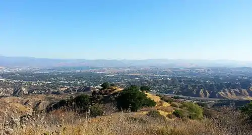
Santa Clarita lies within the Santa Clarita Valley, bounded by the San Gabriel Mountains to the east, the Santa Susana Mountains to the south and west, and the Sierra Pelona Mountains to the north, all part of the Transverse Ranges. The Santa Clara River passes through the city from east to west; it is usually dry and flows only after episodes of heavy rainfall. Within the surrounding mountains are hiking trails including Agua Dulce Canyon, Central Park, East Walker Ranch, Elsmere Canyon, Golden Valley Ranch, Haskell Canyon Open Space, Quigley Canyon, East Canyon, Fish Canyon, San Francisquito Open Space, Tapia Canyon, Towsley Canyon, and Wildwood Canyon.[32] The city limits extend into the Angeles National Forest.[33] The Newhall Pass is located at the southern end of the city, south of Newhall and north of the San Fernando Valley community of Sylmar.
The Santa Clara River and its tributaries carve numerous canyons around the Santa Clarita Valley. Many streets in the region are named after these canyons, including Bouquet Canyon Road, Soledad Canyon Road, San Francisquito Canyon Road, Sand Canyon Road, Wiley Canyon Road, Hasley Canyon Road, Plum Canyon Road, Whites Canyon Road, Haskell Canyon Road, Pico Canyon Road, Vasquez Canyon Road, Placerita Canyon Road, and Rye Canyon Road. The Santa Clara River itself flows through Soledad Canyon, forming a natural boundary between the San Gabriel and Sierra Pelona mountain ranges.
The official elevation of the city is 1,207 feet (368 m). However, the elevation varies substantially throughout the city. The lowest point in Santa Clarita is where CA-126 meets I-5 (34.4433°N 118.6052°W), at an elevation of 1,030 feet (310 m). The highest point within the city limits is in the San Gabriel Mountains (34.3597°N 118.4062°W) at an elevation of 2,962 feet (903 m).[34] Most populated areas in the city are between 1,100 ft and 1,700 ft (335–518 m) above sea level.
Santa Clarita is near the San Fernando fault zone and was affected by the 1971 San Fernando earthquake, also known as the Sylmar quake. The city was also affected by the 1994 Northridge earthquake, and many commercial and residential buildings were devastated by its aftermath, including the nearby Interstate 5 and California State Route 14, the Westfield Valencia Town Center, and Six Flags Magic Mountain.[28]
Santa Clarita falls within nine ZIP codes (see below) and lies within telephone area code 661. It is the southernmost city within area code 661.[35]
Places adjacent to Santa Clarita, California | |
|---|---|
Climate
Santa Clarita experiences hot, very dry summers and cool winters with moderate precipitation. During the summer, hot weather is predominant with occasional high humidity and cumulus buildups over the higher terrain surrounding the valley. Thunderstorms occasionally occur during influxes of monsoonal moisture in the summer as well as during Pacific storms in the winter. Due to its close proximity to the Mojave Desert (High Desert) and Pacific Ocean, and the city's wide range of elevations, varying micro-climates are common. There is a large degree of diurnal temperature variation, especially in the summer. According to the Koppen climate classification, Santa Clarita experiences a hot-summer Mediterranean climate (Csa), bordering on a cold semi-arid climate (Bsk).
Characterized by dry hills covered in brush and chaparral, late summer and early autumn are often referred to as "fire season." Moreover, wildfire activity occurs throughout the year during drought conditions, such as during the December 2017 Southern California wildfires. Wildfire risk is strongest when Santa Ana winds blow through the area from the Mojave Desert. The warmest months are July and August, although it is not unusual for Santa Clarita to experience summer-like weather in October. During this time, average high temperatures are in the 90s Fahrenheit (32–38 °C), but can rise to well over 100 °F (38 °C) during heat waves. Temperatures have reached 115 °F (46 °C) as recently as September 6, 2020.[36] Winters are mild, with temperatures dropping below freezing occasionally on clear winter nights. Rain falls primarily from December through March; snow is rare but can fall in small quantities during the winter. Snowfall is more common in the mountains surrounding the city. Santa Clarita lies within USDA plant hardiness zone 9b.[37] Santa Clarita's average temperatures are more extreme than in downtown Los Angeles but less extreme than in the Antelope Valley.
| Climate data for Santa Clarita, California (Dry Canyon Reservoir, 1921-1990) | |||||||||||||
|---|---|---|---|---|---|---|---|---|---|---|---|---|---|
| Month | Jan | Feb | Mar | Apr | May | Jun | Jul | Aug | Sep | Oct | Nov | Dec | Year |
| Average high °F (°C) | 62.8 (17.1) |
65.2 (18.4) |
67.6 (19.8) |
71.7 (22.1) |
78.1 (25.6) |
85.0 (29.4) |
93.5 (34.2) |
93.7 (34.3) |
89.7 (32.1) |
80.9 (27.2) |
71.4 (21.9) |
64.7 (18.2) |
77.0 (25.0) |
| Average low °F (°C) | 36.4 (2.4) |
37.8 (3.2) |
39.3 (4.1) |
42.6 (5.9) |
46.9 (8.3) |
51.1 (10.6) |
56.2 (13.4) |
56.4 (13.6) |
53.2 (11.8) |
47.0 (8.3) |
41.7 (5.4) |
37.9 (3.3) |
45.5 (7.5) |
| Average precipitation inches (mm) | 2.54 (65) |
2.66 (68) |
2.34 (59) |
1.27 (32) |
0.32 (8.1) |
0.03 (0.76) |
0.02 (0.51) |
0.13 (3.3) |
0.28 (7.1) |
0.42 (11) |
1.46 (37) |
2.27 (58) |
13.74 (349) |
| Source: [38] | |||||||||||||
Neighborhoods
The city of Santa Clarita consists of four distinct communities:
- Canyon Country: Canyon Country is in the eastern part of Santa Clarita. This neighborhood includes Canyon High School, Canyon Country Park, and the Jo Anne Darcy Canyon Country Library. Sand Canyon is located in the southeastern part of Canyon Country, in the foothills of the San Gabriel Mountains. Sierra Highway and California State Route 14 both pass through Canyon Country.
- Newhall: Newhall is the southernmost neighborhood of Santa Clarita. It includes the historic district of Old Town Newhall, a Metrolink station, William S. Hart High School, Hart Park, The Master's University and Pioneer Oil Refinery.
- Saugus: Saugus occupies the central and north-central portions of the city. It includes Central Park (the largest city park in Santa Clarita), Saugus High School, and Saugus Speedway.
- Valencia: Valencia is located in the western portion of the city. This neighborhood includes commercial areas and shopping districts such as Westfield Valencia Town Center; government buildings including the Santa Clarita City Hall, Santa Clarita Courthouse, and the Santa Clarita Valley station of the LASD; and corporate headquarters including those of Princess Cruises. An affluent area, it also includes country clubs such as Valencia Country Club and Vista Valencia Golf Course. CalArts and College of the Canyons are both located in Valencia. Six Flags Magic Mountain is located in an unincorporated area of Valencia.
Outlying unincorporated neighborhoods include:
- Agua Dulce: Agua Dulce is in the Sierra Pelona Mountains northeast of Santa Clarita. It is home to Vasquez Rocks, a popular filming location, as well as Agua Dulce Airpark. Its elevation of about 2,600 feet (790 m) is far higher than the Santa Clarita Valley proper.
- Castaic: Castaic is located northwest of the city of Santa Clarita and includes Castaic Lake and Pitchess Detention Center.
- Stevenson Ranch: Stevenson Ranch is an affluent unincorporated area located directly west of southern Valencia. It includes West Ranch High School, The Oaks Club at Valencia, and the ghost town of Mentryville.
- Val Verde: Val Verde is a small neighborhood located south of Castaic at the western edge of the Santa Clarita Valley.
ZIP codes
The Santa Clarita area falls within nine ZIP codes, in addition to five others for specific PO boxes:[39]
- 91321: Newhall
- 91350: most of Saugus
- 91351: northern and western Canyon Country
- 91354: northern and eastern Valencia
- 91355: southern and western Valencia
- 91381:[40] Areas west of I-5, including Stevenson Ranch
- 91384:[40] Castaic and Val Verde
- 91387: southern and eastern Canyon Country
- 91390: northernmost part of Santa Clarita — parts of Saugus and Canyon Country, as well as Agua Dulce and Green Valley.
- ZIP codes 91310, 91322, 91380, 91385, and 91386 are used for specific PO boxes.[41]
Demographics
| Demographic profile | 2019 | 2010 | 2000 | 1990 |
|---|---|---|---|---|
| White | 72.6% | 70.9% | 79.5% | 87.3% |
| —Non-Hispanic | 47.2% | 56.1% | 69.3% | 80.6% |
| Black or African American | 4.9% | 3.2% | 2.1% | 1.5% |
| Hispanic or Latino (of any race) | 34.6% | 29.5% | 20.5% | 13.4% |
| Asian | 10.4% | 8.5% | 5.2% | 4.0% |
| Native American | 0.6% | 0.6% | 0.6% | 0.6% |
Historically, Santa Clarita's population has been predominantly non-Hispanic white. Since its founding, the proportion of white residents has decreased as Hispanic, Asian, and black Americans have moved into the city. The non-Hispanic white percentage of the population has dropped from 80.6% in 1990 to 47.2% in 2019. When white Hispanics are included, the percentage has fallen from 87.3% in 1990 to 72.6% in 2019. Non-Hispanic whites remain the largest ethnic group in the city, and Santa Clarita's non-Hispanic white percentage is higher than the California statewide average (36.8%)[42] but lower than the national average of 60.4%.[43]
Santa Clarita's population growth rate outpaces county, state, and national averages. In 2019, Santa Clarita was ranked 20th out of 515 U.S. cities in population and economic growth, and was second among California cities.[44] During the 2010 census, Santa Clarita was the fourth-largest city in Los Angeles County, however it has since surpassed Glendale as the county's third-largest city. It is the largest city in northern Los Angeles County.[45] The city's median household income of $99,666 is higher than both statewide and national averages.[46] ZIP code 91321 (Newhall) is the only ZIP code in the city with a median household income below the statewide average.
| Historical population | |||
|---|---|---|---|
| Census | Pop. | %± | |
| 1950 | 2,895 | — | |
| 1960 | 15,212 | 425.5% | |
| 1970 | 50,086 | 229.3% | |
| 1980 | 66,730 | 33.2% | |
| 1990 | 110,642 | 65.8% | |
| 2000 | 151,088 | 36.6% | |
| 2010 | 176,320 | 16.7% | |
| 2019 (est.) | 212,979 | [8] | 20.8% |
| U.S. Decennial Census[47] | |||
2019
The 2019 American Community Survey reported that the city's population was 212,979. The ethnic composition was 72.6% White (47.2% non-Hispanic white), 34.6% Hispanics (of any race), 10.4% Asian American, 4.9% Black or African American, 1.2% Native American, 0.3% Pacific Islander, 8.3% from other races, and 4.0% from two or more races.[48] The median household income in the city was $99,666, and the median family income was $113,167. 5.3% of families and 8.2% of the population were below the poverty line.[46]
20.8% of the city's population was born outside the United States.[49] Among residents 25 years of age and older, 36.9% had a bachelor's degree or higher.[50]
| ZIP Code | Median household income |
|---|---|
| 91354 | $128,308 |
| 91390 | $120,617 |
| 91350 | $117,107 |
| Santa Clarita | $99,666 |
| 91387 | $98,371 |
| 91355 | $95,696 |
| 91351 | $81,758 |
| California | $75,325 |
| 91321 | $73,187 |
| United States | $62,843 |
2010
The 2010 United States Census[52] reported that Santa Clarita had a population of 176,320. The population density was 3,340.6 people per square mile (1,289.8/km2). The racial makeup of Santa Clarita was 125,005 (70.9%) White (56.1% Non-Hispanic White),[53] 5,623 (3.2%) African American, 1,013 (0.6%) Native American, 15,025 (8.5%) Asian (3.4% Filipino, 1.7% Korean, 0.8% Indian, 0.8% Chinese, 0.6% Japanese, 0.3% Vietnamese, 0.9% Other Asian), 272 (0.2%) Pacific Islander, 21,169 (12.0%) from other races, and 8,213 (4.7%) from two or more races. There were 51,941 people of Hispanic or Latino origin, of any race (29.5% of the population).
The census reported that 174,910 people (99.2% of the population) lived in households, 1,281 (0.7%) lived in non-institutionalized group quarters, and 129 (0.1%) were institutionalized. There were 59,507 households, out of which 24,677 (41.5%) had children under the age of 18 living in them, 34,126 (57.3%) were opposite-sex married couples living together, 6,888 (11.6%) had a female householder with no husband present, 3,322 (5.6%) had a male householder with no wife present. There were 3,134 (5.3%) unmarried opposite-sex partnerships, and 484 (0.8%) same-sex married couples or partnerships. 11,634 households (19.6%) were made up of individuals, and 4,335 (7.3%) had someone living alone who was 65 years of age or older. The average household size was 2.94. There were 44,336 families (74.5% of all households); the average family size was 3.37.
In terms of age, the population included 46,180 people (26.2%) under the age of 18, 17,565 people (10.0%) aged 18 to 24, 47,788 people (27.1%) aged 25 to 44, 47,936 people (27.2%) aged 45 to 64, and 16,851 people (9.6%) who were 65 years of age or older. The median age was 36.2 years. For every 100 females, there were 97.1 males. For every 100 females age 18 and over, there were 94.0 males.
There were 62,055 housing units at an average density of 1,175.7 per square mile (453.9/km2), of which 42,335 (71.1%) were owner-occupied, and 17,172 (28.9%) were occupied by renters. The homeowner vacancy rate was 1.4%; the rental vacancy rate was 6.0%. 124,532 people (70.6% of the population) lived in owner-occupied housing units and 50,378 people (28.6%) lived in rental housing units.
According to the Census Bureau, Santa Clarita had a median household income of $82,607, with 9.5% of the population living below the federal poverty line.[53]
2000
As of the census of 2000, there were 151,088 people, 50,787 households, and 38,242 families residing in the city. The population density was 3,159.1 inhabitants per square mile (1,219.6/km2). There were 52,442 housing units at an average density of 1,096.5 per square mile (423.3/km2). The racial makeup of the city was 79.5% White (69.3% Non-Hispanic White), 20.5% Hispanic or Latino of any race, 8.5% from other races, 5.2% Asian, 3.9% from two or more races, 2.1% African American, 0.6% Native American, and 0.1% Pacific Islander.
There were 50,787 households, out of which 44.4% had children under the age of 18 living with them, 61.0% were married couples living together, 9.8% had a female householder with no husband present, and 24.7% were non-families. 18.7% of all households were made up of individuals, and 6.1% had someone living alone who was 65 years of age or older. The average household size was 2.95 and the average family size was 3.38.
In the city, the population was spread out, with 30.3% under the age of 18, 8.1% from 18 to 24, 33.6% from 25 to 44, 20.8% from 45 to 64, and 7.1% who were 65 years of age or older. The median age was 33 years. For every 100 females, there were 98.0 males. For every 100 females age 18 and over, there were 94.4 males.
According to a 2007 estimate, the median income for a household in the city was $79,004, and the median income for a family was $91,450. Males had a median income of $53,769 versus $36,835 for females. The per capita income for the city was $26,841. 6.4% of the population and 4.7% of families were below the poverty line. 6.7% of those under the age of 18 and 5.9% of those 65 and older were living below the poverty line.
1990
As of the 1990 census, there were 110,642 people residing in the city. The racial makeup of the city was 87.3% White (80.6% Non-Hispanic White), 1.5% Black, .6% Native American, 4% Asian, .1% Pacific Islander, and 6.5% some other races.[54] 13.4% of residents were of Hispanic or Latino origin.
Government and politics
According to the California Secretary of State, as of February 10, 2019, Santa Clarita has 135,052 registered voters. Of those, 46,096 (34.1%) are registered Democrats, 45,725 (33.9%) are registered Republicans, and 35,764 (26.5%) have declined to state a political party.[55]
In presidential elections, Santa Clarita has historically been a Republican stronghold. However, it has shifted toward the Democratic Party in recent years. Hillary Clinton and Joe Biden won the city in 2016 and 2020, respectively. Santa Clarita remains one of the most conservative cities in Los Angeles County, having voted for Clinton and Biden by much smaller margins than the county as a whole.
| Year | Democratic | Republican | Third Parties |
|---|---|---|---|
| 2020[56] | 53.07% 63,507 | 44.93% 53,768 | 1.99% 2,388 |
| 2016[57] | 48.53% 42,316 | 45.33% 39,523 | 6.14% 5,355 |
| 2012[58] | 45.10% 32,789 | 52.32% 38,033 | 2.58% 1,874 |
| 2008[59] | 47.57% 35,379 | 50.32% 37,422 | 2.1% 1,564 |
| 2004[60] | 39.26% 25,657 | 59.68% 39,007 | 1.06% 695 |
| 2000[61] | 41.76% 18,607 | 54.79% 24,411 | 3.45% 1,538 |
| 1996[62] | 38.2% 15,136 | 48.56% 19,240 | 13.24% 5,246 |
| 1992[63] | 33.87% 14,780 | 36.94% 16,120 | 29.18% 12,733 |
| 1988[64] | 29.97% 11,722 | 68.9% 26,947 | 1.12% 439 |
Local government
The City of Santa Clarita is a general law city and as such is governed by a council-manager form of government. The city council is made up of five council members, elected at-large to four-year terms. Each year the council selects one of its members to serve as mayor, a largely ceremonial position. Mayors are not directly elected.[65]
The elected council is:[3]
| Council Member | Current Position |
|---|---|
| Bill Miranda | Mayor |
| Laurene Weste | Mayor Pro-Tem |
| Jason Gibbs | Councilmember |
| Cameron Smyth | Councilmember |
| Marsha McLean | Councilmember |
In 2010, councilmember Bob Kellar drew criticism at an immigration rally. While paraphrasing a quote by former President Theodore Roosevelt, Kellar said,
"I brought up in a city council meeting a few weeks ago the quote of Teddy Roosevelt that in America we should have 'one flag...the American flag and one language...the English language'. Afterwards a few people came up to me and said 'Bob, you sound like a racist' in which I responded, ‘That's good. If that's what you think I am because I happen to be proud of America well then I guess I'd say I'm a proud racist.’"
He later stood by his remarks.[66][67][68][69]
According to the city's 2015 Comprehensive Annual Financial Report, the city's various funds had $196.9 million in Revenues, $160.5 million in expenditures, $1,191.8 million in total assets, and $135.3 million in total liabilities.[70]
The structure of the management and coordination of city services is:[71]
| City Department | Director |
|---|---|
| City Manager | Ken Striplin |
| Assistant City Manager | Frank Oviedo |
| Deputy City Manager / Director of Neighborhood Services | Darren Hernández |
| City Attorney | Joe Montes |
| Director of Administrative Services | Carmen Magaña |
| Director of Community Development | Tom Cole |
| Director of Parks, Recreation & Community Services | Janine Prado |
| Director of Public Works / City Engineer | Robert Newman |
List of mayors
Santa Clarita has had 14 mayors since its incorporation, serving 34 terms.
| Name[72] | Term |
|---|---|
| Howard P. "Buck" McKeon | December 1987 – December 1988 |
| Janice "Jan" Heidt | December 1988 – December 1989 |
| Jo Anne Darcy | December 1989 – December 1990 |
| Carl Boyer III | December 1990 – December 1991 |
| Jill Klajic | December 1991 – December 1992 |
| Janice "Jan" Heidt | December 1992 – December 1993 |
| George Pederson | December 1993 – December 1994 |
| Jo Anne Darcy | December 1994 – December 1995 |
| Carl Boyer III | December 1995 – December 1996 |
| Hamilton "Clyde" Smith | December 1996 – December 1997 |
| Janice "Jan" Heidt | December 1997 – December 1998 |
| Jo Anne Darcy | December 1998 – December 2000[73] |
| Laurene Weste | December 2000 – December 2001 |
| Frank Ferry | December 2001 – December 2002 |
| Cameron Smyth | December 2002 – December 2003 |
| Robert Kellar | December 2003 – December 2004 |
| Cameron Smyth | December 2004 – December 2005 |
| Laurene Weste | December 2005 – December 2006 |
| Marsha McLean | December 2006 – December 2007 |
| Robert Kellar | December 2007 – December 2008 |
| Frank Ferry | December 2008 – December 2009 |
| Laurene Weste | December 2009 – December 2010 |
| Marsha McLean | December 2010 – December 2011 |
| Laurie Ender | December 2011 – April 2012 |
| Frank Ferry | April 2012 – December 2012 |
| Robert Kellar | December 2012 – December 2013 |
| Laurene Weste | December 2013 – December 2014 |
| Marsha McLean | December 2014 – December 2015 |
| Robert Kellar | December 2015 – December 2016 |
| Cameron Smyth | December 2016 – December 2017 |
| Laurene Weste | December 2017 – December 2018 |
| Marsha McLean | December 2018 – December 2019 |
| Cameron Smyth[74] | December 2019 – December 2020 |
| Bill Miranda[74] | December 2020 – |
County, state and federal representation
In the Los Angeles County Board of Supervisors, Santa Clarita is entirely in the 5th district, represented by Republican Kathryn Barger.[75]
In the State Senate, Santa Clarita is split between the 21st Senate District, represented by Republican Scott Wilk, and the 27th Senate District, represented by Democrat Henry Stern.[76] The 27th State Senate district includes parts of Valencia and Newhall; the rest of the city is in the 21st district.
In the State Assembly, Santa Clarita is mostly in the 38th Assembly District, represented by Republican Suzette Valladares. Parts of northern Santa Clarita are in the 36th Assembly District, represented by Republican Tom Lackey.[77]
In the United States House of Representatives, Santa Clarita is in California's 25th congressional district, represented by Republican Mike Garcia.[78] California is represented by US Senators Dianne Feinstein and Alex Padilla, both Democrats.
Education
School districts
Santa Clarita elementary school students are served by the Castaic Union School District, Newhall School District, Saugus Union School District, and Sulphur Springs School District. These four districts include 38 schools.[79]
Middle and high school students in Santa Clarita are served by the William S. Hart Union High School District. The district includes seven high schools: Canyon, Castaic, Golden Valley, Hart, Saugus, Valencia, and West Ranch. The middle schools that feed into these high schools are Sierra Vista, Castaic, La Mesa, Placerita, Arroyo Seco, Rio Norte, and Rancho Pico, respectively. All Hart District schools are located within Santa Clarita city limits, except for Castaic Middle and High Schools (which are in unincorporated Castaic), and Rancho Pico Junior High and West Ranch High School (which are in unincorporated Stevenson Ranch).[80] The seven high schools in the Hart District form the Foothill League for athletic competitions. U.S. News and World Report has ranked Hart District high schools in the top 12% in the nation.[81]
Hart District also includes a middle college high school (Academy of the Canyons), the alternative high schools Bowman and Learning Post, and SCVi Charter School in Castaic.
Colleges and universities
The city is home to California Institute of the Arts (CalArts), a private art university.[82] Founded in 1961 by Walt Disney, Roy O. Disney, and Nelbert Chouinard, CalArts was the first college or university created specifically for students of visual and performing arts. It was created by the merger of Chouinard Art Institute and the Los Angeles Conservatory of Music. It relocated to its current Valencia campus in 1971.[83] CalArts has produced numerous renowned actors and musicians including Brad Bird, Tim Burton, Julia Holter, John Lasseter, Marina Rosenfeld, Andrew Stanton, and Carl Stone, among others. CalArts is currently administered by president Ravi Rajan.
The Master's University is a non-denominational, Christian liberal arts university based in Newhall.[84] Founded as Los Angeles Baptist College and Seminary in 1927, it moved to Santa Clarita in 1961 and later adopted the name The Master's College and then The Master's University. The university also operates The Master's Seminary in Sun Valley, Los Angeles.
College of the Canyons is a community college with its main campus in Valencia and a secondary campus in Canyon Country. It is part of the Santa Clarita Community College District of California Community Colleges.
Charter College has a campus in Canyon Country.
Parks and recreation
Six Flags Magic Mountain
.jpg.webp)
One of the most well-known attractions in the Santa Clarita Valley is the Six Flags Magic Mountain theme park, located just outside the city limits. Six Flags occupies 262 acres of land on the west side of the valley, near Valencia. It opened on May 29, 1971, as a development of the Newhall Land and Farming Company[85] and SeaWorld Inc.[86] It was sold to Six Flags in 1979. Six Flags has 19 roller coasters, the most of any amusement park in the world.[87] The park received an estimated 3.365 million visitors in 2017.[88] It is one of 26 Six Flags properties in North America.[89]
City parks and sports facilities
Since incorporation, the City of Santa Clarita's leadership has placed a priority on offering recreational facilities and programs. The city operates a park system which includes 35 parks scattered throughout the city, the largest being Central Park in Saugus. Many of the parks have lighted basketball and tennis courts as well as baseball, softball, and soccer fields.[90]
The George A. Caravalho Sports Complex, located along Centre Pointe Parkway between Saugus and Canyon Country, includes a gymnasium with two indoor, full-sized basketball courts, four pickleball courts, two volleyball courts, two futsal courts, and four racquetball courts.[91] Adjacent to the Sports Complex is the Santa Clarita Aquatic Center, which includes three large swimming pools,[92] and the Santa Clarita Skate Park.[93]
Over the past several years, the city has cosponsored a summer concert series in cooperation with various local businesses. These concerts, offering a variety of musicians, are offered free of charge and take place on weekends in Central Park. The concert was canceled in 2020 due to the COVID-19 pandemic.[94] The city offers a wide variety of fee-based and free classes and programs in a variety of locations throughout the year.
City-sponsored recreational programs are listed in the quarterly magazine Seasons, which is delivered to all residences within the city limits via mail.[95]
The Santa Clarita Marathon is held annually in November. First run in 1995, it is now considered a qualifying race for the Boston Marathon.
Santa Clarita was picked to host stages in the AMGEN Tour of California for a total of 9 years. It has hosted a total of 13 stages as of 2017.
Public and private golf courses in Santa Clarita include The Oaks Club at Valencia (which is actually located in Stevenson Ranch), Valencia Country Club, and Vista Valencia. The city is also home to a public ice skating rink, Ice Station Valencia.
County parks
Santa Clarita is home to three county parks administered by the Los Angeles County Department of Parks and Recreation.[96] William S. Hart Park was the estate of silent film star William S. Hart in Newhall and currently hosts the annual Santa Clarita Cowboy Festival. The William S. Hart Museum, one of three Natural History Museums of Los Angeles County, is located on the grounds of Hart Park.[97][98]
Placerita Canyon State Park is also located in Newhall, in the San Gabriel Mountains on the southeast side of the Santa Clarita Valley. Despite having "state park" in its name, it is actually a county park administered by the Los Angeles County Department of Parks and Recreation.[99]
Tesoro Adobe Historic Park in north Valencia was the home of actor Harry Carey, and has been described as "the first tourist attraction in Santa Clarita." In June 2005, Montalvo Properties LLC, the developer of the nearby Tesoro residential community, donated the park to Los Angeles County.[100]
Sports
Santa Clarita does not have any sports teams in the NBA, MLB, NFL, or NHL. The teams in Los Angeles (specifically, the Clippers and Lakers of the NBA, the Angels and Dodgers of MLB, the Chargers and Rams of the NFL, and Ducks and Kings of the NHL) are popular among Santa Clarita residents.
The Santa Clarita Blue Heat is a women's soccer team in the United Women's Soccer league. It was founded as the Ventura County Fusion in 2008 and played in the city of Ventura before relocating to Santa Clarita.[101]
Santa Clarita also hosts FC Santa Clarita (also known as the Santa Clarita Storm) of the United Premier Soccer League, a development league. The team was founded in 2006 as the Lancaster Rattlers before moving to Santa Clarita.[102]
The college sports teams of The Master's University and College of the Canyons, as well as the sports teams in the valley's seven high schools, have some following among the people of Santa Clarita. Central Park contains a 3.1-mile cross country trail used by high school and college athletes to train and race.[103]
The Canyon Country Little League baseball team plays its games on a field along Sierra Highway in Canyon Country.[104]
Services
Santa Clarita is a contract city, meaning it does not have its own police or fire departments and instead relies on county services. The Los Angeles County Sheriff's Department (LASD) operates the Santa Clarita Valley Sheriff's Station in Valencia, providing local law enforcement for the city.[105]
The city contracts with the Los Angeles County Fire Department for fire protection. The agency has eleven fire stations in the city of Santa Clarita, as well as two stations in unincorporated Castaic, one in Del Valle, one in Stevenson Ranch, and one in Agua Dulce.[106]
The California Department of Motor Vehicles has an office in Newhall, serving the entire Santa Clarita Valley.[107]
Public libraries
The city operates the Santa Clarita Public Library system, consisting of three libraries: the main office in Valencia, the Old Town Newhall Library in Newhall, and the Jo Anne Darcy Library in Canyon Country. The libraries offer books ranging from preschool to adult reading levels. In addition, each library has a variety of services for students, teachers, and home schoolers, including homework help, mental health, and employment resources, as well as community events. All buildings and in-person services are currently closed due to the COVID-19 pandemic. In addition to its three properties, the system includes an eLibrary.[108]
Health
The Henry Mayo Newhall Memorial Hospital, founded in 1975, is a Level II trauma center and hospital located along McBean Parkway in Valencia. It includes 357 beds.[109]
As part of Los Angeles County, Santa Clarita is under the jurisdiction of the Los Angeles County Department of Public Health.[110]
Crime
Santa Clarita has a relatively low crime rate. The city's violent crime rate is about one-third of the national average and 29% of the California statewide average.[111] The home security site Safety ranked Santa Clarita the seventh-safest city in California, specifically mentioning the low property crime rate. Then-mayor Cameron Smyth credited this to the "diligence" of the Santa Clarita Valley Sheriff's Station.[112]
Economy
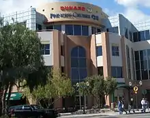
Companies based in Santa Clarita include Melody Ranch, Princess Cruises, Honda Performance Development, Precision Dynamics Corporation, condomman.com, Mechanix Wear, Remo, and the Newhall Land and Farming Company.
Largest employers
According to the City's Comprehensive Annual Financial Report, for the fiscal year ending June 2018,[113] the top employers in the city are:
| # | Employer | # of Employees |
|---|---|---|
| 1 | Six Flags Magic Mountain | 3,200 |
| 2 | Princess Cruises | 2,096 |
| 3 | Henry Mayo Newhall Memorial Hospital | 2,052 |
| 4 | Boston Scientific | 1,000 |
| 5 | The Master's University | 760 |
| 6 | Walmart | 730 |
| 7 | California Institute of the Arts | 700 |
| 8 | Woodward HRT | 680 |
| 9 | Quest Diagnostics | 648 |
| 10 | Aerospace Dynamics International | 617 |
Shopping centers
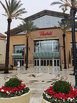
The largest shopping center in Santa Clarita is the Westfield Valencia Town Center (formerly Valencia Town Center) on Valencia Boulevard.[114] This large shopping mall owned by Unibail-Rodamco-Westfield covers over 1,000,000 square feet (93,000 m2) of retail space and includes 134 stores and 46 restaurants. Anchor stores include Macy's, JCPenney, Regal Cinemas, H&M, Gold's Gym, and Forever 21.[115][116]
Other shopping centers include Centre Pointe Village, Seco Canyon Village, and Bouquet Canyon Plaza in Saugus; Old Orchard Center in Newhall; Gateway Village, Tesoro Village, and Northpark Village Square in Valencia; and Canyon Country Plaza, The Plaza at Golden Valley, and Soledad Plaza in Canyon Country.[117]
Media
The City of Santa Clarita and surrounding communities are served by several local media properties.
Newspapers
Santa Clarita is served by the Los Angeles Daily News and The Santa Clarita Valley Signal. The Daily News primarily focuses on news, sports and entertainment stories in the San Fernando Valley and Los Angeles, but also covers Santa Clarita periodically. Daily News circulation numbers within the Santa Clarita Valley are not known.
The Santa Clarita Valley Signal
The primary daily newspaper, The Santa Clarita Valley Signal, was founded in 1919. In 2012, it had a weekday circulation of 10,454[118] and a Sunday circulation of 11,598.[119] Until 2018, the newspaper focused almost exclusively on local news, sports, entertainment and features. The Signal's headquarters are located near Centre Pointe Parkway in Saugus.
From 1979 to 2016, the Signal was owned by Morris Multimedia, a company based in Savannah, Georgia. In 2016, Morris Multimedia sold the Signal to Paladin Multi-Media Group. In June 2018, Richard and Chris Budman purchased Paladin and began to publish a new free Sunday magazine, featuring a column by editor-in-chief Tim Whyte under the byline "Black and Whyte".[120] According to an October 9, 2018 article in the Columbia Journalism Review (CJR), concerns have been raised that under new management, their editorials, opinion pieces, articles and omissions, have been a polarizing factor in the city. Budman denies these allegations.[120]
Radio
The primary radio station serving the Santa Clarita Valley is the Hometown Station, or KHTS. KHTS broadcasts on FM 98.1 and AM 1220. The KHTS transmitters are located along Sierra Highway in north Canyon Country,[121] and its studios have been in Newhall since June 2015.[122] KHTS was founded as KBET[123] in 1984 and was renamed KIIS and later KHTS. KHTS is a full-service station — it covers local news, including talk shows, high school and college sports, as well as professional sports in the Los Angeles area.
The region is also served by FM-101.5 KZNQ-LP, Santa Clarita's first local FM radio station. It features a non-profit country music format owned and is operated by Santa Clarita Public Broadcasters Corporation, transmitting from Round Mountain in the city of Santa Clarita since 2015.[124]
In addition to KHTS and KZNQ-LP, Santa Clarita and its surrounding communities are indirectly served by a number of major market Los Angeles FM and AM radio stations, though residents often complain that radio reception in the valley is poor due to the surrounding hillsides.
There are also several other Internet-based radio stations that serve the public in the Santa Clarita Valley.
Television
All local programming for Santa Clarita is carried on a single public-access television cable TV channel, which is operated by SCVTV, a tax-exempt 501(c)(3) nonprofit corporation. It is available to Spectrum Cable customers throughout the Santa Clarita Valley on Channel 20 and to AT&T U-verse customers under local programming (Channel 99/Santa Clarita). SCVTV carries public, educational and government programming, including Santa Clarita City Council and Planning Commission meetings, history shows, high school and college news programs, talk shows, football games, and other programs of local interest. SCVTV also runs the local news website scvnews.com.
There are no commercial over-the-air television stations in the Santa Clarita Valley. The city is part of the Los Angeles media market. Digital signals from the Los Angeles stations are available on local cable television systems, DirecTV, and Dish Network.
Transportation
Highways
The only interstate highway in the city is Interstate 5, which defines the city's western border. California State Route 14 passes through the east side of the city and connects Santa Clarita to the Antelope Valley cities of Palmdale and Lancaster. Route 14 merges with Interstate 5 at the large Newhall Pass interchange just south of the city. California State Route 126 follows the Santa Clara River from Santa Clarita to Ventura, passing through Piru, Fillmore, and Santa Paula. Sierra Highway passes through the east side of the city, parallel to and west of Route 14, providing an alternate route to the Sierra Pelona Mountains and Antelope Valley.
 Interstate 5
 California State Highway 14
 California State Highway 126
- Sierra Highway
Bus service
City of Santa Clarita Transit, formerly known simply as Santa Clarita Transit, provides extensive bus service within the Santa Clarita Valley and to/from North Hollywood in the San Fernando Valley. City of Santa Clarita Transit is operated by MV Transportation, Inc. under contract with the city of Santa Clarita.[125]
On weekdays, City of Santa Clarita Transit operates commuter buses to/from Union Station in downtown Los Angeles and North Hollywood Station (operating seven days per week as the "NoHo Express/757), allowing riders to access Metro Los Angeles rapid transit subway and light rail services, as well as Warner Center, Burbank, Van Nuys, and Century City.[126] On weekdays when school is in session, City of Santa Clarita Transit operates supplemental school-day service with routes and scheduled stops designed around various school sites within the Santa Clarita Valley.
City of Santa Clarita Transit also operates Dial-A-Ride service for seniors and the disabled. Dial-A-Ride service is also open to the general public after 6:00 p.m. The service allows for pick-up and drop-off at any address within the City of Santa Clarita and within a three-quarter mile radius of the nearest fixed route bus stop in unincorporated areas.[127]
City of Santa Clarita Transit operates weekdays from 4:15 a.m.–11:15 p.m., Saturdays from 6:15 a.m.-10:45 p.m., and on Sundays from 7:15 a.m. to 8:45 p.m. Service operates as frequently as every 15 minutes during peak periods to every 90 minutes during off-peak hours. Typically, buses operate every 30 to 60 minutes.[128]
Rail
Metrolink provides commuter passenger train service to the Santa Clarita Valley along its Antelope Valley Line which runs from Lancaster to Union Station in downtown Los Angeles, where transfers can be made to destinations in Southern California and the rest of the nation. There are three Metrolink stations in the city: Via Princessa in Canyon Country, Santa Clarita station in Saugus (near the geographic center of the city), and Newhall station in Newhall. All stations have large parking lots to allow commuters to "park and ride." An additional Metrolink station known as Vista Canyon is planned to be constructed in Canyon Country.[129]
Metrolink service operates 7 days a week, with reduced service on Saturdays and Sundays.
Bicycle and walking
There are a series of bike trails and walking paths threaded throughout the city. Bicyclists can ride from the eastern end of the city in Canyon Country along a paved path which is independent from automobile traffic all the way to Valencia on the Santa Clara River Trail. This path closely follows the Santa Clara River and Soledad Canyon Road. There are many jumping-off points along this route providing access to neighborhoods, Metrolink stations and commerce. In Valencia, there are several pedestrian bridges called paseos connected to the bike path network. The paseos keep riders and walkers above and away from automobile traffic. The neighborhoods in Valencia were planned to include an ample amount of walking and riding paths that connect to this overall network. In 2007, the League of American Bicyclists awarded Santa Clarita its "bronze" designation as a "bicycle friendly community."[130]
Air travel
There are no airports in the Santa Clarita Valley. The nearest airport is the small Agua Dulce Airpark in Agua Dulce. Commercial flights are served by Bob Hope Airport in Burbank and Los Angeles International Airport in the city of Los Angeles, located 20 miles (32 km) and 40 miles (64 km) from Santa Clarita, respectively.[131]
In popular culture
Santa Clarita was the setting of the horror-comedy show Santa Clarita Diet, which debuted on February 3, 2017[132] and was canceled on April 26, 2019.[133] The show revolves around real estate agents Joel and Sheila Hammond.[134] Sheila Hammond becomes undead and starts craving human flesh. As Joel and the family try helping Sheila during her metamorphosis, they have to deal with neighbors and cultural norms.[135] The series consisted of three seasons with 30 episodes.
Movie ranches
Santa Clarita, along with other foothill regions in Greater Los Angeles, is known for its movie ranches. The valley contains multiple movie ranches including Melody Ranch, Sable Ranch, Golden Oak Ranch, Blue Cloud Movie Ranch, and Veluzat Movie Ranch. These movie ranches lie within the studio zone, the area within a 30-mile (48 km) radius of the intersection of Beverly and La Cienega Boulevards near West Hollywood.[136][137] Movie ranches are a major contributor to Santa Clarita's economy, and the valley has been nicknamed "Hollywood North."[137] Movies and TV shows filmed in Santa Clarita include Django Unchained, NCIS, Franklin & Bash, Jane by Design, Make It or Break It, The Muppets, Pirates of the Caribbean, and Old Yeller. (See Category:Television shows filmed in Santa Clarita, California for a more comprehensive list.)
Vasquez Rocks, located in Agua Dulce about 10 miles (16 km) northeast of the city, has also been used as a filming location for numerous movies and shows.
Notable people
- Trevor Bauer, Major League Baseball
- Kyle Boller, National Football League
- Zach Britton, Major League Baseball
- Crystl Bustos, softball athlete
- Laura Diaz, television
- Jeff Draheim, Film editor
- Lloyd Eisler, figure skater
- Anthony Ervin, 4-time Olympic gold medalist swimmer and 2-time world champion
- Darren Farris, singer and songwriter
- Allyson Felix, track and field
- Lauren Fleshman, track and field
- John Franklin, actor
- Wendy Fulton, actress
- Jon Garland, Major League Baseball
- Tyler Glasnow, Major League Baseball
- Mandy Gonzalez, Broadway actress
- Meagan Good, actress
- Jason Gore, golfer
- Mark-Paul Gosselaar, actor
- William S. Hart, film star
- Bryan Herta, auto racing
- Erik Hiljus, Major League Baseball
- Joe Kapp, Canadian Football League
- Ethan Katz (born 1983), assistant pitching coach for the San Francisco Giants
- Shin Koyamada, actor, producer
- John Lasseter, animator
- Taylor Lautner, actor
- Nate Longshore, arena football
- Andrew Lorraine, Major League Baseball
- Tessa Ludwick, actress
- Kevin Malone, Major League Baseball
- Clarence Marshall, Major League Baseball
- Chris Mattmann, NASA JPL Deputy Chief Technology Officer
- Buck McKeon, politician
- Cesar Millan, dog behaviorist
- Kevin Millar, Major League Baseball
- Kevan Miller, National Hockey League
- Alysia Montaño, Track and field
- Matt Moore, National Football League
- Olivia Moultrie, soccer player
- Eddie Murray, Major League Baseball
- Dee Dee Myers, White House press secretary
- John J. Nazarian, television commentator and private investigator
- Susan Olsen, actress
- Jerry Owens, Major League Baseball
- Kelly Packard, actress
- Mike Penberthy, National Basketball Association
- Erin Perperoglou, Women's National Basketball Association
- Tyler Posey, actor
- Mark Redman, Major League Baseball
- Paul Reubens, actor
- Naya Rivera, actress
- Mackenzie Rosman, actress
- Roger Salkeld, Major League Baseball
- Dwight Schultz, actor
- Chris Seddon, Major League Baseball
- Carl Seel, politician
- Atticus Shaffer, actor[138]
- Del Shannon, singer and songwriter[139]
- James Shields, Major League Baseball
- Smile Empty Soul, post-grunge band
- Cory Snyder, Major League Baseball
- Cliffie Stone, singer[140]
- Kristy Swanson, actress
- Leonard Termo, actor[141]
- Ashley Tisdale, actress
- Brock Vereen, National Football League
- Shane Vereen, National Football League
- Bob Walk, Major League Baseball
- Dan White (1908–1980), American actor in film and television
- Danny Worth, Major League Baseball
- Todd Zeile, Major League Baseball
Sister cities
The city is a member of Sister Cities International.
References
- "California Cities by Incorporation Date". California Association of Local Agency Formation Commissions. Archived from the original (Word) on November 3, 2014. Retrieved August 25, 2014.
- "City Council". City of Santa Clarita. Retrieved December 21, 2020.
- "City Council". City of Santa Clarita. Retrieved December 24, 2020.
- "City Manager's Office". City of Santa Clarita. Retrieved January 30, 2015.
- "2019 U.S. Gazetteer Files". United States Census Bureau. Retrieved July 1, 2020.
- "Santa Clarita". Geographic Names Information System. United States Geological Survey. Retrieved November 5, 2014.
- "California Department of Finance Press Release" (PDF). Archived from the original (PDF) on June 4, 2016.
- "Population and Housing Unit Estimates". Retrieved May 21, 2020.
- "ZIP Code(tm) Lookup". United States Postal Service. Retrieved December 6, 2014.
- Clark, William A. V. (2003). "Monocentric to Policentric: New Urban Forms and Old Paradigms". In Bridge, Gary; Watson, Sophie (eds.). A Companion to the City. Blackwell Publishers. p. 148. doi:10.1002/9780470693414.ch13. ISBN 978-0-470-69341-4.
- Vey, Jennifer S.; Forman, Benjamin (2006). "Demographic Change in Medium-Sized Cities". In Berube, A.; Katz, B.; Lang, R.E. (eds.). Redefining Urban and Suburban America: Evidence from Census 2000, Volume 3. Brookings Institution Press. p. 26. ISBN 978-0-8157-0885-8.
- Lang, Robert E.; LeFurgy, Jennifer B. (2016). "The Ethnic Diversity of Boomburbs". In Kantor, Paul; Judd, Dennis R. (eds.). American Urban Politics in a Global Age. Routledge. ISBN 978-1-317-35035-4.
- Boston, John; Santa Clarita Valley Historical Society (2009). Santa Clarita Valley. Charleston, SC: Arcadia Publishing. p. 124. ISBN 978-0-7385-6938-3.
- Everett-Heath, John (2014). The Concise Dictionary of World Place Names (3rd ed.). Oxford University Press. ISBN 978-0-1917-5139-4.
- RUTH WALDO NEWHALL. "How Santa Clarita Got Its Name". Gazette. SCVHistory.com. Retrieved July 3, 2017.
- Google Maps
- Wormser, Marci (September 1, 1999). "Del Valle descendant pursues her roots". The Signal. Retrieved April 9, 2007.
- Rawls, James; Orsi, Richard J., eds. (1999). A golden state: mining and economic development in Gold Rush California. California History Sesquicentennial, 2. Berkeley and Los Angeles: University of California Press. p. 3. ISBN 0-520-21771-3.
- "About Henry Mayo Newhall". Henry Mayo Newhall Foundation. 2000. Retrieved April 20, 2007.
- "CHL #1006 Beale's Cut Stagecoach Pass". California Historical Landmarks. Retrieved January 16, 2021.
- Capace, Nancy (1999). Encyclopedia of California. North American Book Dist LLC. Page 428. ISBN 9780403093182.
- "Lang Station 1936". SCVHistory.com. Retrieved January 5, 2021.
- "Friends of Mentryville: California's First Oil Boom Town". SCV History. Retrieved January 5, 2020.
- "Tales of the Saugus Cafe, at Santa Clarita Valley History in Pictures Archived September 11, 2010, at the Wayback Machine (retrieved July 22, 2008)
- "Original Saugus Cafe: LA's oldest restaurant struggling after recent outdoor dining ban". FOX11 Los Angeles. December 12, 2020. Retrieved January 18, 2021.
- "News" (PDF). www.scvhs.org.
- "California KKK Holds Rally, Fake Cross Burning in Soledad Canyon". SCV History. Retrieved January 8, 2021.
- "1994 Earthquake Chronology of Events". SCVHistory.com. Retrieved January 16, 2021.
- "MONEY Magazine: Best places to live 2006: Top 100 1-25". money.cnn.com. Archived from the original on October 27, 2007.
- "Santa Clarita shooting: 2 teens killed; attack came on suspect's birthday, officials say". The Los Angeles Times. November 14, 2019. Archived from the original on November 14, 2019. Retrieved November 14, 2019.
- "Completed Annexations". City of Santa Clarita. Retrieved December 25, 2020.
- "Where To Go". hikesantaclarita.com. Retrieved October 3, 2016.
- "OpenStreetMap". openstreetmap.org. Retrieved September 5, 2020.
- "Elevation Finder". FreeMapTools. Retrieved December 23, 2020.
- "Area Code 661 Map". Zipdatamaps. Retrieved January 29, 2021.
- "Sunday was one of the hottest days ever recorded in Southern California. A tally of historic heat". Los Angeles Times. September 7, 2020. Retrieved January 17, 2021.
- "Zipcode 91350 - Santa Clarita, California Hardiness Zones". Retrieved December 21, 2020.
- "DRY CANYON RSVR, CALIFORNIA". Western Regional Climate Center. Retrieved January 16, 2021.
- "Map". www.santa-clarita.com. Retrieved January 2, 2021.
- Lies entirely outside Santa Clarita city limits
- "ZIP Code™ Lookup". USPS. Retrieved January 3, 2021.
- 2018 U.S. Census QuickFacts, United States Census Bureau, 2018.
- "ACS Demographic and Housing Unit Estimates". U.S. Census Bureau. December 2019. Retrieved March 4, 2020.
- "Santa Clarita ranked 20th fastest growing city in America". Hometown Station. October 17, 2019. Retrieved January 8, 2021.
- "Most Populous Cities in Los Angeles County, California". Los Angeles Almanac. Retrieved January 16, 2021.
- "Selected Economic Characteristics". U.S. Census Bureau. Retrieved January 8, 2021.
- "Census of Population and Housing". Census.gov. Retrieved June 4, 2015.
- "ACS Demographic and Housing Estimates". U.S. Census Bureau. Retrieved December 31, 2020.
- "Selected Characteristics of the Native and Foreign-Born Populations". United States Census Bureau. Retrieved January 16, 2021.
- "Educational Attainment". United States Census Bureau. Retrieved January 16, 2021.
- "Selected Economic Characteristics". United States Census Bureau. Retrieved January 15, 2021.
- "2010 Census Interactive Population Search: CA - Santa Clarita city". U.S. Census Bureau. Archived from the original on July 15, 2014. Retrieved July 12, 2014.
- "Santa Clarita city California QuickFacts from the US Census Bureau". Retrieved May 15, 2016.
- 1990 US Census
- "Election data" (PDF). elections.cdn.sos.ca.gov. Retrieved July 30, 2020.
- "Election data" (PDF). lavote.net. Retrieved December 21, 2020.
- "Election data" (PDF). elections.cdn.sos.ca.gov. Retrieved July 30, 2020.
- "Election data" (PDF). elections.cdn.sos.ca.gov. Retrieved July 30, 2020.
- "Election data" (PDF). elections.cdn.sos.ca.gov. Retrieved July 30, 2020.
- "Election data" (PDF). elections.cdn.sos.ca.gov. Retrieved July 30, 2020.
- "Election data" (PDF). elections.cdn.sos.ca.gov. Retrieved July 30, 2020.
- "Election data" (PDF). elections.cdn.sos.ca.gov. Retrieved July 30, 2020.
- "Election data" (PDF). elections.cdn.sos.ca.gov. Retrieved July 30, 2020.
- "Statement of vote". 1988.
- "City Council Election". Vote Santa Clarita. Retrieved April 24, 2020.
- "FACT CHECK: Theodore Roosevelt on Immigration".
- Susan Abram (January 27, 2010). "Santa Clarita councilman stands by 'proud racist' remark". EastBayTimes.com. Retrieved May 15, 2016.
- "Racial epithets: Letters for Sunday, Jan. 31". May 7, 2013. Retrieved May 15, 2016.
- Andrea Christina Nill (January 26, 2010). "Santa Clarita Councilman Tells Anti-Immigrant Protesters He's a Proud Racist". LA Progressive. Retrieved May 15, 2016.
- "FISCAL YEAR 2014-15 COMPREHENSIVE ANNUAL FINANCIAL REPORT AND OTHER RELATED REPORTS". Retrieved May 15, 2016.
- City of Santa Clarita Website Retrieved 2020-12-24
- "Santa Clarita City Council Members, 1987-present". scvhistory.com. Retrieved January 8, 2021.
- Served two consecutive terms
- "Miranda Sworn in as New Santa Clarita Mayor; Gibbs Replaces Kellar on Council". scvnews.com. December 9, 2020. Retrieved January 8, 2021.
- "Fifth Supervisorial District Map" (PDF). County of Los Angeles Board of Supervisors. County of Los Angeles. Retrieved November 26, 2020.
- "California State Senate". Ballotpedia. Retrieved January 16, 2021.
- "California State Assembly". Ballotpedia. Retrieved January 16, 2021.
- "California's 25th Congressional District - Representatives & District Map". Civic Impulse, LLC.
- Castaic Union School District
Saugus Union School District
Saugus Union School District
Sulphur Springs School District - William S. Hart Union High School District
- "Hart District high schools ranked among top 12% in the country". Hometown Station. Retrieved January 8, 2021.
- "CalArts - California Institute of the Arts". Retrieved December 23, 2020.
- "Interview with Tom Lawson, Dean of CalArts School of Art, January 2007". Archived from the original on May 10, 2013. Retrieved December 23, 2020.
- "The Master's University". Retrieved December 23, 2020.
- "The Newhall Land and Farming Company". Encyclopedia of Company Histories. The Gale Group. Retrieved January 8, 2021.
- "Magic Mountain Initial Construction". scvhistory.com. Retrieved January 8, 2021.
- MacDonald, Brady (May 2, 2012). "Six Flags Magic Mountain to reclaim roller coaster title". Los Angeles Times. Tribune Company. Retrieved January 8, 2021.
- "TEA/AECOM 2017 Global Attractions Attendance Report Report" (PDF). Themed Entertainment Association. May 21, 2018. Retrieved May 21, 2018.
- Scott Fais (June 20, 2020). "Six Flags Reopens With Enhanced Safety Protocols". IAAPA. Retrieved July 13, 2020.
- "City Parks and Facilities". City of Santa Clarita. Retrieved January 7, 2021.
- "George A. Caravalho Santa Clarita Sports Complex Gymnasium". City of Santa Clarita. Retrieved January 7, 2021.
- "Santa Clarita Aquatic Center". City of Santa Clarita. Retrieved January 7, 2021.
- "Santa Clarita Skate Park". City of Santa Clarita. Retrieved January 11, 2021.
- "Concerts in the Park". City of Santa Clarita. Retrieved January 7, 2021.
- "Seasons". City of Santa Clarita. Retrieved January 11, 2021.
- Placerita and Tesoro Adobe Parks lie just outside the city limits, although both are within the city's sphere of influence
- "William S. Hart Regional Park". LA County Department of Parks and Recreation. Retrieved January 8, 2021.
- "HART HOMEPAGE". William S. Hart Museum. Retrieved January 17, 2021.
- "Placerita Canyon State Park". Los Angeles County Department of Parks and Recreation. Retrieved January 13, 2021.
- "Tesoro Adobe Historic Park". Los Angeles County Department of Parks and Recreation. Retrieved January 14, 2020.
- "Santa Clarita Blue Heat". Santa Clarita Blue Heat. Retrieved January 16, 2021.
- "Santa Clarita Storm". Santa Clarita Storm. Retrieved January 16, 2021.
- "Central Park". Hike Santa Clarita. Retrieved January 16, 2021.
- "Home". Canyon Country Little League. Retrieved January 17, 2021.
- "Santa Clarita Valley Station Archived January 23, 2010, at the Wayback Machine." Los Angeles County Sheriff's Department. Retrieved on January 21, 2010.
- Los Angeles County Fire Department Stations Map
- "Newhall - California DMV". California Department of Motor Vehicles. Retrieved January 16, 2021.
- "Santa Clarita Public Library". City of Santa Clarita. Retrieved January 12, 2021.
- "Henry Mayo Newhall Hospital - Santa Clarita Valley Hospital". Henry Mayo Newhall Memorial Hospital. Retrieved January 16, 2021.
- "Department of Public Health". Los Angeles County Department of Public Health. Retrieved January 18, 2021.
- "Santa Clarita, CA Crime Report 2021". HomeSnacks. Retrieved January 7, 2021.
- "Santa Clarita named 7th safest city in California". Hometown Station. September 25, 2020. Retrieved January 7, 2021.
- "City of Santa Clarita, California Comprehensive Annual Financial Report".
- "Westfield Valencia Town Center". Westfield. Retrieved January 8, 2020.
- "Westfield Valencia Town Center (stores)". Westfield. Retrieved January 8, 2020.
- "Westfield Valencia Town Center (restaurants)". Westfield. Retrieved January 8, 2020.
- Shopping Centers in Santa Clarita
- Taitl. "Verified Audit Circulation". Retrieved May 15, 2016.
- Taitl. "Verified Audit Circulation". Verifiedaudit.com. Retrieved August 2, 2012.
- Darrach, Amanda (October 9, 2018). "Both Sides Now: When a California town's newspaper gets troubling new owners, critics start their own". Columbia Journalism Review (CJR). Retrieved October 9, 2018.
- "KHTS-AM 1220 kHz - Canyon Country, CA". Radio-Locator. Retrieved January 8, 2020.
- "KHTS AM-1220 moves from Canyon Country to Old Town Newhall". Hometown Station. June 30, 2015. Retrieved January 8, 2021.
- "Directory of Radio Stations in the U.S." (PDF). Broadcasting and Cable Yearbook. New Providence, New Jersey: R.R. Bowker. 1994. p. B-32. Retrieved June 24, 2018.
- "Q-101.5 / KZNQ Hot Country Hit Radio". Q-101.5 / KZNQ Hot Country Hit Radio.
- "City of Santa Clarita Transit -". City of Santa Clarita Transit.
- "NoHo Express". City of Santa Clarita Transit. Retrieved June 21, 2019.
- "Dial-a-Ride & Access Services". City of Santa Clarita Transit. Retrieved January 7, 2021.
- "Routes & Schedules". City of Santa Clarita Transit. Retrieved January 7, 2021.
- "Vista Canyon Metrolink Station Project". CEQAnet. Retrieved January 7, 2020.
- McLean, Marsha (September 30, 2007). "Santa Clarita Named Bicycle Friendly Community". The Signal. Archived from the original on July 19, 2011. Retrieved April 15, 2011.
- Google Maps showing distance from Santa Clarita to Burbank Airport
Google Maps showing distance from Santa Clarita to LAX - Wagmeister, Elizabeth. "Drew Barrymore & Timothy Olyphant to Star in Netflix Comedy Series 'Santa Clarita Diet'". Variety.
- Andreeva, Nellie (May 8, 2018). "'Santa Clarita Diet' Renewed For Season 3 By Netflix". Deadline Hollywood. Retrieved May 9, 2018.
- Respers, Lisa (February 2, 2017). "'Santa Clarita Diet' brings attention to city". CNN Entertainment.
- Harnick, Chris (January 17, 2017). "Drew Barrymore Is TV's Newest Zombie (But, Don't Call Her a Zombie)". E! Online. Retrieved January 22, 2017.
- "Veluzat Motion Picture Ranch". Santa Clarita Film Office. Retrieved January 9, 2021.
- "Santa Clarita movie ranches corral Tarantino and other filmmakers". Los Angeles Times. January 24, 2012. Retrieved January 9, 2021.
- Mark Bennett. "Caught in the 'Middle' - Terre Haute Tribune Star: Lifestyles". Tribstar.com.
- AP. "Del Shannon, a 60's Songwriter, Dies at Home in Apparent Suicide". NYTimes.com.
- "Cliffie Stone Good Luck Token, 1960s". scvhistory.com. SCTV. Retrieved July 31, 2016.
- Barnes, Mike (November 2, 2012). "Character Actor Leonard Termo Dies at 77". The Hollywood Reporter. Retrieved November 22, 2012.
- "Tena, Ecuador" at Santa Clarita Sister Cities (SCVIP) website.
- "Sariaya, Philippines" at Santa Clarita Sister Cities (SCVIP) website.
External links
| Wikivoyage has a travel guide for Santa Clarita. |
| City | |
|---|---|
| Neighborhoods | |
| Schools | |
| Colleges and universities | |
| Points of interest | |
| Services | |
| Media | |
| Transportation | |
| History | |
| Companies | |
| Authority control |
|---|