Équihen-Plage
Équihen-Plage (![]() Pronunciation) is a commune in the Pas-de-Calais department in the Hauts-de-France region of France.
Pronunciation) is a commune in the Pas-de-Calais department in the Hauts-de-France region of France.
Équihen-Plage | |
|---|---|
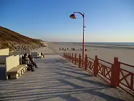 The beach of Équihen-Plage | |
 Coat of arms | |
Location of Équihen-Plage 
| |
 Équihen-Plage  Équihen-Plage | |
| Coordinates: 50°40′40″N 1°34′24″E | |
| Country | France |
| Region | Hauts-de-France |
| Department | Pas-de-Calais |
| Arrondissement | Boulogne-sur-Mer |
| Canton | Outreau |
| Intercommunality | Communauté d'agglomération du Boulonnais |
| Government | |
| • Mayor (2014–2020) | Christian Fourcroy |
| Area 1 | 3.81 km2 (1.47 sq mi) |
| Population (2017-01-01)[1] | 2,738 |
| • Density | 720/km2 (1,900/sq mi) |
| Time zone | UTC+01:00 (CET) |
| • Summer (DST) | UTC+02:00 (CEST) |
| INSEE/Postal code | 62300 /62224 |
| Elevation | 0–96 m (0–315 ft) (avg. 55 m or 180 ft) |
| 1 French Land Register data, which excludes lakes, ponds, glaciers > 1 km2 (0.386 sq mi or 247 acres) and river estuaries. | |
Geography
A fishing port and farming village situated some 3 miles (4.8 km) south of Boulogne, at the junction of the D236e and the D119 roads, on the English Channel coast.
Population
| Year | 1962 | 1968 | 1975 | 1982 | 1990 | 1999 |
|---|---|---|---|---|---|---|
| Population | 2530 | 2592 | 2868 | 3164 | 3067 | 2934 |
| From the year 1962 on: No double counting—residents of multiple communes (e.g. students and military personnel) are counted only once. | ||||||
Places of interest
- The church of St. Pierre, rebuilt after World War II.
- A village that uses upcycled boats as the roofs of homes.[2]
References
- "Populations légales 2017". INSEE. Retrieved 6 January 2020.
- https://unusualplaces.org/equihen-plage-village-of-upside-down-boat-houses/
External links
| Wikimedia Commons has media related to Équihen-Plage. |

Old boat-house
| Authority control |
|---|
This article is issued from Wikipedia. The text is licensed under Creative Commons - Attribution - Sharealike. Additional terms may apply for the media files.
