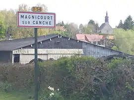
Magnicourt-sur-Canche
Magnicourt-sur-Canche is a commune in the Pas-de-Calais department in the Hauts-de-France region of France.
Magnicourt-sur-Canche | |
|---|---|
 Magnicourt-sur-Canche | |
 Coat of arms | |
Location of Magnicourt-sur-Canche 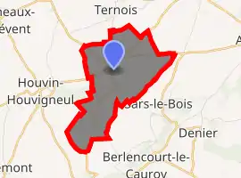
| |
 Magnicourt-sur-Canche  Magnicourt-sur-Canche | |
| Coordinates: 50°18′11″N 2°24′42″E | |
| Country | France |
| Region | Hauts-de-France |
| Department | Pas-de-Calais |
| Arrondissement | Arras |
| Canton | Avesnes-le-Comte |
| Intercommunality | CC Campagnes de l'Artois |
| Government | |
| • Mayor (2008–2014) | Marc Degrendele |
| Area 1 | 4.57 km2 (1.76 sq mi) |
| Population (2017-01-01)[1] | 117 |
| • Density | 26/km2 (66/sq mi) |
| Time zone | UTC+01:00 (CET) |
| • Summer (DST) | UTC+02:00 (CEST) |
| INSEE/Postal code | 62537 /62270 |
| Elevation | 100–144 m (328–472 ft) (avg. 133 m or 436 ft) |
| 1 French Land Register data, which excludes lakes, ponds, glaciers > 1 km2 (0.386 sq mi or 247 acres) and river estuaries. | |
Geography
Magnicourt-sur-Canche is situated 18 miles (29 km) west of Arras, at the junction of the D54 and the D82E roads, by the banks of the river Canche.
Population
| Year | 1962 | 1968 | 1975 | 1982 | 1990 | 1999 | 2006 |
|---|---|---|---|---|---|---|---|
| Population | 99 | 140 | 100 | 80 | 79 | 99 | 107 |
| From the year 1962 on: No double counting—residents of multiple communes (e.g. students and military personnel) are counted only once. | |||||||
Places of interest
- The church of St.Vaast, dating from the eighteenth century.
- The seventeenth century manor house,
References
- "Populations légales 2017". INSEE. Retrieved 6 January 2020.
| Wikimedia Commons has media related to Magnicourt-sur-Canche. |
| Authority control |
|---|
This article is issued from Wikipedia. The text is licensed under Creative Commons - Attribution - Sharealike. Additional terms may apply for the media files.