Rebreuve-Ranchicourt
Rebreuve-Ranchicourt is a commune in the Pas-de-Calais department in the Hauts-de-France region of France.
Rebreuve-Ranchicourt | |
|---|---|
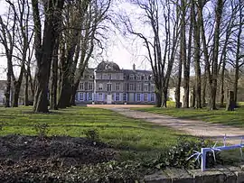 Chateau | |
 Coat of arms | |
Location of Rebreuve-Ranchicourt 
| |
 Rebreuve-Ranchicourt  Rebreuve-Ranchicourt | |
| Coordinates: 50°26′15″N 2°33′22″E | |
| Country | France |
| Region | Hauts-de-France |
| Department | Pas-de-Calais |
| Arrondissement | Béthune |
| Canton | Bruay-la-Buissière |
| Intercommunality | CA Béthune-Bruay, Artois-Lys Romane |
| Government | |
| • Mayor (2008–2014) | Philippe Miloszyk |
| Area 1 | 10.73 km2 (4.14 sq mi) |
| Population (2017-01-01)[1] | 1,074 |
| • Density | 100/km2 (260/sq mi) |
| Time zone | UTC+01:00 (CET) |
| • Summer (DST) | UTC+02:00 (CEST) |
| INSEE/Postal code | 62693 /62150 |
| Elevation | 58–185 m (190–607 ft) (avg. 65 m or 213 ft) |
| 1 French Land Register data, which excludes lakes, ponds, glaciers > 1 km2 (0.386 sq mi or 247 acres) and river estuaries. | |
Geography
Rebreuve-Ranchicourt is situated about 8 miles (12.9 km) southwest of Béthune and 36 miles (57.9 km) southwest of Lille, at the junction of the D341 (an old Roman road, the Chaussee Brunehaut) and the D57 road. The commune was created in 1971 by the joining of the two villages.
Population
| Year | Pop. | ±% p.a. |
|---|---|---|
| 1968 | 933 | — |
| 1975 | 951 | +0.27% |
| 1982 | 892 | −0.91% |
| 1990 | 1,024 | +1.74% |
| 1999 | 1,061 | +0.40% |
| 2007 | 1,099 | +0.44% |
| 2012 | 1,101 | +0.04% |
| 2017 | 1,074 | −0.50% |
| Source: INSEE[2] | ||
Places of interest
- The church of Notre-Dame, dating from the nineteenth century.
- An eighteenth-century manorhouse.
- The church of St.Pierre, dating from the fifteenth century.
- The nineteenth-century château de Ranchicourt with an older dovecote and other outbuildings.
References
- "Populations légales 2017". INSEE. Retrieved 6 January 2020.
- Population en historique depuis 1968, INSEE
| Wikimedia Commons has media related to Rebreuve-Ranchicourt. |
| Authority control |
|---|
This article is issued from Wikipedia. The text is licensed under Creative Commons - Attribution - Sharealike. Additional terms may apply for the media files.