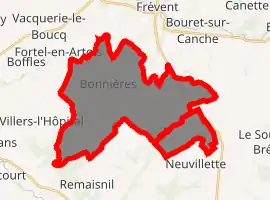
Bonnières, Pas-de-Calais
Bonnières is a commune in the Pas-de-Calais department in the Hauts-de-France region in northern France. On 1 January 2019, the former commune Canteleux was merged into Bonnières.[2]
Bonnières | |
|---|---|
_-_Mairie.JPG.webp) The town hall of Bonnières | |
 Coat of arms | |
Location of Bonnières 
| |
 Bonnières  Bonnières | |
| Coordinates: 50°14′42″N 2°15′40″E | |
| Country | France |
| Region | Hauts-de-France |
| Department | Pas-de-Calais |
| Arrondissement | Arras |
| Canton | Saint-Pol-sur-Ternoise |
| Intercommunality | CC Ternois |
| Government | |
| • Mayor (2014–2020) | Jean-Luc Fay |
| Area 1 | 27.16 km2 (10.49 sq mi) |
| Population (2017-01-01)[1] | 674 |
| • Density | 25/km2 (64/sq mi) |
| Time zone | UTC+01:00 (CET) |
| • Summer (DST) | UTC+02:00 (CEST) |
| INSEE/Postal code | 62154 /62270 |
| Elevation | 54–156 m (177–512 ft) (avg. 152 m or 499 ft) |
| 1 French Land Register data, which excludes lakes, ponds, glaciers > 1 km2 (0.386 sq mi or 247 acres) and river estuaries. | |
Geography
A farming village located 26 miles (41 km) west of Arras at the junction of the D115 and D114 roads.
History
During World War II, Bonnières was subjected to heavy Allied bombing, as the Germans had built a launch site for their V1 rockets within the commune. The village was badly damaged, but not one missile was ever launched successfully
Population
| Year | Pop. | ±% |
|---|---|---|
| 1962 | 752 | — |
| 1968 | 765 | +1.7% |
| 1975 | 708 | −7.5% |
| 1982 | 677 | −4.4% |
| 1990 | 646 | −4.6% |
| 1999 | 607 | −6.0% |
| 2009 | 636 | +4.8% |
Sights
- The church of St. Aubin, rebuilt in 1960 after the destruction of the village during World War II.
References
- "Populations légales 2017". INSEE. Retrieved 6 January 2020.
- Arrêté préfectoral 25 September 2018, modified 26 October 2018 (in French)
| Wikimedia Commons has media related to Bonnières (Pas-de-Calais). |
This article is issued from Wikipedia. The text is licensed under Creative Commons - Attribution - Sharealike. Additional terms may apply for the media files.