Fruges
Fruges (West Flemish: Frusje) is a commune in the Pas-de-Calais department in the Hauts-de-France region of France.
Fruges
Frusje | |
|---|---|
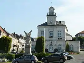 The town hall of Fruges | |
 Coat of arms | |
Location of Fruges 
| |
 Fruges  Fruges | |
| Coordinates: 50°30′55″N 2°08′04″E | |
| Country | France |
| Region | Hauts-de-France |
| Department | Pas-de-Calais |
| Arrondissement | Montreuil |
| Canton | Fruges |
| Intercommunality | CC Haut Pays du Montreuillois |
| Government | |
| • Mayor (2020–2026) | Edmond Zaborowski[1] |
| Area 1 | 18.9 km2 (7.3 sq mi) |
| Population (2017-01-01)[2] | 2,371 |
| • Density | 130/km2 (320/sq mi) |
| Time zone | UTC+01:00 (CET) |
| • Summer (DST) | UTC+02:00 (CEST) |
| INSEE/Postal code | 62364 /62310 |
| Elevation | 84–171 m (276–561 ft) (avg. 107 m or 351 ft) |
| 1 French Land Register data, which excludes lakes, ponds, glaciers > 1 km2 (0.386 sq mi or 247 acres) and river estuaries. | |
Geography
Situated some 12 miles (19 km) northeast of Montreuil-sur-Mer on the D928 road, set in a valley not far from the historic battlefield of Azincourt.
Features
Fruges is a typical small country town in the Pas-de-Calais with a weekly market, agricultural suppliers, a Carrefour and various smaller stores.
An annual Fête des Géants livens up August with parades of marching bands and papier mache giants.
Population
| Year | 1962 | 1968 | 1975 | 1982 | 1990 | 1999 |
|---|---|---|---|---|---|---|
| Population | 2421 | 2460 | 2534 | 2465 | 2499 | 2426 |
| From the year 1962 on: No double counting—residents of multiple communes (e.g. students and military personnel) are counted only once. | ||||||
Places of interest
- Church of St. Bertulphe, dating from the nineteenth century.
References
- "Répertoire national des élus: les maires". data.gouv.fr, Plateforme ouverte des données publiques françaises (in French). 2 December 2020. Retrieved 7 December 2020.
- "Populations légales 2017". INSEE. Retrieved 6 January 2020.
| Wikimedia Commons has media related to Fruges. |
| Authority control |
|
|---|
This article is issued from Wikipedia. The text is licensed under Creative Commons - Attribution - Sharealike. Additional terms may apply for the media files.