Saint-Michel-sous-Bois
Saint-Michel-sous-Bois is a commune in the Pas-de-Calais department in the Hauts-de-France region of France.
Saint-Michel-sous-Bois | |
|---|---|
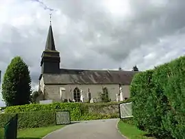 The church of Saint-Michel-sous-Bois | |
 Coat of arms | |
Location of Saint-Michel-sous-Bois 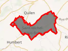
| |
 Saint-Michel-sous-Bois  Saint-Michel-sous-Bois | |
| Coordinates: 50°30′52″N 1°55′57″E | |
| Country | France |
| Region | Hauts-de-France |
| Department | Pas-de-Calais |
| Arrondissement | Montreuil |
| Canton | Lumbres |
| Intercommunality | CC Haut Pays du Montreuillois |
| Government | |
| • Mayor (2020–2026) | René Lecerf[1] |
| Area 1 | 5.66 km2 (2.19 sq mi) |
| Population (2017-01-01)[2] | 119 |
| • Density | 21/km2 (54/sq mi) |
| Time zone | UTC+01:00 (CET) |
| • Summer (DST) | UTC+02:00 (CEST) |
| INSEE/Postal code | 62762 /62650 |
| Elevation | 68–190 m (223–623 ft) (avg. 94 m or 308 ft) |
| 1 French Land Register data, which excludes lakes, ponds, glaciers > 1 km2 (0.386 sq mi or 247 acres) and river estuaries. | |
Geography
Saint-Michel-sous-Bois is located 9 miles (15.5 km) northeast of Montreuil-sur-Mer on the D129 road.
Population
| Year | Pop. | ±% p.a. |
|---|---|---|
| 1968 | 124 | — |
| 1975 | 122 | −0.23% |
| 1982 | 125 | +0.35% |
| 1990 | 106 | −2.04% |
| 1999 | 89 | −1.92% |
| 2007 | 110 | +2.68% |
| 2012 | 122 | +2.09% |
| 2017 | 119 | −0.50% |
| Source: INSEE[3] | ||
Places of interest
- The church of St. Michel, dating from the seventeenth century
References
- "Répertoire national des élus: les maires". data.gouv.fr, Plateforme ouverte des données publiques françaises (in French). 2 December 2020. Retrieved 7 December 2020.
- "Populations légales 2017". INSEE. Retrieved 6 January 2020.
- Population en historique depuis 1968, INSEE
| Wikimedia Commons has media related to Saint-Michel-sous-Bois. |
| Authority control |
|---|
This article is issued from Wikipedia. The text is licensed under Creative Commons - Attribution - Sharealike. Additional terms may apply for the media files.