Monchy-au-Bois
Monchy-au-Bois is a commune in the Pas-de-Calais department in the Hauts-de-France region of France.
Monchy-au-Bois | |
|---|---|
 The town hall of Monchy-au-Bois | |
 Coat of arms | |
Location of Monchy-au-Bois 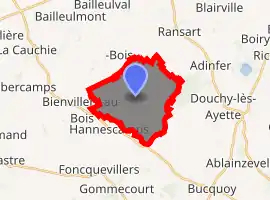
| |
 Monchy-au-Bois  Monchy-au-Bois | |
| Coordinates: 50°10′53″N 2°39′27″E | |
| Country | France |
| Region | Hauts-de-France |
| Department | Pas-de-Calais |
| Arrondissement | Arras |
| Canton | Avesnes-le-Comte |
| Intercommunality | CC Campagnes de l'Artois |
| Government | |
| • Mayor (2008–2014) | Raymond Przybylski |
| Area 1 | 10.98 km2 (4.24 sq mi) |
| Population (2017-01-01)[1] | 561 |
| • Density | 51/km2 (130/sq mi) |
| Time zone | UTC+01:00 (CET) |
| • Summer (DST) | UTC+02:00 (CEST) |
| INSEE/Postal code | 62579 /62111 |
| Elevation | 118–161 m (387–528 ft) (avg. 132 m or 433 ft) |
| 1 French Land Register data, which excludes lakes, ponds, glaciers > 1 km2 (0.386 sq mi or 247 acres) and river estuaries. | |
Geography
Monchy-au-Bois is situated 10 miles (16 km) south-southwest of Arras, at the junction of the D3 and the D2 roads.
Population
| Year | Pop. | ±% p.a. |
|---|---|---|
| 1968 | 473 | — |
| 1975 | 449 | −0.74% |
| 1982 | 420 | −0.95% |
| 1990 | 455 | +1.01% |
| 1999 | 483 | +0.67% |
| 2007 | 506 | +0.58% |
| 2012 | 498 | −0.32% |
| 2017 | 561 | +2.41% |
| Source: INSEE[2] | ||
Places of interest
- The church of St.Pierre, rebuilt along with much of the village, after World War I.
References
- "Populations légales 2017". INSEE. Retrieved 6 January 2020.
- Population en historique depuis 1968, INSEE
This article is issued from Wikipedia. The text is licensed under Creative Commons - Attribution - Sharealike. Additional terms may apply for the media files.