Wancourt
Wancourt is a commune in the Pas-de-Calais department in the Hauts-de-France region of France.
Wancourt | |
|---|---|
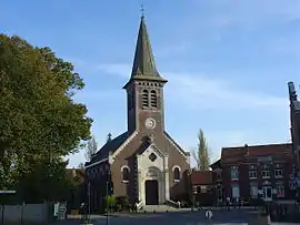
 The church of Wancourt | |
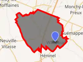
Location of Wancourt 
| |
 Wancourt  Wancourt | |
| Coordinates: 50°14′54″N 2°52′18″E | |
| Country | France |
| Region | Hauts-de-France |
| Department | Pas-de-Calais |
| Arrondissement | Arras |
| Canton | Arras-3 |
| Intercommunality | Arras |
| Government | |
| • Mayor (2020–2026) | Éric Duflot[1] |
| Area 1 | 8.9 km2 (3.4 sq mi) |
| Population (2017-01-01)[2] | 649 |
| • Density | 73/km2 (190/sq mi) |
| Time zone | UTC+01:00 (CET) |
| • Summer (DST) | UTC+02:00 (CEST) |
| INSEE/Postal code | 62873 /62128 |
| Elevation | 56–101 m (184–331 ft) (avg. 61 m or 200 ft) |
| 1 French Land Register data, which excludes lakes, ponds, glaciers > 1 km2 (0.386 sq mi or 247 acres) and river estuaries. | |
Geography
Wancourt is situated some 5 miles (8.0 km) southeast of Arras, at the junction of the D33 and the D34E roads. The A1 autoroute passes by just yards from the commune.
Toponymy
Wahencurt (1072), Wahencourt (around 1110), Waencurt (1148), Waencourt (1226).
Population
| Year | Pop. | ±% |
|---|---|---|
| 2006 | 597 | — |
| 2007 | 598 | +0.2% |
| 2008 | 644 | +7.7% |
| 2009 | 650 | +0.9% |
| 2010 | 658 | +1.2% |
| 2011 | 664 | +0.9% |
| 2012 | 671 | +1.1% |
| 2013 | 673 | +0.3% |
| 2014 | 694 | +3.1% |
| 2015 | 676 | −2.6% |
| 2016 | 663 | −1.9% |
Places of interest
- The church of St.Aubode, rebuilt, along with much of the village, after World War I.
- Commonwealth War Graves Commission cemeteries, including Hibers Trench Cemetery.
References
- "À Wancourt, Éric Duflot réélu maire avec trois adjoints à ses côtés", La Voix du Nord, 5 June 2020 (in French)
- "Populations légales 2017". INSEE. Retrieved 6 January 2020.
This article is issued from Wikipedia. The text is licensed under Creative Commons - Attribution - Sharealike. Additional terms may apply for the media files.