Noyelles-lès-Vermelles
Noyelles-lès-Vermelles is a commune in the Pas-de-Calais department in the Hauts-de-France region of France.
Noyelles-lès-Vermelles | |
|---|---|
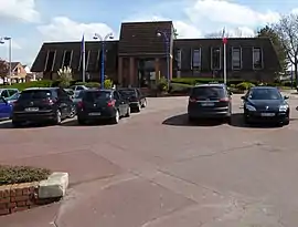 The town hall of Noyelles-lès-Vermelles | |
 Coat of arms | |
Location of Noyelles-lès-Vermelles 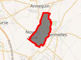
| |
 Noyelles-lès-Vermelles  Noyelles-lès-Vermelles | |
| Coordinates: 50°29′24″N 2°43′36″E | |
| Country | France |
| Region | Hauts-de-France |
| Department | Pas-de-Calais |
| Arrondissement | Béthune |
| Canton | Douvrin |
| Intercommunality | CA Béthune-Bruay, Artois-Lys Romane |
| Government | |
| • Mayor (2008–2014) | Léon Copin |
| Area 1 | 2.53 km2 (0.98 sq mi) |
| Population (2017-01-01)[1] | 2,401 |
| • Density | 950/km2 (2,500/sq mi) |
| Time zone | UTC+01:00 (CET) |
| • Summer (DST) | UTC+02:00 (CEST) |
| INSEE/Postal code | 62626 /62980 |
| Elevation | 22–37 m (72–121 ft) (avg. 32 m or 105 ft) |
| 1 French Land Register data, which excludes lakes, ponds, glaciers > 1 km2 (0.386 sq mi or 247 acres) and river estuaries. | |
Geography
Noyelles-lès-Vermelles is situated about 5 miles (8.0 km) southeast of Béthune and 26 miles (41.8 km) southwest of Lille, at the junction of the D943 and D166 roads.
Population
| Year | Pop. | ±% p.a. |
|---|---|---|
| 1968 | 1,158 | — |
| 1975 | 1,084 | −0.94% |
| 1982 | 1,415 | +3.88% |
| 1990 | 1,851 | +3.41% |
| 1999 | 1,939 | +0.52% |
| 2007 | 2,033 | +0.59% |
| 2012 | 2,315 | +2.63% |
| 2017 | 2,401 | +0.73% |
| Source: INSEE[2] | ||
Places of interest
- The church of St. Vaast, dating from the nineteenth century.
- Traces of the motte of the château de Beaulieu.
- The war memorial.
Twin towns
 Łomianki, Poland
 Waldenburg, Allemagne (Saxe)
References
- "Populations légales 2017". INSEE. Retrieved 6 January 2020.
- Population en historique depuis 1968, INSEE
External links
| Wikimedia Commons has media related to Noyelles-lès-Vermelles. |
- Official website of the commune (in French)
| Authority control |
|---|
This article is issued from Wikipedia. The text is licensed under Creative Commons - Attribution - Sharealike. Additional terms may apply for the media files.