Robecq
Robecq is a commune in the Pas-de-Calais department in the Hauts-de-France region of France found at the junction of the D937, the D69 and the D94 roads
Robecq | |
|---|---|
.JPG.webp) The church of Robecq | |
 Coat of arms | |
Location of Robecq 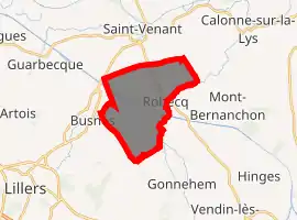
| |
 Robecq  Robecq | |
| Coordinates: 50°35′48″N 2°33′51″E | |
| Country | France |
| Region | Hauts-de-France |
| Department | Pas-de-Calais |
| Arrondissement | Béthune |
| Canton | Lillers |
| Intercommunality | CA Béthune-Bruay, Artois-Lys Romane |
| Government | |
| • Mayor (2008–2014) | Hervé Deroubaix |
| Area 1 | 10.56 km2 (4.08 sq mi) |
| Population (2017-01-01)[1] | 1,359 |
| • Density | 130/km2 (330/sq mi) |
| Time zone | UTC+01:00 (CET) |
| • Summer (DST) | UTC+02:00 (CEST) |
| INSEE/Postal code | 62713 /62350 |
| Elevation | 16–20 m (52–66 ft) (avg. 19 m or 62 ft) |
| 1 French Land Register data, which excludes lakes, ponds, glaciers > 1 km2 (0.386 sq mi or 247 acres) and river estuaries. | |
Geography
Robecq is situated about 7 miles (11.3 km) northwest of Béthune and 31 miles (49.9 km) southwest of Lille. The Canal d’Aire, the Clarence River and the Busnes river all flow through the commune.
History
During World War I intense action took place close to Robecq. In his posthumously published memoir, Private A S Bullock recalls the fighting at Bacquerolles Farm, noting that the German attack was repelled 'chiefly by my Lewis gun!'. He also recalls a much lighter, indeed hilarious, incident when the British troops stationed near Robecq were ordered to have a bath.[2]
Population
| Year | Pop. | ±% p.a. |
|---|---|---|
| 1968 | 1,109 | — |
| 1975 | 1,006 | −1.38% |
| 1982 | 1,037 | +0.43% |
| 1990 | 1,063 | +0.31% |
| 1999 | 1,062 | −0.01% |
| 2007 | 1,195 | +1.49% |
| 2012 | 1,322 | +2.04% |
| 2017 | 1,359 | +0.55% |
| Source: INSEE[3] | ||
Places of interest
- The church of St. Maurice, dating from the fourteenth century.
- The eighteenth-century farmhouse of L’Abiette.
- The war memorial.
- The Commonwealth War Graves Commission cemetery.
References
- "Populations légales 2017". INSEE. Retrieved 6 January 2020.
- Bullock, A. S., Gloucestershire Between the Wars: A Memoir, History Press, 2009, pages 69 and 72
- Population en historique depuis 1968, INSEE
This article is issued from Wikipedia. The text is licensed under Creative Commons - Attribution - Sharealike. Additional terms may apply for the media files.