Saint-Floris
Saint-Floris is a commune in the Pas-de-Calais department in the Hauts-de-France region of France.
Saint-Floris | |
|---|---|
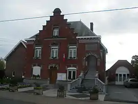 The town hall of Saint-Floris | |
 Coat of arms | |
Location of Saint-Floris 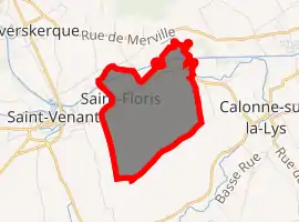
| |
 Saint-Floris  Saint-Floris | |
| Coordinates: 50°37′40″N 2°34′14″E | |
| Country | France |
| Region | Hauts-de-France |
| Department | Pas-de-Calais |
| Arrondissement | Béthune |
| Canton | Lillers |
| Intercommunality | CA Béthune-Bruay, Artois-Lys Romane |
| Government | |
| • Mayor (2008–2014) | Guy Bouvart |
| Area 1 | 4.05 km2 (1.56 sq mi) |
| Population (2017-01-01)[1] | 592 |
| • Density | 150/km2 (380/sq mi) |
| Time zone | UTC+01:00 (CET) |
| • Summer (DST) | UTC+02:00 (CEST) |
| INSEE/Postal code | 62747 /62350 |
| Elevation | 14–18 m (46–59 ft) (avg. 18 m or 59 ft) |
| 1 French Land Register data, which excludes lakes, ponds, glaciers > 1 km2 (0.386 sq mi or 247 acres) and river estuaries. | |
Geography
Saint-Floris is a small farming village situated some 9 miles (14.5 km) north of Béthune and 30 miles (48.3 km) west of Lille, on the D186 road. The canalized river Lys flows through the commune, forming part of the border with the department of Nord.
Population
| Year | Pop. | ±% p.a. |
|---|---|---|
| 1968 | 313 | — |
| 1975 | 326 | +0.58% |
| 1982 | 353 | +1.14% |
| 1990 | 416 | +2.07% |
| 1999 | 413 | −0.08% |
| 2007 | 456 | +1.25% |
| 2012 | 540 | +3.44% |
| 2017 | 592 | +1.86% |
| Source: INSEE[2] | ||
Places of interest
- The church of St. Florent, rebuilt, along with much of the village, after the First World War.
- The Commonwealth War Graves Commission cemetery.
References
- "Populations légales 2017". INSEE. Retrieved 6 January 2020.
- Population en historique depuis 1968, INSEE
This article is issued from Wikipedia. The text is licensed under Creative Commons - Attribution - Sharealike. Additional terms may apply for the media files.