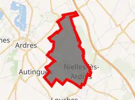
Nielles-lès-Ardres
Nielles-lès-Ardres is a commune in the Pas-de-Calais department in the Hauts-de-France region of France.
Nielles-lès-Ardres | |
|---|---|
_mairie.JPG.webp) The town hall of Nielles-lès-Ardres | |
 Coat of arms | |
Location of Nielles-lès-Ardres 
| |
 Nielles-lès-Ardres  Nielles-lès-Ardres | |
| Coordinates: 50°50′33″N 2°01′02″E | |
| Country | France |
| Region | Hauts-de-France |
| Department | Pas-de-Calais |
| Arrondissement | Calais |
| Canton | Calais-2 |
| Intercommunality | CC Pays d'Opale |
| Government | |
| • Mayor (2020–2026) | Pierre-Eloi Calais |
| Area 1 | 4.48 km2 (1.73 sq mi) |
| Population (2017-01-01)[1] | 557 |
| • Density | 120/km2 (320/sq mi) |
| Time zone | UTC+01:00 (CET) |
| • Summer (DST) | UTC+02:00 (CEST) |
| INSEE/Postal code | 62614 /62610 |
| Elevation | 1–29 m (3.3–95.1 ft) (avg. 9 m or 30 ft) |
| 1 French Land Register data, which excludes lakes, ponds, glaciers > 1 km2 (0.386 sq mi or 247 acres) and river estuaries. | |
Geography
Nielles-lès-Ardres lies about 14 miles (22 km) northwest of Saint-Omer, on the D225E road.
Population
| Year | Pop. | ±% p.a. |
|---|---|---|
| 1968 | 261 | — |
| 1975 | 282 | +1.11% |
| 1982 | 344 | +2.88% |
| 1990 | 383 | +1.35% |
| 1999 | 444 | +1.66% |
| 2007 | 484 | +1.08% |
| 2012 | 521 | +1.48% |
| 2017 | 557 | +1.35% |
| Source: INSEE[2] | ||
Places of interest
- The church of St. Pierre, dating from the year 1200.
- Ruins of the château de la Montoire, destroyed by the duc de Vendôme in 1542.
- Château de la Cressonnerie, built between 1808/1812.
- The seventeenth century ‘Le Colombier’, an enormous round tower.
References
- "Populations légales 2017". INSEE. Retrieved 6 January 2020.
- Population en historique depuis 1968, INSEE
| Wikimedia Commons has media related to Nielles-lès-Ardres. |
This article is issued from Wikipedia. The text is licensed under Creative Commons - Attribution - Sharealike. Additional terms may apply for the media files.