Erny-Saint-Julien
Erny-Saint-Julien (West Flemish: Erni) is a commune in the Pas-de-Calais department in the Hauts-de-France region of France.
Erny-Saint-Julien
Erni | |
|---|---|
_mairie.JPG.webp) The town hall of Erny-Saint-Julien | |
 Coat of arms | |
Location of Erny-Saint-Julien 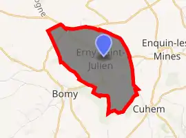
| |
 Erny-Saint-Julien  Erny-Saint-Julien | |
| Coordinates: 50°35′11″N 2°15′19″E | |
| Country | France |
| Region | Hauts-de-France |
| Department | Pas-de-Calais |
| Arrondissement | Saint-Omer |
| Canton | Fruges |
| Intercommunality | Pays de Saint-Omer |
| Government | |
| • Mayor (2020–2026) | Jean-Claude Dupont |
| Area 1 | 5.41 km2 (2.09 sq mi) |
| Population (2017-01-01)[1] | 325 |
| • Density | 60/km2 (160/sq mi) |
| Time zone | UTC+01:00 (CET) |
| • Summer (DST) | UTC+02:00 (CEST) |
| INSEE/Postal code | 62304 /62960 |
| Elevation | 66–173 m (217–568 ft) (avg. 76 m or 249 ft) |
| 1 French Land Register data, which excludes lakes, ponds, glaciers > 1 km2 (0.386 sq mi or 247 acres) and river estuaries. | |
Geography
A farming village situated 10 miles (16 km) south of Saint-Omer, at the D158 and D193 crossroads.
Its surrounded by the common Bomy, Enquin-les-Mines and Fléchin, Erny-Saint-Julien is located 18 km southwest of Saint-Omer's largest city nearby.[2]
Population
| Year | 1962 | 1968 | 1975 | 1982 | 1990 | 1999 |
|---|---|---|---|---|---|---|
| Population | 320 | 348 | 317 | 312 | 301 | 288 |
| From the year 1962 on: No double counting—residents of multiple communes (e.g. students and military personnel) are counted only once. | ||||||
Places of interest
- The church of St.Julien, dating from the nineteenth century, with some Gallo-Roman finds in the foundations.
- Traces of an ancient château.
References
- "Populations légales 2017". INSEE. Retrieved 6 January 2020.
- "Annuaire-Mairie"
External links
| Wikimedia Commons has media related to Erny-Saint-Julien. |
| Authority control |
|
|---|
This article is issued from Wikipedia. The text is licensed under Creative Commons - Attribution - Sharealike. Additional terms may apply for the media files.