Mont-Saint-Éloi
Mont-Saint-Éloi is a commune in the Pas-de-Calais department in the Hauts-de-France region of France.
Mont-Saint-Éloi | |
|---|---|
 Abbey of Mont Saint-Éloi | |
 Coat of arms | |
Location of Mont-Saint-Éloi 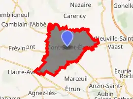
| |
 Mont-Saint-Éloi  Mont-Saint-Éloi | |
| Coordinates: 50°21′07″N 2°41′38″E | |
| Country | France |
| Region | Hauts-de-France |
| Department | Pas-de-Calais |
| Arrondissement | Arras |
| Canton | Arras-1 |
| Intercommunality | CU Arras |
| Government | |
| • Mayor (2008–2014) | Jean-Pierre Bavière |
| Area 1 | 15.85 km2 (6.12 sq mi) |
| Population (2017-01-01)[1] | 1,023 |
| • Density | 65/km2 (170/sq mi) |
| Time zone | UTC+01:00 (CET) |
| • Summer (DST) | UTC+02:00 (CEST) |
| INSEE/Postal code | 62589 /62144 |
| Elevation | 67–145 m (220–476 ft) (avg. 135 m or 443 ft) |
| 1 French Land Register data, which excludes lakes, ponds, glaciers > 1 km2 (0.386 sq mi or 247 acres) and river estuaries. | |
Geography
Mont-Saint-Éloi is situated 5 miles (8 km) northwest of Arras, at the junction of the D341 and the D49 roads, on the banks of the river Scarpe.
Population
| Year | Pop. | ±% p.a. |
|---|---|---|
| 1968 | 1,042 | — |
| 1975 | 1,056 | +0.19% |
| 1982 | 1,023 | −0.45% |
| 1990 | 982 | −0.51% |
| 1999 | 1,018 | +0.40% |
| 2007 | 1,009 | −0.11% |
| 2012 | 1,011 | +0.04% |
| 2017 | 1,023 | +0.24% |
| Source: INSEE[2] | ||
Places of interest
- The church of St. Joseph, dating from the sixteenth century.
- The Commonwealth War Graves Commission cemetery.
- The eighteenth-century chateau d’Écoivres.
- Remains of an abbey church, destroyed in 1783.
- Two menhirs, known as the Twin Stones.
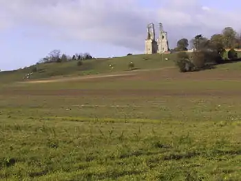
Towers of the abbey of Mont Saint-Éloi
References
- "Populations légales 2017". INSEE. Retrieved 6 January 2020.
- Population en historique depuis 1968, INSEE
External links
| Wikimedia Commons has media related to Mont-Saint-Éloi. |
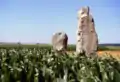 The menhirs
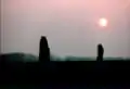 Menhirs
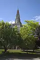 Écoivres village
 Features on the church spire
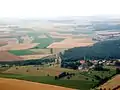 Aerial view of the countryside
 Aerial view
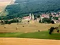 Aerial view of the abbey
| Authority control |
|---|
This article is issued from Wikipedia. The text is licensed under Creative Commons - Attribution - Sharealike. Additional terms may apply for the media files.