Saint-Laurent-Blangy
Saint-Laurent-Blangy is a commune in the Pas-de-Calais department in the Hauts-de-France region of France.
Saint-Laurent-Blangy | |
|---|---|
 A road within Saint-Laurent-Blangy | |
 Coat of arms | |
Location of Saint-Laurent-Blangy 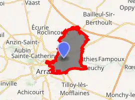
| |
 Saint-Laurent-Blangy  Saint-Laurent-Blangy | |
| Coordinates: 50°18′11″N 2°48′13″E | |
| Country | France |
| Region | Hauts-de-France |
| Department | Pas-de-Calais |
| Arrondissement | Arras |
| Canton | Arras-2 |
| Intercommunality | Communauté urbaine d'Arras |
| Government | |
| • Mayor (2020–2026) | Nicolas Desfachelle[1] |
| Area 1 | 9.83 km2 (3.80 sq mi) |
| Population (2017-01-01)[2] | 6,606 |
| • Density | 670/km2 (1,700/sq mi) |
| Time zone | UTC+01:00 (CET) |
| • Summer (DST) | UTC+02:00 (CEST) |
| INSEE/Postal code | 62753 /62223 |
| Elevation | 50–103 m (164–338 ft) (avg. 93 m or 305 ft) |
| 1 French Land Register data, which excludes lakes, ponds, glaciers > 1 km2 (0.386 sq mi or 247 acres) and river estuaries. | |
Geography
Saint-Laurent-Blangy is a light industrial suburb and river port on the northeast side of Arras, at the junction of the N50, D42 and D919 roads.
History
Joan of Arc was imprisoned here at the chateau, after her capture at Compiègne.
The town was completely destroyed during the First World War.
Population
| Year | Pop. | ±% p.a. |
|---|---|---|
| 1968 | 3,752 | — |
| 1975 | 5,227 | +4.85% |
| 1982 | 6,100 | +2.23% |
| 1990 | 5,358 | −1.61% |
| 1999 | 5,578 | +0.45% |
| 2007 | 5,531 | −0.11% |
| 2012 | 6,450 | +3.12% |
| 2017 | 6,606 | +0.48% |
| Source: INSEE[3] | ||
Places of interest
- The church of St. Laurent, rebuilt in 1982.
- The château of Immercourt
- The feudal motte.
- The Commonwealth War Graves Commission cemeteries.
References
- "Répertoire national des élus: les maires". data.gouv.fr, Plateforme ouverte des données publiques françaises (in French). 2 December 2020. Retrieved 7 December 2020.
- "Populations légales 2017". INSEE. Retrieved 6 January 2020.
- Population en historique depuis 1968, INSEE
External links
| Wikimedia Commons has media related to Saint-Laurent-Blangy. |
- Official website of Saint Laurent Blangy (in French)
- Bailleul Road East CWGC cemetery
- Bailleul Road West CWGC cemetery
- The CWGC communal cemetery
| Authority control |
|---|
This article is issued from Wikipedia. The text is licensed under Creative Commons - Attribution - Sharealike. Additional terms may apply for the media files.