Saint-Léger, Pas-de-Calais
Saint-Léger is a commune in the Pas-de-Calais department in the Hauts-de-France region of France.
Saint-Léger | |
|---|---|
_-_Rue_de_Vaulx-Vraucourt.JPG.webp) The town hall and church of Saint-Léger | |
 Coat of arms | |
Location of Saint-Léger 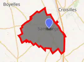
| |
 Saint-Léger  Saint-Léger | |
| Coordinates: 50°11′13″N 2°51′31″E | |
| Country | France |
| Region | Hauts-de-France |
| Department | Pas-de-Calais |
| Arrondissement | Arras |
| Canton | Bapaume |
| Intercommunality | CC Sud-Artois |
| Government | |
| • Mayor (2008–2014) | Michel Blondel |
| Area 1 | 7.47 km2 (2.88 sq mi) |
| Population (2017-01-01)[1] | 450 |
| • Density | 60/km2 (160/sq mi) |
| Time zone | UTC+01:00 (CET) |
| • Summer (DST) | UTC+02:00 (CEST) |
| INSEE/Postal code | 62754 /62128 |
| Elevation | 69–117 m (226–384 ft) (avg. 83 m or 272 ft) |
| 1 French Land Register data, which excludes lakes, ponds, glaciers > 1 km2 (0.386 sq mi or 247 acres) and river estuaries. | |
Geography
Saint-Léger lies 10 miles (16 km) south of Arras, at the junction of the D12, D9 and D36E roads. The A1 autoroute passes by half a mile to the east of the commune.
Population
| Year | Pop. | ±% p.a. |
|---|---|---|
| 1968 | 447 | — |
| 1975 | 422 | −0.82% |
| 1982 | 413 | −0.31% |
| 1990 | 392 | −0.65% |
| 1999 | 393 | +0.03% |
| 2007 | 404 | +0.35% |
| 2012 | 423 | +0.92% |
| 2017 | 450 | +1.25% |
| Source: INSEE[2] | ||
Places of interest
- The church of St.Leger, rebuilt, as was all of the village, after the First World War.
- The Commonwealth War Graves Commission cemetery.
References
- "Populations légales 2017". INSEE. Retrieved 6 January 2020.
- Population en historique depuis 1968, INSEE
External links
| Wikimedia Commons has media related to Saint-Léger (Pas-de-Calais). |
| Authority control |
|---|
This article is issued from Wikipedia. The text is licensed under Creative Commons - Attribution - Sharealike. Additional terms may apply for the media files.