Monchy-Cayeux
Monchy-Cayeux is a commune in the Pas-de-Calais department in the Hauts-de-France region of France.
Monchy-Cayeux | |
|---|---|
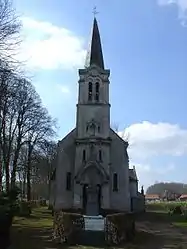 The church of Monchy-Cayeux | |
 Coat of arms | |
Location of Monchy-Cayeux 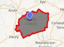
| |
 Monchy-Cayeux  Monchy-Cayeux | |
| Coordinates: 50°26′19″N 2°16′39″E | |
| Country | France |
| Region | Hauts-de-France |
| Department | Pas-de-Calais |
| Arrondissement | Arras |
| Canton | Saint-Pol-sur-Ternoise |
| Intercommunality | CC Ternois |
| Government | |
| • Mayor (2008–2014) | Claude Hoguet |
| Area 1 | 6.22 km2 (2.40 sq mi) |
| Population (2017-01-01)[1] | 300 |
| • Density | 48/km2 (120/sq mi) |
| Time zone | UTC+01:00 (CET) |
| • Summer (DST) | UTC+02:00 (CEST) |
| INSEE/Postal code | 62581 /62134 |
| Elevation | 60–138 m (197–453 ft) (avg. 68 m or 223 ft) |
| 1 French Land Register data, which excludes lakes, ponds, glaciers > 1 km2 (0.386 sq mi or 247 acres) and river estuaries. | |
Geography
Monchy-Cayeux is situated 29 miles (47 km) northwest of Arras, in the Ternoise river valley and on the D343 road.
Population
| Year | Pop. | ±% p.a. |
|---|---|---|
| 1968 | 313 | — |
| 1975 | 286 | −1.28% |
| 1982 | 277 | −0.46% |
| 1990 | 297 | +0.88% |
| 1999 | 274 | −0.89% |
| 2007 | 283 | +0.40% |
| 2012 | 311 | +1.90% |
| 2017 | 300 | −0.72% |
| Source: INSEE[2] | ||
Places of interest
- The church and the chapel of St.Pierre.
- An eighteenth-century chateau.
References
- "Populations légales 2017". INSEE. Retrieved 6 January 2020.
- Population en historique depuis 1968, INSEE
| Wikimedia Commons has media related to Monchy-Cayeux. |
| Authority control |
|---|
This article is issued from Wikipedia. The text is licensed under Creative Commons - Attribution - Sharealike. Additional terms may apply for the media files.