Mont-Bernanchon
Mont-Bernanchon is a commune in the Pas-de-Calais department in the Hauts-de-France region of France.
Mont-Bernanchon | |
|---|---|
.JPG.webp) The town hall of Mont-Bernanchon | |
 Coat of arms | |
Location of Mont-Bernanchon 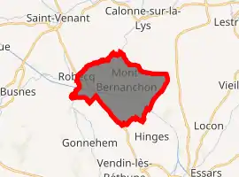
| |
 Mont-Bernanchon  Mont-Bernanchon | |
| Coordinates: 50°35′02″N 2°35′25″E | |
| Country | France |
| Region | Hauts-de-France |
| Department | Pas-de-Calais |
| Arrondissement | Béthune |
| Canton | Lillers |
| Intercommunality | CA Béthune-Bruay, Artois-Lys Romane |
| Government | |
| • Mayor (2008–2014) | Marie-Claude Duhamel |
| Area 1 | 11.4 km2 (4.4 sq mi) |
| Population (2017-01-01)[1] | 1,359 |
| • Density | 120/km2 (310/sq mi) |
| Time zone | UTC+01:00 (CET) |
| • Summer (DST) | UTC+02:00 (CEST) |
| INSEE/Postal code | 62584 /62350 |
| Elevation | 16–37 m (52–121 ft) (avg. 29 m or 95 ft) |
| 1 French Land Register data, which excludes lakes, ponds, glaciers > 1 km2 (0.386 sq mi or 247 acres) and river estuaries. | |
Geography
Mont-Bernanchon situated some 5 miles (8.0 km) north of Béthune and 27 miles (43.5 km) west of Lille, at the junction of the D937 and D184 roads. Both the Clarence River and the Canal d’Aire flow by the commune, which covers a large area of forests and lakes.
Population
| Year | Pop. | ±% p.a. |
|---|---|---|
| 1968 | 861 | — |
| 1975 | 872 | +0.18% |
| 1982 | 972 | +1.56% |
| 1990 | 1,262 | +3.32% |
| 1999 | 1,170 | −0.84% |
| 2007 | 1,343 | +1.74% |
| 2012 | 1,383 | +0.59% |
| 2017 | 1,359 | −0.35% |
| Source: INSEE[2] | ||
Places of interest
- The church of St.Nicaise, dating from the seventeenth century.
- The Commonwealth War Graves Commission cemeteries.
References
- "Populations légales 2017". INSEE. Retrieved 6 January 2020.
- Population en historique depuis 1968, INSEE
This article is issued from Wikipedia. The text is licensed under Creative Commons - Attribution - Sharealike. Additional terms may apply for the media files.