Bathurst Regional Council
Bathurst Regional Council is a local government area in the Central West region of New South Wales, Australia. The area is located adjacent to the Great Western Highway, Mid-Western Highway, Mitchell Highway and the Main Western railway line. At the 2016 census, the Bathurst Region had a population of 41,300.[1]
| Bathurst Regional Council New South Wales | |||||||||||||||
|---|---|---|---|---|---|---|---|---|---|---|---|---|---|---|---|
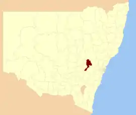 Location in New South Wales | |||||||||||||||
| Coordinates | 33°25′S 149°34′E | ||||||||||||||
| Population |
| ||||||||||||||
| • Density | 10.812/km2 (28.00/sq mi) | ||||||||||||||
| Established | 26 May 2004 | ||||||||||||||
| Area | 3,820 km2 (1,474.9 sq mi) | ||||||||||||||
| Mayor | Bobby Bourke (Unaligned) [3] | ||||||||||||||
| Council seat | Bathurst | ||||||||||||||
| Region | Central West | ||||||||||||||
| State electorate(s) | Bathurst | ||||||||||||||
| Federal Division(s) | Calare | ||||||||||||||
| Website | Bathurst Regional Council | ||||||||||||||
| |||||||||||||||
The administrative centre of the area is located in the city of Bathurst, approximately 200 kilometres (120 mi) west of Sydney central business district.
The Mayor of Bathurst is Cr. Bobby Bourke, an unaligned politician.[3]
City, towns and localities
In addition to the city of Bathurst, the area includes the suburbs of Kelso and Raglan and the villages of Eglinton, Perthville, Rockley, Georges Plains, Trunkey Creek, Brewongle, Vittoria, Peel, Wattle Flat, Sofala, Hill End, Meadow Flat, Sallys Flat and Caloola.
Demographics
| Selected historical census data for Bathurst Regional local government area | ||||||
|---|---|---|---|---|---|---|
| Census year | 2011[4] | 2016[1] | ||||
| Population | Estimated residents on census night | 38,519 | ||||
| LGA rank in terms of size within New South Wales | 52nd | |||||
| % of New South Wales population | 0.56% | |||||
| % of Australian population | 0.18% | |||||
| Estimated ATSI population on census night | 1,634 | |||||
| % of ATSI population to residents | 4.20% | |||||
| Cultural and language diversity | ||||||
| Ancestry, top responses | Australian | 32.9% | ||||
| English | 30.1% | |||||
| Irish | 10.9% | |||||
| Scottish | 7.3% | |||||
| German | 2.6% | |||||
| Language, top responses (other than English) | Mandarin | 0.2% | ||||
| Arabic | 0.3% | |||||
| Cantonese | 0.2% | |||||
| Punjabi | n/a | |||||
| German | 0.2% | |||||
| Religious affiliation | ||||||
| Religious affiliation, top responses | Catholic | 34.1% | ||||
| No religion, so described | 16.0% | |||||
| Anglican | 23.2% | |||||
| Not stated | n/a | |||||
| Presbyterian and Reformed | 4.6% | |||||
| Median weekly incomes | ||||||
| Personal income | Median weekly personal income | A$544 | A$646 | |||
| % of Australian median income | 94% | |||||
| Family income | Median weekly family income | A$1,437 | A$1,632 | |||
| % of Australian median income | 97% | |||||
| Household income | Median weekly household income | A$1,142 | A$1,310 | |||
| % of Australian median income | 93% | |||||
Council
Current composition and election method
Bathurst Regional Council is composed of nine Councillors elected proportionally as a single ward. All Councillors are elected for a fixed four-year term of office. The Mayor is elected by the Councillors at the first meeting of the Council, and in September annually. The most recent election of Councillors was held on 9 September 2017, and the makeup of the Council is as follows:[5]
| Party | Councillors | |
|---|---|---|
| Independents and Unaligned | 8 | |
| Greens | 1 | |
| Total | 9 | |
The current Council, elected in 2017, in order of election, is:[5]
| Councillor | Party | Notes | |
|---|---|---|---|
| Bobby Bourke | Unaligned | Mayor[3] | |
| Graeme Hanger OAM | Independent | Served as Mayor, 2017-19[6] | |
| Alex Christian | Independent | ||
| Ian North | Unaligned | Deputy Mayor[3] | |
| Warren Aubin | Independent | ||
| Jess Jennings | Independent | ||
| Jacqui Rudge | Independent | ||
| Monica Morse | Unaligned | Served as Mayor, 2012-13[7] | |
| John Fry | Greens | ||
History
Bathurst was proclaimed a city in 1885.[8] The Bathurst Region was created on 26 May 2004 as a result of a merger of Bathurst City and Evans Shire.
A 2015 review of local government boundaries recommended that the Bathurst Region merge with the Oberon Shire to form a new council with an area of 7,443 square kilometres (2,874 sq mi) and support a population of approximately 47,000.[9] The outcome of an independent review was expected to be completed by mid–2016.
Sister cities
Bathurst has sister city relations with the following city:[10]
 Ōkuma, Japan, since 1991
References
- Australian Bureau of Statistics (27 June 2017). "Bathurst Regional (A)". 2016 Census QuickStats. Retrieved 7 July 2017.

- "3218.0 – Regional Population Growth, Australia, 2017-18". Australian Bureau of Statistics. 27 March 2019. Retrieved 27 March 2019. Estimated resident population (ERP) at 30 June 2018.
- Nicholls, Murray (20 September 2019). "Bobby Bourke's long journey from Annesley Street to the city's top job". Western Advocate. Retrieved 21 September 2019.
- Australian Bureau of Statistics (31 October 2012). "Bathurst Regional (A)". 2011 Census QuickStats. Retrieved 23 December 2012.
- "Bathurst Regional". Local Government Elections 2017. New South Wales Electoral Commission. 15 September 2017. Retrieved 17 May 2018.
- "Graeme Hanger elected the new mayor of Bathurst". Western Advocate. 2 March 2017. Retrieved 17 May 2018.
- "New Mayor at Bathurst and funding to be provided to city's Simplot plant". ABC News Central West. Australia. 19 September 2013. Retrieved 23 December 2013.
- "Bathurst". Geographical Names Register (GNR) of NSW. Geographical Names Board of New South Wales. Retrieved 23 May 2006.
- "Merger proposal: Bathurst Regional Council, Oberon Council" (PDF). Government of New South Wales. January 2016. p. 7. Retrieved 4 March 2016.
- "Sister Cities". Community. Bathurst Regional Council. Archived from the original on 26 February 2012. Retrieved 15 October 2012.
