Cambria County, Pennsylvania
Cambria County is a county located in the U.S. state of Pennsylvania. As of the 2010 census, the population was 143,679.[2] Its county seat is Ebensburg.[3] The county was created on March 26, 1804, from parts of Bedford, Huntingdon, and Somerset Counties and later organized in 1807.[4] It was named for the nation of Wales, which in Latin is known as "Cambria".[5]
Cambria County | |
|---|---|
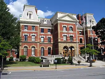 Cambria County Courthouse | |
 Seal | |
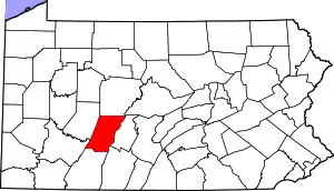 Location within the U.S. state of Pennsylvania | |
 Pennsylvania's location within the U.S. | |
| Coordinates: 40°29′N 78°43′W | |
| Country | |
| State | |
| Founded | November 2, 1807 |
| Named for | Latin name of Wales |
| Seat | Ebensburg |
| Largest city | Johnstown |
| Area | |
| • Total | 694 sq mi (1,800 km2) |
| • Land | 688 sq mi (1,780 km2) |
| • Water | 5.3 sq mi (14 km2) 0.8%% |
| Population | |
| • Estimate (2019) | 130,192 |
| • Density | 191/sq mi (74/km2) |
| Time zone | UTC−5 (Eastern) |
| • Summer (DST) | UTC−4 (EDT) |
| Congressional districts | 13th, 15th |
| Website | www |
| Designated | May 25, 1982[1] |
.jpg.webp)
Cambria County comprises the Johnstown, PA Metropolitan Statistical Area, which is also included in the Johnstown-Somerset, PA Combined Statistical Area.
Geography
According to the U.S. Census Bureau, the county has a total area of 694 square miles (1,800 km2), of which 688 square miles (1,780 km2) is land and 5.3 square miles (14 km2) (0.8%) is water.[6] Cambria has a warm-summer humid continental climate (Dfb) and average monthly temperatures in downtown Johnstown range from 27.8 °F in January to 71.0 °F in July, while in Ebensburg they range from 23.9 °F in January to 67.7 °F in July. PRISM Climate Group, Oregon State U
Adjacent counties
- Clearfield County (north)
- Blair County (east)
- Bedford County (southeast)
- Somerset County (south)
- Westmoreland County (southwest)
- Indiana County (west)
National protected areas
Demographics
| Historical population | |||
|---|---|---|---|
| Census | Pop. | %± | |
| 1810 | 2,117 | — | |
| 1820 | 3,287 | 55.3% | |
| 1830 | 7,076 | 115.3% | |
| 1840 | 11,256 | 59.1% | |
| 1850 | 17,773 | 57.9% | |
| 1860 | 29,155 | 64.0% | |
| 1870 | 36,569 | 25.4% | |
| 1880 | 46,811 | 28.0% | |
| 1890 | 66,375 | 41.8% | |
| 1900 | 104,837 | 57.9% | |
| 1910 | 166,131 | 58.5% | |
| 1920 | 197,839 | 19.1% | |
| 1930 | 203,146 | 2.7% | |
| 1940 | 213,459 | 5.1% | |
| 1950 | 209,541 | −1.8% | |
| 1960 | 203,283 | −3.0% | |
| 1970 | 186,785 | −8.1% | |
| 1980 | 183,263 | −1.9% | |
| 1990 | 163,029 | −11.0% | |
| 2000 | 152,598 | −6.4% | |
| 2010 | 143,679 | −5.8% | |
| 2019 (est.) | 130,192 | [7] | −9.4% |
| U.S. Decennial Census[8] 1790-1960[9] 1900-1990[10] 1990-2000[11] 2010-2019[2] | |||
As of the census[12] of 2000, there were 152,598 people, 60,531 households, and 40,616 families residing in the county. The population density was 222 people per square mile (86 per km2). There were 65,796 housing units at an average density of 96 per square mile (37 per km2). The racial makeup of the county was 95.80% White, 2.83% Black or African American, 0.09% Native American, 0.38% Asian, 0.02% Pacific Islander, 0.25% from other races, and 0.64% from two or more races. 0.89% of the population were Hispanic or Latino of any race. 27.7% were of German, 10.2% Irish, 10.1% Italian, 10.0% Polish, 6.5% Slovak, 6.2% American and 5.6% English ancestry.
There were 60,531 households, out of which 27.00% had children under the age of 18 living with them, 52.80% were married couples living together, 10.40% had a female householder with no husband present, and 32.90% were non-families. 29.80% of all households were made up of individuals, and 15.60% had someone living alone who was 65 years of age or older. The average household size was 2.38 and the average family size was 2.96.
In the county, the population was spread out, with 21.00% under the age of 18, 9.00% from 18 to 24, 26.20% from 25 to 44, 24.10% from 45 to 64, and 19.70% who were 65 years of age or older. The median age was 41 years. For every 100 females there were 94.20 males. For every 100 females age 18 and over, there were 91.30 males.
Law and government
| Year | Republican | Democratic | Third parties |
|---|---|---|---|
| 2020 | 68.0% 48,085 | 30.7% 21,730 | 1.3% 936 |
| 2016 | 66.5% 42,258 | 29.7% 18,867 | 3.9% 2,464 |
| 2012 | 58.1% 35,163 | 40.1% 24,249 | 1.8% 1,114 |
| 2008 | 48.5% 31,995 | 49.2% 32,451 | 2.4% 1,560 |
| 2004 | 50.8% 34,048 | 48.7% 32,591 | 0.5% 344 |
| 2000 | 46.5% 28,001 | 50.3% 30,308 | 3.3% 1,977 |
| 1996 | 34.3% 20,341 | 51.3% 30,391 | 14.4% 8,543 |
| 1992 | 31.3% 20,770 | 51.8% 34,334 | 16.9% 11,245 |
| 1988 | 39.7% 25,626 | 59.7% 38,517 | 0.6% 409 |
| 1984 | 44.5% 32,173 | 55.1% 39,865 | 0.4% 258 |
| 1980 | 45.9% 33,072 | 50.1% 36,121 | 4.1% 2,938 |
| 1976 | 45.0% 32,469 | 53.8% 38,797 | 1.2% 862 |
| 1972 | 60.1% 43,825 | 38.3% 27,950 | 1.6% 1,200 |
| 1968 | 42.1% 33,280 | 52.1% 41,225 | 5.9% 4,645 |
| 1964 | 32.2% 26,281 | 67.6% 55,183 | 0.2% 134 |
| 1960 | 41.4% 37,062 | 58.5% 52,409 | 0.2% 151 |
| 1956 | 52.6% 46,373 | 47.3% 41,753 | 0.1% 123 |
| 1952 | 43.5% 39,294 | 56.3% 50,774 | 0.2% 182 |
| 1948 | 39.4% 27,725 | 59.0% 41,533 | 1.7% 1,164 |
| 1944 | 41.4% 28,203 | 58.2% 39,676 | 0.4% 264 |
| 1940 | 41.3% 30,306 | 58.4% 42,894 | 0.3% 201 |
| 1936 | 33.7% 24,378 | 64.6% 46,687 | 1.7% 1,239 |
| 1932 | 41.8% 21,351 | 55.1% 28,197 | 3.1% 1,597 |
| 1928 | 51.8% 29,494 | 47.5% 27,024 | 0.8% 427 |
| 1924 | 51.8% 24,728 | 28.4% 13,563 | 19.8% 9,473 |
| 1920 | 63.9% 19,629 | 22.7% 6,961 | 13.4% 4,122 |
| 1916 | 49.8% 10,688 | 43.8% 9,416 | 6.4% 1,378 |
| 1912 | 15.0% 3,252 | 33.5% 7,282 | 51.5% 11,191 |
| 1908 | 57.9% 12,325 | 37.5% 7,979 | 4.7% 992 |
| 1904 | 61.8% 13,109 | 34.1% 7,232 | 4.1% 879 |
| 1900 | 58.0% 10,476 | 39.7% 7,168 | 2.3% 420 |
| 1896 | 55.3% 8,865 | 42.7% 6,843 | 2.0% 314 |
| 1892 | 47.4% 6,020 | 49.3% 6,259 | 3.3% 417 |
| 1888 | 47.1% 5,517 | 50.8% 5,948 | 2.1% 246 |
| 1884 | 44.5% 4,253 | 50.3% 4,816 | 5.2% 498 |
| 1880 | 45.6% 3,962 | 52.4% 4,555 | 2.0% 169 |
As of September 2020, there were 84,733 registered voters in Cambria County.[15]
- Democratic: 37,833 (44.64%)
- Republican: 38,045 (44.89%)
- Other Parties / No Party: 8,855 (10.45%)
Cambria has been a swing county in statewide elections since the 1990s, with all four statewide winners carrying it in 2008. Cambria County is one of Pennsylvania's most competitive counties. That is primarily due to its mixed urban-rural ratio.
Al Gore received 50.3% of the county vote to 46.4% for George W. Bush in 2000, but Bush carried it with 50.8% of the vote to 48.7% for John Kerry in 2004–only the third time since 1928 that the county had supported a Republican for president. Cambria returned to the Democratic Presidential column in 2008, with Barack Obama receiving 49.4% of the vote to 48.7% for John McCain. In 2011 the GOP won a majority on the county commissioners board and in 2012 gave Mitt Romney 58.1% of the vote to Barack Obama's 40.1%.
In 2016, Donald Trump carried the county with 66.5% of the vote to Hillary Clinton's 29.7%, winning the county by 36.8%. This broke the modern record for margin of victory in the county of 35.4% set by Lyndon Johnson in 1964.[13] Four years later, Trump won the county with an even bigger margin of 37.34%.
County commissioners
| Commissioner | Party |
|---|---|
| Thomas C. Chernisky | Democrat |
| William "B.J." Smith | Democrat |
| Scott W. Hunt | Republican |
Other county offices
| Office | Official | Party |
|---|---|---|
| District Attorney | Gregory J. Neugebauer | Republican |
| Clerk of Courts | Max R. Pavlovich | Democrat |
| Controller | Ed Cernic Jr. | Democrat |
| Coroner | Jeffrey Lees | Democrat |
| Prothonotary | Lisa Crynock | Republican |
| Recorder of Deeds | Melissa Kimla | Republican |
| Register of Wills | Cindy Perrone | Democrat |
| Sheriff | Vacant | |
| Treasurer | Lisa Kozorosky | Democrat |
State Senate
| District | Senator | Party |
|---|---|---|
| 35 | Wayne Langerholc | Republican |
State House of Representatives
| District | Representative | Party |
|---|---|---|
| 71 | James Rigby | Republican |
| 72 | Frank Burns | Democrat |
| 73 | Tommy Sankey | Republican |
United States House of Representatives
| District | Representative | Party |
|---|---|---|
| 13 | John Joyce | Republican |
| 15 | Glenn Thompson | Republican |
United States Senate
| Senator | Party |
|---|---|
| Pat Toomey | Republican |
| Bob Casey | Democrat |
Public services
Waste management for the county is regulated by the Cambria County Solid Waste Management Authority.
Education
Colleges and universities
Community, junior, and technical colleges
- Cambria-Rowe Business College
- Pennsylvania Highlands Community College
- Commonwealth Technical Institute, Johnstown
- Wrightco Technologies Technical Training Institute, Ebensburg
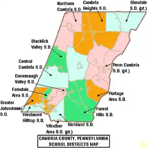
Public school districts
- Blacklick Valley School District
- Cambria Heights School District
- Central Cambria School District
- Conemaugh Valley School District
- Ferndale Area School District
- Forest Hills School District
- Glendale School District (also in Clearfield County)
- Greater Johnstown School District
- Northern Cambria School District
- Penn Cambria School District (also in Blair County)
- Portage Area School District
- Richland School District
- Westmont Hilltop School District
- Windber Area School District (also in Somerset County)
There are also 11 public, cyber charter schools in Pennsylvania that are available for free statewide, to children K-12. See: Education in Pennsylvania.
Private schools
- All Saints Catholic School, Cresson
- Appalachian Youth Service
- Arbutus Park Manor, Johnstown
- Bishop Carroll High School (Ebensburg, Pennsylvania)
- Bishop McCort High School, Johnstown
- Cambria County Child Development Center, Ebensburg
- Cambria County Christian School, Johnstown
- Carousel Learning & Development Center, Johnstown
- Cathedral Catholic Academy, Johnstown
- Center for Achievement
- Childrens Express Inc., Cresson
- Easter Seal Day Care Center, Johnstown
- Genesis Christian Academy, Johnstown
- Holy Name School, Ebensburg
- Houston House, Johnstown
- Laurel Highlands Therapeutic Academy, Ebensburg
- Little Learning Lamp, Johnstown
- Northern Cambria Catholic School, Nicktown
- Occupational Preparation School, Ebensburg
- Our Mother of Sorrow School, Johnstown
- Richland Academy, Johnstown
- Sean Davison School of Driving, Lilly
- St Michael School, Loretto
- St Sophia Orthodox Christian Academy, Johnstown
According to the Pennsylvania Department of Education's Ed Names and Addresses, July 1, 2015
Vo Tech schools
- Admiral Peary Vocational Technical School
- Greater Johnstown Career Technical Center
Recreation
There are two Pennsylvania state parks in Cambria County.
- Prince Gallitzin State Park is named for Demetrius Gallitzin, a Russian nobleman turned Catholic priest who was instrumental in the settlement of Cambria County.
- Laurel Ridge State Park surrounds a 70-mile (113-km) hiking trail that begins in Cambria County and ends at Ohiopyle State Park in Fayette County.
Communities
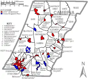
Under Pennsylvania law, there are four types of incorporated municipalities: cities, boroughs, townships, and, in at most two cases, towns. The following cities, boroughs and townships are located in Cambria County:
City
Boroughs
- Ashville
- Brownstown
- Carrolltown
- Cassandra
- Chest Springs
- Cresson
- Daisytown
- Dale
- East Conemaugh
- Ebensburg (county seat)
- Ehrenfeld
- Ferndale
- Franklin
- Gallitzin
- Geistown
- Hastings
- Lilly
- Lorain
- Loretto
- Nanty Glo
- Northern Cambria
- Patton
- Portage
- Sankertown
- Scalp Level
- South Fork
- Southmont
- Summerhill
- Tunnelhill (partly in Blair County)
- Vintondale
- Westmont
- Wilmore
Townships
Census-designated places
Census-designated places are geographical areas designated by the U.S. Census Bureau for the purposes of compiling demographic data. They are not actual jurisdictions under Pennsylvania law. Other unincorporated communities, such as villages, may be listed here as well.
Unincorporated communities
- Allendale
- Amsbry
- Bakersville
- Belsano
- Bens Creek
- Beaver Valley
- Bonair
- Bradley Junction
- Buckhorn
- Cardiff
- Carrolltown Road
- Chickaree
- Condron
- Coupon
- Daugherty
- Dean
- Dearmin
- Dysart
- Dysertown
- Eastmont
- Echo
- Eckonrode Mill
- Elmora
- Elstie
- Elton
- Emeigh
- Eureka
- Fairview
- Fallen Timber
- Fiske
- Flinton
- Foxburg
- Frugality
- Garmantown
- Germantown
- Glasgow
- Glendale
- Goods Corner
- Greenwich
- Hollentown
- Ingleside
- Jamestown
- Krayn
- Kring
- Lilly Coal
- Llanfair
- Lloydell
- Lloydville
- Loretto Road
- Lower Dutchtown
- Lovett
- Luckett
- Marsteller
- Martinsdale
- Mineral Point
- Morrellville
- Moshannon
- Mountainburg
- Munster
- Mylo Park
- Newtown
- New Germany
- Nicktown
- Nipton
- Number 37
- Onnalinda
- Parkhill
- Parkstown
- Pindleton
- Plane Blank
- Plattsville
- Puritan
- Rockville
- Saint Augustine
- Saint Benedict
- Saint Boniface
- Saint Lawrence
- Scanlon Hill
- Shazen
- Spindley City
- Sonman
- Soukesburg
- Summit
- Swedetown
- Syberton
- Tippletown
- Thomas Mill
- Tunnel
- Tripoli
- Twin Rocks
- Upper Dutchtown
- Van Omer
- Vetera
- Walsell
- Watkins
- Wesley Chapel
- West Point
- Wheelers Hill
- Wildwood Springs
- Winterset
- Wissingertown
Population ranking
The population ranking of the following table is based on the 2010 census of Cambria County.[16]
† county seat
| Rank | City/Town/etc. | Municipal type | Population (2010 Census) |
|---|---|---|---|
| 1 | Johnstown | City | 20,978 |
| 2 | Westmont | Borough | 5,181 |
| 3 | Northern Cambria | Borough | 3,835 |
| 4 | Elim | CDP | 3,727 |
| 5 | † Ebensburg | Borough | 3,351 |
| 6 | Belmont | CDP | 2,784 |
| 7 | Nanty Glo | Borough | 2,734 |
| 8 | Portage | Borough | 2,638 |
| 9 | Geistown | Borough | 2,467 |
| 10 | Southmont | Borough | 2,284 |
| 11 | Patton | Borough | 1,769 |
| 12 | Cresson | Borough | 1,711 |
| 13 | Gallitzin | Borough | 1,668 |
| 14 | Mundys Corner | CDP | 1,651 |
| 15 | Ferndale | Borough | 1,636 |
| 16 | Oakland | CDP | 1,578 |
| 17 | University of Pittsburgh (Johnstown) | CDP | 1,572 |
| 18 | Vinco | CDP | 1,305 |
| 19 | Loretto | Borough | 1,302 |
| 20 | Hastings | Borough | 1,278 |
| 21 | Dale | Borough | 1,234 |
| 22 | East Conemaugh | Borough | 1,220 |
| 23 | Salix | CDP | 1,149 |
| 24 | Beaverdale | CDP | 1,035 |
| 25 | Lilly | Borough | 968 |
| 26 | Colver | CDP | 959 |
| 27 | South Fork | Borough | 928 |
| 28 | Carrolltown | Borough | 853 |
| 29 | Spring Hill | CDP | 839 |
| 30 | Scalp Level | Borough | 778 |
| 31 | Lorain | Borough | 759 |
| 32 | Brownstown | Borough | 744 |
| 33 | Sankertown | Borough | 675 |
| 34 | Revloc | CDP | 570 |
| 35 | Summerhill | Borough | 490 |
| 36 | Sidman | CDP | 431 |
| 37 | Vintondale | Borough | 414 |
| 38 | St. Michael | CDP | 408 |
| 39 | Blandburg | CDP | 402 |
| 40 | Riverside | CDP | 381 |
| 41 | Tunnelhill (partially in Blair County) | Borough | 363 |
| 42 | Dunlo | CDP | 342 |
| 43 | Daisytown | Borough | 326 |
| 44 | Franklin | Borough | 323 |
| 45 | Ehrenfeld | Borough | 228 |
| 46 | Ashville | Borough | 227 |
| 47 | Wilmore | Borough | 225 |
| 48 | Chest Springs | Borough | 149 |
| 49 | Cassandra | Borough | 147 |
See also
- Cambria Somerset Authority - Water supply authority for Cambria County and Somerset County
- National Register of Historic Places listings in Cambria County, Pennsylvania
References
- "PHMC Historical Markers Search" (Searchable database). Pennsylvania Historical and Museum Commission. Commonwealth of Pennsylvania. Retrieved January 25, 2014.
- "State & County QuickFacts". United States Census Bureau. Archived from the original on July 8, 2011. Retrieved November 16, 2013.
- "Find a County". National Association of Counties. Archived from the original on May 31, 2011. Retrieved June 7, 2011.
- "Pennsylvania: Individual County Chronologies". Pennsylvania Atlas of Historical County Boundaries. The Newberry Library. 2008. Retrieved March 11, 2015.
- Espenshade, A. Howry (1925). Pennsylvania Place Names. State College, PA: Pennsylvania State College. pp. 160–161.
- "2010 Census Gazetteer Files". United States Census Bureau. August 22, 2012. Retrieved March 5, 2015.
- "Population and Housing Unit Estimates". Retrieved March 26, 2020.
- "U.S. Decennial Census". United States Census Bureau. Retrieved March 5, 2015.
- "Historical Census Browser". University of Virginia Library. Retrieved March 5, 2015.
- Forstall, Richard L., ed. (March 24, 1995). "Population of Counties by Decennial Census: 1900 to 1990". United States Census Bureau. Retrieved March 5, 2015.
- "Census 2000 PHC-T-4. Ranking Tables for Counties: 1990 and 2000" (PDF). United States Census Bureau. April 2, 2001. Retrieved March 5, 2015.
- "U.S. Census website". United States Census Bureau. Retrieved January 31, 2008.
- Leip, David. "Dave Leip's Atlas of U.S. Presidential Elections". uselectionatlas.org. Retrieved 21 November 2018.
- http://geoelections.free.fr/. Retrieved January 13, 2021. Missing or empty
|title=(help) - "Home". Pennsylvania Department of State. Retrieved 30 July 2020.
- Bureau, US Census. "Decennial Census by Decades". The United States Census Bureau.
External links
| Wikimedia Commons has media related to Cambria County, Pennsylvania. |
- Cambria County official website
- Cambria County Historical Society housed in the A.W. Buck House
- Pennsylvania Department of Transportation Map of Cambria County showing cities, boroughs, unincorporated villages, and townships.
Municipalities and communities of Cambria County, Pennsylvania, United States | ||
|---|---|---|
| City | | |
| Boroughs |
| |
| Townships | ||
| CDPs |
| |
| Unincorporated communities | ||
| Footnotes | ‡This populated place also has portions in an adjacent county or counties | |
| ||

| Authority control |
|---|