Laurel Highlands
The Laurel Highlands is a region in southwestern Pennsylvania made up of Fayette County, Somerset County and Westmoreland County.[1] It has a population of about 600,000 people.
The region is approximately fifty-five miles southeast of Pittsburgh; the Laurel Highlands center on Laurel Hill and Chestnut Ridge of the Allegheny Mountains. The mountains making up the Laurel Highlands are the highest in Pennsylvania, with Mount Davis in Somerset County the highest point in the state at 3,213 feet (979 m). Because of the elevation, weather in the Laurel Highlands is generally cooler and wetter than in most other parts of the state.
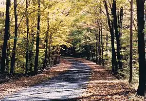
The Laurel Highlands are a popular area for camping, hiking, mountain biking, hunting, boating, trout fishing, wildlife viewing, and downhill (and cross-country) skiing.
Amusement parks and resorts
Architecture
Historic sites
- Allegheny Portage Railroad
- Bushy Run Battlefield
- Flight 93 National Memorial
- Fort Ligonier
- Fort Necessity
- Friendship Hill
- Heritage Discovery Center
- Johnstown Flood Museum
- Johnstown Flood National Memorial
- Johnstown Inclined Plane
- National Road
- Somerset County Courthouse
- Somerset Historical Center
- Staple Bend Tunnel
- Uptown Somerset Historic District
- Wagner–Ritter House & Garden
Parks and outdoor recreation
- Campbell Farm Glamping
- Forbes State Forest
- Ghost Town Trail
- James Mayer River Walk
- Kooser State Park
- Laurel Caverns
- Laurel Highlands Hiking Trail (part of Laurel Ridge State Park)
- Laurel Hill State Park
- Laurel Mountain State Park
- Laurel Summit State Park
- Linn Run State Park
- Loyalhanna Gorge
- Mount Davis
- Ohiopyle State Park
- Paddler's Lane Retreat
- Prince Gallitzin State Park
- Roaring Run Resort
- Youghiogheny River
Downhill ski areas
References
- "Laurel Highlands - visitPA". Pennsylvania Department of Community and Economic Development. Retrieved 6 November 2011.
External links
| Counties |  Map of the Pittsburgh Tri-State with green counties in the metropolitan area and yellow counties in the combined area | |
|---|---|---|
| Major cities | ||
| Cities and towns 15k–50k (in 2010) | ||
| Airports | ||
| Topics | ||
| ||
