National Register of Historic Places listings in Adams County, Colorado
This is a list of the National Register of Historic Places listings in Adams County, Colorado.
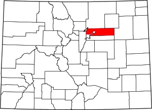
Location of Adams County in Colorado
This is intended to be a complete list of the properties and districts on the National Register of Historic Places in Adams County, Colorado, United States. The locations of National Register properties and districts for which the latitude and longitude coordinates are included below, may be seen in a map.[1]
There are 19 properties and districts listed on the National Register in the county. Another property was once listed but has been removed.
- This National Park Service list is complete through NPS recent listings posted February 5, 2021.[2]
| Adams - Alamosa - Arapahoe - Archuleta - Baca - Bent - Boulder - Broomfield - Chaffee - Cheyenne - Clear Creek - Conejos - Costilla - Crowley - Custer - Delta - Denver - Dolores - Douglas - Eagle - El Paso - Elbert - Fremont - Garfield - Gilpin - Grand - Gunnison - Hinsdale - Huerfano - Jackson - Jefferson - Kiowa - Kit Carson - La Plata - Lake - Larimer - Las Animas - Lincoln - Logan - Mesa - Mineral - Moffat - Montezuma - Montrose - Morgan - Otero - Ouray - Park - Phillips - Pitkin - Prowers - Pueblo - Rio Blanco - Rio Grande - Routt - Saguache - San Juan - San Miguel - Sedgwick - Summit - Teller - Washington - Weld - Yuma |
Current listings
| [3] | Name on the Register[4] | Image | Date listed[5] | Location | City or town | Description |
|---|---|---|---|---|---|---|
| 1 | Adams County Courthouse | 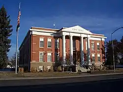 Adams County Courthouse |
October 4, 2006 (#06000916) |
22 S. 4th Ave. 39°59′11″N 104°49′02″W |
Brighton | |
| 2 | Bowles House | 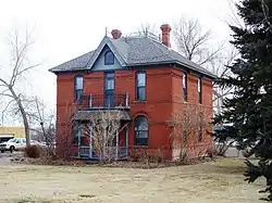 Bowles House |
November 3, 1988 (#88002308) |
3924 W. 72nd Ave. 39°49′38″N 105°02′17″W |
Westminster | |
| 3 | Brannan Sand and Gravel Pit No. 8-Lake Sangraco Boathouse Complex | 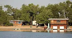 Brannan Sand and Gravel Pit No. 8-Lake Sangraco Boathouse Complex |
August 16, 2011 (#11000519) |
Off Lowell Boulevard south of 62nd Ave.[6] 39°48′22″N 105°01′56″W |
Berkley | |
| 4 | Brighton High School | 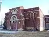 Brighton High School |
January 23, 1998 (#97001665) |
830 E. Bridge St. 39°59′09″N 104°48′40″W |
Brighton | |
| 5 | Bromley Farm-Koizuma Hishinuma Farm | 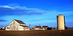 Bromley Farm-Koizuma Hishinuma Farm |
August 16, 2007 (#07000811) |
15820 E. 152nd Ave. 39°58′17″N 104°48′05″W |
Brighton | |
| 6 | Colorado Sanitary Canning Factory | 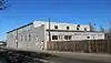 Colorado Sanitary Canning Factory |
March 15, 2016 (#16000073) |
224 N. Main St. 39°59′24″N 104°49′14″W |
Brighton | |
| 7 | Eastlake Farmers Co-Operative Elevator Company | Eastlake Farmers Co-Operative Elevator Company |
May 17, 2010 (#10000259) |
126th Ave and Claude Ct. 39°55′31″N 104°57′51″W |
Thornton | |
| 8 | Engelbrecht Farm | December 10, 2014 (#14000170) |
2024 Strasburg Rd. 39°44′47″N 104°19′20″W |
Strasburg | ||
| 9 | Granville Fuller House | 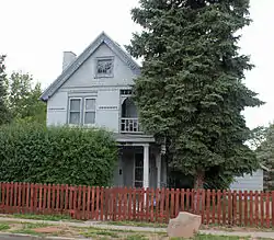 Granville Fuller House |
May 1, 2012 (#12000242) |
2027 Galena St. 39°44′53″N 104°52′11″W |
Aurora | |
| 10 | William J. Gregory House | 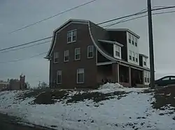 William J. Gregory House |
February 23, 1996 (#96000166) |
8140 Lowell Boulevard 39°50′40″N 105°02′01″W |
Westminster | |
| 11 | Harris Park School | 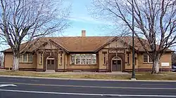 Harris Park School |
August 30, 1990 (#90000868) |
7200 Lowell Boulevard 39°49′40″N 105°02′00″W |
Westminster | |
| 12 | Metzger Farm | 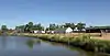 Metzger Farm |
March 20, 2013 (#13000077) |
12080 Lowell Blvd. 39°55′01″N 105°01′51″W |
Westminster | |
| 13 | Riverside Cemetery |  Riverside Cemetery |
October 28, 1994 (#94001253) |
5201 Brighton Boulevard 39°47′39″N 104°57′33″W |
Commerce City | Extends into Denver |
| 14 | M.J. Lavina Robidoux House | 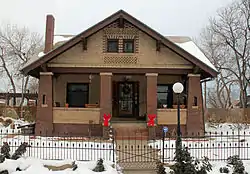 M.J. Lavina Robidoux House |
September 15, 2011 (#11000655) |
1615 Galena St. 39°44′32″N 104°52′11″W |
Aurora | |
| 15 | St. Stephen's Lutheran Church | St. Stephen's Lutheran Church |
July 12, 2019 (#100004209) |
10828 Huron St. 39°53′34″N 104°59′48″W |
Northglenn | |
| 16 | Thede Farmhouse | 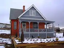 Thede Farmhouse |
January 30, 1998 (#98000024) |
3190 W. 112th Ave. 39°53′42″N 104°57′04″W |
Northglenn | |
| 17 | Union High School | 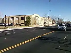 Union High School |
January 14, 2000 (#99001665) |
3455 W. 72nd Ave. 39°49′40″N 105°01′56″W |
Westminster | |
| 18 | Westminster University | 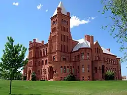 Westminster University |
August 10, 1979 (#79000572) |
3455 W. 83rd Ave. 39°50′50″N 105°01′53″W |
Westminster | Red sandstone college building designed by E.B. Gregory and Stanford White. See also Westminster University |
| 19 | Blanche A. Wilson House | 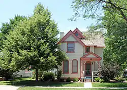 Blanche A. Wilson House |
November 7, 1996 (#96001278) |
1671 Galena St. 39°44′38″N 104°52′09″W |
Aurora |
Former listing
| [3] | Name on the Register | Image | Date listed | Date removed | Location | City or town | Summary |
|---|---|---|---|---|---|---|---|
| 1 | David Wolpert House | February 27, 1975 (#75002141) | January 1, 1999 | 9190 River Dale Rd. |
Thornton | Destroyed by fire in 1976[7] |
See also
| Wikimedia Commons has media related to National Register of Historic Places in Adams County, Colorado. |
References
- The latitude and longitude information provided in this table was derived originally from the National Register Information System, which has been found to be fairly accurate for about 99% of listings. Some locations in this table may have been corrected to current GPS standards.
- "National Register of Historic Places: Weekly List Actions". National Park Service, United States Department of the Interior. Retrieved on February 5, 2021.
- Numbers represent an alphabetical ordering by significant words. Various colorings, defined here, differentiate National Historic Landmarks and historic districts from other NRHP buildings, structures, sites or objects.
- "National Register Information System". National Register of Historic Places. National Park Service. July 9, 2010.
- The eight-digit number below each date is the number assigned to each location in the National Register Information System database, which can be viewed by clicking the number.
- Location derived from its GNIS feature record; the NRIS lists the site as "Address Restricted".
- "Archived copy". Archived from the original on 2012-08-18. Retrieved 2012-08-17.CS1 maint: archived copy as title (link)
| Topics | |
|---|---|
| Lists by state |
|
| Lists by insular areas | |
| Lists by associated state | |
| Other areas | |
| Related | |
| |
Municipalities and communities of Adams County, Colorado, United States | ||
|---|---|---|
| Cities | Map of Colorado highlighting Adams County | |
| Towns | ||
| CDPs | ||
| Unincorporated communities |
| |
| Footnotes | ‡This populated place also has portions in an adjacent county or counties | |
| ||
This article is issued from Wikipedia. The text is licensed under Creative Commons - Attribution - Sharealike. Additional terms may apply for the media files.