National Register of Historic Places listings in Jefferson County, Colorado
This is a list of the National Register of Historic Places listings in Jefferson County, Colorado.
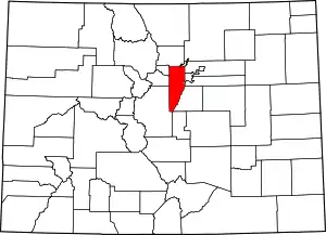
Location of Jefferson County in Colorado
This is intended to be a complete list of the properties and districts on the National Register of Historic Places in Jefferson County, Colorado, United States. The locations of National Register properties and districts for which the latitude and longitude coordinates are included below, may be seen in a map.[1]
There are 87 properties and districts listed on the National Register in the county, including 1 National Historic Landmark.
- This National Park Service list is complete through NPS recent listings posted February 5, 2021.[2]
| Adams - Alamosa - Arapahoe - Archuleta - Baca - Bent - Boulder - Broomfield - Chaffee - Cheyenne - Clear Creek - Conejos - Costilla - Crowley - Custer - Delta - Denver - Dolores - Douglas - Eagle - El Paso - Elbert - Fremont - Garfield - Gilpin - Grand - Gunnison - Hinsdale - Huerfano - Jackson - Jefferson - Kiowa - Kit Carson - La Plata - Lake - Larimer - Las Animas - Lincoln - Logan - Mesa - Mineral - Moffat - Montezuma - Montrose - Morgan - Otero - Ouray - Park - Phillips - Pitkin - Prowers - Pueblo - Rio Blanco - Rio Grande - Routt - Saguache - San Juan - San Miguel - Sedgwick - Summit - Teller - Washington - Weld - Yuma |
Current listings
| [3] | Name on the Register[4] | Image | Date listed[5] | Location | City or town | Description |
|---|---|---|---|---|---|---|
| 1 | Ammunition Igloo | 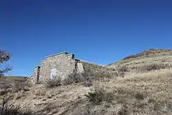 Ammunition Igloo |
May 20, 1993 (#93000379) |
15001 Denver West Parkway 39°44′33″N 105°10′22″W |
Golden | |
| 2 | Arvada Downtown |  Arvada Downtown |
July 15, 1998 (#98000854) |
Roughly bounded by Ralston Rd., N. Teller St., Grandview Ave., and N Yukon St. 39°48′04″N 105°04′46″W |
Arvada | |
| 3 | Arvada Flour Mill | 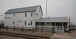 Arvada Flour Mill |
April 24, 1975 (#75000521) |
5580 Wadsworth Boulevard 39°47′54″N 105°04′51″W |
Arvada | |
| 4 | Astor House Hotel | 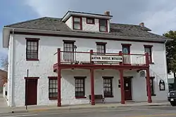 Astor House Hotel |
March 1, 1973 (#73000478) |
822 12th St. 39°45′19″N 105°13′18″W |
Golden | |
| 5 | Barnes-Peery House | 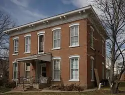 Barnes-Peery House |
October 12, 2001 (#01001105) |
622 Water St. 39°45′29″N 105°13′16″W |
Golden | |
| 6 | James H. Baugh House | 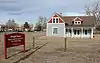 James H. Baugh House |
August 14, 2012 (#12000495) |
11361 W. 44th Ave. 39°46′43″N 105°07′33″W |
Wheat Ridge | |
| 7 | Bear Creek Canyon Scenic Mountain Drive | 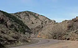 Bear Creek Canyon Scenic Mountain Drive |
November 15, 1990 (#90001706) |
Section of State Highway 74 between Morrison and Idledale 39°39′22″N 105°13′32″W |
Morrison | |
| 8 | Bergen Park | 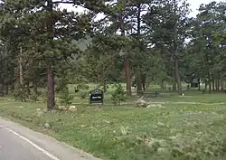 Bergen Park |
November 15, 1990 (#90001707) |
State Highway 74 south of Interstate 70 39°41′21″N 105°21′42″W |
Evergreen | |
| 9 | Blue Jay Inn | 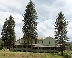 Blue Jay Inn |
October 1, 1974 (#74000580) |
Deckers Rd. (Jefferson CR 126) 39°23′17″N 105°16′23″W |
Buffalo Creek | |
| 10 | Bradford House II | Bradford House II |
February 2, 2001 (#01000031) |
North of Killdeer Ln. 39°36′07″N 105°10′19″W |
Littleton | |
| 11 | Bradford House III Archeological Site | April 8, 1980 (#80000906) |
On the Ken-Caryl Ranch[6] |
Morrison | ||
| 12 | Robert Boyles Bradford Property | February 2, 2015 (#14001235) |
Address Restricted |
Morrison | ||
| 13 | Brook Forest Inn | 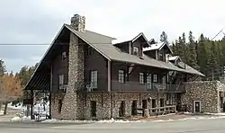 Brook Forest Inn |
July 29, 2009 (#09000567) |
8136 S. Brook Forest Rd. 39°34′46″N 105°22′56″W |
Evergreen | |
| 14 | Building 710, Defense Civil Preparedness Agency, Region 6 Operations Center | 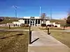 Building 710, Defense Civil Preparedness Agency, Region 6 Operations Center |
March 2, 2000 (#00000104) |
Denver Federal Center 39°42′40″N 105°07′13″W |
Lakewood | |
| 15 | Calvary Episcopal Church | 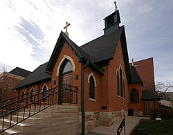 Calvary Episcopal Church |
March 3, 1995 (#95000186) |
1300 Arapahoe St. 39°45′14″N 105°13′16″W |
Golden | |
| 16 | Camp George West Historic District | Camp George West Historic District |
February 11, 1993 (#92001865) |
15000 S. Golden Rd. 39°44′12″N 105°10′20″W |
Golden | |
| 17 | Churches Ranch |  Churches Ranch |
July 23, 1998 (#98000883) |
17999 W. 60th Ave. 39°48′24″N 105°12′20″W |
Arvada | |
| 18 | Colorado Amphitheater | 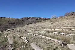 Colorado Amphitheater |
May 20, 1993 (#93000378) |
15001 Denver West Parkway 39°44′36″N 105°10′33″W |
Golden | |
| 19 | Colorado National Guard Armory | 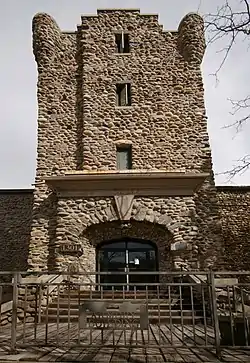 Colorado National Guard Armory |
December 18, 1978 (#78000860) |
1301 Arapahoe St. 39°45′13″N 105°13′14″W |
Golden | |
| 20 | Colorow Point Park | 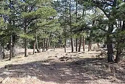 Colorow Point Park |
November 15, 1990 (#90001712) |
900 Colorow Rd. 39°43′55″N 105°14′55″W |
Golden | |
| 21 | Conifer Junction Schoolhouse | 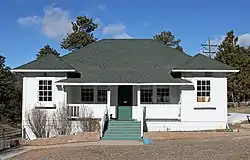 Conifer Junction Schoolhouse |
February 10, 2014 (#13001167) |
26951 Barkley Rd. 39°32′06″N 105°18′28″W |
Conifer | |
| 22 | Herman Coors House | 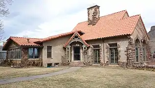 Herman Coors House |
October 17, 1997 (#97001227) |
1817 Arapahoe St. 39°44′58″N 105°12′58″W |
Golden | |
| 23 | Corwina Park, O'Fallon Park, Pence Park |  Corwina Park, O'Fallon Park, Pence Park |
December 28, 1990 (#90001708) |
Roughly the area southeast of Kittredge and the junction of Hwy 74 and Myers Gulch Rds. 39°38′49″N 105°17′13″W |
Evergreen | |
| 24 | Katherine Craig Park |  Katherine Craig Park |
June 30, 1995 (#95000797) |
Along Interstate 70/U.S. Highway 40 northwest of Morrison 39°42′42″N 105°17′12″W |
Morrison | |
| 25 | Crown Hill Burial Park | 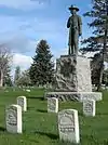 Crown Hill Burial Park |
July 24, 2008 (#08000708) |
7777 W. 29th Ave. 39°45′30″N 105°05′34″W |
Wheat Ridge | |
| 26 | Davies' Chuck Wagon Diner | 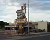 Davies' Chuck Wagon Diner |
July 2, 1997 (#97000619) |
9495 W. Colfax Ave. 39°44′26″N 105°06′11″W |
Lakewood | |
| 27 | Deaton Sculptured House | 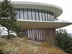 Deaton Sculptured House |
February 24, 2004 (#02000385) |
24501 Ski Hill Dr. 39°42′02″N 105°16′36″W |
Genesee | |
| 28 | Dedisse Park | 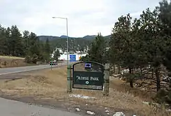 Dedisse Park |
November 15, 1990 (#90001709) |
29614 Upper Bear Creek Rd. 39°28′49″N 105°19′42″W |
Evergreen | |
| 29 | Denver and Intermountain Railroad Interurban No. 25 | 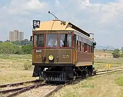 Denver and Intermountain Railroad Interurban No. 25 |
January 12, 2012 (#11001016) |
W. 6th Ave. & Kipling St. 39°43′38″N 105°06′35″W |
Lakewood | |
| 30 | Denver and Rio Grande Western Railroad Caboose No. 0578 | 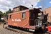 Denver and Rio Grande Western Railroad Caboose No. 0578 |
November 4, 2003 (#02000678) |
17155 W. 44th Ave. 39°46′17″N 105°11′36″W |
Golden | located at the Colorado Railroad Museum |
| 31 | District No. 17 School-Medlen School | 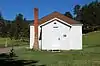 District No. 17 School-Medlen School |
April 14, 2015 (#15000139) |
South Turkey Creek Road 39°33′41″N 105°13′16″W |
Morrison | District school; owned by county historical society. |
| 32 | Evergreen Conference District | 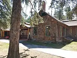 Evergreen Conference District |
May 1, 1979 (#79000611) |
State Highway 74 39°38′13″N 105°18′48″W |
Evergreen | |
| 33 | Everhardt Ranch | May 7, 1980 (#80000903) |
Southeast of Evergreen 39°36′06″N 105°16′31″W |
Evergreen | ||
| 34 | Fillius Park | 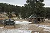 Fillius Park |
February 24, 1995 (#95000108) |
State Highway 74 northwest of Evergreen 39°41′45″N 105°21′09″W |
Evergreen | |
| 35 | First Presbyterian Church of Golden-Unger House | 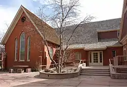 First Presbyterian Church of Golden-Unger House |
March 14, 1991 (#91000294) |
809 15th St. 39°45′09″N 105°13′07″W |
Golden | |
| 36 | The Fort | 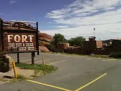 The Fort |
July 14, 2006 (#06000585) |
19192 State Highway 8 39°37′44″N 105°11′31″W |
Morrison | Boundary increase approved July 27, 2020. |
| 37 | Fruitdale Grade School |  Fruitdale Grade School |
March 20, 2013 (#13000078) |
10801 W. 44th Ave. 39°46′43″N 105°07′08″W |
Wheat Ridge | |
| 38 | Genesee Park | 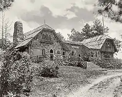 Genesee Park |
November 15, 1990 (#90001710) |
26771 Genesee Ln. 39°42′53″N 105°18′44″W |
Genesee | |
| 39 | Golden Cemetery | 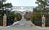 Golden Cemetery |
April 18, 2012 (#12000200) |
755 Ulysses St. 39°43′43″N 105°11′49″W |
Golden | |
| 40 | Golden High School | 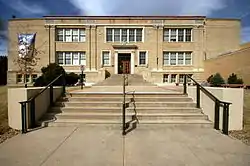 Golden High School |
March 14, 1997 (#97000229) |
710 10th St. 39°45′30″N 105°13′21″W |
Golden | Old Golden High School is no longer used by the current Golden High School |
| 41 | Green Mercantile Store | 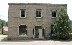 Green Mercantile Store |
October 1, 1974 (#74000581) |
Northwest of Buffalo Creek 39°23′36″N 105°16′38″W |
Buffalo Creek | |
| 42 | Green Mountain Ranch | 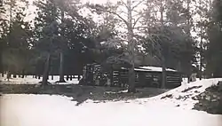 Green Mountain Ranch |
October 1, 1974 (#74000582) |
South of Buffalo Creek on Deckers Rd. 39°17′43″N 105°16′28″W |
Buffalo Creek | |
| 43 | Hildebrand Ranch | 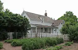 Hildebrand Ranch |
March 13, 1975 (#75000524) |
7 miles (11 km) southwest of Littleton off Deer Creek Canyon Rd. 39°33′05″N 105°06′03″W |
Littleton | |
| 44 | Hill Section, Golden Hill Cemetery |  Hill Section, Golden Hill Cemetery |
July 31, 1995 (#94001230) |
12000 W. Colfax Ave. 39°44′22″N 105°08′12″W |
Lakewood | |
| 45 | Hiwan Homestead | 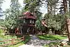 Hiwan Homestead |
April 9, 1974 (#74000583) |
Meadow Dr. 39°38′22″N 105°19′21″W |
Evergreen | |
| 46 | Humphrey House | 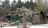 Humphrey House |
December 31, 1974 (#74000584) |
620 S. Soda Creek Rd. 39°42′14″N 105°21′53″W |
Evergreen | |
| 47 | Jewish Consumptives' Relief Society | 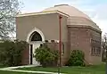 Jewish Consumptives' Relief Society |
June 26, 1980 (#80000905) |
6401 W. Colfax Ave. 39°44′37″N 105°04′03″W |
Lakewood | |
| 48 | La Hacienda | .JPG.webp) La Hacienda |
July 20, 1973 (#73000477) |
On State Highway 126 off U.S. Highway 285 39°23′38″N 105°16′16″W |
Buffalo Creek | |
| 49 | Lariat Trail Scenic Mountain Drive | 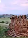 Lariat Trail Scenic Mountain Drive |
November 15, 1990 (#90001711) |
Lookout Mountain Rd. south of U.S. Highway 6 to Golden Reservoir 39°44′23″N 105°14′23″W |
Golden | |
| 50 | Little Park | 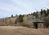 Little Park |
February 24, 1995 (#95000111) |
Miller Ln. (State Highway 74) southwest of Idledale 39°39′22″N 105°14′45″W |
Idledale | |
| 51 | LoDaisKa Site | 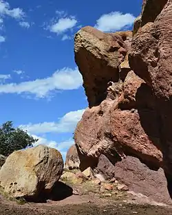 LoDaisKa Site |
September 25, 2003 (#03000962) |
SH 8 At US 285 39°37′39″N 105°11′38″W |
Morrison | |
| 52 | Lookout Mountain Park | 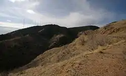 Lookout Mountain Park |
November 15, 1990 (#90001713) |
987½ Lookout Mountain Rd. 39°43′58″N 105°14′28″W |
Golden | |
| 53 | Lorraine Lodge | 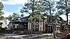 Lorraine Lodge |
January 18, 1984 (#84000858) |
Southwest of Golden 39°43′35″N 105°14′53″W |
Golden | |
| 54 | Loveland Building and Coors Building | 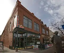 Loveland Building and Coors Building |
May 16, 1996 (#96000544) |
1122 and 1120 Washington Ave. 39°45′20″N 105°13′16″W |
Golden | |
| 55 | Magic Mountain Site | Magic Mountain Site |
August 21, 1980 (#80000904) |
Address Restricted |
Golden | |
| 56 | Midway House | 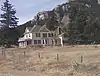 Midway House |
September 18, 1990 (#90001479) |
9345 U.S. Highway 285 39°32′47″N 105°16′37″W |
Conifer | |
| 57 | Morrison Historic District | 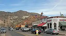 Morrison Historic District |
September 28, 1976 (#76000561) |
State Highway 8 39°39′15″N 105°11′30″W |
Morrison | |
| 58 | Morrison Schoolhouse | 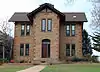 Morrison Schoolhouse |
September 4, 1974 (#74000585) |
226 Spring St. 39°39′07″N 105°11′21″W |
Morrison | |
| 59 | Mount Vernon House | 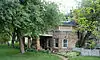 Mount Vernon House |
November 20, 1970 (#70000162) |
About 1 mile (1.6 km) south of the Golden city limits at the junction of Interstate 70, State Highway 26, and Mount Vernon Canyon Rd. 39°41′41″N 105°12′30″W |
Golden | |
| 60 | North Fork Historic District | 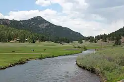 North Fork Historic District |
October 9, 1974 (#74000586) |
Both sides of the South Platte River from Pine to South Platte, in the Pike National Forest; also Longview, Foxton, Argyle and Pine Grove Expansions 39°24′35″N 105°14′57″W |
Pine and South Platte | Second set of boundaries represents a boundary increase of October 8, 2008 |
| 61 | Office of Civil Defense Emergency Operations Center | 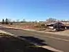 Office of Civil Defense Emergency Operations Center |
December 16, 1999 (#99001541) |
Denver Federal Center 39°42′56″N 105°07′08″W |
Lakewood | |
| 62 | Peterson House | 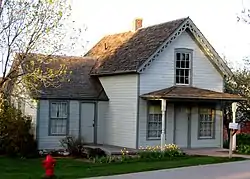 Peterson House |
September 10, 1981 (#81000184) |
7840 W. Ohio Avenue 39°38′24″N 105°07′45″W |
Lakewood | |
| 63 | Pioneer Sod House | 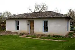 Pioneer Sod House |
March 14, 1973 (#73000479) |
4610 Robb St. 39°46′51″N 105°07′30″W |
Wheat Ridge | |
| 64 | Quaintance Block | 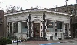 Quaintance Block |
March 25, 1994 (#94000261) |
805 13th St. 39°45′15″N 105°13′13″W |
Golden | |
| 65 | Queen of Heaven Orphanage Summer Camp | 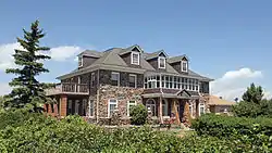 Queen of Heaven Orphanage Summer Camp |
January 14, 2000 (#99001666) |
20189 Cabrini Boulevard 39°42′14″N 105°13′39″W |
Golden | |
| 66 | Red Rocks Park District | 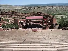 Red Rocks Park District |
May 18, 1990 (#90000725) |
16351 County Road 93 39°39′41″N 105°12′15″W |
Morrison | |
| 67 | Reno Park Addition Historic District | 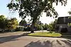 Reno Park Addition Historic District |
September 29, 1999 (#99001183) |
Roughly bounded by Allison St., Ralston Rd., Yukon St., and Reno Dr. 39°47′59″N 105°05′02″W |
Arvada | |
| 68 | Richards Mansion | 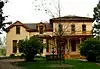 Richards Mansion |
September 15, 1977 (#77000379) |
5349 W. 27th Ave. 39°45′20″N 105°03′25″W |
Wheat Ridge | |
| 69 | Rio Grande Southern Railroad Engine No. 20 | December 14, 2000 (#00001003) |
17155 W. 44th Ave. 39°46′20″N 105°11′36″W |
Golden | located at the Colorado Railroad Museum | |
| 70 | Rio Grande Southern Railroad, Motor No. 2 | 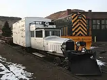 Rio Grande Southern Railroad, Motor No. 2 |
February 14, 1997 (#97000049) |
17155 W. 44th Ave. 39°46′17″N 105°11′36″W |
Golden | located at the Colorado Railroad Museum |
| 71 | Rio Grande Southern Railroad, Motor No. 6 | 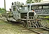 Rio Grande Southern Railroad, Motor No. 6 |
February 19, 1997 (#97000050) |
17155 W. 44th Ave. 39°46′17″N 105°11′36″W |
Golden | located at the Colorado Railroad Museum |
| 72 | Rio Grande Southern Railroad, Motor No. 7 | 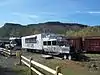 Rio Grande Southern Railroad, Motor No. 7 |
February 28, 1997 (#97000161) |
17155 W. 44th Ave. 39°46′18″N 105°11′35″W |
Golden | located at the Colorado Railroad Museum |
| 73 | Rockland Community Church and Cemetery | 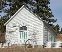 Rockland Community Church and Cemetery |
August 5, 2009 (#09000584) |
24225 Rockland Rd. 39°42′35″N 105°16′23″W |
Golden | |
| 74 | Rocky Flats Plant | 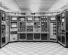 Rocky Flats Plant |
May 19, 1997 (#97000377) |
Approximately 2 miles (3.2 km) southeast of the junction of State Highways 93 and 198 39°53′31″N 105°12′09″W |
Golden | |
| 75 | Samuel and Albina Romano House | 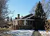 Samuel and Albina Romano House |
September 26, 2016 (#16000668) |
16300 S. Golden Rd. 39°44′06″N 105°10′59″W |
Golden | |
| 76 | Rooney Ranch |  Rooney Ranch |
February 13, 1975 (#75000522) |
South of Golden at the junction of Rooney Rd. and Alameda Parkway 39°41′10″N 105°11′35″W |
Golden | |
| 77 | Russell-Graves House | 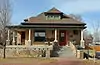 Russell-Graves House |
May 9, 1983 (#83001296) |
5605 Yukon St. 39°47′59″N 105°04′56″W |
Arvada | |
| 78 | Schnell Farm | 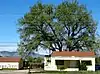 Schnell Farm |
February 14, 1997 (#97000048) |
3113 S. Wadsworth Boulevard 39°39′37″N 105°04′59″W |
Lakewood | |
| 79 | John C. Shaffer Barn | 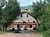 John C. Shaffer Barn |
July 12, 2019 (#100004188) |
14422 W. Ken Caryl Ave. 39°35′05″N 105°09′36″W |
Littleton vicinity | |
| 80 | South Ranch | April 18, 2003 (#03000227) |
Address Restricted |
Lakewood | ||
| 81 | Starbuck Park | 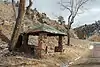 Starbuck Park |
June 30, 1995 (#95000796) |
State Highway 74 through Bear Creek Canyon, south of Idledale 39°39′47″N 105°14′23″W |
Idledale | |
| 82 | Staunton Ranch-Rural Historic Landscape | December 4, 2012 (#12000991) |
11559 Upper Ranch Dr. 39°30′17″N 105°23′24″W |
Pine | Extends into Park County | |
| 83 | Stocke-Walter Addition Historic District | 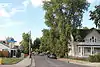 Stocke-Walter Addition Historic District |
September 24, 1999 (#99001182) |
Roughly along Saulsbury St., Ralston Rd., Grandview Ave., and Reed St. 39°48′02″N 105°04′26″W |
Arvada | |
| 84 | Stone House | 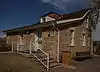 Stone House |
May 1, 1975 (#75000523) |
West Yale Avenue and South Estes Street 39°39′56″N 105°05′36″W |
Lakewood | |
| 85 | Thiede Ranch | January 11, 1996 (#95001509) |
22258 Shingle Creek Rd. 39°41′50″N 105°14′54″W |
Golden | ||
| 86 | Tower of Memories |  Tower of Memories |
September 25, 1987 (#87001725) |
8500 W. 29th Ave. 39°45′30″N 105°05′32″W |
Wheat Ridge | |
| 87 | Twelfth Street Historic Residential District |  Twelfth Street Historic Residential District |
September 22, 1983 (#83001321) |
Roughly bounded by 11th, 13th, Elm, and Arapahoe Sts. 39°45′13″N 105°13′25″W |
Golden |
See also
| Wikimedia Commons has media related to National Register of Historic Places in Jefferson County, Colorado. |
References
- The latitude and longitude information provided in this table was derived originally from the National Register Information System, which has been found to be fairly accurate for about 99% of listings. Some locations in this table may have been corrected to current GPS standards.
- "National Register of Historic Places: Weekly List Actions". National Park Service, United States Department of the Interior. Retrieved on February 5, 2021.
- Numbers represent an alphabetical ordering by significant words. Various colorings, defined here, differentiate National Historic Landmarks and historic districts from other NRHP buildings, structures, sites or objects.
- "National Register Information System". National Register of Historic Places. National Park Service. July 9, 2010.
- The eight-digit number below each date is the number assigned to each location in the National Register Information System database, which can be viewed by clicking the number.
- Location derived from this Jefferson County webpage; the NRIS lists the site as "Address Restricted"
| Topics | |
|---|---|
| Lists by state |
|
| Lists by insular areas | |
| Lists by associated state | |
| Other areas | |
| Related | |
| |
Municipalities and communities of Jefferson County, Colorado, United States | ||
|---|---|---|
| Cities | Map of Colorado highlighting Jefferson County | |
| Towns | ||
| CDPs | ||
| Unincorporated communities | ||
| Ghost town | ||
| Footnotes | ‡This populated place also has portions in an adjacent county or counties | |
| ||
This article is issued from Wikipedia. The text is licensed under Creative Commons - Attribution - Sharealike. Additional terms may apply for the media files.