National Register of Historic Places listings in Chaffee County, Colorado
This is a list of the National Register of Historic Places listings in Chaffee County, Colorado.
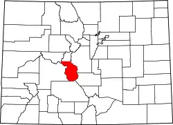
Location of Chaffee County in Colorado
This is intended to be a complete list of the properties and districts on the National Register of Historic Places in Chaffee County, Colorado, United States. The locations of National Register properties and districts for which the latitude and longitude coordinates are included below, may be seen in a map.[1]
There are 44 properties and districts listed on the National Register in the county. Another property was once listed but has been removed.
- This National Park Service list is complete through NPS recent listings posted February 5, 2021.[2]
| Adams - Alamosa - Arapahoe - Archuleta - Baca - Bent - Boulder - Broomfield - Chaffee - Cheyenne - Clear Creek - Conejos - Costilla - Crowley - Custer - Delta - Denver - Dolores - Douglas - Eagle - El Paso - Elbert - Fremont - Garfield - Gilpin - Grand - Gunnison - Hinsdale - Huerfano - Jackson - Jefferson - Kiowa - Kit Carson - La Plata - Lake - Larimer - Las Animas - Lincoln - Logan - Mesa - Mineral - Moffat - Montezuma - Montrose - Morgan - Otero - Ouray - Park - Phillips - Pitkin - Prowers - Pueblo - Rio Blanco - Rio Grande - Routt - Saguache - San Juan - San Miguel - Sedgwick - Summit - Teller - Washington - Weld - Yuma |
Current listings
| [3] | Name on the Register[4] | Image | Date listed[5] | Location | City or town | Description |
|---|---|---|---|---|---|---|
| 1 | Alexander House | 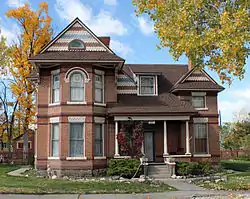 Alexander House |
November 7, 2007 (#07001148) |
846 F St. 38°31′47″N 105°59′52″W |
Salida | |
| 2 | Alpine Tunnel Historic District | 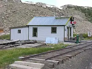 Alpine Tunnel Historic District |
April 1, 1996 (#80004632) |
Along the Denver, South Park and Pacific Railroad tracks from Quartz to Hancock 38°37′46″N 106°24′02″W |
Hancock and Quartz | |
| 3 | Behrman Ranch | March 27, 2012 (#12000143) |
31715 U.S. Route 24 N. 38°52′48″N 106°09′40″W |
Buena Vista | ||
| 4 | Bode-Stewart House | 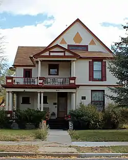 Bode-Stewart House |
April 29, 2008 (#08000344) |
803 F St. 38°31′49″N 105°59′52″W |
Salida | |
| 5 | J. M. Bonney House | 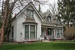 J. M. Bonney House |
December 19, 1994 (#94001469) |
408 Princeton Ave. 38°50′39″N 106°08′13″W |
Buena Vista | |
| 6 | Bridge over Arkansas River | .JPG.webp) Bridge over Arkansas River |
February 4, 1985 (#85000190) |
U.S. Route 24 38°48′49″N 106°06′12″W |
Buena Vista | |
| 7 | Brown's Canyon Bridge | 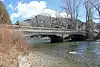 Brown's Canyon Bridge |
July 30, 2013 (#13000554) |
County Road 191 crossing the Arkansas River 38°36′46″N 106°03′43″W |
Salida | |
| 8 | Chaffee County Courthouse and Jail Buildings | 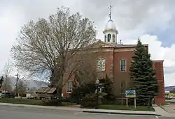 Chaffee County Courthouse and Jail Buildings |
September 10, 1979 (#79000575) |
501 E. Main St. 38°50′37″N 106°07′37″W |
Buena Vista | |
| 9 | Chaffee County Poor Farm | 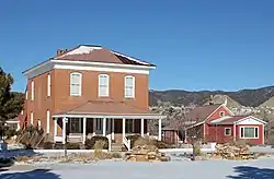 Chaffee County Poor Farm |
May 16, 1985 (#85001062) |
8495 County Road 160 38°33′07″N 106°01′57″W |
Salida | |
| 10 | Cleora Cemetery |  Cleora Cemetery |
March 27, 2017 (#100000784) |
Southern side of U.S. Route 50, 1.4 miles (2.3 km) east of Salida 38°30′49″N 105°58′40″W |
Salida | |
| 11 | Comanche Drive-In | Comanche Drive-In |
August 3, 2015 (#15000481) |
17063 County Road 106 38°49′24″N 106°11′02″W |
Buena Vista | |
| 12 | Commercial Hotel | .JPG.webp) Commercial Hotel |
July 27, 2015 (#15000460) |
43255 County Road 397 39°02′37″N 106°15′53″W |
Granite | |
| 13 | E.W. Corbin House | 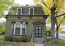 E.W. Corbin House |
November 1, 1996 (#96001239) |
303 E. 5th St. 38°31′53″N 105°59′33″W |
Salida | |
| 14 | Crescent Moly Mine No. 100 and Mining Camp | October 11, 2003 (#03001005) |
Address Restricted |
Granite | Located in the vicinity of the Vicksburg Mining Camp | |
| 15 | F Street Bridge | 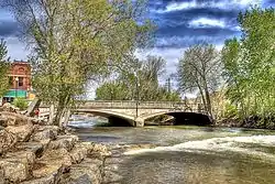 F Street Bridge |
February 4, 1985 (#85000192) |
F St. 38°32′16″N 105°59′33″W |
Salida | |
| 16 | William and Anna Fay House | 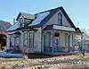 William and Anna Fay House |
July 27, 2015 (#15000461) |
201 S. Colorado Ave. 38°50′30″N 106°07′43″W |
Buena Vista | |
| 17 | Gas Creek School | 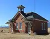 Gas Creek School |
November 26, 2018 (#100003127) |
20925 US 285 38°43′22″N 106°05′09″W |
Nathrop vicinity | |
| 18 | Gimlett/LeFevre Cabin | 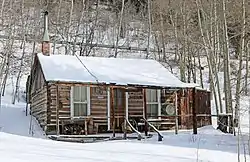 Gimlett/LeFevre Cabin |
December 17, 2018 (#100003128) |
22555 Martin St. 38°33′08″N 106°17′30″W |
Garfield | |
| 19 | Grace Episcopal Church | .JPG.webp) Grace Episcopal Church |
January 20, 1978 (#78000834) |
Main and Park Ave. 38°50′27″N 106°07′57″W |
Buena Vista | |
| 20 | Garret and Julia Gray Cottage | 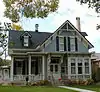 Garret and Julia Gray Cottage |
September 12, 1980 (#80000884) |
125 E. 5th St. 38°31′56″N 105°59′40″W |
Salida | |
| 21 | Head Lettuce Day-Collegiate Peaks Stampede Rodeo Grounds |  Head Lettuce Day-Collegiate Peaks Stampede Rodeo Grounds |
November 7, 2016 (#16000758) |
2001 Gregg Dr. 38°49′23″N 106°09′17″W |
Buena Vista | |
| 22 | Heister House | 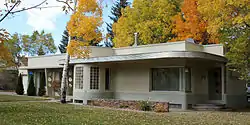 Heister House |
October 8, 2008 (#08000965) |
102 Poncha Boulevard 38°30′56″N 105°59′49″W |
Salida | |
| 23 | Hutchinson Ranch | 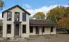 Hutchinson Ranch |
May 11, 1973 (#73000463) |
2 miles east of Poncha Springs on U.S. Route 50; also 8911 W. U.S. Route 50 38°30′56″N 106°02′33″W |
Poncha Springs | Second address represents a boundary increase |
| 24 | F.A. Jackson House | 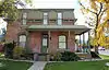 F.A. Jackson House |
April 15, 1999 (#99000445) |
401 E. 1st St. 38°32′02″N 105°59′17″W |
Salida | |
| 25 | Jacobs Building | 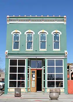 Jacobs Building |
December 22, 2011 (#11000946) |
414 Main St. 38°50′36″N 106°07′42″W |
Buena Vista | |
| 26 | Kelley-McDonald House | 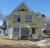 Kelley-McDonald House |
July 27, 2015 (#15000462) |
108 S. Pleasant Ave. 38°50′24″N 106°08′14″W |
Buena Vista | |
| 27 | Littlejohn Mine Complex | December 27, 1978 (#78000835) |
Southwest of Granite 38°57′15″N 106°18′49″W |
Granite | ||
| 28 | Manhattan Hotel | 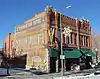 Manhattan Hotel |
April 21, 1983 (#83001302) |
225 F St. 38°31′54″N 105°59′10″W |
Salida | |
| 29 | Maxwell Park School | December 7, 2020 (#100005853) |
Northwest corner, Jct. of Cty. Rds. 321 and 326 38°47′46″N 106°08′49″W |
Buena Vista vicinity | ||
| 30 | Maysville School | 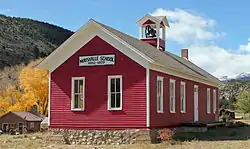 Maysville School |
April 29, 1999 (#99000484) |
South of U.S. Route 50 38°32′22″N 106°11′24″W |
Maysville | |
| 31 | Morley Bridge | 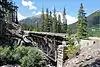 Morley Bridge |
August 14, 2003 (#03000744) |
County Road 297 at milepost 2.40 38°40′30″N 106°21′51″W |
Romley | |
| 32 | Nachtrieb-Kelly Ranch | March 27, 2017 (#100000785) |
25887 County Road 319 38°47′41″N 106°07′57″W |
Buena Vista | Historic ranch | |
| 33 | Ohio-Colorado Smelting and Refining Company Smokestack | 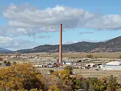 Ohio-Colorado Smelting and Refining Company Smokestack |
January 11, 1976 (#76000548) |
Northeast of Salida at the junction of County Roads 150 and 152 38°33′07″N 106°01′25″W |
Salida | |
| 34 | Pedro-Botz House | 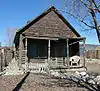 Pedro-Botz House |
July 27, 2015 (#15000463) |
7467 County Road 150 38°32′52″N 106°00′53″W |
Salida | |
| 35 | Pine Hall | 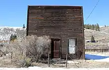 Pine Hall |
November 7, 2016 (#16000759) |
43145 County Road 397 39°02′37″N 106°15′53″W |
Granite | |
| 36 | Poncha Springs Schoolhouse | 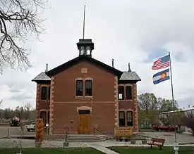 Poncha Springs Schoolhouse |
January 25, 1990 (#89002375) |
330 Burnett St. 38°30′53″N 106°04′17″W |
Poncha Springs | |
| 37 | Rock Ledge Ranch-Franzel Ranch |  Rock Ledge Ranch-Franzel Ranch |
July 27, 2015 (#15000464) |
17975 County Road 338 38°49′27″N 106°12′03″W |
Buena Vista | |
| 38 | St. Elmo Historic District | 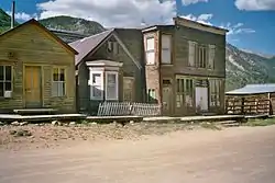 St. Elmo Historic District |
September 17, 1979 (#79000577) |
Pitkin, Gunnison, 1st, Main, and Poplar Sts. 38°42′17″N 106°20′42″W |
St. Elmo | |
| 39 | Salida Downtown Historic District |  Salida Downtown Historic District |
June 14, 1984 (#84000800) |
Roughly bounded by the Arkansas River, railroad tracks, 3rd and D Sts. 38°32′08″N 105°59′26″W |
Salida | |
| 40 | Salida Livestock Commission Company |  Salida Livestock Commission Company |
July 27, 2015 (#15000465) |
5005 E. U.S. Route 50 38°30′44″N 105°58′16″W |
Salida | |
| 41 | Smith-Friskey Ranch | March 27, 2017 (#100000786) |
County Road 339, 0.5 miles west of the road 38°48′54″N 106°11′03″W |
Buena Vista | ||
| 42 | Valley View School | 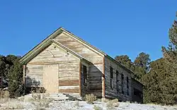 Valley View School |
October 12, 2003 (#03001006) |
8465 County Road 140 38°32′09″N 106°02′33″W |
Salida | |
| 43 | Vicksburg Mining Camp |  Vicksburg Mining Camp |
March 8, 1977 (#77000364) |
15 miles northwest of Buena Vista on Forest Service Route 390 38°59′55″N 106°22′34″W |
Granite | Remnants of a 19th century mining community (population c. 800). |
| 44 | Winfield Mining Camp |  Winfield Mining Camp |
March 10, 1980 (#80000883) |
19 miles northwest of Buena Vista on Forest Service Route 390 38°59′08″N 106°26′24″W |
Granite | Remnants of a 19th century mining community (population c. 1500). |
Former listing
| [3] | Name on the Register | Image | Date listed | Date removed | Location | City or town | Summary |
|---|---|---|---|---|---|---|---|
| 1 | Hortense Bridge | _vicinity_(Chaffee_County%252C_Colorado).jpg.webp) Hortense Bridge |
February 4, 1985 (#85000191) | April 11, 1997 | State Highway 162 |
Nathrop | Bridge was disassembled to be relocated and was damaged and never reassembled[6] |
See also
| Wikimedia Commons has media related to National Register of Historic Places in Chaffee County, Colorado. |
References
- The latitude and longitude information provided in this table was derived originally from the National Register Information System, which has been found to be fairly accurate for about 99% of listings. Some locations in this table may have been corrected to current GPS standards.
- "National Register of Historic Places: Weekly List Actions". National Park Service, United States Department of the Interior. Retrieved on February 5, 2021.
- Numbers represent an alphabetical ordering by significant words. Various colorings, defined here, differentiate National Historic Landmarks and historic districts from other NRHP buildings, structures, sites or objects.
- "National Register Information System". National Register of Historic Places. National Park Service. July 9, 2010.
- The eight-digit number below each date is the number assigned to each location in the National Register Information System database, which can be viewed by clicking the number.
| Topics | |
|---|---|
| Lists by state |
|
| Lists by insular areas | |
| Lists by associated state | |
| Other areas | |
| Related | |
| |
Municipalities and communities of Chaffee County, Colorado, United States | ||
|---|---|---|
| City | Map of Colorado highlighting Chaffee County | |
| Towns | ||
| CDPs | ||
| Unincorporated communities | ||
| ||
This article is issued from Wikipedia. The text is licensed under Creative Commons - Attribution - Sharealike. Additional terms may apply for the media files.