National Register of Historic Places listings in Larimer County, Colorado
This is a list of the National Register of Historic Places listings in Larimer County, Colorado.
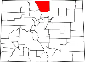
Location of Larimer County in Colorado
This is intended to be a complete list of the properties and districts on the National Register of Historic Places in Larimer County, Colorado, United States. The locations of National Register properties and districts for which the latitude and longitude coordinates are included below, may be seen in a map.[1]
There are 105 properties and districts listed on the National Register in the county, including 2 National Historic Landmarks. Another 3 properties that were once listed have been removed.
- This National Park Service list is complete through NPS recent listings posted January 29, 2021.[2]
| Adams - Alamosa - Arapahoe - Archuleta - Baca - Bent - Boulder - Broomfield - Chaffee - Cheyenne - Clear Creek - Conejos - Costilla - Crowley - Custer - Delta - Denver - Dolores - Douglas - Eagle - El Paso - Elbert - Fremont - Garfield - Gilpin - Grand - Gunnison - Hinsdale - Huerfano - Jackson - Jefferson - Kiowa - Kit Carson - La Plata - Lake - Larimer - Las Animas - Lincoln - Logan - Mesa - Mineral - Moffat - Montezuma - Montrose - Morgan - Otero - Ouray - Park - Phillips - Pitkin - Prowers - Pueblo - Rio Blanco - Rio Grande - Routt - Saguache - San Juan - San Miguel - Sedgwick - Summit - Teller - Washington - Weld - Yuma |
Current listings
| [3] | Name on the Register[4] | Image | Date listed[5] | Location | City or town | Description |
|---|---|---|---|---|---|---|
| 1 | Ammons Hall | Ammons Hall |
June 15, 1978 (#78000864) |
Colorado State University campus 40°34′40″N 105°04′52″W |
Fort Collins | |
| 2 | Peter Anderson House | 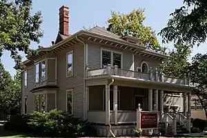 Peter Anderson House |
October 25, 1979 (#79000614) |
300 S. Howes St. 40°35′02″N 105°04′47″W |
Fort Collins | |
| 3 | Armstrong Hotel | 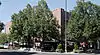 Armstrong Hotel |
August 31, 2000 (#00001002) |
249-261 S. College Ave. 40°35′04″N 105°04′36″W |
Fort Collins | |
| 4 | Arrowhead Lodge | 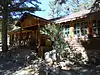 Arrowhead Lodge |
May 27, 1992 (#92000502) |
34500 Poudre Canyon Highway in the Roosevelt National Forest 40°42′13″N 105°38′09″W |
Bellvue | |
| 5 | Avery House | 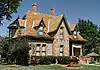 Avery House |
June 24, 1972 (#72000274) |
328 W. Mountain Ave. 40°35′14″N 105°04′53″W |
Fort Collins | |
| 6 | Baker House | 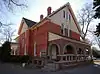 Baker House |
July 20, 1978 (#78000866) |
304-304½ E. Mulberry St. 40°34′54″N 105°04′24″W |
Fort Collins | |
| 7 | Baldpate Inn | 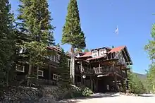 Baldpate Inn |
January 11, 1996 (#95001510) |
4900 S. State Highway 7 40°18′30″N 105°32′04″W |
Estes Park | |
| 8 | Bear Lake Comfort Station | 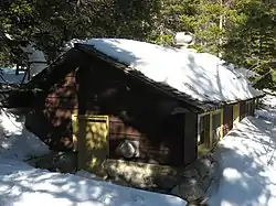 Bear Lake Comfort Station |
January 29, 1988 (#87001137) |
Bear Lake 40°18′44″N 105°38′42″W |
Estes Park | |
| 9 | Bee Farm | November 25, 2002 (#02001409) |
4320 E. County Road 58 40°40′17″N 104°59′42″W |
Fort Collins | ||
| 10 | A. S. Benson House | 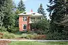 A. S. Benson House |
January 6, 2004 (#03001362) |
463 W. 5th St. 40°23′48″N 105°04′56″W |
Loveland | |
| 11 | Big Thompson River Bridge III | 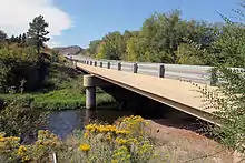 Big Thompson River Bridge III |
October 15, 2002 (#02001139) |
U.S. Highway 34 at milepost 85.15 40°24′54″N 105°11′42″W |
Loveland | |
| 12 | Big Thompson River Bridge IV | 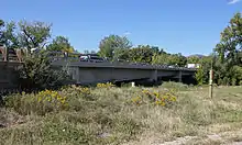 Big Thompson River Bridge IV |
October 15, 2002 (#02001140) |
U.S. Highway 34 at milepost 86.04 40°25′07″N 105°10′47″W |
Loveland | |
| 13 | Bimson Blacksmith Shop | 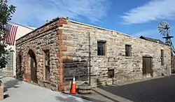 Bimson Blacksmith Shop |
July 23, 1981 (#81000185) |
224 Mountain St. 40°18′21″N 105°04′32″W |
Berthoud | |
| 14 | Bingham Homestead Rural Historic Landscape | 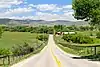 Bingham Homestead Rural Historic Landscape |
April 16, 2013 (#13000161) |
4916 Bingham Hill Rd. 40°37′33″N 105°10′07″W |
Bellvue | |
| 15 | Maude Stanfield Harter Borland House | Maude Stanfield Harter Borland House |
July 6, 2004 (#04000662) |
610 N. Jefferson Ave. 40°23′52″N 105°04′16″W |
Loveland | |
| 16 | Botanical and Horticultural Laboratory | 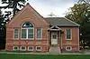 Botanical and Horticultural Laboratory |
September 18, 1978 (#78003395) |
Colorado State University campus 40°34′40″N 105°04′40″W |
Fort Collins | Now called Routt Hall. |
| 17 | Jay H. Bouton House | 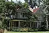 Jay H. Bouton House |
December 18, 1978 (#78000867) |
113 N. Sherwood St. 40°35′15″N 105°05′04″W |
Fort Collins | |
| 18 | Buckeye School | 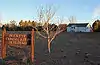 Buckeye School |
June 26, 2008 (#08000599) |
Off W. County Road 80 40°49′35″N 105°05′36″W |
Wellington | |
| 19 | Cascade Cottages | August 27, 2020 (#100005475) |
4140 Fall River Rd. (Rocky Mountain National Park) 40°24′09″N 105°36′02″W |
Estes Park | ||
| 21 | Clatworthy Place | 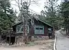 Clatworthy Place |
July 14, 2004 (#04000681) |
225 Cyteworth Rd. 40°22′21″N 105°31′17″W |
Estes Park | |
| 22 | Colorado and Southern Railway Depot | Colorado and Southern Railway Depot |
June 14, 1982 (#82002303) |
405 Railroad Ave. 40°23′46″N 105°04′31″W |
Loveland | |
| 23 | Crags Lodge | 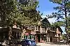 Crags Lodge |
July 1, 1998 (#98000814) |
300 Riverside Dr. 40°22′12″N 105°31′25″W |
Estes Park | |
| 24 | Downtown Loveland Historic District | 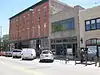 Downtown Loveland Historic District |
June 1, 2015 (#15000281) |
Roughly bounded by Railroad & Jefferson Aves., alleys between 3rd & 4th Sts. & 4th & 5th Sts. 40°23′44″N 105°04′27″W |
Loveland | |
| 25 | Dunraven Cottage-Camp Dunraven | April 5, 2019 (#100003644) |
898 Fish Creek Rd. 40°21′50″N 105°29′37″W |
Estes Park vicinity | ||
| 26 | East Longs Peak Trail | 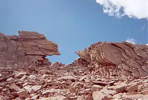 East Longs Peak Trail |
July 10, 2007 (#07000740) |
West of State Highway 7[6] 40°16′20″N 105°36′02″W |
Allenspark | Extends into Boulder County. |
| 27 | Edgemont | 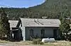 Edgemont |
July 15, 1998 (#98000853) |
1861 Mary's Lake Rd. 40°21′02″N 105°32′21″W |
Estes Park | |
| 28 | Elkhorn Lodge |  Elkhorn Lodge |
December 27, 1978 (#78000862) |
530 W. Elkhorn Ave. 40°22′38″N 105°32′00″W |
Estes Park | |
| 29 | Fall River Entrance Historic District | 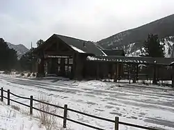 Fall River Entrance Historic District |
January 29, 1988 (#87001139) |
Fall River Entrance 40°24′11″N 105°35′13″W |
Estes Park | Boundary increase approved March 5, 2018. |
| 30 | Fall River Pass Ranger Station | 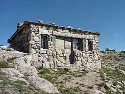 Fall River Pass Ranger Station |
January 29, 1988 (#87001140) |
Fall River Pass 40°26′27″N 105°45′13″W |
Estes Park | |
| 31 | Fall River Pump House and Catchment Basin | 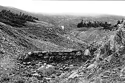 Fall River Pump House and Catchment Basin |
August 30, 2006 (#06000735) |
Near the top of Fall River Road in Rocky Mountain National Park 40°26′15″N 105°44′50″W |
Estes Park | |
| 32 | Fall River Road | 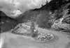 Fall River Road |
July 20, 1987 (#87001129) |
Fall River Rd. 40°25′47″N 105°42′43″W |
Estes Park | Boundary increase approved May 21, 2018 |
| 33 | Fern Lake Patrol Cabin | 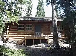 Fern Lake Patrol Cabin |
January 29, 1988 (#87001142) |
Fern Lake 40°20′17″N 105°40′34″W |
Estes Park | |
| 34 | Fern Lake Trail | 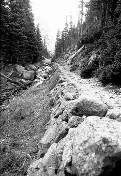 Fern Lake Trail |
February 28, 2005 (#05000074) |
Rocky Mountain National Park 40°20′34″N 105°39′48″W |
Estes Park | |
| 35 | First National Bank Building | 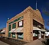 First National Bank Building |
August 10, 2000 (#00000937) |
3728 Cleveland Ave. 40°42′15″N 105°00′20″W |
Wellington | |
| 36 | First United Presbyterian Church | 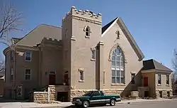 First United Presbyterian Church |
July 7, 2004 (#04000664) |
400 E. 4th St. 40°23′43″N 105°04′16″W |
Loveland | |
| 37 | Flattop Mountain Trail | 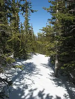 Flattop Mountain Trail |
September 27, 2007 (#07000999) |
Rocky Mountain National Park[7] 40°18′50″N 105°40′42″W |
Estes Park | |
| 38 | Jacob and Elizabeth Flowers House | 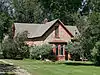 Jacob and Elizabeth Flowers House |
March 1, 2007 (#07000086) |
5200 W. County Road 52E 40°37′48″N 105°10′19″W |
Bellvue | |
| 39 | Fort Collins Armory | 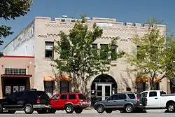 Fort Collins Armory |
October 15, 2002 (#02001133) |
314 E. Mountain Ave. 40°35′14″N 105°04′21″W |
Fort Collins | |
| 40 | Fort Collins Municipal Railway Birney Safety Streetcar No. 21 | 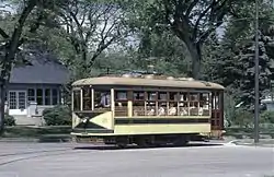 Fort Collins Municipal Railway Birney Safety Streetcar No. 21 |
January 5, 1984 (#84000860) |
1801 W. Mountain Ave. 40°35′12″N 105°06′32″W |
Fort Collins | |
| 41 | Fort Collins Post Office | 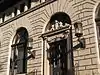 Fort Collins Post Office |
January 30, 1978 (#78000868) |
201 S. College Ave. 40°35′07″N 105°04′37″W |
Fort Collins | Now used as the Ft. Collins Museum of Contemporary Art |
| 42 | Montezuma Fuller House | 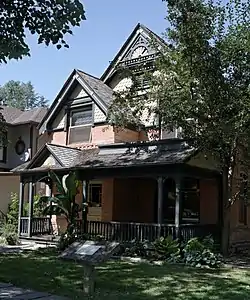 Montezuma Fuller House |
December 15, 1978 (#78000869) |
226 W. Magnolia St. 40°34′58″N 105°04′47″W |
Fort Collins | |
| 43 | Gem Lake Trail |  Gem Lake Trail |
January 29, 2008 (#07001473) |
North of Devils Gulch Rd. to Gem Lake[8] 40°24′40″N 105°30′13″W |
Estes Park | |
| 44 | Glacier Basin Campground Ranger Station | 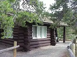 Glacier Basin Campground Ranger Station |
July 20, 1987 (#87001143) |
Glacier Basin 40°19′48″N 105°35′40″W |
Estes Park | |
| 45 | Graves Camp Rural Historic District |  Graves Camp Rural Historic District |
December 14, 2016 (#16000155) |
Five miles west of I-25 just south of the Colorado-Wyoming state line, in far northeastern Larimer County 40°59′11″N 105°00′31″W |
Wellington | In the Soapstone Prairie Natural Area |
| 46 | Great Western Sugar Company Effluent Flume and Bridge |  Great Western Sugar Company Effluent Flume and Bridge |
November 19, 2014 (#14000927) |
Cache la Poudre R., 1/2 mi. W. of Timberline Rd. 40°34′42″N 105°02′43″W |
Fort Collins | |
| 47 | Greeley, Salt Lake and Pacific Railroad-Stout Branch |  Greeley, Salt Lake and Pacific Railroad-Stout Branch |
April 16, 2008 (#08000291) |
Approximately 0.5 miles (0.80 km) south of the junction of U.S. Highway 287 and County Road 28 40°37′32″N 105°09′05″W |
Laporte | |
| 48 | Harmony Mill | 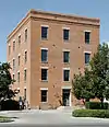 Harmony Mill |
November 22, 1995 (#95001327) |
131 Lincoln Ave. 40°35′18″N 105°04′13″W |
Fort Collins | |
| 49 | Hewes-Kirkwood Inn | 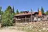 Hewes-Kirkwood Inn |
October 28, 1994 (#94001254) |
465 Long Peak Rd. 40°16′18″N 105°33′15″W |
Estes Park | Now part of an adult summer music camp. |
| 50 | Homestead Meadows Discontiguous District | 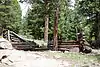 Homestead Meadows Discontiguous District |
October 4, 1990 (#90001476) |
At the end of Lion Gulch[9] 40°19′N 105°27′W |
Estes Park | |
| 51 | Kaplan-Hoover Site | April 18, 2003 (#03000229) |
800 metres (2,600 ft) south of the Cache La Poudre River, west of Windsor[10] 40°28′19″N 104°57′20″W |
Windsor | A bone bed 15 metres (49 ft) long, dating from the Late Archaic period[10] | |
| 52 | Kelley House | November 15, 2019 (#100004613) |
1410 N. Garfield Ave. 40°24′28″N 105°04′40″W |
Loveland | ||
| 53 | Kissock Block Building | 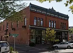 Kissock Block Building |
May 16, 1985 (#85001061) |
115-121 E. Mountain Ave. 40°35′12″N 105°04′33″W |
Fort Collins | |
| 54 | Lake Haiyaha Trail | 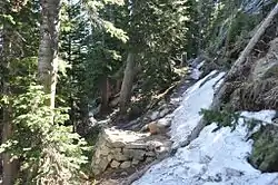 Lake Haiyaha Trail |
March 5, 2008 (#08000125) |
Roughly along Bear, Nymph, and Dream Lakes, then up Chaos Canyon[11] 40°18′17″N 105°39′44″W |
Estes Park | |
| 55 | Laurel School Historic District | 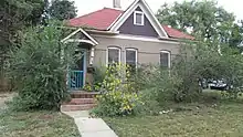 Laurel School Historic District |
October 3, 1980 (#80000909) |
Off U.S. Highway 287 40°34′40″N 105°04′20″W |
Fort Collins | |
| 56 | Leiffer House | August 2, 1978 (#78000278) |
South of Estes Park off State Highway 7 40°16′34″N 105°32′42″W |
Estes Park | ||
| 57 | Lindenmeier Site | 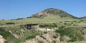 Lindenmeier Site |
October 15, 1966 (#66000249) |
Address Restricted |
Fort Collins | |
| 58 | Livermore Hotel and General Store | 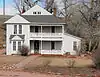 Livermore Hotel and General Store |
September 14, 2001 (#01000970) |
2140 Red Feather Lakes Road[12] 40°47′16″N 105°15′14″W |
Livermore | |
| 59 | Lost Lake Trail | March 5, 2008 (#08000126) |
Roughly along the North Fork of the Big Thompson River[13] 40°29′56″N 105°33′02″W |
Estes Park | ||
| 60 | Loveland State Armory | 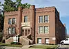 Loveland State Armory |
April 12, 2001 (#01000350) |
201 S. Lincoln Ave. 40°23′28″N 105°04′23″W |
Loveland | |
| 61 | R.G. Maxwell House | 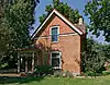 R.G. Maxwell House |
September 29, 1980 (#80000910) |
2340 W. Mulberry St. 40°35′44″N 105°08′24″W |
Fort Collins | |
| 62 | MacGregor Ranch |  MacGregor Ranch |
July 31, 1989 (#89001008) |
180 MacGregor Ave. 40°23′45″N 105°31′58″W |
Estes Park | |
| 63 | William H. McCreery House | 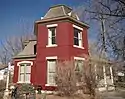 William H. McCreery House |
May 2, 2001 (#01000445) |
746 N. Washington Ave. 40°23′57″N 105°04′10″W |
Loveland | |
| 64 | McGraw Ranch | 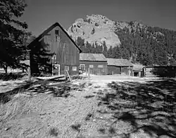 McGraw Ranch |
September 17, 1998 (#98001163) |
McGraw Ranch Rd. 40°25′53″N 105°30′06″W |
Estes Park | |
| 65 | McHugh-Andrews House | 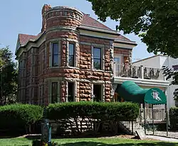 McHugh-Andrews House |
December 27, 1978 (#78000870) |
202 Remington St. 40°35′08″N 105°04′29″W |
Fort Collins | |
| 66 | Enos Mills Homestead Cabin |  Enos Mills Homestead Cabin |
May 11, 1973 (#73000480) |
South of Estes Park off State Highway 7 40°16′54″N 105°32′24″W |
Estes Park | |
| 67 | Milner-Schwarz House | 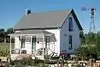 Milner-Schwarz House |
March 19, 2014 (#14000058) |
710 S. Railroad Ave. 40°23′09″N 105°04′52″W |
Loveland | |
| 68 | Moraine Lodge | 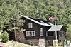 Moraine Lodge |
October 8, 1976 (#76000206) |
West of Estes Park off U.S. Highway 36 on Bear Lake Rd. 40°21′31″N 105°34′59″W |
Estes Park | Boundaries increased on June 15, 2005 under the name of "Moraine Park Museum and Amphitheater" |
| 69 | Mosman House | 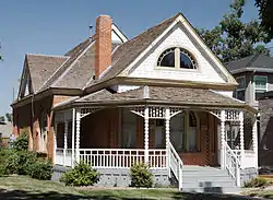 Mosman House |
December 15, 1978 (#78000865) |
324 E. Oak St. 40°35′08″N 105°04′21″W |
Fort Collins | |
| 70 | Mountainside Lodge | 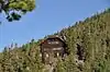 Mountainside Lodge |
July 20, 2000 (#00000814) |
2515 Tunnel Rd. 40°20′05″N 105°35′20″W |
Estes Park | On the grounds of the YMCA of the Rockies |
| 71 | North Inlet Trail | 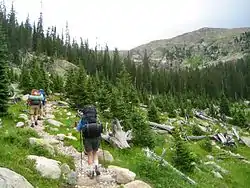 North Inlet Trail |
March 5, 2008 (#08000127) |
Roughly along North Inlet and Hallett Creek to Flattop Mountain[14] 40°15′50″N 105°47′22″W |
Grand Lake | Extends into Grand County |
| 72 | Old Town Fort Collins | 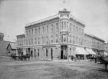 Old Town Fort Collins |
August 2, 1978 (#78000871) |
Roughly bounded by College Ave. and Mountain, Pine, Willow, and Walnut Sts. 40°35′22″N 105°04′27″W |
Fort Collins | |
| 73 | Opera House Block/Central Block Building | 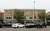 Opera House Block/Central Block Building |
February 8, 1985 (#85000214) |
117-131 N. College Ave. 40°35′15″N 105°04′37″W |
Fort Collins | |
| 74 | Park Theatre | 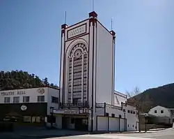 Park Theatre |
June 14, 1984 (#84000862) |
130 Moraine Ave. 40°22′35″N 105°31′22″W |
Estes Park | |
| 75 | Patterson House | 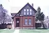 Patterson House |
January 22, 2019 (#100003319) |
121 N. Grant Ave. 40°35′17″N 105°05′24″W |
Fort Collins | |
| 76 | Peep O Day Park | August 10, 2011 (#11000520) |
5445 Wild Ln. 40°24′36″N 105°09′17″W |
Loveland | ||
| 77 | Pleasant Valley School | 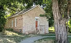 Pleasant Valley School |
October 11, 2003 (#03001008) |
4032 N. County Road 25E 40°38′51″N 105°11′07″W |
Bellvue | |
| 78 | Plummer School | 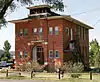 Plummer School |
April 29, 1999 (#99000485) |
2524 E. Vine Dr. 40°35′47″N 105°01′46″W |
Fort Collins | |
| 79 | Preston Farm | .jpg.webp) Preston Farm |
May 10, 2001 (#01000489) |
4605 S. Ziegler Rd. 40°31′19″N 105°01′14″W |
Fort Collins | |
| 80 | Provost Homestead-Herring Farm Rural Historic Landscape |  Provost Homestead-Herring Farm Rural Historic Landscape |
December 27, 2010 (#10001053) |
2405 North Overland Trail 40°37′20″N 105°08′33″W |
Laporte | |
| 81 | Rialto Theater | 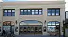 Rialto Theater |
February 17, 1988 (#87002213) |
228-230 E. 4th Ave. 40°23′43″N 105°04′24″W |
Loveland | |
| 82 | T.H. Robertson House | 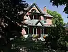 T.H. Robertson House |
July 2, 1992 (#92000811) |
420 W. Mountain Ave. 40°35′15″N 105°04′59″W |
Fort Collins | |
| 83 | Rocky Mountain National Park Administration Building | 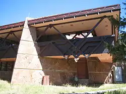 Rocky Mountain National Park Administration Building |
January 3, 2001 (#01000069) |
U.S. Highway 36 40°21′58″N 105°33′38″W |
Estes Park | |
| 84 | Rocky Mountain National Park Utility Area Historic District | 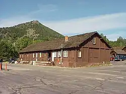 Rocky Mountain National Park Utility Area Historic District |
March 18, 1982 (#82001717) |
Beaver Meadows Entrance Rd. 40°21′50″N 105°33′38″W |
Estes Park | |
| 85 | E.A. Schlichter House | 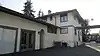 E.A. Schlichter House |
November 22, 2016 (#16000784) |
1312 S. College Ave. 40°34′14″N 105°04′36″W |
Fort Collins | |
| 86 | Henry K. and Mary E. Shaffer House | 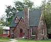 Henry K. and Mary E. Shaffer House |
January 9, 2007 (#06001219) |
1302 N. Grant Ave. 40°24′22″N 105°04′42″W |
Loveland | |
| 87 | Snogo Snow Plow | 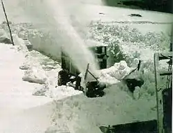 Snogo Snow Plow |
October 4, 2006 (#06000934) |
Rocky Mountain National Park 40°21′51″N 105°33′34″W |
Estes Park | |
| 88 | Soloman Batterson Ranch | October 15, 2010 (#10000860) |
603 Mount Moriah Rd. 40°44′18″N 105°24′19″W |
Livermore | ||
| 89 | Spruce Hall | 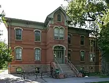 Spruce Hall |
January 9, 1977 (#77000381) |
Colorado State University campus 40°34′38″N 105°04′40″W |
Fort Collins | |
| 90 | Stanley Hotel | Stanley Hotel |
May 26, 1977 (#77000380) |
333 Wonder View Ave. 40°23′00″N 105°31′02″W |
Estes Park | |
| 91 | Stanley Hotel District |  Stanley Hotel District |
June 20, 1985 (#85001256) |
333 Wonder View Ave.; also Fish Hatchery Rd. at the Fall River 40°23′00″N 105°31′06″W |
Estes Park | Fish Hatchery is the Stanley Power Plant, a boundary increase of April 14, 1998 |
| 92 | Gustav and Annie Swanson Farm | 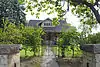 Gustav and Annie Swanson Farm |
October 5, 2005 (#05001116) |
1932 N. U.S. Highway 287 40°22′03″N 105°04′21″W |
Berthoud | |
| 93 | Tonahutu Creek Trail |  Tonahutu Creek Trail |
March 5, 2008 (#08000130) |
Roughly along Tonahutu Creek to Flattop Mountain[15] 40°19′10″N 105°46′32″W |
Grand Lake | Extends into Grand County |
| 94 | Trail Ridge Road | 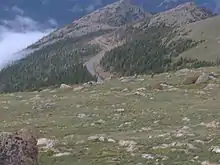 Trail Ridge Road |
November 14, 1984 (#84000242) |
Rocky Mountain National Park 40°21′30″N 105°45′47″W |
Estes Park | Extends into Grand County |
| 95 | Truscott Junior High School | 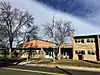 Truscott Junior High School |
July 16, 2017 (#100001339) |
211 W. 6th St. 40°23′53″N 105°04′43″W |
Loveland | |
| 96 | Twin Sisters Lookout |  Twin Sisters Lookout |
December 24, 1992 (#92001670) |
On the Twin Sisters Peaks in Rocky Mountain National Park 40°17′21″N 105°31′03″W |
Estes Park | |
| 97 | Agnes Vaille Shelter | 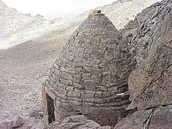 Agnes Vaille Shelter |
December 24, 1992 (#92001669) |
Northwest of Longs Peak along the East Longs Peak Trail in Rocky Mountain National Park 40°15′38″N 105°37′13″W |
Estes Park | |
| 98 | Virginia Dale Stage Station | .JPG.webp) Virginia Dale Stage Station |
September 26, 1985 (#85002562) |
Off U.S. Highway 287 40°58′24″N 105°21′54″W |
Virginia Dale | |
| 99 | Ernest Waycott House | 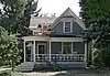 Ernest Waycott House |
December 2, 1993 (#93001363) |
1501 W. Mountain Ave. 40°35′13″N 105°06′13″W |
Fort Collins | |
| 100 | William Allen White Cabins | 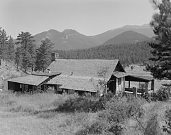 William Allen White Cabins |
October 25, 1973 (#73001944) |
West of Estes Park of Moraine Park Visitor Center in Rocky Mountain National Park 40°21′22″N 105°34′55″W |
Estes Park | |
| 101 | Beatrice Willard Alpine Tundra Research Plots |  Beatrice Willard Alpine Tundra Research Plots |
October 25, 2007 (#07001101) |
U.S. Highway 34 at Rock Cut and Forest Canyon 40°23′43″N 105°42′40″W |
Estes Park | |
| 102 | Willow Park Patrol Cabin | 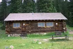 Willow Park Patrol Cabin |
July 20, 1987 (#87001144) |
Fall River Rd. 40°25′59″N 105°44′01″W |
Estes Park | |
| 103 | Willow Park Stable | 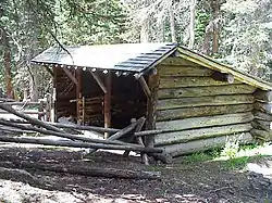 Willow Park Stable |
July 20, 1987 (#87001145) |
Fall River Pass 40°26′01″N 105°43′59″W |
Estes Park | |
| 104 | Wind Ridge |  Wind Ridge |
October 15, 2002 (#02001130) |
1397 Clara Dr. 40°23′41″N 105°30′36″W |
Estes Park | |
| 105 | Ypsilon Lake Trail | 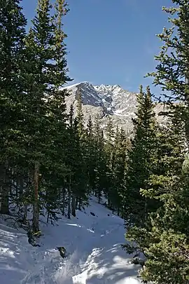 Ypsilon Lake Trail |
March 5, 2008 (#08000131) |
Along a ridge between Chiquita Creek and the Roaring River 40°25′43″N 105°39′02″W |
Estes Park |
Former listings
| [3] | Name on the Register | Image | Date listed | Date removed | Location | City or town | Summary |
|---|---|---|---|---|---|---|---|
| 1 | Bear Lake Ranger Station |  Bear Lake Ranger Station |
January 29, 1988 (#87001138) | April 9, 2009 | Bear Lake 40°18′44″N 105°38′46″W |
Estes Park | |
| 2 | Big Thompson River Bridge I | October 15, 2002 (#02001144) | November 29, 2010 | U.S. Highway 34 at milepost 65.53 40°22′49″N 105°28′19″W |
Estes Park | Highway Bridges in Colorado MPS | |
| 3 | Big Thompson River Bridge II | November 15, 2002 (#02001141) | November 29, 2010 | U.S. Highway 34 at milepost 66.22 40°22′49″N 105°28′19″W |
Estes Park | Highway Bridges in Colorado MPS |
See also
| Wikimedia Commons has media related to National Register of Historic Places in Larimer County, Colorado. |
References
- The latitude and longitude information provided in this table was derived originally from the National Register Information System, which has been found to be fairly accurate for about 99% of listings. Some locations in this table may have been corrected to current GPS standards.
- "National Register of Historic Places: Weekly List Actions". National Park Service, United States Department of the Interior. Retrieved on January 29, 2021.
- Numbers represent an alphabetical ordering by significant words. Various colorings, defined here, differentiate National Historic Landmarks and historic districts from other NRHP buildings, structures, sites or objects.
- "National Register Information System". National Register of Historic Places. National Park Service. July 9, 2010.
- The eight-digit number below each date is the number assigned to each location in the National Register Information System database, which can be viewed by clicking the number.
- Coordinates are those of the East Longs Peak Trail as provided by its GNIS record; the NRIS gives no coordinates
- Coordinates are derived from its GNIS record; the NRIS gives no coordinates
- Coordinates are those of Gem Lake as provided by its GNIS record; the NRIS gives no coordinates
- Location derived from Fogelberg, Ben, and Steve Grinstead. Walking Into Colorado's Past: 50 Front Range History Hikes. Neenah: Big Earth, 2006, 67. The NRIS lists the site as "Address Restricted".
- Todd, Lawrence C., et al. "Late Archaic Bison Hunters in Northern Colorado: 1997-1999 Excavations at the Kaplan-Hoover Bison Bonebed (5LR3953)". Plains Anthropologist 46.176 (2001): 125-147: 126.
- Coordinates are those of Lake Haiyaha, derived from its GNIS record; the NRIS gives no coordinates
- Coords are for the address on the building, shown on a picture at this website; the NRIS lists the site as "Address Restricted"
- Coordinates are derived from its GNIS record; the NRIS gives no coordinates
- Coordinates are those of the Grand Lake end of the trail as provided by its GNIS record; the NRIS gives no coordinates
- Coordinates are those of the Grand Lake end of the trail as provided by its GNIS record; the NRIS gives no coordinates
| Topics | |
|---|---|
| Lists by state |
|
| Lists by insular areas | |
| Lists by associated state | |
| Other areas | |
| Related | |
| |
Municipalities and communities of Larimer County, Colorado, United States | ||
|---|---|---|
| Cities | Map of Colorado highlighting Larimer County | |
| Towns | ||
| CDPs | ||
| Unincorporated communities | ||
| Ghost towns |
| |
| Footnotes | ‡This populated place also has portions in an adjacent county or counties | |
| ||
This article is issued from Wikipedia. The text is licensed under Creative Commons - Attribution - Sharealike. Additional terms may apply for the media files.